Vis - Anita Goitan

Vis - Anita Goitan

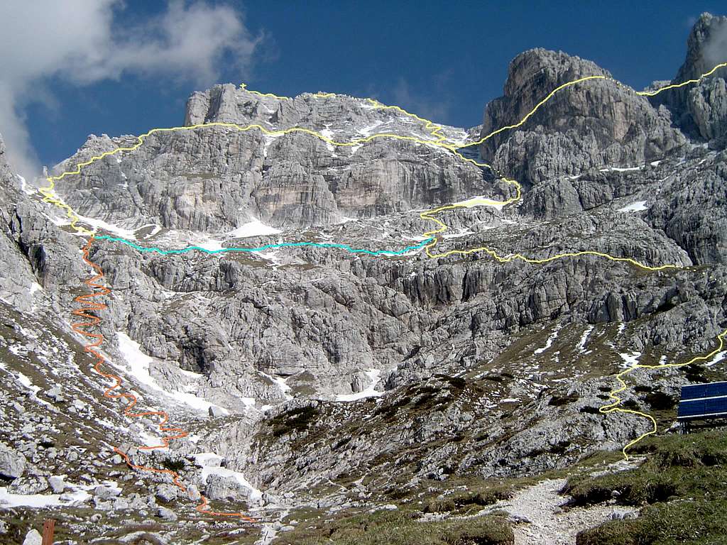
Here you can see the summit of Vis, and it's southern slopes (Jóf Fuart/Wischberg). The "horizontal" yellow line shows you the central part of the "ferrata" route Anita Goitan - from the ledge of Gamsova Mati to Forcella Mose. The "vertical" yellow line shows you the normal hiking route to this beautiful summit of Uncle Kugy's wonderworld! Taken from the terrace of Corsi hut, June 2003 (The orange, and blue lines are used mainly as "emergency exits" in case of bad weather etc, or to shorten your tour)
Tomi Gellér
on Feb 9, 2007 11:24 am
Image ID: 268278

Comments

Post a Comment
Viewing: 1-2 of 2
Vid Pogachnik

Vid Pogachnik - Feb 9, 2007 11:59 am - Voted 10/10

Fine!

Hi, Tomi! Welcome to SP! Nice contribution, I'm looking forward for more.
Cheers!
Vid

Tomi Gellér

Tomi Gellér - Feb 12, 2007 5:42 pm - Hasn't voted

Hello

Thank you. I have a huge photo archive about Julian/Kamnik Alps. more to come soon :)))

Viewing: 1-2 of 2