

-
 24973 Hits
-
 74.92% Score
-
 5 Votes
|
|
Route |
|---|---|
|
|
46.68060°N / 8.53040°E |
|
|
Rock Climb |
|
|
Spring, Summer, Fall |
|
|
A long day |
|
|
VI+/A0 (VII-) |
|
|
5.10b (YDS) |
|
|
36 |
|
|
In Memory of Stefan "kletterwebbi" Weber
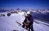
Stefan Weber, the member we all used to know from his climbing pseudonym kletterwebbi, died on May 28th 2004 in southern France at the age of 37.
Stefan joined SP early on in 2002 and contributed a number of excellent pages and routes to this site. He was an accomplished climber excelling in difficult alpine and technical routes. The Dolomites, especially the area around Gröden / Val Gardena were special to him, as it was his old ancestral home.
kletterwebbi was always willing to share his knowledge and experience with other climbers, mainly here on SP, but also on other sites. He contributed his IT expertise as webmaster of his local section of the German Alpine Club, where he also engaged in leading trips for fellow members. Besides his climbing and mountaineering activities he was a musician, a composer of contemporary music. Stefan will be greatly missed by us all.
Stefan Weber created the Salbitschijen West ridge page in 2003.
Overview
The West ridge of the Salbitschiijen is the longest and perhaps the best ridge climb of the whole alps. It's a impressive, hard, long and challenging climb on perfect rock.Some years ago it was common to do this route in two days, today most parties will need between 10 - 12 hours for the ascent. The route has 36 pitches up to UIAA VI+/VII-. The difficult pitches are near the end of the route. The crux pitch is normally aided using a bolt ladder. If one climbs this pitch free, it may be a VII+ (but less people will do that).
The W-ridge of the Salbitschiijen consists of 5 big towers. The route travels over all this towers up to the summit. There are three escapes from the route at the notches between tower 2/3, tower 3/4 and tower 4/5. These escapes are not recommended, to be used only in case of trouble. There is a point of no return after one rappels from tower 5. At that point the most difficult pitches have still to come! Be aware of the fact that there is no water all over the route.
Altogether the Salbitschijen West ridge is very serious undertaking. The weather can change rapidly in the Uri Alps, so stick to your time scheme and be sure that you can tackle the difficulties.
First ascent: B. and E. Favre and L. Henchoz; 1948

Getting there (Salbit Bivaouc)
The start of the Salbitschiijen W-ridge is directly behind the Salbit-bivaouc (SAC, 2402 m). The Salbit-bivaouc has enough space for 10 persons. Water can be found about 100 meters SE of the bivaouc. This depends on the amouth of snow in the area. Usually there no snow (and water) at all during july and august. There are two possibilities to reach the Salbit-bivaouc:From the Salbithütte (SAC, 2105 m): A good path leads first to the base of S-ridge of the Salbitschijen and then to the bivaouc. Between the S-ridge and the bivaouc there is a kind of via ferrata. This via ferrata can be a great fun after one has climbed the W-ridge, descented the mountain and finally want to go back to the bivaouc. It may take 1-2 hours from the Salbit-hut to the bivaouc.
From the Göschener-valley: Park your car at the parking area at the Voralpkurve, a prominent bend at the road leading from Göschenen to the Göscheneralp-lake (1404 m). There a trail starts, leading to the Voralp-huts. Follow this trail up to the Alp Horefelli (1786 m). There a small, marked path bends right and up to the Horefelli-couloir. The couloir can be filled with snow, wich makes an ascent a bit more challenging. When the couloir forks one uses the right part up to a grass saddle (2202 m). Turning right and up (good path) brings one finally
to the bivaouc. This approach is faster (3-4 hours) then the approch via the Salbit-hut (4-5 hours in total) but not so easy to find. Do not try to find this by night.

Route Description
From the bivy walk up to the start of the route at the base of the first tower. The first pitch is a foul. From the very first move this is very exhausting VI+/VII- pitch on steep cracks. After that beginning the top of the first tower is reached in 6 pitches rated IV/V. When reaching the top of the first tower one have to walk to the E end of the tower with two abseils (12m, 20m). Now one has reached the notch between tower one and tower two. No escape at this place. It is possible to climb the first pitch the day before, and leave the rope in place. This way you won't have to climb this exhausting pitch in the morning. It is also possible (in cause of crowds) to take the SE-face route on the first tower.Now the second tower have to be climbed. The following two pitches are great! Climb up obvious cracks in two pitches (V+, VI). Then following the ridge for other three pitches (IV,V,V) up to the top of the second tower (good bivy places). There two other abseils (8m, 45 m) are starting to the notch between tower 2 and tower 3. At this notch an escape line is going down at the S-side.
The next job is to climb the third tower. This is done using the ridge himself straight forward in three pitches up to VI/A0. Stay slightly right most time. From the top of the third tower one have to rappel once again (40 m). This brings one to the notch between tower three and tower four. There an other escape line is going down at the S-side.
The fourth tower is climbed from the notch 3/4 in four fantastic pitches (V-,VI+,VI-,V+). From the top an abseil is going down 45m to the north side. After rapelling an easy traverse leads to the beginning of a IV+ pitch witch finally leads to the notch between tower four and five. There the last escape line (direction S) is located. This place is also known as "Hotel Salbit", and offers a nice bivy spot.
To climb the fifth tower climb three pitches on the south side of the ridge (IV,VI,V+). Especially the second one is a very good one, using a big crack. Really great climbing, but very exhausting. From the top of tower five an other rappel have to be done (20 m) to the notch between tower five and the final part of the ridge.
From this notch climb one easy pitch (III) up to a chain. Going down 6 m and do a pendulum to the beginning of a crack. Climb this crack (rated V+) up to the crest of the ridge to a good belay. Then say "have fun ... " to your partner. This is the point of no return! The next pitch is the crux. In former times, this crux is done by aiding a small crack at the crest of the ridge. The old piton are still visible. If one climb this crack free it may be a VII+. Today a bolt ladder at the S-side of the ridge heads up this pitch. From the end of the bolt ladder climb up to a bolted belay (VI,A0). Then climb up a very steep, very exposed pitch (2 bolts) with a big run out (grade VI) to the crest of the ridge. Following the ridge up to the summit for other 4-5 pitches (rated III-V). Finally one reaches the summit, there the famous summit needle is waiting.
The summit needle is climbed at the east face in a 15 m pitch. At the top there is a bolt, use this to rappel from the needle (a very good place to take photos !).

Possible time scheme: The Topoguide guidebook has the most comprehensive information about the climb. We used it and only lost the route shortly on the fourth tower. We used the times scheme wich can be found in Topoguide:
1. Start of the route at 6 h in the morning (prepare the first pitch the evening before)
2. Leave the first tower before 9.30 h.
3. Arrive at the second tower before 12 h.
4. Arrive at the third tower on our later and the fourth at 14 h.
5. Pass the traverse before 16 h.
6. The following A0 pitch can take some time. So it will take another 1-2 hours to reach the summit.
These times are final deadlines! I would advice a party to be faster and reach the summit by 16 h. This way you still can make it for dinner in the Salbit hut.

Descent
Descent the regular route of the Salbitschijen towards the Salbit hut. This will take about 2 hours from the summit to the Salbit-hut or about 2-3 hours to the Salbit-bivaouc (shortcut possible). Acording to Schweiz Plaisir Ost it is also possible to rappel down towards the Salbit Bivaouc, but most just descent to the hut.Caution: The descent route is using a snow covered couloir, below the snow there is a creek. The descent path is at the right boundary of that couloir (there is a good path).
DO NOT USE THE MIDDLE OF THE COULOIR !
There where some accidents, some climbers are drowned after they breaked through the snow and then falled into the creek.
Essential Gear, Maps and Guidebooks
Essential Gear:- 50 or 60 meters double or twin ropes
- Enough slings
- Approach shoes (depending on the amounth of snow on the ascent to the bivaouc and the descent)
- Medium rack (Nuts and some friends, depending on your level of confidence and climbing skills)
- Maybe 2-3 pitons for accidents
- Enough water and food!
- Bivy gear in case your planning on a two day ascent
Map 1:25 000:
- SAC Map: 1211 Meiental
Map 1:50 000:
- SAC Map: 255 Sustenpass
Online Maps:
Guidebooks:
- SAC Guidebook: Clubführer Urner Alpen 2, Toni Fullin and Andi Banholzer, ISBN: 3859022229
- Topoguide: Kletterführer Alpen V bis VIII, Nicole Luzar and Volker Roth, ISBN: 3-00-016204-6
- Schweiz Plaisir Ost, Jürg von Känel, ISBN 3-906087-28-X
To order SAC Maps: www.toposhop.ch
To order SAC Guidebook: www.sac-cas.ch
External Links
Salbit Bivaouc SAC 2400 mBiwakchef: Markus Camenzind
Bernerhöhe
6410 Goldau
Phone: +41 (0)41 790 36 05

Homepage:www.sac-mythen.ch
Other useful links:
WSL Institute for Snow and Avalanche Research SLF - Avalance Bulletin
Weather Forecast - Detailed weather forecast
Railroad information - Railroad schedule
Bus information - Postbus schedule
Salbit Hut - Page of the Salbit Hut (excellent place for climbing!)