Southern or Cabrerías Route
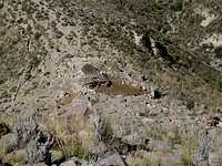
![Reserva Nacional Sign]() Reserva Nacional Sign
Reserva Nacional Sign
Around the beginning of July, I received an email from Tim, a fellow SPer from Salt Lake City. He had read my Arequipa Seven Summits report and wanted to climb some of those peaks using public transportation. I also was interested in climbing Chachani by the southern route using public transportation so we discussed that and agreed to do it together. As usual, Julver Castro, a mountain guide friend here, was willing to give us very helpful information about the route. He showed me some photos and pointed out the route on them, which seemed very clear at the time. He also told me that we could take a taxi to the first National Reserve sign on the old road between Misti and Chachani, which is the trailhead for the climb. I had driven past that point about seven months before, but didn't remember the sign. Not wanting to lead Tim astray, I decided to ride up there on my mtn. bike and check it out while he was climbing Pichu Pichu. I did this on Tuesday, taking a few photos and climbing up the first hill as well, to get a better look at the route. I again checked with Julver after returning to Arequipa that afternoon to confirm the route, using my photos.
On the Cheap - Using Public Transportation
![Combi for Chachani]() Combi for Chachani
Combi for Chachani
Tim and I got together to make final plans and agreed to take a combi as far as possible and then use a taxi to the trailhead. On Tuesday afternoon I had talked with a taxi driver at the end of the combi route, but couldn't find his card when I wanted to call to arrange for him to meet us there on Thursday morning, so we decided to just find one when we got there. I met Tim at his hostel at 7:00 am on Thursday and we walked a couple of blocks to get the combi (see route page for details). All went well until we got to the pueblo of Primero de Junio and the combi didn't stop at the same point I had found as the end of the line a few days before. Evidently there are a couple of different routes they use, anyway, it was only a five-minute walk from where we needed to be and a lady kindly gave us the directions.
Just as we arrived at the proper street and I realized that we were above the gas station where the taxis wait, an empty taxi came by so I flagged him down. He was familiar with the route and agreed to take us to the start of the gravel road for 15 soles or a little farther on the gravel road to the sign for 20 soles. It turned out that he had climbed El Misti many times, so we talked about climbing and religion the whole way to the trailhead. I didn't understand everything he was saying but the main point was that religious leaders should be out helping and teaching the people rather than just sitting in a fancy office drawing a large salary. I was in agreement with that so we got along well. He made sure we had his cell number so we could call to have him pick us up the next day, and even wanted to take our photo on his cell phone before he left.
Who Needs a Trail Anyway!
![Looking Down On the Goat Herder s Home]() Looking Down On the Goat Herder's Home
Looking Down On the Goat Herder's Home![Starting the Traverse of the Big Hill]() Starting the Traverse of the Big Hill
Starting the Traverse of the Big Hill![Going Up the Gully]() Going Up the Gully
Going Up the Gully![A Rest On the Way Up]() A Rest On the Way Up
A Rest On the Way Up![Almost To the Top of the Ridge]() Almost To the Top of the Ridge
Almost To the Top of the Ridge![The Final Climb To the Summit]() The Final Climb To the Summit
The Final Climb To the Summit
We started hiking just before 8:30 am and were soon met by the goat herder's dogs, which Tim was able to make friends with. Alfredo wasn't home but we talked with his sister and gave her a bag of bread, which they don't get very often. We then climbed up the first hill (which was the only part on a trail), followed the ridge to the larger hill and started our traverse around that. We stopped for lunch on the far side, and after that Tim decided to take the direct route down and through a large bowl while I chose to go around it, trying to maintain hard earned elevation. My route turned out to be a rough rocky traverse, which was slower than I expected, and I got to the other side about a minute after Tim. Then it was a fairly easy hike to Pampa Grande, where we found a nice campsite in the flat sand near a large boulder, at around 15,000 feet. However we were close to the mountain and the sun went down early, after which it turned quickly turned cold. We had our dinner of grilled cheese sandwiches and instant mashed potatoes and went to bed early.
Starting up the steep side of the mountain in the morning, we soon deviated from the normal route and took our own, a more direct route up a rock strewn sandy gully, rather than going back to the start of the long ridge. Tim went up the sand in the bottom of the gully while I hugged the rocks along the left side, at the base of a cliff at the bottom of the ridge. We later joined up and climbed up a rocky slope to the main ridge, just below a large step, which thankfully was easy to climb around. From there it was a direct climb up the sometimes very rocky ridge to the snow, just below the final summit ridge. We arrived there just before 1:00 pm, had a snack and put on our crampons. Thankfully the final climb on the snow wasn't quite as steep as I'm still not too confident with crampons and an ice axe, and we made it to the summit at a little after 1:30. Supposedly Chachani can be busy at times but in both of my climbs we haven't seen any other groups on the mountain, unlike Misti where there have been others at high camp, on the trail and at the summit. As usual the weather was clear and sunny and the views of the other Arequipa area peaks were spectacular.
By the Light of the Silvery Moon
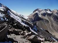
![On the Summit of Ampato]() On the Summit of Ampato
On the Summit of Ampato![Tim s Route Down]() Tim's Route Down
Tim's Route Down![A View of La Azufrera Route]() A View of La Azufrera Route
A View of La Azufrera Route
On the descent, Tim chose to keep his crampons on and go down the snow gully, after which he decided that would probably be the fastest and easiest ascent route as well. I stuck with the ridge until I found a sand slope to plunge-step down and then used a combination of sand and snow in the lower part of the gully. At 4:40 pm we were packed and leaving the campsite, hoping to get as far as possible before dark, as there is no trail for most of the way. We had just rounded the large hill and could see the almost full moon coming up behind El Misti, but as we traversed lower it went behind Misti again and we had to use our headlamps. We could see the Arequipa city lights off to our right, and knew that we had to keep Misti to our left, so we headed in-between in the general direction of Pichu Pichu, which was also nicely silhouetted in the moonlight. On the way, the taxi driver called to make sure we were OK and to see if we needed him to pick us up, however I had already called and made arrangements to have my friend Lucho meet us with my car.
We knew we needed to reach the long ridge and hill above the goat herder's home, but we couldn't see any detail in that direction. We finally had to sit and take a break while we waited for the moon to get above Misti so we could see our landmarks. We were making very slow time in the dark and I finally got a hold of Lucho by cell phone to tell him we would be late. He had gotten to the sign at 7:00 pm, our expected arrival time, and when we didn't show up after awhile he went and talked to Alfredo and his sister. She was worried about us and stood outside yelling "Gringos, Gringos", but we were too far away to hear her. We couldn't tell where we were on the ridge until we came to a fire circle on the top of the hill, just above their place. That is where the trail starts and we quickly found that and started down, flashing our headlights at Lucho waiting below. He flashed the car lights for us and we continued down, soon reaching Alfredo's house where he was waiting outside, relieved to see us. We reached the car at 8:40 and were soon telling our story to Lucho as we drove back down to Arequipa.
Comments
No comments posted yet.