
|
|
Mountain/Rock |
|---|---|
|
|
46.35361°N / 11.44478°E |
|
|
italy |
|
|
Hiking, Skiing |
|
|
Spring, Summer, Fall, Winter |
|
|
7602 ft / 2317 m |
|
|
Overview
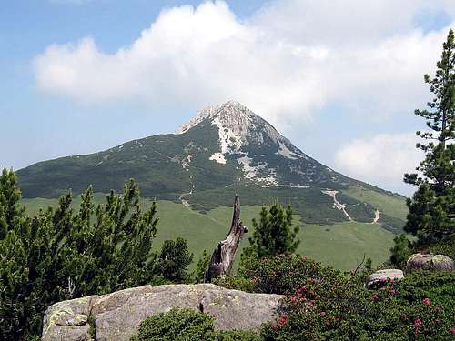
The Weisshorn 2317m.


Weisshorn (Corno Bianco) 2317m is a not very known (but however spectacular) summit belonging to Val di Fiemme: easy to get, it is popular in all seasons.
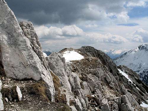
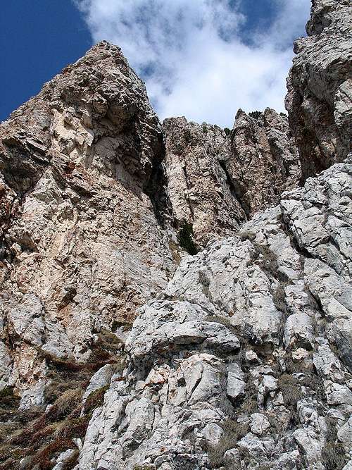
From its summit, between the rugged white rocks (limestone and dolomite), one can give a glance to the surrounding summits and groups :Corno Nero/Schwarzhorn, Latemar's spires, the Pala di Santa, the Sciliar group, the Catinaccio group featuring in foreground the Roda di Vael, the Fiemme range of Lagorai group ...
To its NW side it overhangs the spectacular canyon del Butterloch (Buco del Burro), a big crack, 8 km long and 400m deep, showing rocky and permian sediments layers. This wild environment is like a book about the different geological eras starting from 15 thousand years ago : history, climate, fossil life. Hiking along the Blatterbach stream is like a travel in antiquity and geological middle age.
The area near the Passo di Lavazé, with its turbary has been classified as biotope where many different animal species (34 different species of birds, just to give an example) and a rich flora (over 200 vegetal species) can be seen.
Borders
Weisshorn 2317m : the top
Its borders are:
This summit belongs to the dolomite chain of Val d'Ega (Eggental), whose main summits are:
Getting there
motorway A22 Brennero - Modena
Get out at Egna-Ora toll gate, forward along the SS 48 of Val di Fiemme till Cavalese then toward Passo di Lavazè and, 3 km later, to Passo Oclini
Public transport in Trentino
Public transport in Alto Adige
By train closest stations are : Ora, Trento and Bolzano, joined to the valley by daily bus service of SAD and TRENTINO TRASPORTI
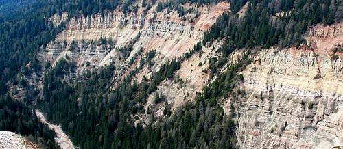
Bletterbach canyon
Route
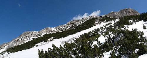
Weisshorn is not a difficult hike but an enjoyable tour among huge rocky structures and wild beauty sceneries.Starting from Passo Oclini (1989m) you must follow, westward, the dirt road leading to the Gurndin Alm and, after some hundreds of meters, on the right following the mark for Weisshorn: sentiero H or Gamplsteig. crossing wide meadows you get the mugo pine band, the white rugged rocks and the cross on the summit (2317m).
From the summit one can (should) go down towards the spectacular canyon Butterloch opened under the Weisshorn, following eastwards the path n° 5, descending steeply along the ridge and the debris cutting the canyon, then get the path H that brings back to the dirt road and the passo Oclini having done the "ring"
This area (Corno Bianco, Pala di Santa, Corno Nero) gives good opportunities in every season for ski-mountaneering and hiking, in the marvellous setting of the great groups of the Dolomites.
 Weisshorn | 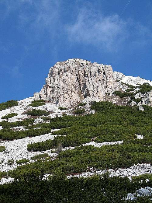 Weisshorn | 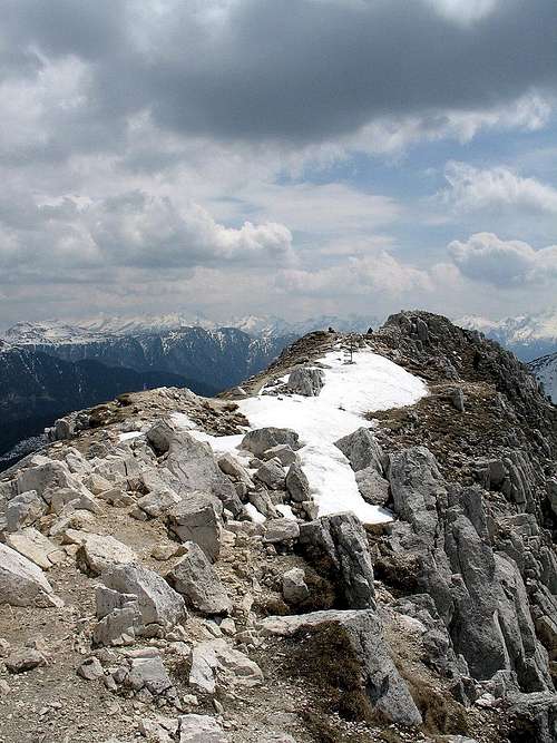 Weisshorn |
links
biotopi del trentinoCanyon di Bletterbach
Val di Fiemme info
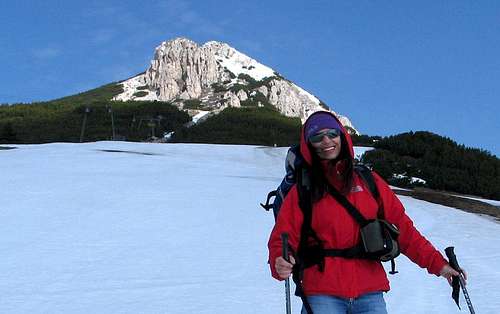
Weisshorn 2317m from the Oclini Pass (south side)
Mountain conditions
Dolomiti MeteoMeteotrentino
Maps and Books
Kompass: Guida Escursionistica - 974 Val di FiemmeKompass: Val di Fiemme/ Fleimstal Catena dei Lagorai - 618 1:25.000
Tabacco: Val di Fiemme/ Lagorai/ Latemar - 014 1:25.000
Weisshorn, south-west side