
|
|
Mountain/Rock |
|---|---|
|
|
41.64400°N / 112.0138°W |
|
|
Box Elder, Cache |
|
|
Hiking, Mountaineering, Skiing |
|
|
Summer, Fall |
|
|
9356 ft / 2852 m |
|
|
Overview
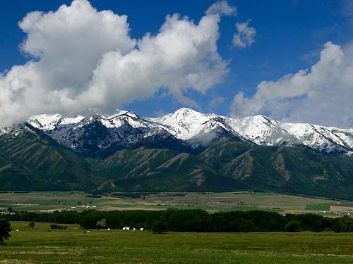
Wellsville Cone is the second highest mountain in the Wellsville Mountains of Northern Utah. The Wellsville Mountains are a subrange of the Wasatch Mountains.
The Wellville Mountains have been listed in some geology books as the steepest mountain range in the world (some say the United States) since the range is less than four miles wide and average and rises 4500 feet above the valley floors. While the mountains are steep and without foothills, they aren’t as rugged as say the Tetons.
Wellsville Cone itself is only 16 feet lower than Box Elder Peak, the highest peak in the Wellsvilles. Although slightly lower, Wellsville Cone is probably a little more impressive and scenic than Box Elder Peak. Before county highpointing and prominence came into vogue, Wellsville Cone was probably the most well know peak in the range. Before county highpointing became popular, Wellsville Cone was a more popular climb as well.
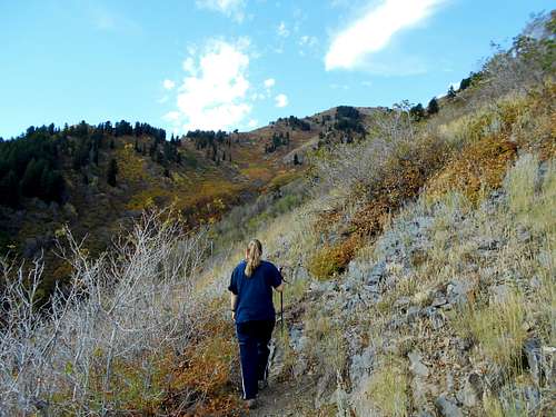
While four trails reach the summit of Wellsville Cone, all of them are steep and brushy and at least minor bushwhacking is required on all routes.
Because of heavy snowfall and high winds, Wellsville Cone just touches timberline. It is a popular place to view raptors as well and they are commonly seen all along the summit ridge of the range.
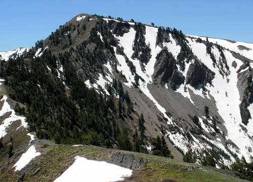 Wellsville Cone from the north.
Getting There
Deep Canyon Trailhead
First, drive to the tiny community of Mendon. Mendon is located west of Logan and north of Wellsville.
On Highway 23, which runs north/south through town, locate 300 North at the north side of town. Turn west on 300 north and follow the road for about two miles to the trailhead, which is at the end of the road.
Coldwater/Maple Bench Trailhead
First, drive to the tiny community of Mendon. Mendon is located west of Logan and north of Wellsville.
From Highway 23, which runs north/south through town, Main Street intersects Highway 23 on the south side of town. Follow the road south from Highway 23 and after a short distance turn right onto a gravel road (there may be a sign for Forest Service Lands here). Stay on the main gravel road and follow it to the trailhead at the end of the road. The road is a bit rough, but most cars can make it if driven slowly. The distance from the highway to the trailhead is about 3.5 miles.
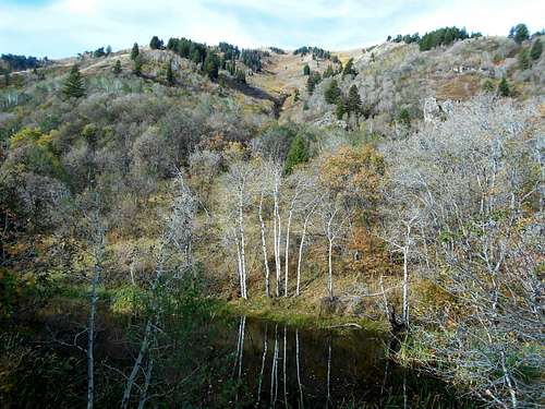 Coldwater Lake.
West Coldwater Trailhead
This trailhead is near the tiny community of Honeyville on the west side of the range. From Honeyville, rough dirt roads access the trailhead near a spring and water trough. Supposedly, it is OK to cross a piece of private land here, but obey any signs.
Rattlesnake Trailhead
This trailhead is located off Highway 89 and 91 between Brigham City and Wellsville. The trailhead is near the head of Wellsville Canyon and between mile markers 13 and 14.
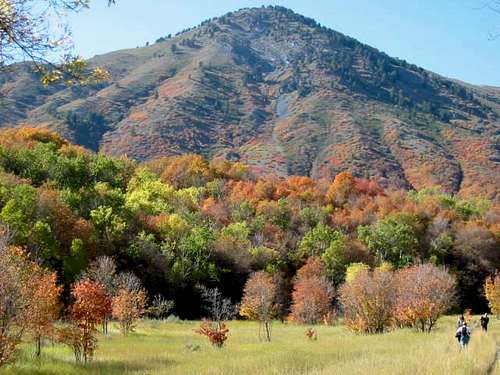 Near the Rattlesnake Trailhead.
Routes Overview
Wellsville Cone can be climbed from all directions. All routes are brushy, steep, and require some bushwhacking. Wellsville Cone can be climbed in combination with Box Elder Peak as a 0.9 mile trail connects the two peaks along the summit ridge.
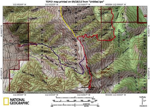 Yellow = Deep Canyon Route (much of the route is north of the map). Purple = West Coldwater Route. Red = Coldwater/Maple Bench Route. Click for full size.
Deep Canyon Route
This is one of the longer routes up Wellsville Cone. The trail (brushy) heads south through Deep Canyon and reaches the ridge after 3.2 miles. From there the trail follows the ridge past Mendon and Scout Peaks before reaching Stewart Pass at mile 4.9. Wellsville Cone is another 1.6 miles along the ridge from Stewart Pass. The total round trip distance is 13 miles.
The SP Deep Canyon Route Page described the route up Deep Canyon to Mendon Peak.
 Stewart Pass.
Coldwater Route
This is the shortest route to Wellsville Cone, but it may or may not be the easiest route. It is the only route I have done. From the trailhead, a good trail leads to Coldwater Lake (0.6 miles). From there the trail is confused by other cow trails before reaching the ridge. Once on the ridge, the steep trail climbs up to Stewart Pass. It is pretty brushy and very steep. Once at Stewart Pass, a good trail is followed south to the summit of Wellsville Cone. This route is 8.4 miles round trip.
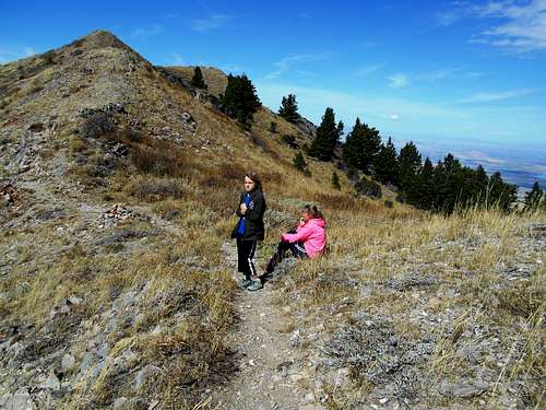
 Approaching Wellsville Cone from the north.
West Coldwater Route
An old trail climbs to the ridge between Stewart Pass and Wellsville Cone from the west side of the range. It is said to be steep, little used, and hard to follow in places.
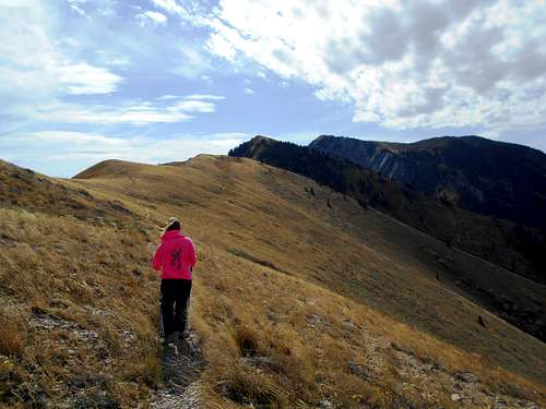
 Looking down the west side of the Wellsvilles.
Rattlesnake Route
This is probably the most used route up Box Elder Peak and can be used to climb Wellsville Cone as well. See the Rattlesnake Trail Route Page. The trail is said to be brushy, but pretty easy to follow. Once on the summit of Box Elder Peak, you can follow the trail south to the summit of Wellsville Cone, 0.9 miles away. This route to Wellsville Cone is about 10.8 miles route trip.
 Wellsville Cone from the summit ridge of Box Elder Peak.
Red Tape
No permits are required. Standard rules for designated wilderness apply.
 Make sure to stay on the switchbacks instead of cutting them.
When to Climb
The normal climbing season is late June through September. Expect to use an iceaxe before late June if climbing from the northerly routes.
Wellsville Cone would be very challenging from the northerly routes. Michael Kelsey, author of the Utah Mountaineering Guide says that the ridge south of Pine Canyon makes a good winter route.
 Wellsville Cone in June.
Camping
There are some pretty good campsites around the Coldwater Lake Trailhead. Because of the steepness of the range and the lack of flat ground, backcountry campsites are rare. Coldwater Lake is an OK campsite.
Mountain Conditions
WELLSVILLE MOUNTAINS WEATHER FORECAST
Below is the climate summary for the fairly close Beaver Mountain Ski Resort at 8016 feet elevation, and only 1300 feet lower than the summit of Wellsville Cone. These are all averages, so expect more variation, but this will give you a good idea about the climate at higher elevations in the area. Temperatures on the summit of Wellsville Cone should be 3-5 degrees colder than those at Beaver Mountain. *National Weather Service Data.
| MONTH | HIGH | LOW | PRECIP (in) | SNOWFALL (in) |
| JAN | 21 | 5 | 4.82 | 51.7 |
| FEB | 26 | 8 | 4.18 | 46.7 |
| MAR | 34 | 13 | 4.49 | 49.4 |
| APR | 45 | 23 | 3.95 | 33.6 |
| MAY | 56 | 32 | 1.82 | 8.3 |
| JUN | 65 | 39 | 1.08 | 1.7 |
| JUL | 75 | 47 | 0.78 | 0 |
| AUG | 73 | 45 | 1.15 | 0 |
| SEP | 64 | 36 | 1.04 | 2.3 |
| OCT | 51 | 27 | 2.23 | 16.0 |
| NOV | 34 | 16 | 3.54 | 35.4 |
| DEC | 24 | 7 | 4.66 | 57.9 |