
|
|
Route |
|---|---|
|
|
39.06280°N / 106.9516°W |
|
|
steep, loose scramble |
|
|
A long day |
|
|
class 3 |
|
|
Approach
RT-10miles and 4,400-ft
You might consider doing this climb in two days, hiking up the night before and doing the climb the next morning. This will allow you to take your time up the mountain with good weather. Again, good weather is essential.
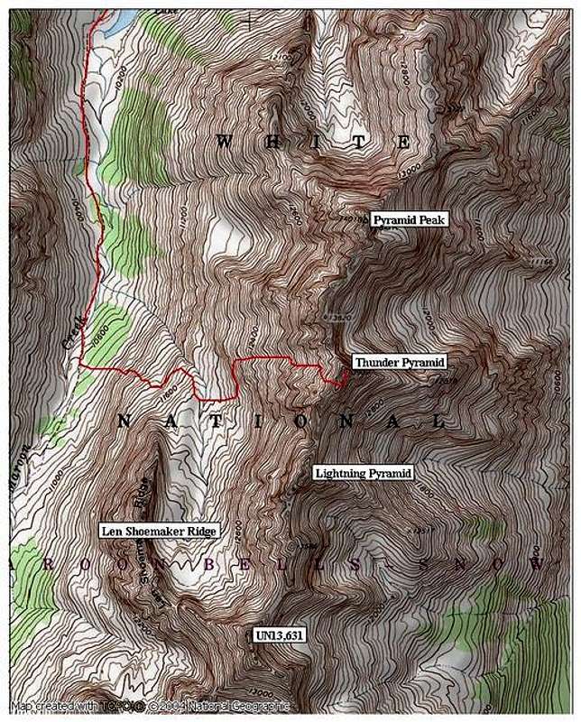
Overall the approach to Thunder is difficult. The first 3.5 miles is on easy trail. Once you leave the trail and begin the climb up into Len Shoemaker Basin is where this route gets tough. The entrance to Len Shoemaker Basin is ringed with cliffs. Locating the correct passage up through these cliffs is a bitch. Any trails you find in this area only last for about 50 feet, don’t expect to locate a trail that leads to the upper basin. There is an occasional cairn however, most of them will take you away from the correct route.
Starting at Maroon Lake TH (9,580-ft) follow the West Maroon Trail as it climbs the aspen laden benches above Maroon Lake. Continue about two miles to Crater Lake where you will come to a junction in the trail. Take the “West Maroon Trail” and follow it another 1.5 miles to a place where the trail will cross West Maroon Creek. This is the same spot where South Maroon’s standard route leaves the West Maroon Trail
Cross the creek and hike the West Maroon Trail another 50 yards and look sharp for a small cairn on the left. This marks where you leave the comforts of the trail. Find a faint trail and follow it to a boulder field that rests below the first set of cliffs. Once through the boulders, try to locate a boulder-strewn gully that provides a steep passage up through the cliffs. Once out of this gully you will be in another boulder field with a second set of cliffs above you. Hike out of this field and locate another steeper, boulder-strewn gulley to the left. You can hike on grassy slopes up to this gully. Climb this loose gully and reach the comforts of grassy benches that will escort you to the tundra filled Len Shoemaker Basin.
Route Description
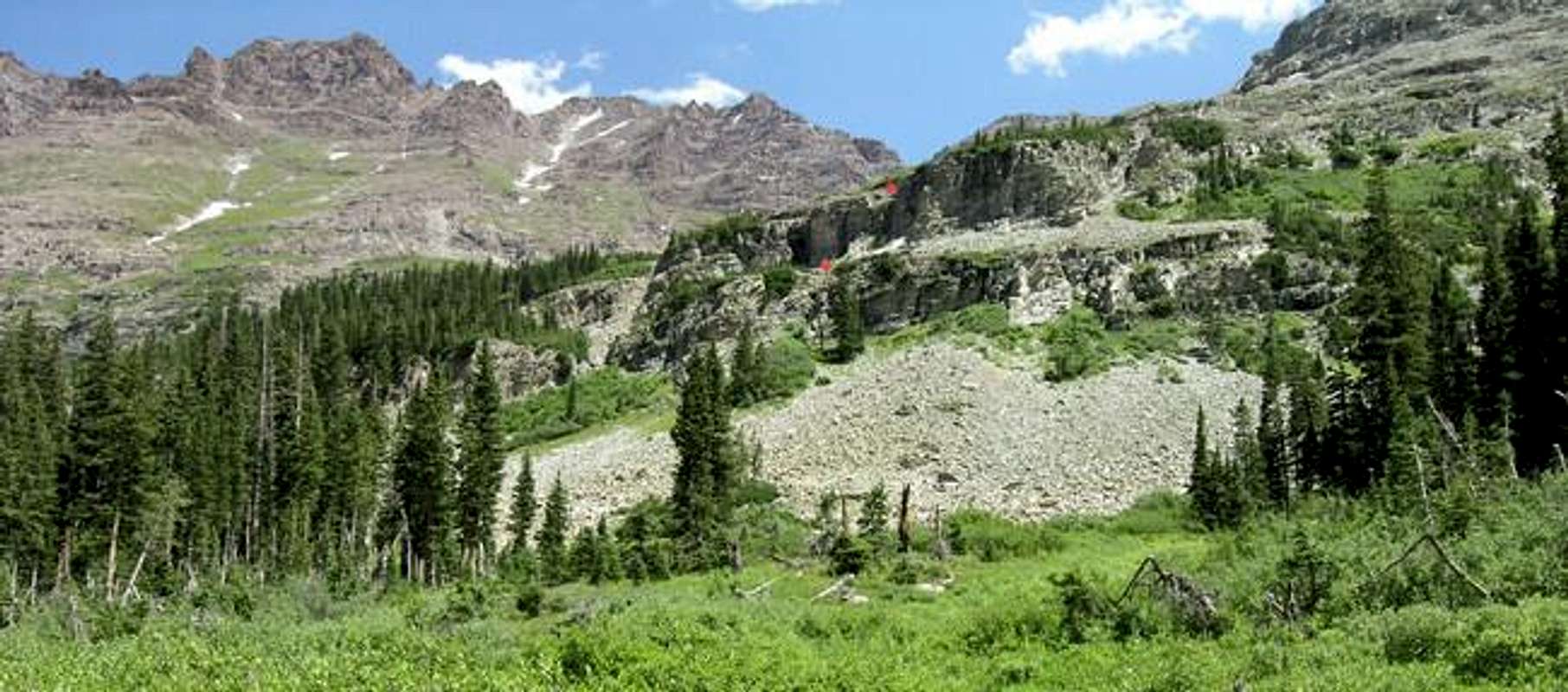
Once in the basin, you can easily see the White Couloir high on the mountain and rest of the West Face Route to the summit of Thunder Pyramid. Start an initial hike up through some loose talus and gain some grassy benches. Next, traverse to the left along these benches above a cliff to a place where a steep grassy gully runs down through your traverse. Leave the traverse and begin the steep climb up this gully. This gully will take you all the way to the White Couloir.
At about 12,400-ft, you can hike the steep, grassy rib on the left of the couloir all the way to around 13,000-ft. The route becomes obvious the higher you get. At around 13,000-ft you need to climb the White Couloir. The terrain inside the steep couloir is unpleasant scree and loose rock. Good footing the rest of the way to the summit is difficult to attain.
At about 13,400-ft the couloir becomes too steep and you will have to cross out onto the west face of the mountain. This is where the fun starts. The rest of this route to the summit is very difficult to convey in words. Just pick your way up through this mess the best you can. If you dislodge anything, its going a 1000-ft below and probably carrying everything along with it. No climbers should be below you at this point. The idea is to angle up to the right and gain the south ridge. If you angle too far to the right, steep drop-offs will suddenly appear, but that’s OK. The trick is to locate this drop off because there is more solid rock above you here for climbing and will provide some needed relief from the super loose stuff below. Also, this rock will get you to the south ridge. Once you gain the ridge crest, hike easy ground to the summit.
Descending this mountain is easier than coming up. Here is the catch, you must wait for your party to descend about a 1000 vertical feet and climb out of the White Couloir where safe ground exits from rock fall. You will understand what I’m talking about pretty fast; it’s absolutely impossible to descend the west face without dislodging rock with every move. Most of the rock just scoots down the face but quite a bit keeps going. There really is no way around this, unless two of you descend very close to one another, which may be somewhat awkward. I waited about 30 minutes for my party to get down this couloir. Thank God for the good weather.
Essential Gear
Helmet, TOPO map, trekking poles. Do not bring a rope.
Miscellaneous Info
If you have information about this route that doesn't pertain to any of the other sections, please add it here.