
-
 8544 Hits
-
 84.13% Score
-
 18 Votes
|
|
Route |
|---|---|
|
|
38.42264°N / 106.22481°W |
|
|
Hiking, Mountaineering |
|
|
Spring, Summer, Fall, Winter |
|
|
Half a day |
|
|
Class 2 |
|
|
Overview
Mount Ouray is a centennial peak (among highest 100 in Colorado) in Sawatch range, Colorado 13ers.Colorado Rank: 58
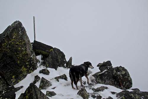
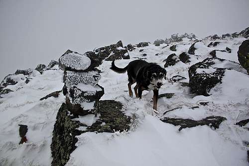
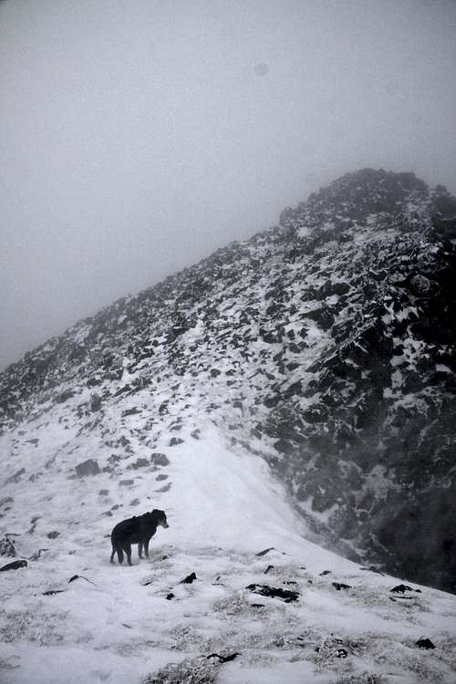 A strong wind would sometimes nearly knock me off my feet. Duchess did great. |  West Ridge of Mount Ouray | 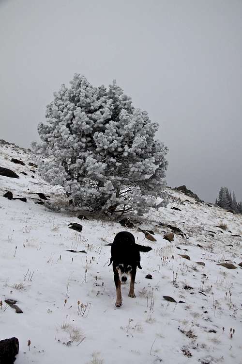 Accessing west ridge of Mount Ouray. |
West Ridge Route from Marshall Pass is one of the most common routes up Mount Ouray. James Dziezynski in his "Best Summit Hikes in Colorado" wrote: Ouray's west ridge is an adventure fit for a chief! Named after the great leader of Utes, this southern Sawatch mountain is a great hike, with views to mach.
Round Trip Distance: 6 miles
Hiking Time: 5 hrs
Class: 2
Elevation Gain: 3,260 feet (Starting Elevation at Marshall Pass TH: 10,813 feet)
Terrain: mostly off trail, but not much talus (grass, larger rocks). You can hike part of your way on Colorado Trail/Continental Divide Trail, which share the same trail in this section.
The hike can be nicely combined with Chipeta Mountain 12,775 foot and Unnamed 13,572 feet high peak (1.9 miles away). Chipeta Mountain is named after Chief Ouray's 2nd wife Chipeta. Chipeta was famous for her courage and wisdom, she was the only woman ever allowed to sit on a Ute tribal council, and she continued as a leader of her people of Ouray's death in 1880.
![Marshall Pass]()
The trail starts just a little bit below the top of Marshall Pass, on the east side.![Trailhead]()
Trailhead just below Marshall Pass.The route starts just below the summit of Marshall Pass. The Marshall Pass road is a nice dirt road, easily passable by 2WD vehicles, no high clearance needed. The turn off for Marshall Pass is well marked. You can either access it from the east, US Highway 285, 5 miles south of Poncha Springs. Turn west onto Marshall Pass Road, country road 200. From here it is 14 miles to the top of the pass.
Route Description
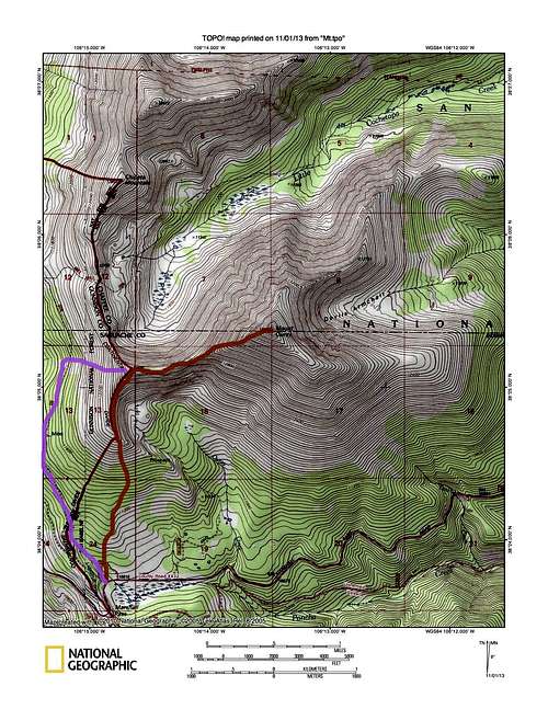
![West Ridge TOPO]()
Red - approximate hiking off trailPurple - Colorado Trail option
![West Ridge of Mount Ouray]()
West ridge of Mount Ouray.
Start at Colorado Trail - Continental Divide Trail (same trail here): you have two options. Option #1: Ascend initially gentle southern grassy slopes of Mt. Ouray to gain the west ridge. There are some trees, but off route hiking was easy, winding in between patches of trees and nice meadows. The terrain is easy to navigate, about 1 mile up you will get above the timberline, and see a ridge. Try to reach this spur ridge, which gradually curves into the west ridge. There are a few ups and downs along this section, occasional cairns on the route and some faint trail. The views should be spectacular (we had a stormy windy day with very poor visibility). The hiking is easy, at 2.2 miles you reach a saddle, keep heading up. Some sections of the ridge appear pretty narrow, but there is no difficult scrambling. You reach the summit after 3 miles of hiking.
Essential Gear
![West Ridge]()
West Ridge with frosty cairn.Hiking shoes, trekking poles, sunscreen, camera. Map.
Getting There
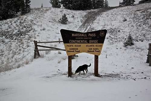
The trail starts just a little bit below the top of Marshall Pass, on the east side.
Trailhead just below Marshall Pass.
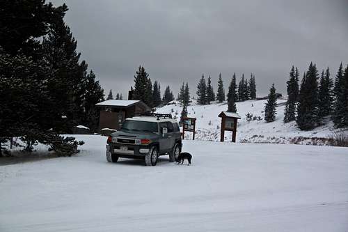
The Trailhead is well marked, just east (below the summit of Marshall Pass). There is ample parking and a large sign kiosk for the Colorado Trail, also vault toilet.
If coming from the west, turn from US Highway 50 at the town of Sargents on a good dirt road well marked for Marshall Pass. Come to the summit of Marshall Pass and continue east 0.2 miles to the above mentioned Trailhead for Colorado trail. There is a short section of narrow passage through a corridor just below the past.
History of Marshall Pass: the pass is part of backcountry alternative to U.S. 50 between Salida and Gunnison. Marshall Pass was discovered and named for Lt. William L. Marshall. of the Wheeler Survey, in 1873. Marshall Pass was part of the narrow gauge Denver and Rio Grande Western Railroad transcontinental route from Denver to Salt Lake City. The railroad line was completed in 1881, and it was closed in 1955. The rails were removed the same year.
Marshall Pass is just a few miles south of Monarch Pass, and both were considered as potential routes for U.S. 50, Monarch won.
Conditions: information on the status of the road closure can be obtained by contacting the Gunnison Ranger District office at 970-641-0471 (office hours 7:30 to 4:30, weekdays only).
Route Description
Red - approximate hiking off trailPurple - Colorado Trail option
West ridge of Mount Ouray.
Option #2: Follow the Colorado Trail - Continental Divide Trail for about 1 mile and then gain the west ridge. I used this option on my descent. The trails are well marked and easy to follow.
Descent: the same way. As I mentioned I encountered very poor visibility and missed the spur ridge on my return. I ended up on Colorado Trail, and took this trail back to the trailhead at Marshall Pass.
The hike is often combined with Chipeta Mountain (a nice tribute to Ouray's wife), which lies only 1.5 miles from the end of the west ridge to the north, and past Chipeta you can continue for another 0.8 miles to a large unnamed peak (UN 13,472 feet).
Essential Gear
West Ridge with frosty cairn.
Click for weather forecast
External Links
- Mt. Ouray on 13ers.com
- Interesting history of Marshall Pass - it sounds like we should be thankful for Marshall's toothache
- Description of Marshall Pass road
- Chipeta Roadless Area
- Monarch Crest Mountain Bike Trail - the trails follows the Colorado Trail and passes below Mount Ouray.
- Nice TR of West Ridge Route on Mount Ouray
- Another short description Lemke Climbs