
-
 6552 Hits
-
 77.48% Score
-
 8 Votes
|
|
Route |
|---|---|
|
|
39.13620°N / 106.1639°W |
|
|
Hiking |
|
|
Spring, Summer, Fall |
|
|
Half a day |
|
|
Steep Class 2 |
|
|
Overview
After winding under buzzing high tension wires, this route begins suddenly, steeply up the southwest slopes of the ridge between Ptarmigan Peak and Weston Peak. After leaving the parking area the hiker quickly ascends more than 1,000 feet in about 1 mile. Topping out on the ridge, the hiker will enjoy a walk in the sky between these two peaks with unobstructed views the entire time on the ridge. The cirque crested by Point 13,525 is a rugged, special treat in these otherwise gentle, rounded mountains. Welcome to Weston Pass
This wishbone-shaped route takes in two Colorado thirteeners, Ptarmigan Peak and Weston Peak, and treats the visitor to breathtaking views. After the initial steep climb, this route will keep your hiking team high above timber line for most of the outing. Keep a close eye on the sky and be prepared to bail quickly should weather threaten.
Roundtrip Distance: 4.25 miles
Elevation Gain: 2200 ft net gain (cumulative gain is quite a bit more)
YDS Rating: Class 2
Getting There
 Mosquito Range from Weston Pass Road
From Fairplay
When dry, this route is suitable for all passenger cars. | From Leadville
This route is best suited to high-clearance vehicles only. 4x4 strongly recommended. |


Click on images to enlarge.
Route Description
- Leaving the pass, head generally northwest under the buzzing high tension wires.
- A faint footpath can be followed briefly to the foot of the steep slope to the ridge.
- As the topo lines on your map constrict, follow the lung-busting, relentless climb to the top of the ridge.
- Topping out on the ridgeline, you have only one mile to go to the summit of Ptarmigan Peak.
- Bypass Point 13,525 to its west on the grassy ridge and head almost due north.
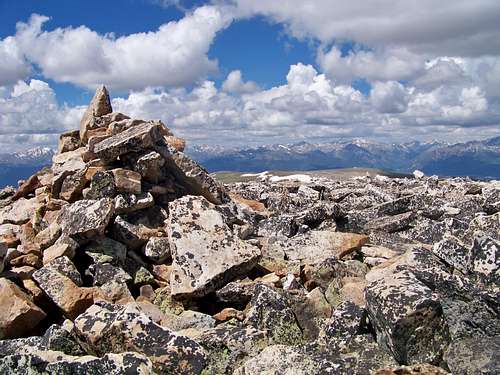
- Ascend the boulders and talus to the summit of Ptarmigan Peak, marked by a large summit cairn and pole.
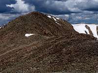 Hump on the ridge to weston
- Descend Ptarmigan Peak, retracing your steps heading almost due south, and again bypass Point 13,525.
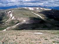
- About 1.5 miles from the summit of Ptarmigan Peak, ascend a small bump.
- The ridge then turns east-southeast and begins to narrow pleasantly and your next target, Weston Peak, is clear in front of you.
- Follow the grassy northwest upper slope of Weston Peak, reaching the talus and scampering the last few feet to the top.
- The summit is a broad expanse marked by black-and-white mottled boulders.
 Beginning the steep descent
- After enjoying the views, descend the northwest slope and re-cross the pleasant sky bridge to the hump.
- After crossing over the hump, turn southwest and descend steeply back to Weston Pass.
- Keen eyes may find a cross made of white rocks on these slopes.
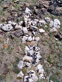 Cross on Weston Peak Slope
 Small purple flowers on Weston Peak
Route Map

Essential Gear
|  Crossing the ridge to Weston Peak Crossing the ridge to Weston Peak |