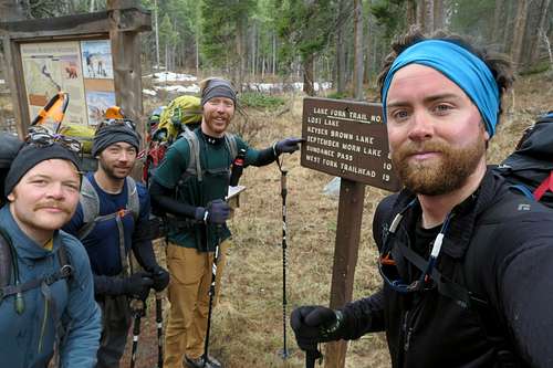
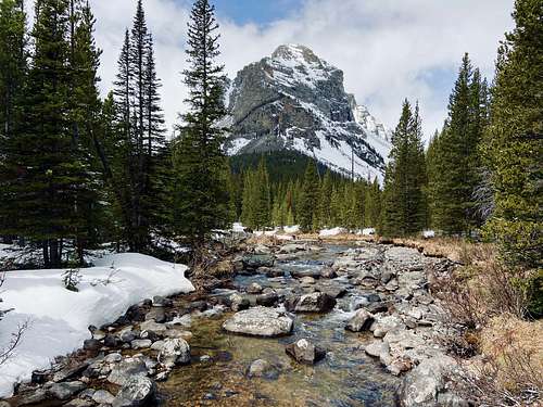
The day began at a camp along West Rosebud Rd after attempting Granite Peak the 3 days prior. Our day plan was to relax in the morning, break camp, stop in Red Lodge and relocate to the West Fork trailhead. The plan had been to summit Whitetail via the north facing Whitetail Couloir so logically the West Fork Trail to the northeast made the most sense.
After experiencing poor snow quality descending from Granite and seeing a few more inches of snow in the forecast the group discussed our options for how to proceed. In the end we decided to bail on the couloir plan and to take the northeast ridge route instead. We could use the same approach and camp in the same area between Sundance and Shadow Lake. The only difference would be on summit day instead of entering the couloir we’d take the switchbacks up to Sundance Pass and follow the ridge into a scramble to the top.
Our plan took an unexpected turn when we realized the last ~3 miles of West Fork Road was still closed. The road was open all the way up to the Basin Lakes trailhead/campground but was closed leading to Cascade campground and West Fork trailhead. According to our conversation with the Ranger later that day the road would still be closed for at least a couple more weeks.
Through some last minute research, brainstorming and a phone call with the Red Lodge Ranger Office we pivoted our plan to approach from Lake Fork Road and trailhead. This likely worked to our advantage because even though this approach is the same length, it has a nicer camp spot near September Morn lake and has fewer switchbacks to the top of Sundance Pass on summit day.
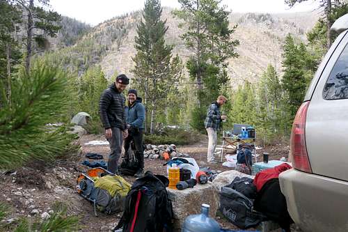
We found a nearby spot to camp for the night and spend the rest of the day packing our bags and prepping a meal for a speedy departure in the morning. Our rest and prep day had ended up being a lot more travel, problem solving and logistics than we had anticipated. However, having known there could be road closures we were relieved to have a tangible and realistic plan in place to pursue Whitetail in the off-season.
Thursday, May 14, 2020 – TRAIL DAY
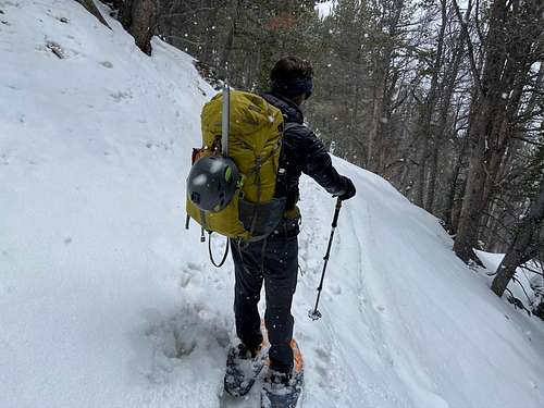
The day started with a 6AM wake up with ambitions of being on trail by ~7:30AM. At this point we were pretty quick at breaking camp. As a team we had fallen into a routine and had developed a somewhat efficient flow of individual tasks. We ate a meal of potatoes and breakfast sausage out of a shared pot and filled our thermoses with caffeinated green herbal tea for the drive.
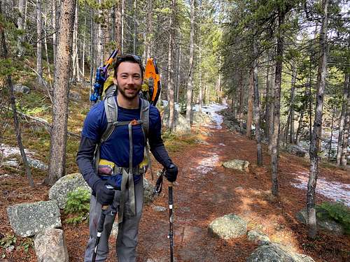
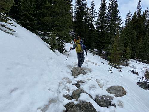
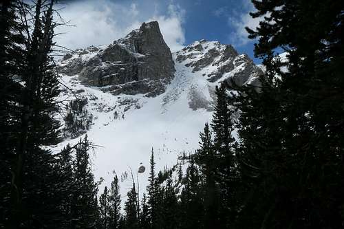
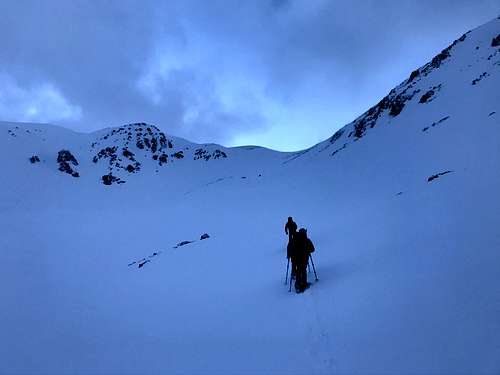
We were at the trailhead parking lot shortly after 7:30AM and on the trail moments after 8. The trail starts close to 7200’ gradually following a canyon and stream wedged between Silver Run and Hellroaring plateaus. The first ~4 miles was well trafficked and very easy to follow. The ground was covered in red, dead pine needles that helped with traction over snowy/icy spots. We each made comments about how pleasant the start to our hike was and how eventually it would become far more difficult. It did.
Miles 5 and 6 were covered in a lot more snow and we were no longer following the footprints of anybody else before us. It was getting more difficult to keep solid footing so I decided to throw on my snowshoes after some ugly postholing. The 3 other guys stuck to their boots so they had a good laugh when my first few steps in snowshoes were also postholes.
Soon all 4 of us were in snowshoes as we were continuing to gain elevation and more snow was inevitable. We made it to the bridge where the trail crosses over from the south side of the creek to the north. The bridge is very close to the 6 mile marker meaning only 2 more to reach September Morn lake. It was clear from standing on the bridge that the incline and elevation in those last two miles would increase significantly.
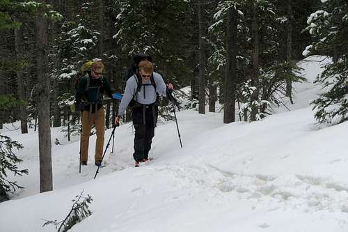
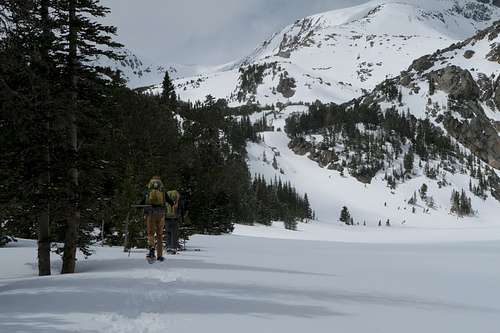
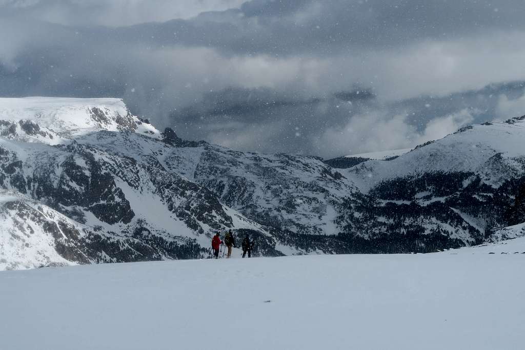
The last 2 miles took about the same amount of time as the first 6. It was a lot steeper and the south facing snow was a lot more cumbersome to deal with. At times the trees would break and we would have great views. Unfortunately those views came with melted snow and exposed dirt/rock trail. There were several instances where we would be snowshoeing through mud, dirt and rock for ~20 yards at a time. A couple times we had to rock hop in snowshoes over moving water that was trickling down the hillside.
Eventually there was a section of trail that looked to be ~50 yards of exposed rocky trail. I made the call to take off snowshoes because I was worried about damaging them. As soon as we continued past those ~50 yards the trail returned to snow and there wasn’t another rocky section for the rest of the way. By this point it was a sunk cost so we continued slowly by boot until the trail broke and we could see it round off into the base of a lake.
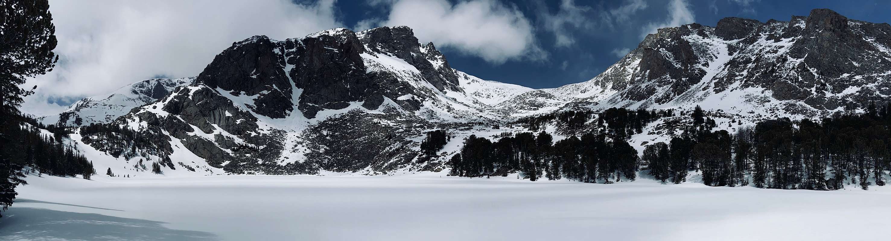
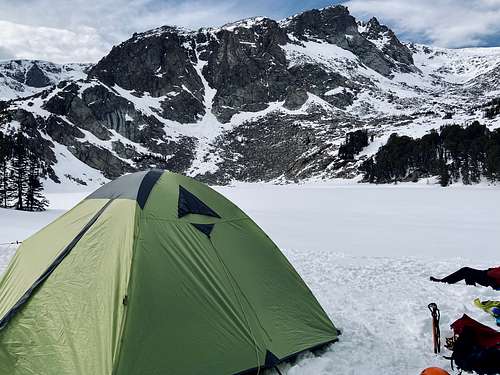
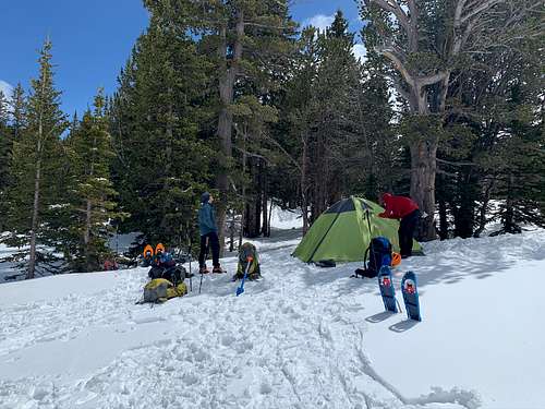
According to the map the trail runs along the south side of the lake through the wooded hills towards Sundance Pass. Following the trail became too difficult so we opted to follow the shoreline until we easily found a flat spot for a tent. Camping here was incredible. The surrounding cliffs overlooking a snow covered lake nestled between distant mountains was surreal.
It was between 2 and 3PM and we had ample amount of time to enjoy the afternoon into evening. After flattening camp with our snowshoes we erected the tent and anchored it in position. The spot was very protected of wind and guying out the tent was likely unnecessary.
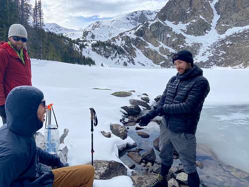
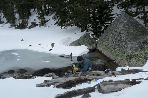
The rest of the afternoon was spent napping, eating food, and filtering from open water near the start of a stream. All four of us were relaxing and filtering water when we witnessed an avalanche from one of the gullies on the other side of the lake. It was far enough away that there was no danger so it made for a pleasant first avalanche sighting for a couple of us.
While the 3 other guys manned the water filter I decided to grab some bear mace and try to find the trail for a quick start the next day. I followed through gaps in trees but wasn’t certain if it was the trail or not. About a quarter mile later I popped above a wooded section on the southwest side of the lake. I saw a prolonged flat area leading towards Sundance Pass. It looked like it would be easy to navigate even if we were on trail or not. I headed back to camp, starting to get a bit paranoid of bears.
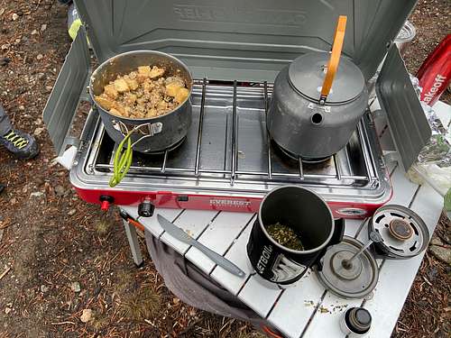
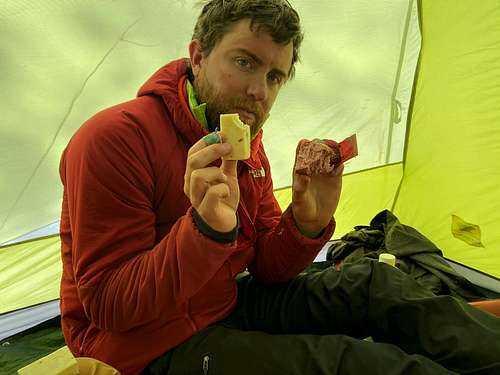
The rest of the evening was spent readying summit packs and lounging in the tent. We had made the decision to pack as little fuel-dependent food as possible so dinner for the night was salami with blocks of cheese. We turned in for an early nights rest in anticipation of a big next day.
Friday, May 15, 2020 – SUMMIT/RETREAT DAY
5AM alarm sounded and soon after the four of us were out of the tent. Summit packs were ready from the night before so all we really had to do was get in the right layers, do our morning duties and be on our way. We were intentionally dressed light to accommodate the extra heat we’d find once we started moving. It was decided to wait to eat tuna breakfast until we warmed up a bit.
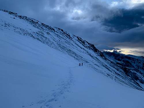
The group departed from camp following the same trail I had created the day before. All of us started the day in snowshoes and 20 minutes later we were at the point where I had turned around. We convened as a team to discuss our options and decided to march around a bend to a hilltop where there was another cropping of trees.
It worked really well. We moved up to the trees and they were sparse enough that we could walk through them single file towards the pass. Eventually the trees came to an end. We stopped at the very last group of trees to take protection from the wind and eat our tuna.
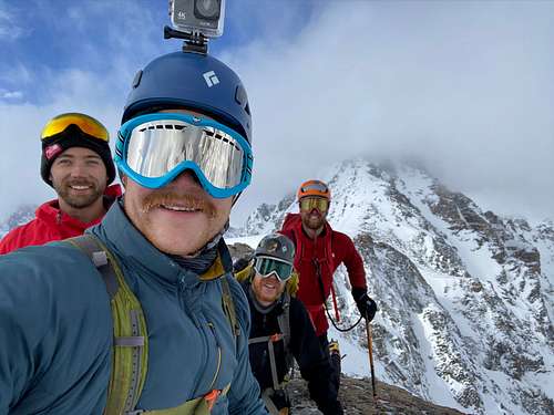
We discussed the best lines we could take to approach the pass and reached a consensus. We’d leave the cluster of trees for a group of rocks a few hundred yards up hill. From there we’d veer right passing the foot of a snow filled gully towards more exposed rocks. Then we would skirt around the underside of the rocks and continue straight up to the far north side of the pass. This would help us avoid coming anywhere near the overhanging cornice in the middle of the pass. All in all the plan was executed perfectly. We only took 2 or 3 short breaks to catch our breath.
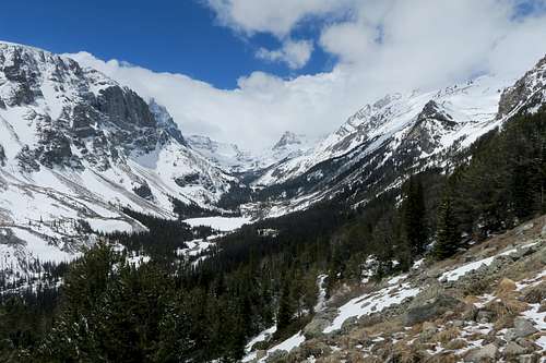
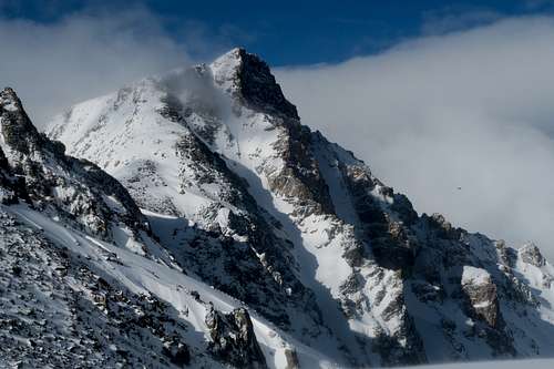
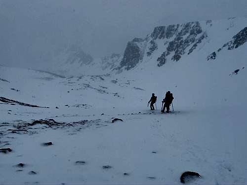
Once at the top, as we had expected, the conditions began to intensify. The wind speed increased significantly to 15-20MPH from being almost non-existent on the east side of the pass. The four of us came together to remark on our surroundings. The long distance visibility to the west was not promising. We could see the base of Whitetail but not the peak. There were walls of clouds in the distance and it was clear their movement was towards us. The clouds were not evidently storm clouds and there were visible breaks/gaps between them so we figured continuing onwards would not be entering us into immediate danger.
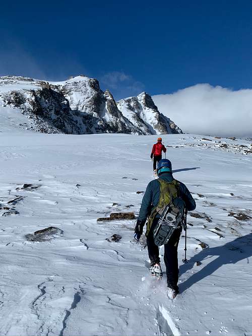
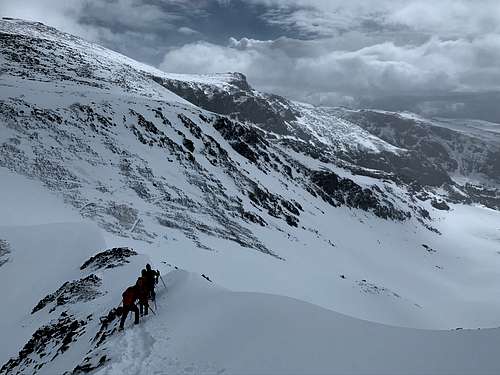
One by one we moved across the pass to the southwest towards Whitetail. We made sure to stay near to and on top of the rocks to avoid falling through any unsupported snow. In less that 50 yards we realized snowshoes were no longer going to cut it. We paused briefly to switch into crampons, leaving the snowshoes tethered to solid rocks so we could retrieve them later.
Our movement was a lot smoother and quicker having donned our crampons. We continued onwards another couple hundred yards when winds really picked up with snow and the nearsighted visibility rapidly deteriorated. As a team we discussed the situation and decided it wasn’t worth continuing any further should things worsen. We retreated backward together and grabbed our snowshoes before returning lower to the top of the pass.
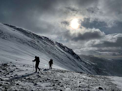
By the time we were back standing right on top of Sundance Pass a large break in the clouds arrived and we were surrounded by mostly blue skies. For the first time we could see the top of Whitetail. It was equally inspiring and hopeful having a good turn in the weather.
I suggested that the weather might hold and we should reconsider going back for Whitetail. It was only about 9:30AM. The guys agreed so after a capturing a few photos we were headed back in the direction of Whitetail.
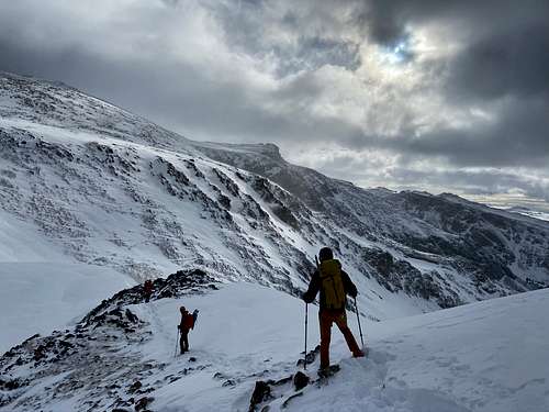
We secured our snowshoes at the top of Sundance and it did not take long for us to follow our steps and make up lost ground. We continued far past our previous turn around spot and ended up right alongside Mount Lockhart as the route suggests. We paused for a brief moment on a rock between Lockhart and Whitetail before getting to the ridges where the real scrambling begins.
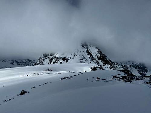
Again, the weather and clouds were beginning to change for the worse. We talked on the rock for a brief moment before agreeing that we really couldn’t predict what would happen with the weather once committed to the ridge of Whitetail. We weren’t comfortable proceeding into a situation we couldn’t control. Especially because the weather had been indicating it could change very rapidly.
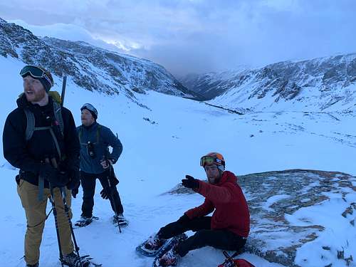
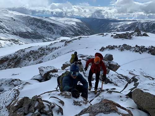
As a team we agreed to bag Lockhart before returning back to and down Sundance pass. The highpoint was already very close so topping out only required a short walk along an obvious snow line to get to its exposed rocky high point. We circled around to the front and had easy access scrambling up a handful of boulders to the top.
The four of us spent a few moments sitting at the top reflecting on the experience and were gladly justifying our decision to retreat. Whitetail was engulfed in clouds the whole time we were on Lockhart. We each took a nip of bourbon and a team photo, pleased to attain our consolation prize.
Our retreat was fast and straightforward. We just had to follow our footsteps back to where we came. Once at the top of the pass we grabbed our snowshoes before continuing back down. I was hoping for one last glimpse of Whitetail before descending but the clouds never let up.
The retreat was very quick and simple. It was all downhill following our path from before so there really was not much to it. We moved single file still wearing crampons and had no issues making it back to camp in only a fraction of the time. We were relieved knowing that we were still able to return to the car in the same day.
When we made it back to camp all we really had to do was grab and pack our things and be on our way. We decided to take a little extra time to filter more water as it would be convenient for the full trip to the parking lot. After bags were packed and water was topped off we equipped the snowshoes and were on our way.
The path down was much easier with snowshoes on opposed to postholing in boots through the holes we created the day before. We stomped through the dirty mud sections of the trail until it made sense for us to remove the snowshoes.
The first 2 miles back to the bridge crossing the creek was pretty quick. The remaining 6 miles to the trailhead, though straightforward, seemed to drag on forever. Once we were on relatively flat land we hastened our pace and started crossing paths with afternoon hikers.
We made it back to the car in the afternoon somewhere between 4 and 5PM. A lot of time was spent relaxing and unwinding in the parking lot. We changed clothes, ate Cheetos and shotgunned a couple beers.
I have plenty of photos in the report but they’re not visible to the public yet. I think it’s because it's so new and they need to publish to the site? In editing mode they’re all there. But when I’m not logged in they don’t show up. Unsure what’s the deal!
Parents refers to a larger category under which an object falls. For example, theAconcagua mountain page has the 'Aconcagua Group' and the 'Seven Summits' asparents and is a parent itself to many routes, photos, and Trip Reports.


Comments
Post a Comment