Overview
![View from Trail #9]() View from Trail #9
View from Trail #9The Willow Creek Trailhead provides an approach to Harney Peak from the north. The primary advantage to this route is that there are significantly less people on the trail than you will find on any approach from Sylvan Lake (we saw only two other groups on
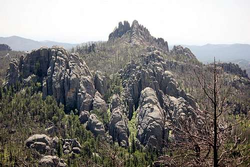
our 4-hr. ascent). The trail is also quite scenic, with unusual rock formations and occasional views out over the Needles. The drawbacks (depending on how you look at it) are greater distance and elevation gain. It is almost 6 miles from the trailhead to the summit, and a total elevation gain of around 2600'. For the hiker looking for solitude and a slightly bigger challenge to ascending Harney, the Willow Creek approach will serve nicely.
Getting There
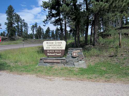
![Harney Pk via North #9]() USFS sign along SD-244
USFS sign along SD-244The trailhead can be found along SD-244, west of Mount Rushmore. To get there from I-90 (either direction) take exit 57 onto I-190 S. In Rapid City this becomes US-16, which you follow for about 18 miles. At the large directional interchange go left onto US-16A toward Mount Rushmore. At the junction with SD-244 continue straight past Mount Rushmore 7.3 miles to the turn-out on your left. There is a large brown-and-yellow USFS sign marking the lane, easily visible from either direction. Head down the lane to the grass parking lot. The trailhead is next to the large sign at the far end of the lot. There is no charge to park at this trailhead and hike to the summit, as this is outside of Custer State Park. However, you are required to submit a permit. Permits and the box to submit them are at the large map sign are at the trailhead.
If you're already spending time in the Black Hills and just want the distances to local points of reference:
- from the Mount Rushmore parking lot it is 5.7 miles to the turn-out
- from the junction with US-385 it is 3.1 miles to the turn-out
Route Description
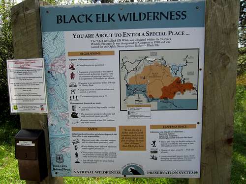
![Harney Pk via North #9]() Large "map sign" at the trailhead
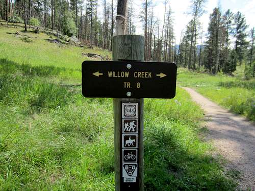
Large "map sign" at the trailhead![Harney Pk via North #9]() Trail #9 also goes to the left!
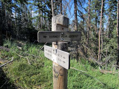
Trail #9 also goes to the left!The trail signage is immediately confusing if you aren't familiar with the trail numbering. Trail #9 will take you all the way to the summit spur (and on southward to Sylvan Lake if you have a shuttle), but no signs for Trail #9 exist at the trailhead. Heading past the large map sign you will immediately come to a small sign informing you that Trail #8 branches off in both directions, with no mention of Trail #9. This is because Trail #8 is a small loop trail at the Willow Creek trailhead. However, be not afeared, Trail #9 is concurrent with Trail #8...to the left! Follow the route to the left and you will be on your way to the summit.
![View of Harney summit]() View of Harney summit
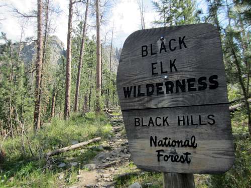
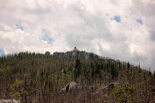
View of Harney summitFor the first bit of the trail you will stick pretty close to the highway (SD-244). Eventually, however, the trail heads south in earnest, shortly after breaking off of Trail #8. Shortly after this, the trail junctions with Trail #5, which heads toward Horsethief Lake and Mount Rushmore (via Trail #89). After this junction, Trail #9 is all alone all the way to the summit. Not long after the junction with Trail #5 you will cross into the Black Elk Wilderness, which is signed. The trail is a simple walk, but the elevation gain is not insignificant. The footing is easy, and I can only recall one tiny stream crossing. I did not test the water, but I did use it to wet my hat brim and water the dogs. There was some tree-fall in places across the trail. This is obviously a changing component of the trail, but due to the lack of use on this trail, downed trees probably remain for awhile before someone lugs a chainsaw up to clear them. The summit itself is capped with an old (no longer used) fire tower, and this is easily visible from many points along the trail. The view of "how far" and "how high" you still have to go can either invigorate or dismay the hiker, depending on his attitude.
![Harney Pk via North #9]() Jct of Trail #9 and summit spur
Jct of Trail #9 and summit spurEventually, Trail #9 reaches the ridgeline of Harney Peak. The trail now continues down toward Sylvan Lake (3.5 miles further south), but a spur trail leads directly to the fire tower and summit. Hikers will immediately see a surge in traffic as they join with those hiking up the Sylvan Lake trails. The summit area was very crowded when we were there, but not as many people were going up to the top level of the tower, so I got pictures from there. After enjoying the summit, you can hike back to Willow Creek or continue south to Sylvan Lake if you have a car or shuttle ready.
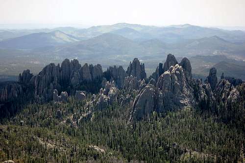
![Needles from Harney Peak]() Needles from Harney Peak
Needles from Harney PeakEssential Gear
Good hiking boots (a lot of the footing is rock, although usually flat/smoothed) and a hat are recommended. A tourist in sneakers and a fanny pack would have no trouble completing this hike assuming they had the stamina. Remember it is about 11 miles round trip.
External Links
Add External Links text here.

 10460 Hits
 75.89% Score
 7 Votes