-
 3445 Hits
-
 78.27% Score
-
 9 Votes
|
|
Route |
|---|---|
|
|
43.82676°N / 103.47135°W |
|
|
A long day |
|
|
Overview
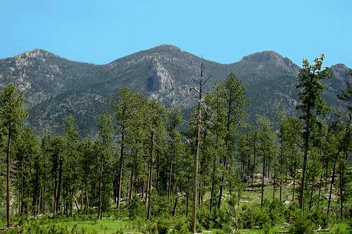
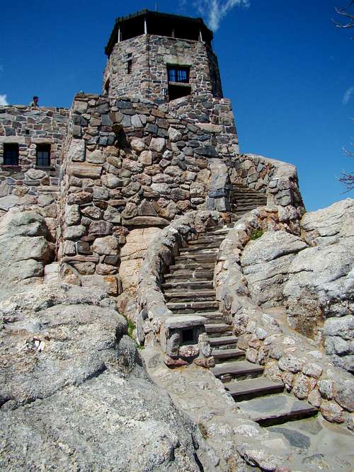
Black Elk Peak is not only the highest summit in the Black Hills it is also one of the most popular hiking and climbing destinations. To reach the summit, most hikers use Trail 9 south, which often makes for a lot of traffic on that route.
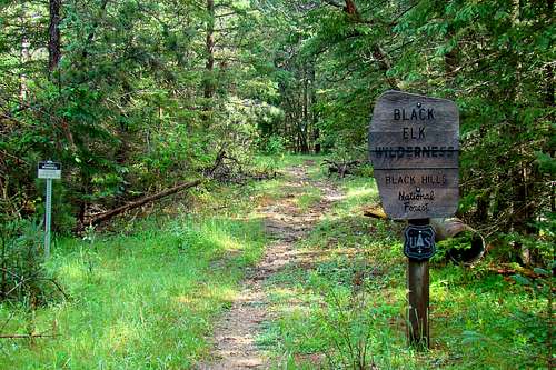
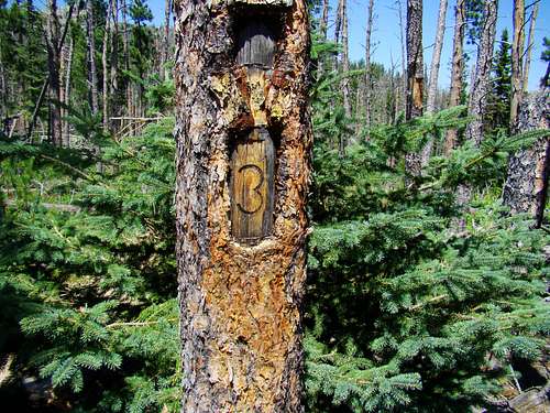
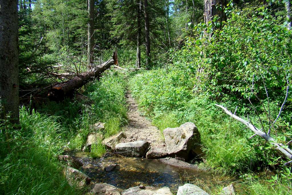
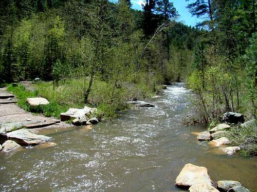
One of the most scenic alternatives for more serious hikers and climbers is Trail 3, the Norbeck Trail in the Black Elk Wilderness. Because the trail is much longer than Trail 9 or even Trail 4, this route sees far less traffic. And yet, this often rocky and narrow trail passes through rugged and beautiful mountainous terrain, sometimes quite steep, on its way to the summit area of Black Elk Peak. Much of the trail follows or parallels Iron Creek, a beautiful clear mountain stream. It is a scenic route that allows for lots of solitude plus dispersed camping opportunities.
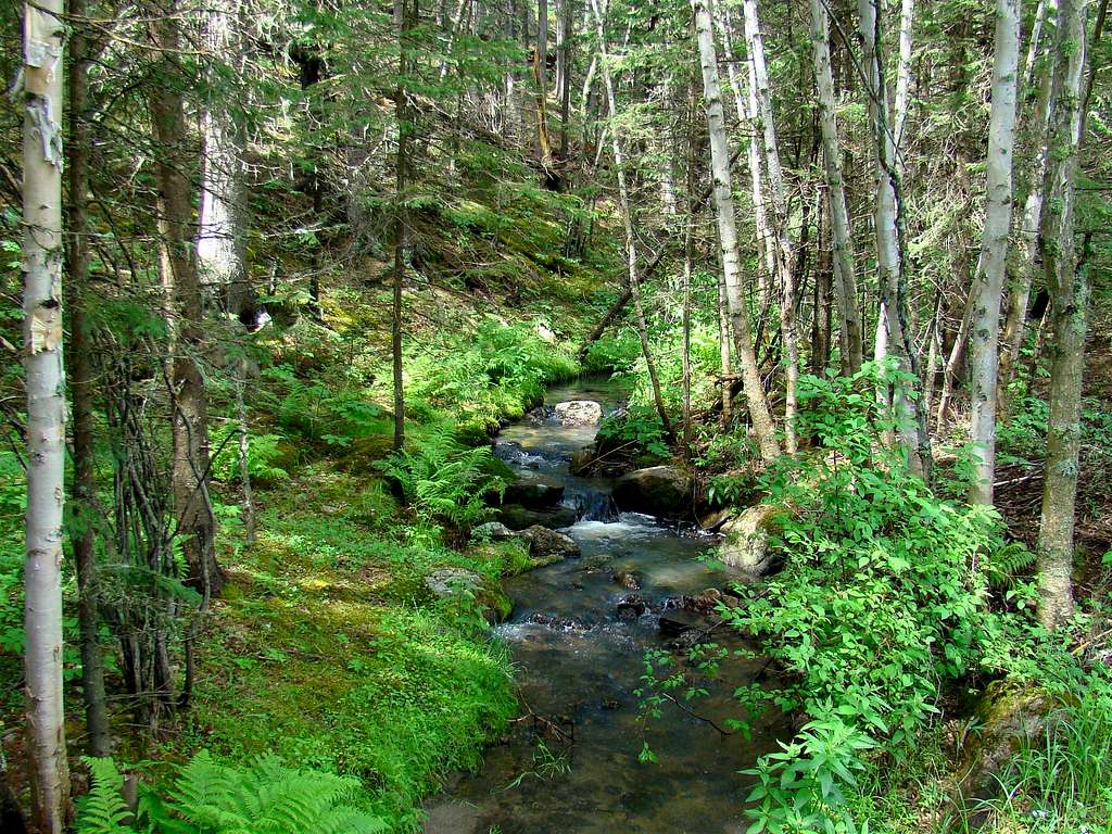
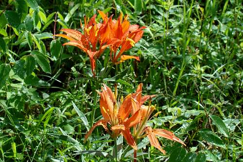
Wildlife commonly seen in the wilderness area includes deer, elk, mountain goats, bighorn sheep, wild turkeys and mountain lions. The granite rock formations and spires that are so abundant in the area provide excellent terrain for the bighorn sheep and the mountain goats. The forest in the area is comprised mostly of ponderosa pine, spruce and aspen trees. While the water in Iron Creek looks crystal clear, forest service officials advise it should still be purified before attempting to drink it.
Getting There
From the Custer State Park Game Lodge on Highway 16A, travel west 6 miles to the Needles Highway (87A). Follow the Needles Highway 5.7 miles to Camp Remington Road, turn left and go .4-mile to Iron Creek Horse Camp Road, turn left and go .5-mile to the camp and the trailhead, located on the west side of the campground.
If you are driving from Rapid City, the distance to the State Game Lodge is about 30 miles (south-southwest), and takes about 40 minutes to get there.
Red Tape
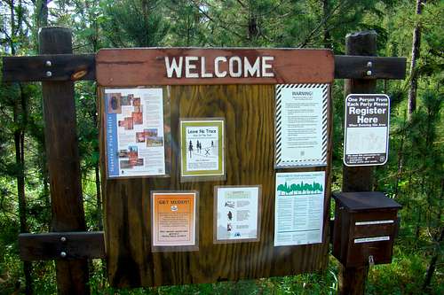
To venture anywhere into the Black Elk Wilderness, you will need to register at the kiosk located at the trailhead of the trail you choose. If you neglect to do this, you could be fined. Who needs a fine when it is free to register?
Dispersed camping is allowed anywhere in the Black Elk Wilderness, except within ¼ mile of Black Elk Peak and within ¼ mile of Trail 9. However, no open campfires, motorized vehicles, bicycles, strollers or carts are allowed in the Black Elk Wilderness. All dogs must be on a leash.
For additional Information, you may contact:
US Forest Service
Black Hills National Forest
1019 N. 5th Street
Custer, SD 57730
605-673-9200
Route Information & Options
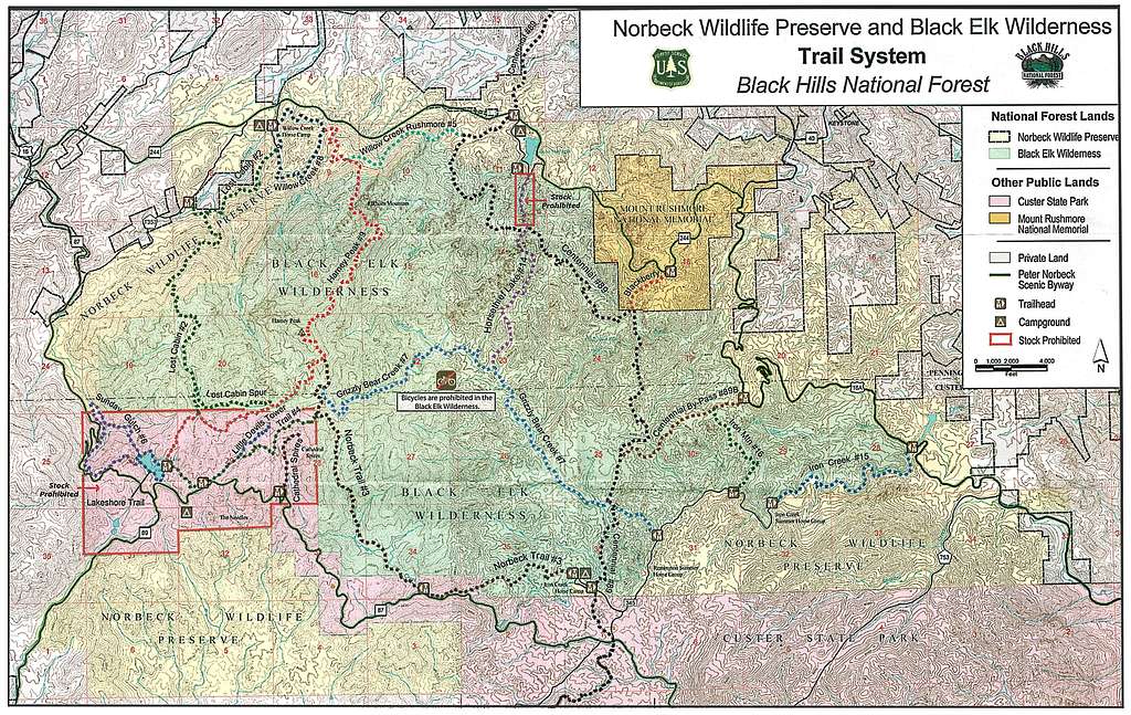
Trail 3, the Norbeck Trail, runs 6.3 miles from Iron Creek Horse Camp to the junction with Trail 9 near the summit of Black Elk Peak. It is another .4-mile from the trail junction to the summit. There is an elevation gain of around 1,700 feet on Trail 3, then nearly another 400 feet to the summit of Black Elk Peak on Trail 9.
The elevation gain over the first 5 miles of Trail 3 is around 800 feet, making for a fairly leisurely hike for that segment. However, the trail then begins to ascend in earnest after the last crossing of Iron Creek, rising another 900 feet over the last mile or so, making this section moderate to difficult.
An interesting option for your return trip is to take the Grizzly Bear Creek Trail, (Trail # 7) when you reach that junction. When you reach the Centennial Trail (#89), take that south back to the Iron Creek Horse Camp. This option will add a few tenths of a mile to your return trip, but will also treat you to some more of the spectacular granite formations that characterize the Black Elk wilderness.
A shorter and popular option for an out-and-back would be to park at the Upper Iron Creek Trailhead along Highway 87A, the Needles Highway. The distance from this trailhead to the Trail 9 junction is approximately 3.7 miles, with an elevation gain of about 1,500 feet to the Trail 9 junction. Parking is plentiful at this trailhead.
Downloadable Black Elk Wilderness Map & Brochure
Essential Gear
Because of the length of this trail, an adequate water supply is essential. Water from Iron Creek can be purified, but the last two miles are away from the creek, so plan carefully. Appropriate footwear, for what could be 14 miles of hiking, is very important in your plans. There are plenty of mountain lions in this secluded area, so pepper spray is a good idea. If you are doing dispersed camping along the way, you will need to include that gear in your plans. If you are rock climbing along the way, you will need to bring whatever gear corresponds to your plans. And of course, other common things like food, sunscreen, camera, hiking poles, a first-aid kit, etc. are often on many hikers planning lists.
When to Hike & Climb
The Black Elk Wilderness is in the highest part of the Black Hills, and can be subject to heavy thunderstorms, lightning, and hail in the summer, and blizzards in the winter.
Because of past forest fires plus trees killed by pine beetles in some locations, there is significant deadfall, creating potential falling tree hazards (“snags”), especially on windy days. Please be aware of the potential hazards when making your plans.
Because of the steep terrain, cell phones often do not work, so please do not depend on them in your plans.
To check out weather forecasts and conditions, click on this link:
Weather Forecast & Conditions for the Black Elk Wilderness Area
Black Elk Wilderness Area Camping Information Links
Black Hills National Forest Dispersed Camping