
-
 9360 Hits
-
 86.19% Score
-
 22 Votes
|
|
Route |
|---|---|
|
|
54.49238°N / 3.2959°W |
|
|
Scrambling |
|
|
Summer |
|
|
Less than two hours |
|
|
grade 2/3 scramble |
|
|
II |
|
|
OVERVIEW
Topo of Wistow Crags, Pillar
This page was originally posted by Georgen in 2009 - with his kind permission I have adopted and updated it with some more detail and images...
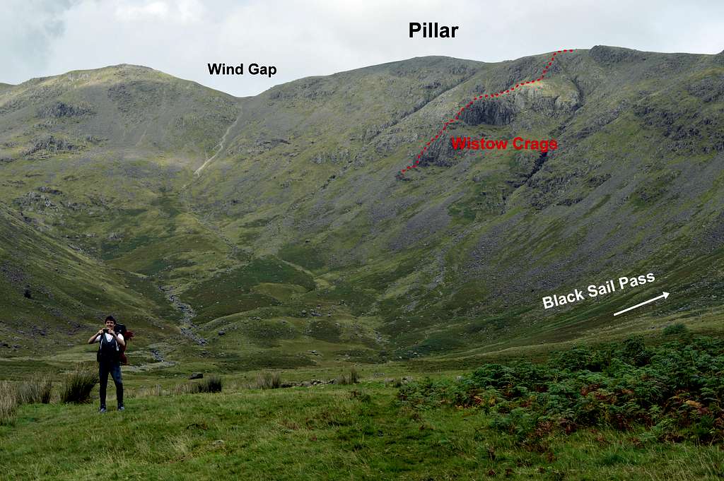
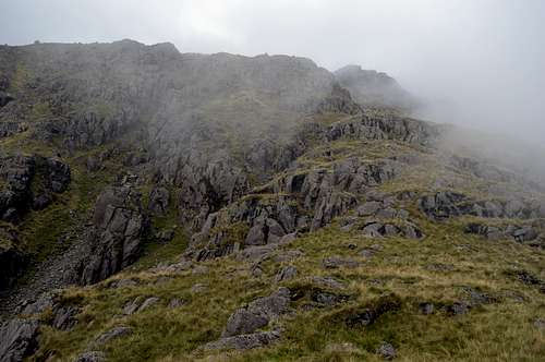
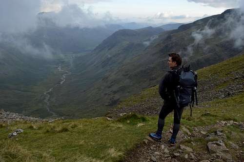
Access to Wistow Crags is from Wasdale Head in the western English Lake District. The walk in, up the side valley of Mosedale, involves a little over 3km horizontal distance and something over 400m ascent. Much of the walk in shares the same path as the main walking approaches to Pillar and Pillar Rock and is thus well defined. However, the final approach deviates away and follows a distinctly ill-defined course over partly overgrown scree and mossy boulders to reach the start of the route at the foot of the buttress. Lack of an obvious path and little ‘polish’ on the rocks to show the way indicates that the route is little frequented – and route finding is correspondingly mildly challenging, especially low down where the climbing is also at its steepest and hardest.
In terms of seriousness, the hardest climbing is low down and can be avoided on grade 2 scrambling terrain to the left of the buttress. Thereafter the climbing and route finding become progressively easier and a competent rock-climber could solo this route fairly safely in dry conditions. Nevertheless it is a long mountaineering route ending close to the top of a biggish mountain by English standards. General hill-walking skills including navigation with map/compass/GPS can be called for in addition to those of rock-climbing. The crags are south facing so theoretically should dry quickly after rain - but we are talking English Lake District - the sun can be a rarity, even at the height of summer and some of the rocks may be slow to dry, especially where there is vegetation.
APPROACH
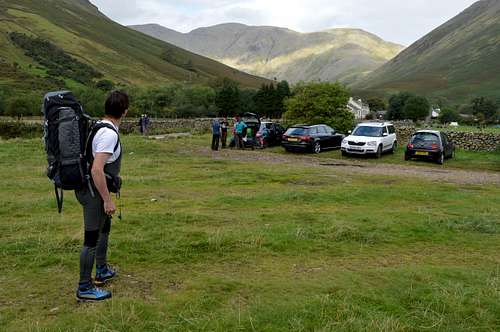
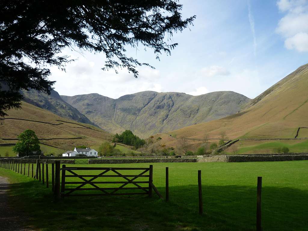
Pillar from Wasdale Head Car-Park
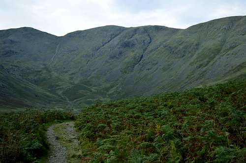
Pillar south face - path can be seen continuing to Wind Gap in distance
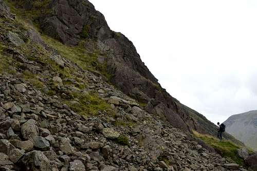
Just a little above the lowest rocks of the buttress (GR 174 115) there a few flattish grassy platforms, but the flattest and most plausible looking is the start of the route, just at the edge of the obvious gully to the left (west) of the lower buttress.
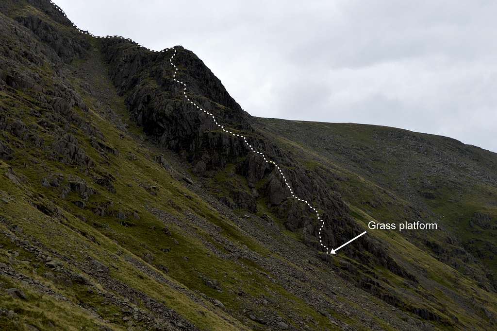
Wistow Crags route showing grass platform at start
OS Map image of area:
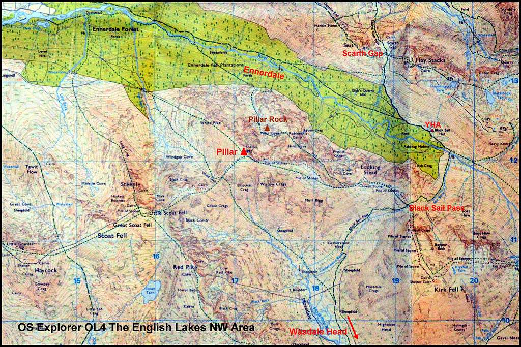
OS Map image of Pillar, Lake District
THE ROUTE
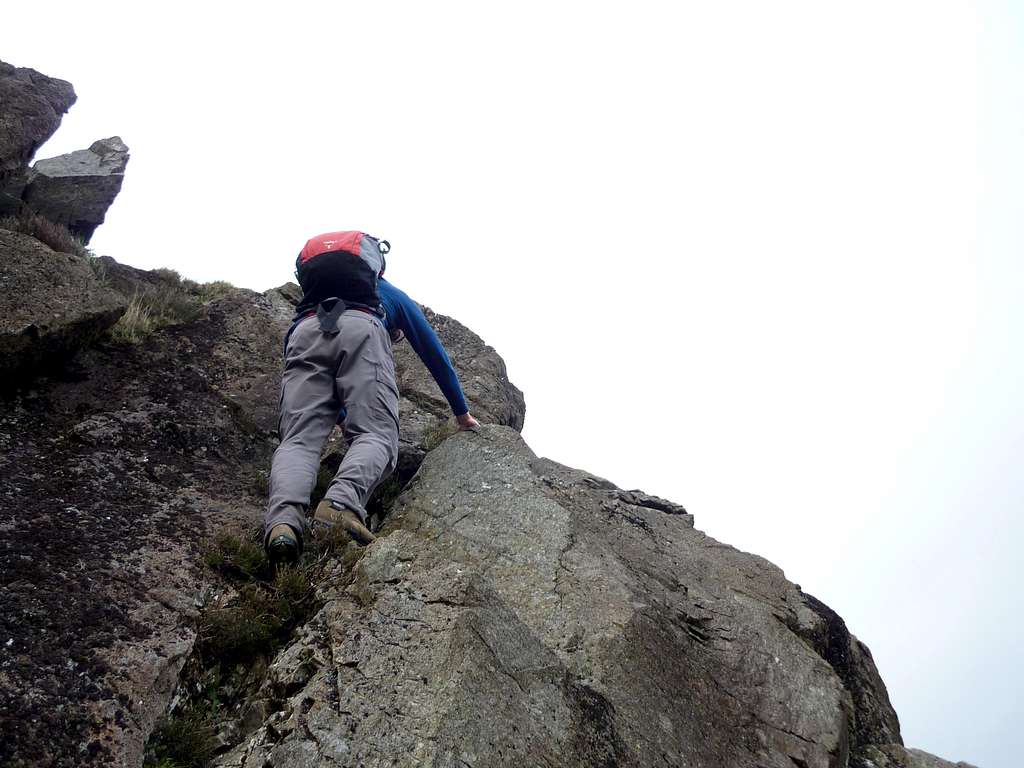
The Start: The Brian Evans Cicerone guide describes the start thus: “Start at a grass platform at the foot of the buttress. An easy initial stretch is followed by a steep wall which proves to be the crux (grade 3), but this can be avoided by a detour on the left…”
 Grassy terrace at start of Wistow Crags - note paler rock where route goes... | 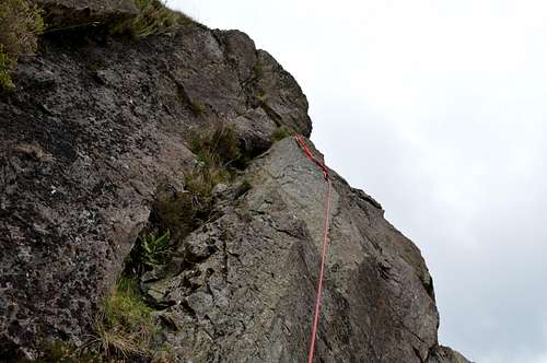 The crux - just above terrace - note light moss cover worn away on route | 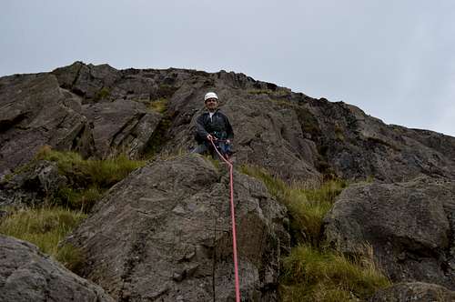 Above the crux at the top of the 1st pitch |
When I did the climb on 26th September 2015 my companion and I found a few grass platforms but the most level proves to be the one. As above the rocks are too ill-frequented to show much polish, but nonetheless the route can still be identified from a distance by the apparent slight paleness - where a light covering of moss is worn away (see photos above). We weren’t too sure about the exact location about this ‘wall’ since again, there seemed to be more than one possibility and there was no indication as to how long the ‘easy initial stretch’ was to reach it. In the event both proved to be very short and the wall not especially difficult – and we only worked out we had climbed it when we recognised that we had almost immediately reached “the base of a fine rib to the right of the gulley”
The crux as seen in 2009 - image by Georgen
The ‘wall’ is more of a mild steepening of the otherwise relatively gentle gradient of the spur. There is a small grassy crack (see middle photo followed by Georgen's photo above) with a step to the right at the top after perhaps 3-4m – which is easily protected with a sling (as in middle photo), if a rope is used. This move is described as ‘airy’ and there is a sweep of steep rock below and to the right down to the lowest extremity of the buttress – but there is none of the electrifying exposure of Slab & Notch, on Pillar Rock on the other side of the mountain – which is at the same grade.
Lower Tier: Above the slightly steeper start the route finding becomes easier. As described in the Cicerone guide there is indeed an obvious ‘rib’ forming the crest of the spur at the right of the gulley. This this gives some pleasant and easy climbing for some distance before terrain starts to become progressively more broken as the ‘top’ of the first tier is reached.
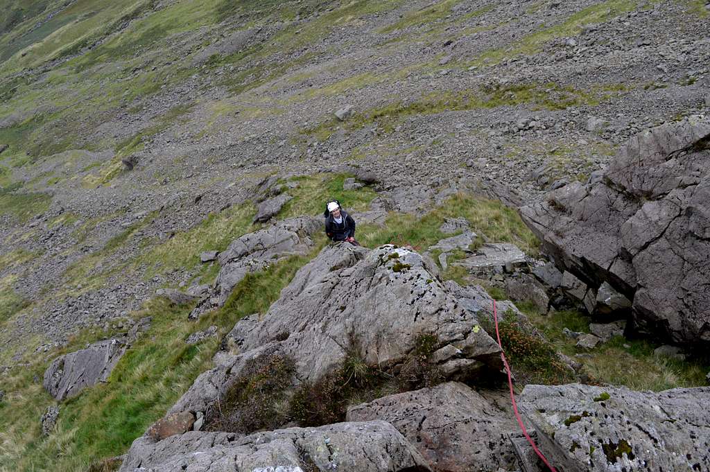 Climbing the rib - low down | 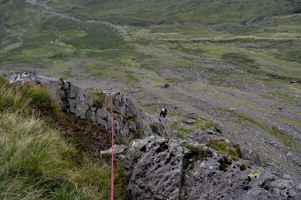 Climbing the rib - higher up |
Upper Tier: The top of the lower tier is not well defined. The angle eases and the terrain becomes more grass than rock for a distance – and then it gradually steepens again and the grass progressively more replaced by rock. Apart from the odd little step the terrain never becomes especially steep and it ‘works’ to simply keep roughly to the line of the spur as it curves slightly leftwards around the upper extremities of a now divided gulley – which has risen on left all the way up the route from the bottom. Although now getting high on the route the exposure is never great – but nonetheless the views open out and there is the sensation of having gained a lot of height since the start, with Mosedale receding far below. As the very top of the route is reached the angle gradually eases and the terrain becomes more broken again – before falling back completely as the rounded grassy crest of the east ridge of Pillar is reached close to the summit.
 Looking up to the 2nd tier and top | 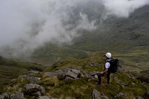 Near top of Wistow Crags - looking down | 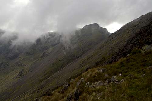 Near top of Wistow Crags - looking towards Wind Gap |
To Pillar Summit: At the ill defined crest of the ridge an obvious path is to be found ascending from R to L. This is now followed as it ascends the last few meters to the top of Pillar – about 350m from the top of the route.
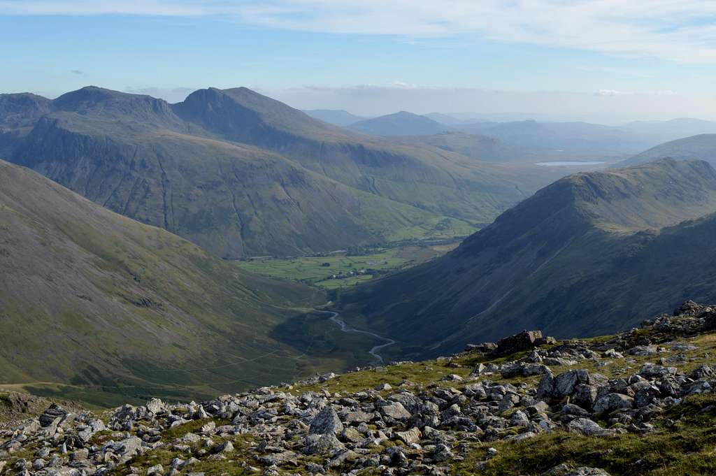 Summit view from Pillar - looking south to Wasdale Head and Scafell group | 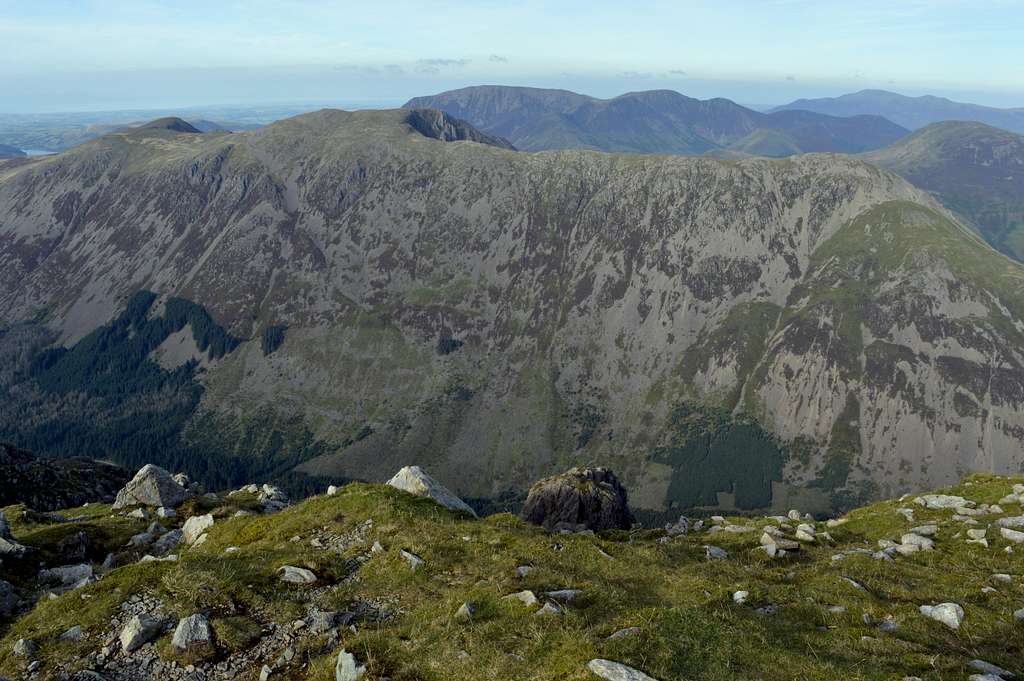 Summit view from Pillar - looking north over top of Pillar Rock to Ennerdale |
DESCENT
At the top of the scree at Wind Gap
To return to Wasdale there are two options:
1) Reverse last 350m back towards the top of Wistow Crags – but continue to follow the path all the way to Black Sail Pass (GR 192 114) – and thence down to Mosedale and Wasdale Head (GR 187 088) - joining the main path at GR 183 102 before the last mile in down to the hotel.
2) Continue along the path beyond the shelter but heading approximately south west towards ‘Wind Gap’ (GR 168 118) which is reached after descending a boulder slope for about ½ km. From Wind Gap there is a very steep and mildly unpleasant scree descent of about 250m to the south – and back into the top of Mosedale. At the bottom of the scree the path is reached at the point it will have been left earlier to traverse across to the bottom of Wistow Crags – so full circle has now been completed. It is now a simple matter to follow the path – to where it joins that coming down from Black Sail Pass (at GR 183 102 and described in option 1) – and thence all the way back down to the hotel at Wasdale Head.
RED TAPE
None bar the usual common sense following of the country code
EQUIPMENT
Normal attire for a day out in the mountains in the Lake District – so to include water-proofs!
Map OS Explorer OL4 1:25 000 “The English Lakes North West Area”, compass and/or GPS.
Guidebook: Cicerone guide “Scrambles in the Lake District” by Brian Evans – northern volume
Helmets & Harnesses
Selection of slings and chocks according to preference
Rope – a 30m walking rope would do.
LINKS
Wasdale Mountain Rescue: To call out dial 999 and ask for Cumbria Police
YHA Black Sail - Youth Hostel in Ennerdale
Wasdale Inn - For Hotel, Restaurant, Bar and Campsite
VIDEO TRIP REPORT
Pillar south face from near Wasdale Head - by Georgen