
-
 22922 Hits
-
 83.54% Score
-
 17 Votes
|
|
Route |
|---|---|
|
|
54.49905°N / 3.28016°W |
|
|
Scrambling |
|
|
Summer |
|
|
Most of a day |
|
|
Grade 3 scramble |
|
|
5.1 (YDS) |
|
|
3 |
|
|
III |
|
|
OVERVIEW
Slab & Notch is one of thirty one 3 star rated i.e. high quality scrambling routes as listed in the northern and southern volumes of the Cicerone guide “Scrambles in the Lake District” by Brian Evans. At grade 3 it is at the higher end of the scrambling grade system in difficulty– and thereby bordering on classification as an ‘easy rock climb’. Indeed there are notable places on the route where the individual climbing moves would not be out of place on a climb graded Difficult (UK adjectival system – UIAA III,USA 5.2) – and the exposure is worthy of climbs of much harder grade. Many grade 3 scrambles can be safely soloed by a competent climber, without need for a rope. However this climb is very exposed, there is the occasional loose rock as well as a section which can be damp and slippery – and the route then has to be descended. My recommendation would be to take a rope on this one…
Slab & Notch is one of the two easiest routes by which to reach the top of Pillar Rock – one of the finest and most remote crags in the English Lake District (the other at same grade and star rating being ‘Old West Route’). It is worth noting therefore that there is no easy walk-off; to get off Pillar Rock you have to either down-climb Slab & Notch– or abseil off.
 Slab & Notch route from East | 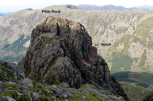 Slab & Notch from south |
Pillar Rock deserves an entire page in itself – but I shall include a brief description here:
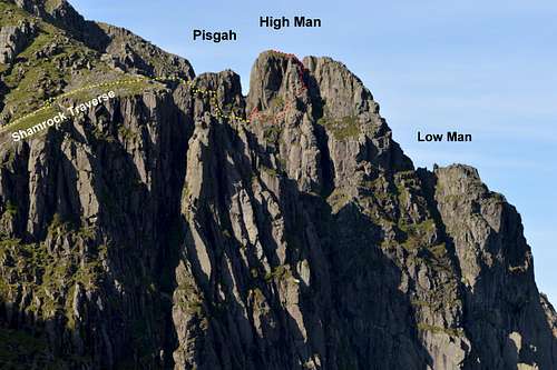
PILLAR ROCK
Pillar and Pillar Rock from Robinson's Cairn - early morning view
Summit altitude: 780m (2,558ft)
Height: 150m (492ft).
Exposure: north facing so not quick to dry after rain.
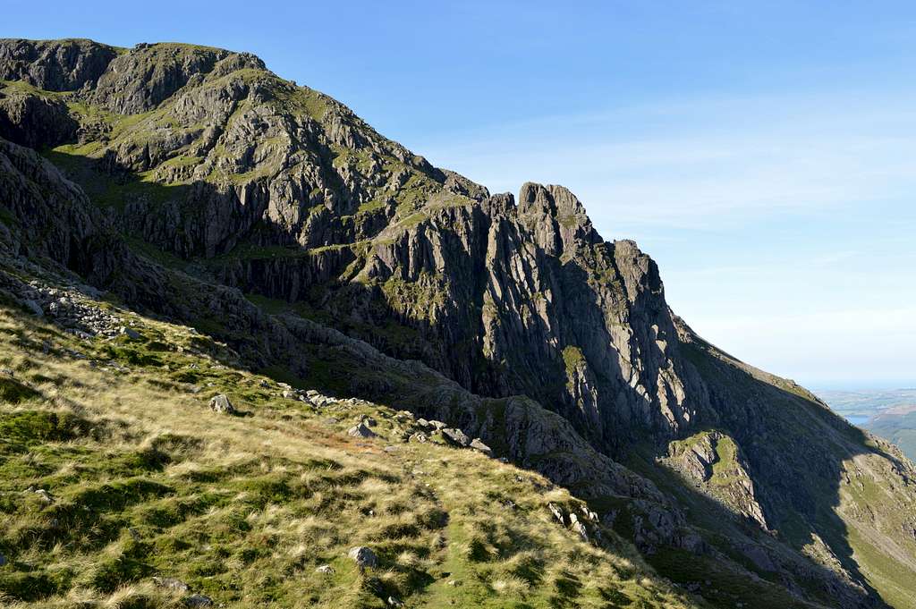
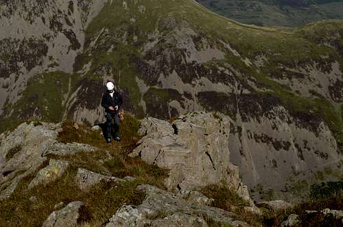
Situation: It projects like a giant dorsal fin from the northern (Ennerdale) aspect of Pillar 2927ft/892m – which although it doesn’t quite top the 3000ft mark surely ranks up alongside the likes of the Scafell’s, Helvellyn and Great Gable, the bigger cousins, which do...Description: The rock is complex, composed of a number of buttresses – which lead to the 3 ‘summits’ of Pisgah, High and Low Man (which also form a sort of knobbly crest to the fin, with east and west faces either side). Pisgah is barely significant, a little bump at the southern (near) end of the main crest as it joins the northern flank of Pillar the mountain. Nonetheless the top of Pisgah is a very airy little platform, reached by a grade 1 scramble – and is a fine view point from which to eye-ball especially the eastern aspect of High Man, which includes Slab & Notch.
Access to Pillar Rock is long and a little complex – see approaches, below. By the shortest route it takes about 3 hours to reach. This apparently deters many of today’s rock-climbers who seemingly prefer to avoid crags with a long walk in. Brian Evans, author of the “Scrambles in the Lake District” guide, comments that Pillar Rock was far more frequented back in the 1950’s. And on my own ascent of Slab & Notch, on a perfect September day in 2015, there was nobody else on our route – and we detected perhaps two rock-climbing pairs on the entire rest of Pillar Rock despite the presence of some 109 worthy rock-climbing routes as listed on UKC page for Pillar RockIn terms of rock-climbing grades, on these 109 routes there are everything from the two grade 3 scrambles at the easiest end - all the way up to E4 6a (UIAA VIII, USA 5.11) at the hardest. There is literally something for everyone – so long as you are prepared to walk. Some twenty of the routes are 3 star rated in terms of quality and another ten 2 star.
APPROACHES
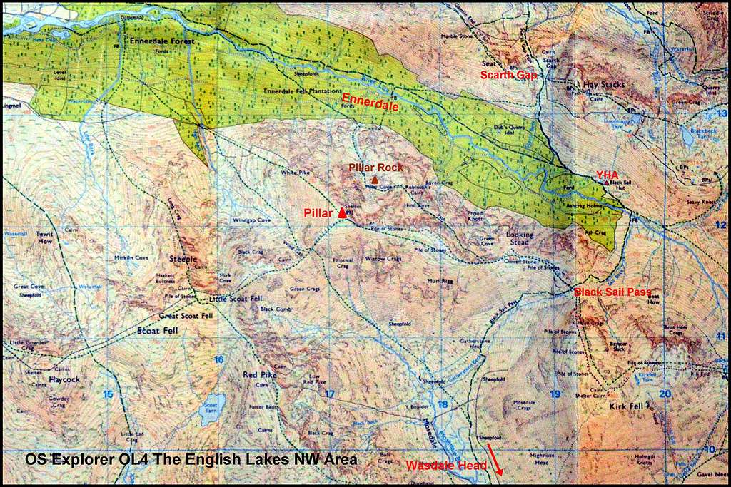
OS Map image of Pillar and Pillar Rock showing main approaches and connections
From the South
The valley base is at Wasdale Head, where there is a hotel, a camp-site and plentiful parking (which unusually for the Lake District is FREE). A well-defined path leads to the north from the hotel, up Mosedale and towards the south face of Pillar. There are 3 options:
1) High Level Route/Shamrock Traverse: after about a mile, at GR 183 102, turn R (north-east) up to Black Sail Pass between Mosedale and Ennerdale. At the pass (GR 192 114) there is a tiny lake and a path junction. Take L turn (north-west) – now heading along an undulating nearly horizontal ridge straight towards Pillar. After less than a mile the path starts to ascend – and at GR 184 117 divides to a L fork (which is the main footpath to Pillar) – and a R fork which is the High Level Route, traversing the northern slopes to reach the famous Robinson’s Cairn, followed by the Shamrock Traverse and finally Pillar Rock. Robinson’s Cairn is at GR 176 127 and is a memorial to John Wilson Robinson, an esteemed local who died in 1907 – and built by some 100 of his friends. It stands at a notch on a prominent spur descending from the heights of Pillar - and which offers a first and somewhat spectacular/intimidating view of Pillar Rock. The remainder of the approach crosses a little more intervening hillside before taking the slightly airy Shamrock Traverse rising L to R to a little terrace at the southern end of the little whales back of Pisgah. About 3 hours to Pillar Rock from Wasdale Head.
 Black Sail Pass - looking north | 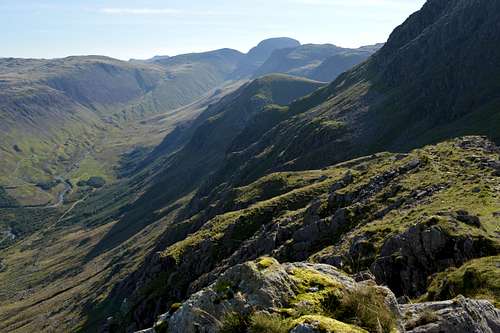 On High Level Route - looking back east along traverse towards Pass | 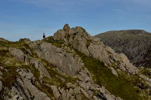 Approaching Robinson's Cairn from east |
2) Pillar – normal route: Follow same route but at the fork beyond Black Sail Pass take the L fork, ascend to the top of Pillar –and then descend about 500ft (150m) to Pillar Rock from the cairn at the northern end of the summit plateau – to then reach the same little terrace described above, at the end of the Shamrock Traverse. Also about 3 hours for this approach.
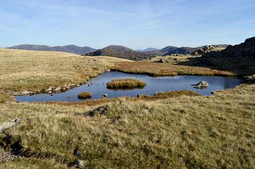
3) Via Wistow Crags: the most sporting route of all would be to follow the path up Mosedale but instead of following the side valley up to Black Sail Pass to carry on up the valley on the path leading to the infernal screes of Wind Gap (not recommended as an ascent route) to climb Wistow Crags – another grade 3*** scramble route ascending the prominent rocky spur rising up the middle of the south face of Pillar. Once on the top of Pillar option 2) can be followed on the summit plateau – thereby accessing the cairn at northern end and thence the descent to Pillar Rock. This would be a very long day.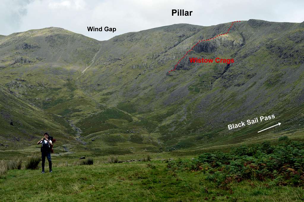
South face of Pillar, opposite side to Pillar Rock, showing Wistow Crags scramble route and other access routes via Wind Gap or Black Sail Pass
From the North
This approach is from Ennerdale, which is said to be the remotest valley in the Lake District. There are two options:
1) Walk in from western end of Ennerdale (driving/parking is not permitted on the forestry road leading to the remote Black Sail Youth Hostel at eastern extremity). This is a very long approach and not very realistic for a day trip to Pillar Rock – but a further option may be to spend the night at Black Sail YHA and climb up the northern valley side to Pillar Rock from there. See image below.2) Walk in from Buttermere: another and also long approach is to access the Ennerdale valley from the ‘next valley over’ – from Buttermere, further to the north. This involves a start at Gatesgarth Farm (GR 195 149 – bottom of Honnister Pass and 3km SE from the village of Buttermere) where there is a car-park. A defined path climbs up Buttermere Fell for some 250m to pass through Scarth Gap at GR 189 133 (between Haystacks and High Crag) – and then descends into Ennerdale and to the Black Sail YHA – from where Pillar Rock can be accessed. If returning via same route this will make for a fairly long day –unless broken with a night at the YHA. The cropped image below shows the Upper Ennerdale Valley with the Youth Hostel in view... the valley (and river) would need to be crossed to then ascend steep slopes of the R (south) side of the valley up towards Black Sail Pass (hidden behind a spur of hillside) and the start of the High Level Route to Pillar Rock - from where photo was taken. Outside of the image on L (northern) side of the valley would be the ascent to Scarth Gap and the access to and from Buttermere.
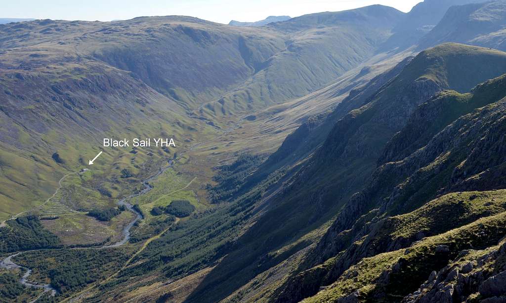
Looking down on Black Sail Youth Hostel, Upper Ennerdale - slopes on R side of valley would have to be ascended to reach Black Sail Pass
THE ROUTE
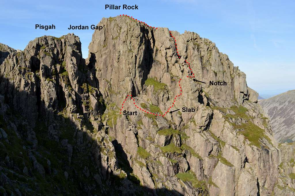
Slab & Notch route east face of Pillar Rock - approach follows shallow approximately U shaped line of least resistance along base of Pisgah
 Looking across at Slab & Notch from the top of Pisgah - with (vegetated) Slab and Notch in view | 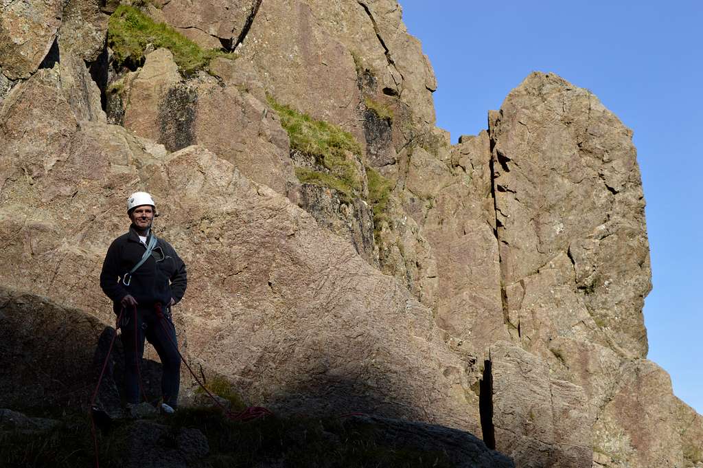 The start of Slab & Notch: at the little wall , with the Slab behind out of sight - but 'Notch' in plain view |
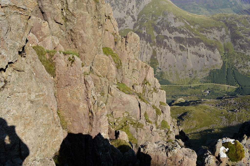
The Slab: climb the little wall and step over onto the main slab, which is descended first to an obvious near horizontal traverse passing (in 2015) between 2 patches of vegetation (not so obvious in a similar image in the Cicerone guide). The climbing is very easy, in fact the angle of the slab is shallow enough to literally just ‘walk’ it without use of the hands, with a little care – but with a bit of nerve as well, since the drop below the slab is significant! At the end of the traverse is a little step up on to another and smaller slab – which leads to a vertical wall, at the top of which is the ‘Notch’. If climbing this roped (with what is to follow this would be my recommendation)then the leader should give some thought to placing protection, which also protects the second…
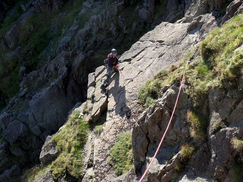
On the sun-lit Slab - having just made descent and about to advance along line of weakness between the patches of vegetation
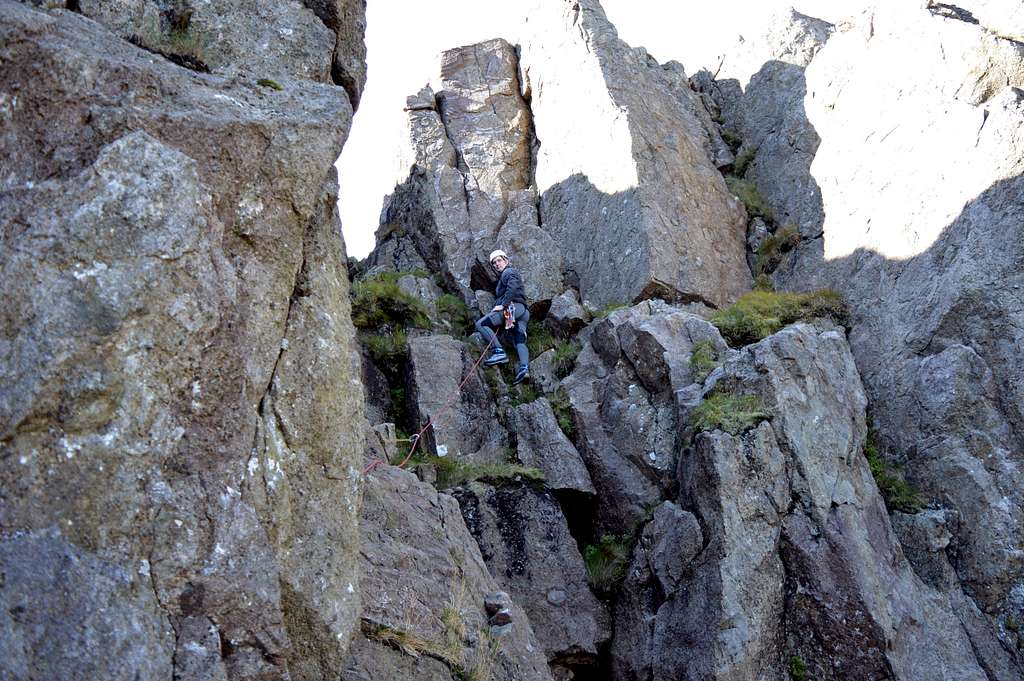
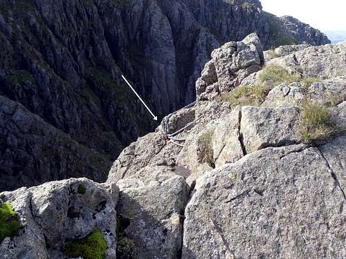
The Notch: climb the wall (about 6m) on polished holds. The climbing is at about Diff standard and this section is the crux. It is worth sparing a thought to the eventual descent, when this section will require due care. There is an excellent stance at the obvious ‘Notch’ – with a good adjacent sling placement.
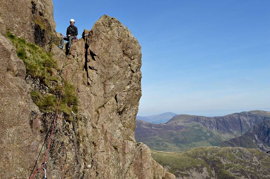
Belay at the Notch - having just climbed the wall, which is the crux of the climb
Above the Notch: Take a few steps along the obvious ledge to a corner (at edge of the big gully between the two main buttresses) and a big drop. The corner is climbed steeply on more obvious polished holds - and in a somewhat sensational setting. At the top of the corner is another stance tucked in a crevice at the side of the gully. Looking through a gap at the back of the crevice there is a bird’s eye view straight down onto the stance at the Notch. It could be possible to continue on to the top from here – but this would likely result in undue rope drag as well as in communication difficulties… so better to break at the stance at the end of this fairly short pitch. The LH image below shows the view looking through the gap at the back of the crevice (behind my shoulder in RH image) - note that route of ascent follows a C shaped course (along the ledge, up corner and then into niche) out of sight to L of LH image...
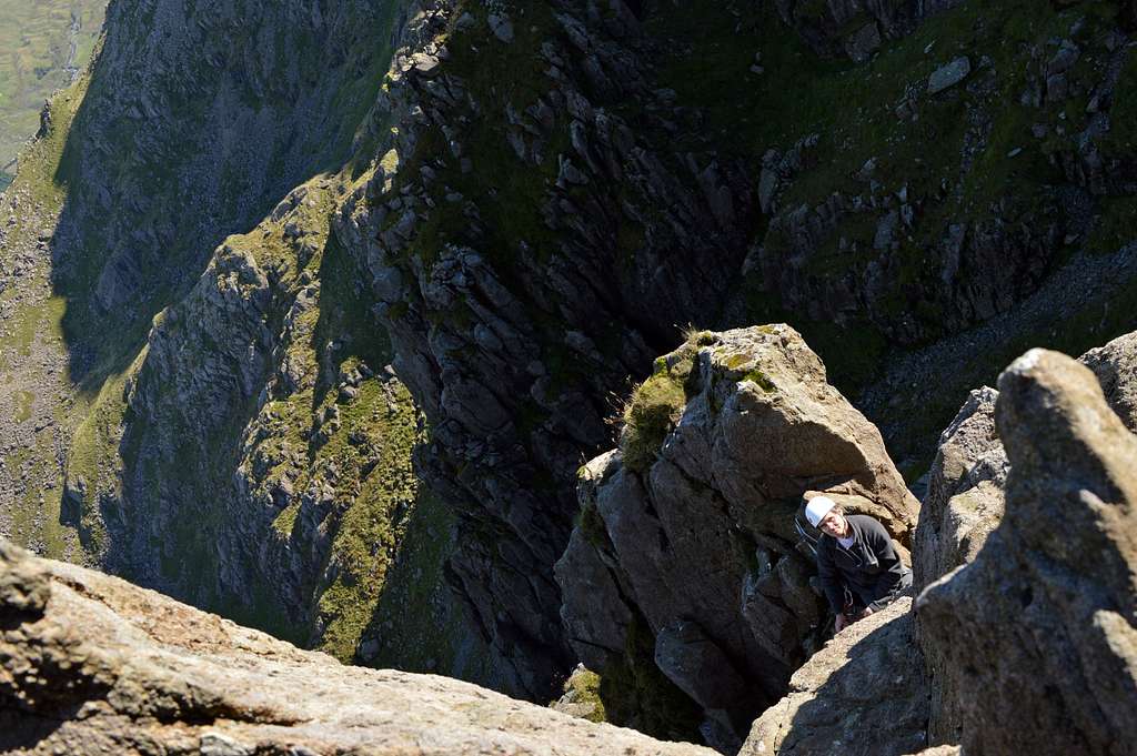 Looking down from 'Niche' belay top of pitch 2 looking down on stance at the Notch | 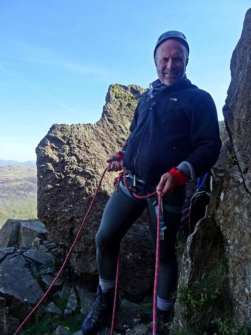 In the 'Niche' top of pitch 2 |
 Top pitch Slab & Notch - having traversed into gulley and about to enter final groove | 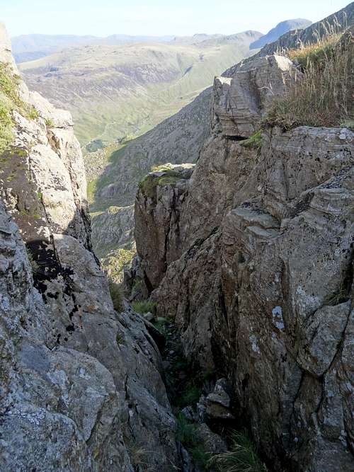 Exit from the final groove |
SUMMIT VIEWS
 Emerging from groove into sun on summit of Pillar Rock | 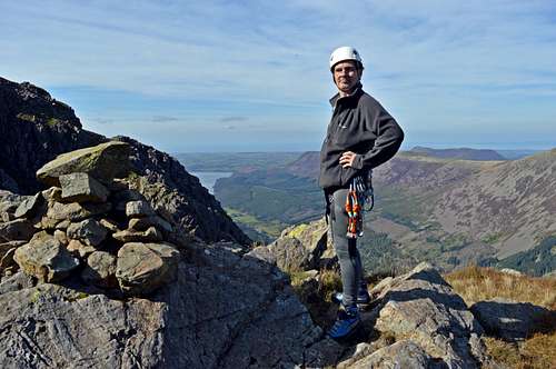 Summit cairn on Pillar Rock - a distant Ennerdale Water and coast beyond | 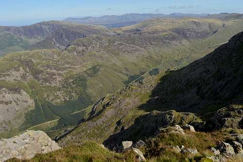 Pillar Rock summit view looking E to Robinson's Cairn/Upper Ennerdale |
DESCENT
Block with old abseil slings above Jordon Gap, Pillar Rock summit
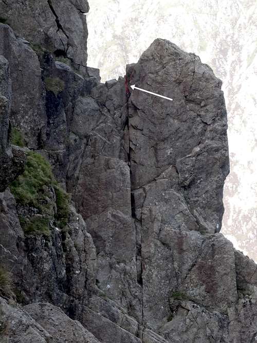
Slab & Notch crux pitch - note sling left to protect descent
More realistically there are two main ways of descending from Pillar, with an option on a third if planning on continuing the descent into lower Ennerdale:
Option 1: Abseil into Jordon Gap - at the southern end of the summit plateau behind the cairn there is large block which can be used as placement for a large sling (see photo to R). A doubled 50m rope should reach the bottom (but I didn't try it - please check!). In September 2015 there were 3 sun-bleached vintage rope slings with rusting crabs which we didn’t feel inclined to trust and we didn’t have along enough and ‘spare’ sling to leave a new one. And also we had not really considered this option and so hadn’t checked out the descent from Jordon Gap,which is steep, awkward and loose looking (an alternative is to climb over Pisgah – said to be more grade 3 scrambling to get up out of Jordon Gap but then easy grade 1 down the other side to the terrace). This abseil option would undoubtedly be the quickest way off Pillar Rock – but having no personal experience of it I’d recommend to check it out very carefully – and take a length of spare rope from which to create a sling…
Option 2: to down-climb Slab and Notch: this is allegedly the preferred option for most – and what we did in September 2015… It is easy descending the top end of the gully, but care needed at the bottom end reversing the awkward move crossing the top of the little slab, with growing exposure… It is a good idea for the first down to place a couple of runners to afford some protection for the last down. In September 2015 with nobody else on the route we had left 2 sling placements at this part of the route on the way up – and then taken advantage of them already being in situ for our descent.
The next awkward bit is scrambling out of the niche stance at the top of pitch 2 (as described above) and down the exposed corner – before reversing back along the (easy) ledge back to the ‘Notch’. There is one move at about Diff standard in a sensational position, which is worth protecting with a couple of runners for the last down.
The most awkward bit of all is the descent from the Notch, back down to the slab. We didn’t manage to find very good runner placements here (Cam’s would work better than what we had) on the way up in September 2015 – so we left a spare medium tape sling and crab at the Notch to provide a top-rope for the last down (see photo).
Reversing the Slab and back up over to the start is very straight forward.
Option 3: to down-climb Old West Route: this could be an option if descending to lower Ennerdale since this particular climb is on the right side of Pillar Rock to pick up the main path. However, Old West Route is another grade 3 scramble on very exposed terrain, with a bit of route finding involved, with some very tricky ground around if you got off route…Personally I wouldn’t like to try to descend this without having climbed it first.
Note on return to valley bases:
Ennerdale side: it is a simple matter of returning on the path of approach – back down to the Youth Hostel and/or lower Ennerdale – or back up and through Scarth Gap to Buttermere.
Wasdale side: it would be straight forward to return back along the long traverse of the High Level Route (starting with descent into the Shamrock Traverse). However this route does involve a lot of up and down – the emphasis being on the UP – and you might as well just break new ground and walk up and over Pillar, which involves an ascent of 500ft (150m). The summit view in general but in particular of the Scafell group is well worth the extra ascent – and then it is a straight forward matter to descend the main path back to Wasdale Head… but there is also the option to descend in the other direction and battle it out with the ankle breaking terrain of the scree descent from Wind Gap (see earlier photo). This is not a particularly pleasant descent – albeit a fairly quick way to access upper Mosedale and thence Wasdale Head.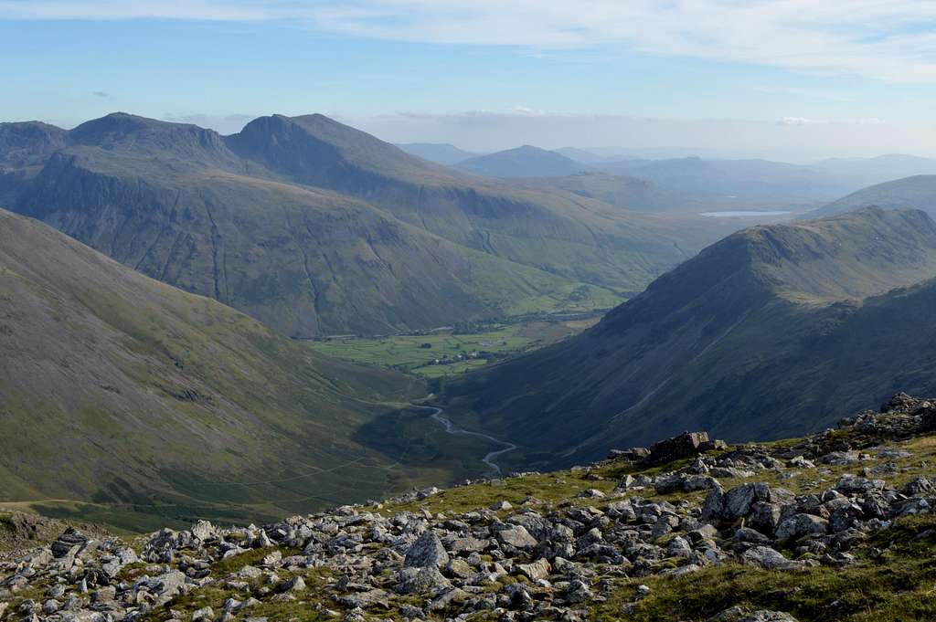 Summit view from Pillar looking over Wasdale Head to Scafell group | 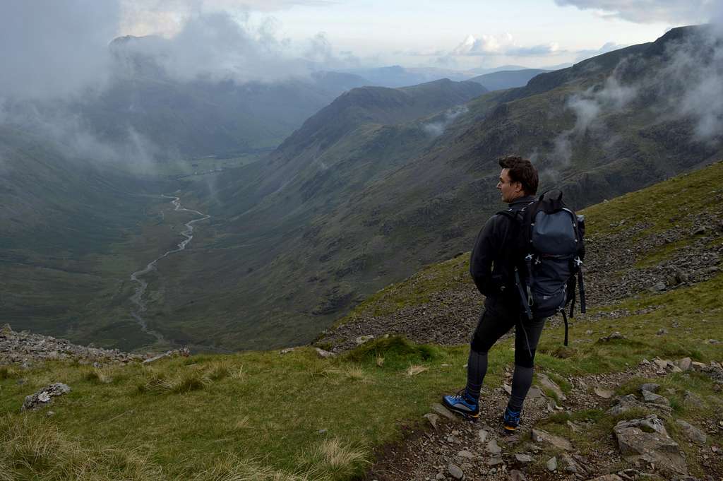 At top of scree descent at Wind Gap looking towards Wasdale Head |
RED TAPE
None bar the usual common sense following of the country code.
EQUIPMENT
Normal attire for a day out in the mountains in the Lake District – so to include water-proofs!
Map OS Explorer OL4 1:25 000 “The English Lakes North West Area”, compass and/or GPS.
Guidebook: Cicerone guide “Scrambles in the Lake District” by Brian Evans – northern volume
Helmets & Harnesses
Selection of slings and chocks according to preference – a few cams would have made some placements easier on Pillar Rock
Spare rope to turn into a long sling if considering an abseil descent from Pillar Rock - and spare crab.
50m rope
LINKS
Wasdale Mountain Rescue To call out dial 999 and ask for Cumbria Police.
YHA Black Sail Youth Hostel in Ennerdale
Wasdale Inn – Hotel, Bar, Restaurant and Campsite in Wasdale Head