
-
 3995 Hits
-
 80.49% Score
-
 12 Votes
|
|
Mountain/Rock |
|---|---|
|
|
46.85183°N / 10.58975°E |
|
|
Hiking |
|
|
Spring, Summer, Fall, Winter |
|
|
9495 ft / 2894 m |
|
|
Overview
 Wölfeleskopf Wölfeleskopf |
In the north-west of the Ötztal Alps, almost completely on Austrian territory, there is a small subgroup, called Nauderer Berge. It consists of two ridges running northward from the Alpine main ridge and is named by the only town in the area, Nauders. While most of the subgroups of the Ötztal Alps display huge glaciated areas, here, in the west of the group, alpine meadows are the rule. With all consequence around Nauders quite a number of ski runs have been developped, which make the western part of the group off limits to hikers / climbers. Who would want to spend his day among ski lifts?
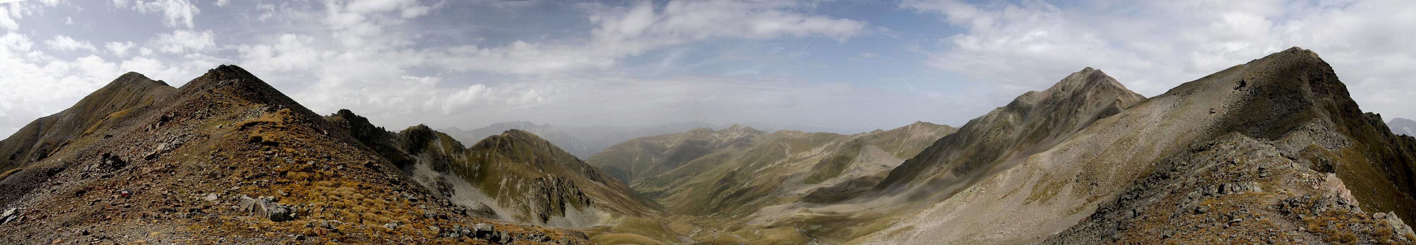
The main ridge, however, is an exception. While on its northern slopes you find most of the runs, the ridge itself is relatively unspoilt. The summits to the east and west are rocky and repelling while in the centre you'll find several hikers' summits with good lookout positions. Close by - on the southern side of the ridge - runs Langtauferer Höhenweg, a very panoramic high route. This adds up to some memorable climbs - even the traverse of three summits, if you bring enough stamina and time with you.
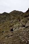
The three summits are Mataunkopf / Cima Mataun (2892m), Wölfeleskopf / Cima del Lupo (2894m) and Großer Schafkopf / Cima delle Peccore (3001m). All three can be climbed from Langtauferer Höhenweg but the best approach is across the ski runs on the northern side. That way you'll be able to fit the traverse into a neat loop. The central of these three summits, Wölfeleskopf, is the most easily accessible as to the east and west of it, two high passes lead across the ridge: Wölfelesjoch (2829m) and Saletztjoch (2799m). The mountain itself can be reached in a 100m dash, which cuts across broken and somewhat exposed terrain.
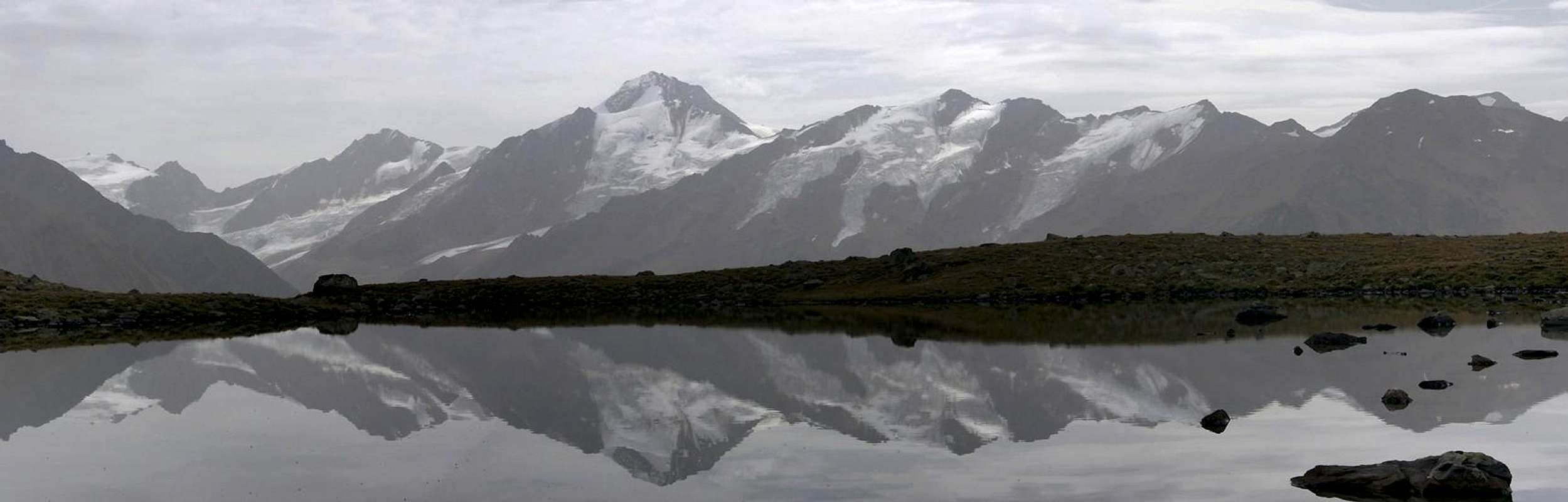
As a lookout summit Wölfeleskopf is a good choice. The glaciated peaks of the Weißkugel / Palla Bianca Ridge are just south of Langtauferer Tal while the Ortler Group shines in the far south. Across the Inn River there are the Samnaun and Ferwall Groups while in the north the Lechtal Alps hover in the distance. The pictures you see on this page fell victim to southern winds with a full load of Sahara dust in the air.
Wölfeleskopf with its two neighbours also is a popular ski tour destination in winter.
|


Panoramic View
Hintere HintereisspitzeHochvernaglwandVernaglLangtauferer SpitzeWeißkugelInnerer BärenbartkogelÄußerer BärenbartkogelFreibrunner SpitzeRoter KopfFalbenairspitzeRabenkopfMitterlochspitzeTiergartenspitzeValvelspitzenRote Köpfe 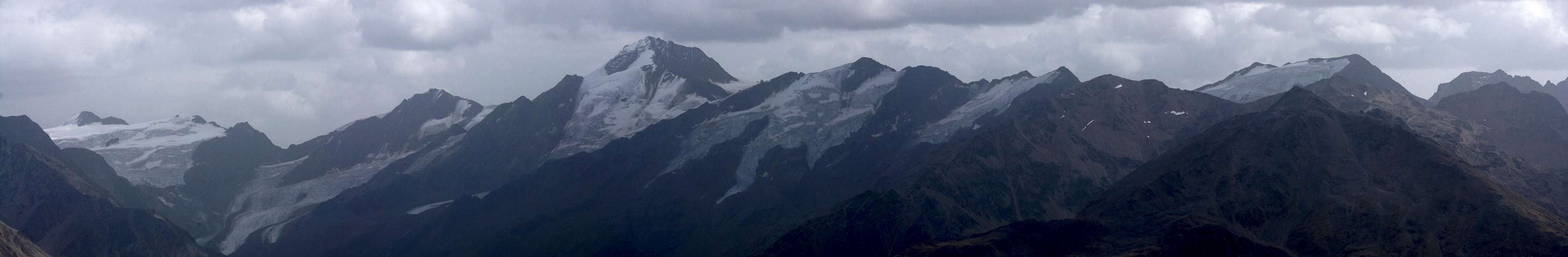  |
Getting There
 |
Reasonable starting points for a climb of Wölfeleskopf are the town of Nauders in the north-west and the villages within Langtauferer Tal / Vallelunga in the south. Starting from Nauders you can make use of the chairlift, which will take you to an elevation of 2200m. For the southern approach you need to climb at least 1000m. However you could also hike the panoramic Langtauferer Höhenweg, an 9 - 11h affair, and sidestep through one of the two passes onto the Wölfeleskopf summit.
Nauders
The town of Nauders is located several kilometres north of Reschenpass / Passo di Resia. It can be reached by B180 from Landeck in the north or via SS38 / SS40 from the south (Bozen / Bolzano and Meran / Merano). The lifts are about 2km south of the town.
Langtaufers / Vallelunga
The valley's mouth is at Graun / Curon Venosta, directly on the Reschenpas road. The closest trailhead for the Saletzjoch Route is at Pazin, for the Wölfelesjoch Route you can start at Hotel Alpenfrieden.
Red Tape
 Customs Check
Wölfeleskopf is a border summit on the Austrian / Italian border. There may be no checks anymore but it is mandatory to carry passport / ID. Apart from this there is no red tape.
Accommodation
 |
- Nauders Accommodation
- Vinschgau / Val Venosta Accommodation
- Reschenpass / Passo di Resia Accommodation
Weather Conditions
Maps & Books
Maps
- Vinschgau / Val Venosta
Kompass Map WK52
1:50000
ISBN: 978-3-85491-058-9
- Ötztaler Alpen, Nauderer Berge
Deutsche Alpenvereinskarte 30/4
1:25000
Art.Nr.: 100031
- Alta Val Venosta / Vinschgauer Oberland
Tabacco Map 43
1:25000
Books
- Ötztaler Alpen
W. Klier
Alpenvereinsführer
Rother Verlag
ISBN: 3-7633-1123-8
- Vinschgau
Rother Wanderführer
Rother Verlag
ISBN: 978-3-7633-4204-1
- Vinschgau / Ortlergruppe
Kompass Wanderbuch 950
Kompass Verlag
ISBN: 3-87051-404-3