
-
 5149 Hits
-
 83.69% Score
-
 17 Votes
|
|
Area/Range |
|---|---|
|
|
46.89694°N / 10.56308°E |
|
|
Hiking, Mountaineering, Scrambling, Via Ferrata, Skiing |
|
|
Spring, Summer, Fall, Winter |
|
|
10039 ft / 3060 m |
|
|
1 - Overview
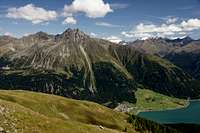
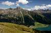
 Laungtauferer Tal and Nauderer Berge Laungtauferer Tal and Nauderer Berge |
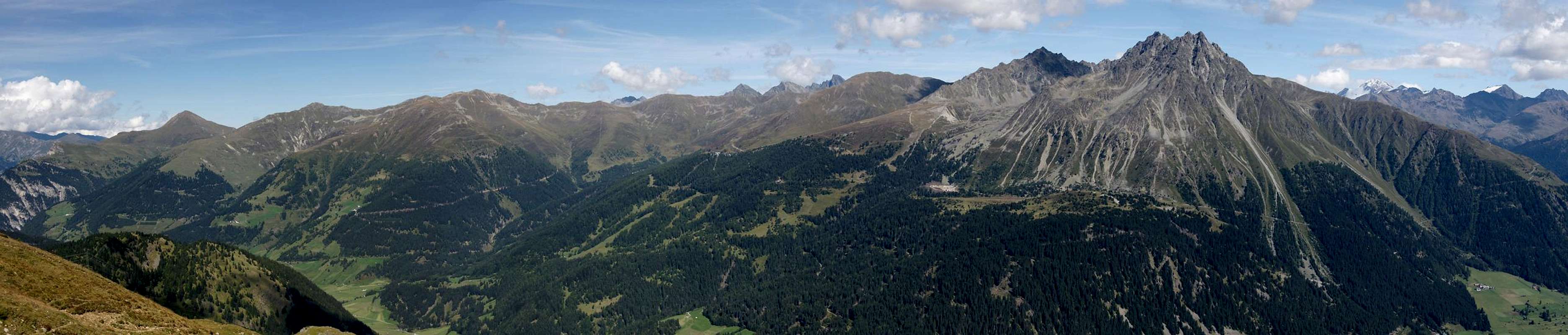
The Ötztal Alps are mainly known for their glaciated summits along the Weißkamm Ridge and the Main Ridge in the centre of the group. Less known are the threee northward ridges Glockturmkamm, Kaunergrat and Geigenkamm, as well as the southern (Italian) Saldurkamm and Texel Group. Almost obscure, however, are the two western groups Planeiler Berge and Nauderer Berge though both reach up to elevations above 3000m and though one of the most important north-east throughways of the Alps runs close by across Reschenpass / Passo di Resia.
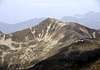
Nauderer Berge is the westernmost subgroup of the Öztal Alps and also the smallest one. It is bounded by Oberinntal Valley to the west and north, Langtauferer Tal / Vallelunga to the south and Radurschltal Valley to the east. The mountains rise in several ridges from the valley floors to the 3000ers Nauderer Hennesiglspitze (3042m and Schafköpfe (3060m), close to which the Radurschlscharte Pass separates the group from nearby Glockturmkamm. The group separates in three ridges:
- the Main Ridge (also border between Austria and Italy) running east to west
- the Schafkopf Ridge running south to north in the west
- the Seekarkopf Ridge, also running south ro north in the east.
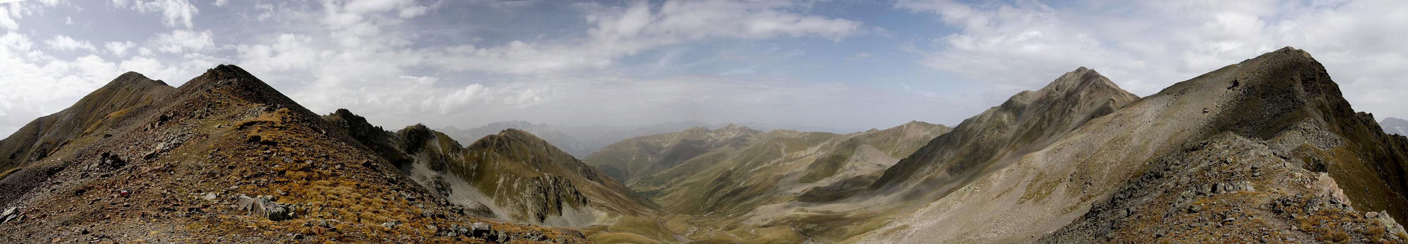
 |  |  |
Main activity in the area is skiing. Nauders in particular has 120km of ski runs with some 25 ski lifts. All of them are on the western slopes of the Schafkopf Ridge, which forms a half circle around Plengbach Valley to the south of the village. In summer the ridge is an easy hiking ground even though the ski runs certainly spoil part of the experience. The mountains are round topped and you hike across meadows above the treeline for most of the time.
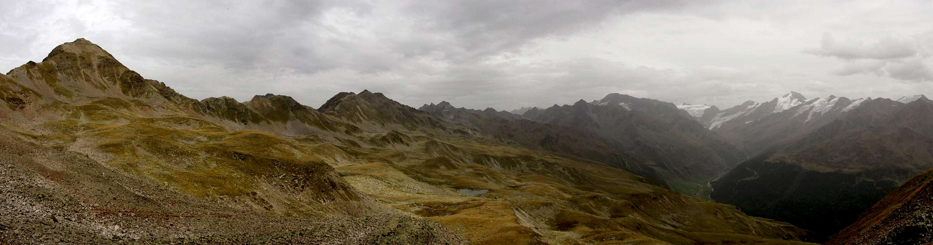
From a hiking perspective much more important is Langtauferer Höhenweg / Alta Via Vallunga which traverses the south slopes of the main ridge. Somehow it is rarely associated with Nauderer Berge though it definitely is part of the group but rather counted among the must-do hikes of Obervinschgau / Upper Val Venosta. The trail, a long one day affair if you don't want to return on foot, starts at Graun / Curon Venosta and follows the ridge all the way to Radurschlscharte, shortly before which it descends to Melag in the back of Langtauferer Tal. A second leg of the trail passes the south slopes of Schwarzer Schragen to Weißseejoch / Passo di Melaga, a 3000+m pass to traverse to Kaunertal in the north of the Ötztal Alps.
The most visible mountain of the group is Klopaierspitze (2918m), which rises above Graun / Curon Venosta and often serves as a backdrop to photos taken of Reschensee / Lago di Resia. It is connected by a short ridge to Plamorder Spitze (2982m) and Bergkastellspitze (2913m), all of which are ranked among the best lookout peaks of the greater area. There are two vie ferrate, Goldweg to Bergkastellspitze and Tiroler Weg to Plamorder Spitze both of which were built to increase cable-car traffic in summer.
To the east of Nauderer Berge you will find Hohenzollernhaus, the only mountain hut associated to the group. Though it rather serves as a base to climb the mountains of Glockturmkamm it can also be used for hikes in the remote Seekarkopf Ridge. A very long dayhike can take you around the subgroup and up to Nauderer Hennesiglspitze. In winter there are quite a number of possible ski tours in Nauderer Berge, all of which have either the passes or summits of the main ridge as their destinations.
2 - Nauderer Berge on SP
  |
3 - The Summits
 Overview Map Nauderer Berge
- Main Ridge
- Nauderer Hennesiglspitze / Monte Cantone (3045m)
![]()
- Großer Schafkopf / Cima delle Pecore (3001m)
![]()
- Wölfeleskopf / Punta del Lupo (2897m)
![]()
- Mataunkopf / Cima Mataun (2895m)
![]()
- Bergkastelspitze / Cima Castello (2915m)
![]()
- Plamorderspitze / Cima Pian dei Morti (2985m)
![]()
- Klopaierspitze / Piz Clopai (2922m)
![]()
- Schafkopf Ridge
- Arzkopf (2787m)
![]()
- Kleiner Schafkopf (2742m)
- Guesen Kopf (2740m)
- Tscheyegg (2666m)
- Schafkarkopf (2678m)
![]()
- Schartlkopf (2810m)
- Valdafourkopf (2746m)
- Ferminkopf (2413m)
- Ochsenkopf (2769m)
- Affenkopf (2626m)
- Gaispleiskopf (2771m)
- Schmalzkopf (2724m)
- Roßkopf (2461m)
- Ulrichskopf (2457m)
- Piengkopf (2789m)
![]()
- Arzkopf (2787m)
- Seekarkopf Ridge
- Seekarköpfe
- Southern Seekarkopf (3059m)
- Central Seekarkopf (3063m)
- Northern Seekarkopf (3003m)
- Schönkarlesspitze (2928m)
- Brunnewandspitze (2982m)
- Wildnörderer (3015m)
- Muttlerkopf (2744m)
- Seekarköpfe


4 - Getting There
 |
You can access the Nauderer Berge Group from from three sides, all of which can be reached from B180 (Austria) and SS38 (Italy), which connect at the border at Reschenpass / Passo di Resia.:
- Inntal to the west and north (trailheads at Nauders).
- Langtauferer Tal / Vallelunga to the south (trailheads at Graun / Curon).
- Radurschlbach Valley to the north-east (trailheads at Pfunds).
From Austria
- Take B180 from Landeck, which at the border turns into SS40 / SS38.
From Italy
- Take SS38 from Bozen / Bolzano passing Meran / Merano into Vinschgau / Val Venosta
From Switzerland
- Southern Access:
- Take B28 across Ofenpass / Pass dal Fuorn and through Münstertal / Val Müstair.
- At the border it turns into SS41 to Glurns / Glorenza.
- There turn onto SS38 east or north into Vinschgau / Val Venosta and across the border.
- Take B28 across Ofenpass / Pass dal Fuorn and through Münstertal / Val Müstair.
- Northern Access:
- Take B27 through Unterengadin to the border at Schalkl, where it meets B180, Reschenpassstrasse
5 - Accommodation
- Nauders Accommodation
- Vinschgau / Val Venosta Accommodation
- Reschenpass / Passo di Resia Accommodation
6 - Red Tape
There's no red tape to speak of. The western part of the range anyway is heavily developped with ski runs and lifts. The eastern, higher part as well as the main ridge are undevelopped. Since the mainridge constitutes the border between Italy and Austria, iit might be advisable to bring an ID while hiking / climbing in the area.7 - Weather Conditions
 |
8 - Maps and Books
8.1 - Maps
- Regular Maps
- Landeck - Nauders - Samnaungruppe
Kompass Map WK42
1:50000
ISBN: 978-3-85026-542-3
- Ötztaler Alpen, Nauderer Berge
Deutsche Alpenvereinskarte 30/4
1:25000
Art.Nr: 100031
- Landeck - Nauders - Samnaungruppe
- Digital Maps
8.2 - Books
- Ötztaler Alpen
W. Klier
Alpenvereinsführer
Rother Verlag
ISBN: 3-7633-1123-8
- Kaunertal – Oberinntal
Herbert Mayr
Rother Verlag
ISBN: 978-3-7633-4027-9
- Vinschgau
Henriette Klier
Rother Verlag
ISBN: 978-3-7633-4205-1
- Vinschgau / Ortlergruppe
Kompass Wanderbuch 950
Kompass Verlag
ISBN: 3-87051-404-3