-
 11225 Hits
-
 74.92% Score
-
 5 Votes
|
|
Route |
|---|---|
|
|
42.60400°N / 110.624°W |
|
|
hike on trail |
|
|
Half a day |
|
|
walk-up, app. 9 miles RT |
|
|
Approach


In some ways, getting to the trailhead is more fun than the hike itself, and that is why I recommend this route over Forest Trail 62. Start in Alpine, Wyoming, and head south on the Greys River Road. This road is a little rough and bumpy in places, but you can travel it with almost any passenger car. In good weather, this road gives wild scenery and a remote feel that only the truly dead of heart will fail to appreciate.
It is about 60 miles from Alpine to Tri-Basin Divide, a few feet north of which the Greys River begins as a trickle in some gorgeous meadows. The spur road to the trailhead branches off about 2.5 miles north of the divide. But first you get to enjoy what I like to think of as the "real" Wyoming-- classic mountain country with canyons, meadows, wildlife, rugged peaks, and no crowds. There has been and continues to be much extractive use in this area, and it lacks grizzlies and wolves-- my standards for declaring any place in the Rockies true wilderness-- but this country is so big, beautiful, and remote that you will feel as though you are on safari in some undiscovered territory despite the fact that you're on a signed road.
The first few miles of the road take you through a dramatic rapids-filled canyon. Then the scenery opens up as you travel well above wildflower meadows and the river's east banks while the pyramid-like peaks of the Salt River Range compete for your attention. Watch for cattle, but watch for moose, too, and look out for the ground squirrels-- they deserve a break (and brake), too.
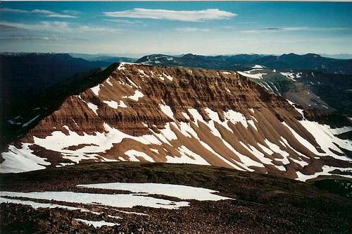
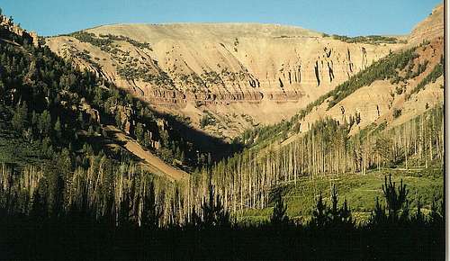
As trees begin to block your views of the Salt River Range and the road gets a little rougher, the Wyoming Range, reddish-brown in color and looking like something out of Utah or Arizona instead of Wyoming, comes into view. Some particularly beautiful areas are around Box Canyon Creek, where a great trail accesses the crest of the range, and Poison Meadows, where there are stunning meadows of gold and purple in July. All the while, take time to enjoy the changing faces of the Greys River.
Along the way, many streams join the Greys River, and most of them are marked with easy-to-see signs. You need to look for Shale Creek. Just before Shale Creek joins the Greys River, a road heads off to the left (east). Take it. The Poison Meadows quad marks it as a 4wd road, but most passenger cars can make it in dry conditions. About three miles of driving will take you to the trailhead, which was marked for Wyoming Peak with a small sign as recently as July 2004. There is limited parking available here, but you're not likely to find a crowd (or even anyone else for that matter), anyway. The trailhead is at 8800'.
You can also approach Tri-Basin Divide from La Barge or from U.S. 89 and then head south to Shale Creek. The way from 89 is nicer and easier than the La Barge way, but it is still nowhere near as scenic as the Greys River way.
Route Description
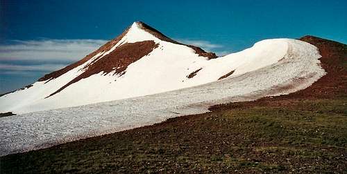
There is not much to describe. A good trail with a moderately steep grade takes you to a junction at almost 10,300' (go left) and then to a saddle with some spectacular views, including one of your final destination. Just follow the trail up the steepening slopes until you reach the ruined lookout at the summit.
The views heading up were great-- most hiking was on open slopes and gave sweeping panoramas of the Salt River Range as dawn woke the mountains with its red hand-- but the summit views are astounding. You can see the Grand Teton far to the north, the Gros Ventres (and, on the horizon, the Absarokas) to the northeast, almost all of the Wind River Range to the east (and you can pick out many of the higher named peaks), Commissary Ridge to the south, the crest of the Wyoming Range to the north and south, and the span of the Salt River Range to the west. You will have fun admiring this top-of-the-world perspective and identifying distant peaks.
RT Distance: About 9 miles
Elevation Gain: About 2500'