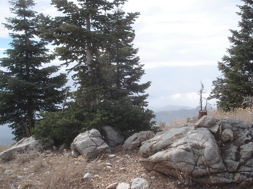
Gaining Yucaipa Ridge:
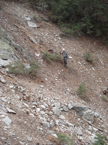
With the threat of afternoon storms sitting in the back of my mind, I parked my car at Vivian Creek trailhead and we started walking up the road as you would for hiking San Gorgonio via Vivian Creek. We were not sure what this hike would entail, since if storms developed we did not want to be descending the ridge within a drainage (obviously). So at some point we had to either commit or retreat if storms were developing. We continued walking on the trail past the large and dramtic drainage for Camp Creek, past the turnoff for San Gorgonio and continued about ¼ mile to the next gully east of Camp Creek. We basically followed the HPS description, however it can be confusing.
(Note: sorry pictures do not have titles, but if you hold your mouse over them the Title will appear)
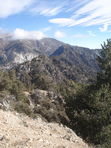
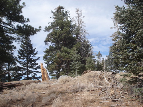
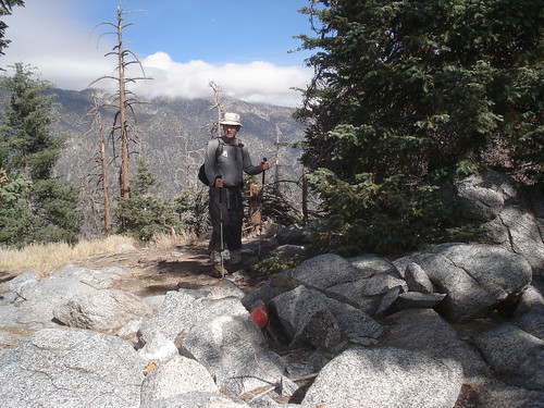
The gully branches off a couple of times and it is hard to understand when to get up on the ridge separating the gullies. But we had GPS data and figured out to ignore the small branches and wait until it is obvious and the ridge between the gullies is obvious. There are some rock cairns marking the point at which to gain the ridge. Once on the ridge the ascent is pretty straightforward, it is steep but still considered class 1. We continued up until this ridge between gullies met up with the ridge leading southwest. At this point we followed this new ridge in a circular path up and around to Little San Gorgonio.
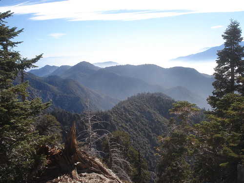
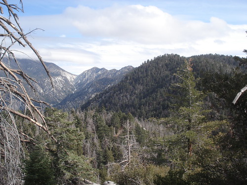
The views are the best at Little San G. There is a great view of Galena, and it is from here we realized that we could have (and should have) included Galena in this traverse. In fact, if one were to include Galena and Allen peaks in this trip it might even qualify as an epic hike. Whereas the ascent of Little San Gorgonio is only 2 miles, with over 3000 ft of elevation it is very steep and tough. Upon looking at the Summit Post page on Little San Gorgonio I am intrigued with the main route described via Camp Creek. I would think this would be more technical, but that is a good thing as long as the scree is not too bad. Otherwise it might make for a good descent route.
Traversing Yucaipa Ridge
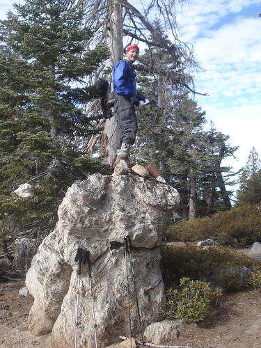
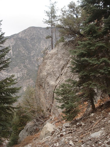
Once on the ridge the hiking is far less strenuous. There are trails all along the ridge, but it looks like they have not been maintained for years and would now qualify as faint use trails. Most of the signs are in pieces rotting on the ground.
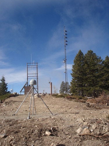
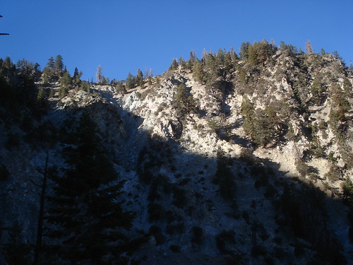
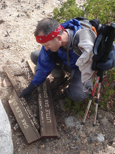
The first summit of sorts is the radio tower. Not a very appealing summit and it is not named. From the radio tower there is a freshly graded road generally following the ridge all the way to Wilshire Mountain. The road switches back often and we preferred to pretend the road did not exist and stay up high on the ridge. From Wilshire Mountain we went onto Wilshire Peak. The difference between a mountain and peak in this case is not clear, and why the both share the same name also causes me some curiosity. From Wilshire Peak we lost a significant amount of elevation and gained some back for Oak Glen Peak. This is not one of the Sierra Club Hundred Peaks and it was a surprise for me, as I did not know it was there.
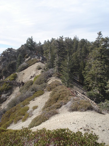
From Oak Glen we traversed on to Cedar Mountain and then Birch Mountain. The Oak Glen Divide Trail as it is shown on may topo maps is almost totally reclaimed by the wilderness and very easy to loose. It is possible for one to continue along the ridge from Birch and on to Allen Mountain, then potentially take the fire road down to intersection of Valley of Falls Drive and SR138. However, this crosses private property and permission is required.
Descending back to Forest Falls
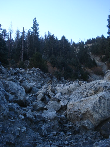
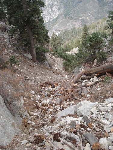
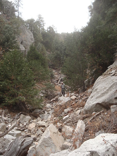
From Birch Mountain we backtracked to the saddle between Birch and Cedar and followed the GPS track I had downloaded form the HPS website to Forest Falls. From the route description (below) I had been looking forward to some nice, “soft” scree slopes and was expecting a quick descent to Forest Falls. Well, this was not the case. We contoured from the saddle over to the east until we reached a rocky gully. We were right on the GPS track so assumed this was the correct descent route. However, there was no scree and the descent was tedious. The gully was filled with large to medium sized rocks all the way, and took continual deep concentration to navigate. Not to mention dealing with bush and fallen trees. It took over 1 hour to reach the road. The gully got smaller as we went also and become more of what I would consider a rocky drainage. We reached a green water tank and eagerly left the drainage to hike on road, however the road led into private property and we had to deal with a loud dog and apologize to a resident for entering his property and asked nicely if we could continue (he was cool with it). All the way down this drainage I repeated what I had read in the HPS website route description in my head “If you encounter brush you are too far to the west. There is no brush if the proper descent route is used.” Because we encountered bush and even through we were following the GPS track, this gully did not match the route description. I just checked out our descent on Google Earth and I see a large gully just to the east of our descent route and feel pretty confident that this is the gully the description was referring to. Perhaps someone different supplied the GPS track. This gully does appear to be filled with scree and looks much easier (and more enjoyable) to descend. Oh well, if I am ever looking to descend this ridge again, I will try it. But caution is needed because it looks like it could be significantly more technical to climb down into this gully, and the route description warns of loose class 3 rock.
Once we reached the road we realized that it was a LONG ways back up to the car at Vivian Creek Trailhead. We were basically at the very westernmost border of Forest Falls. Over 3 miles and 1000f t gain. It was threatening to rain and my knee was bothering me from the descent. So we stuck out our thumbs at the passing cars. The “yuppie mobiles” all passes us by, not wanting sweaty hikers in their Hummers and BMWs. Finally a very nice, local resident pulled over and picked us up. He even went out of his way to drive us all the way back to our car, saving us at least 2 miles on the road. In the end we were back at the car by 2:40 pm, 7 hours after we started. 11 miles and 4000+ ft gain of hiking.
Statistics:
![Yucaipa Ridge Topo]() Yucaipa Ridge Traverse Topo
Yucaipa Ridge Traverse Topo
Google Earth Image of Traverse
GPS Tracks and Google Map are available here:
http://www.gpsmountaineering.com/yucaiparidge
Date: 11/11/2007
Start: 7:50 AM
End: 2:40 PM
Area:
San Bernardino Mountains within the
San Gorgonio Wilderness Area
Peaks Climbed:
Little San Gorgonio (9,133 ft)
Wilshire Mountain (8,832 ft)
Wilshire Peak (8,800+ ft)
Oak Glen Peak (8,404 ft)
Cedar Mountain (8,324 ft)
Birch Mountain (7,826 ft)
Ascent Route:
HPS Route #1 for Little San Gorgonio, Ridge East of Camp Creek:
-From the parking lot (6080'), hike east up the road past a locked gate to the road end.
-Keeping on the right side of the canyon continue east to a point about 3/4 mile from the parking lot where a large wide gully can be seen to the south. This is the gully just east of Camp Creek.
-Hike into this gully for about 0.1 mile to where it forks into two large gullies.
-Hike straight ahead (south) up onto the wooded ridge that separates the two gullies.
-Hike up this ridge making sure the gravel wash is to your right (west).
-Once you are near the top of the gravel wash contour somewhat to your right (west) above the gravel wash until you meet the main ridge. This ridge is the east ridge of Camp Creek Canyon. (Do not attempt to hike up this ridge from Mill Creek as it contains unstable class 3 rocks.)
-Hike south up this ridge to a small saddle at 8440'+ (UTM 112693 Nad 27 - see current HPS map).
-Cross the saddle and sidehill to the right (south) into a gully, then up the gully to the saddle on Yucaipa Ridge east-northeast of Little San Gorgonio Peak (UTM 113689 Nad 27). The chinquapin is a bit thick in most places.
-Turn right and hike up the ridge to the summit.
Descent Route:
HPS Alternative Route for Birch Mountain:
Note: I think we may have descended in the wrong gully, there is a much larger gully with more scree just east of the gully we descended (as shown in the GPS Track). As long as this route does not get to steep upon entering the gulley, it looks much better than our rocky, bushy, scree-less gully we descended.
It is possible to descend north from the Birch Mountain-Cedar Mountain saddle to Forest Falls. The descent starts in the easternmost part of the saddle and descends on an eastern diagonal to the gully. Stay high on the ridge until it runs out, and then descend into the gully to take advantage of the scree slope. If you encounter brush you are too far to the west. There is no brush if the proper descent route is used. This route should be used by experienced hikers only. The route goes across and down steep rocky slopes where rock fall can be very dangerous. This route can be used without permission from private landowners.
GPS Tracks
GPS Tracks and Google Map are available here:
http://www.gpsmountaineering.com/yucaiparidge


Comments
Post a Comment