
-
 392 Hits
-
 74.92% Score
-
 5 Votes
|
|
Mountain/Rock |
|---|---|
|
|
41.92200°N / 105.428°W |
|
|
Sport Climbing |
|
|
Spring, Summer, Fall |
|
|
7224 ft / 2202 m |
|
|
Overview
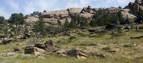
Zephyr Wall is among the more remote climbing locations in the range. Located within the Laramie Peak Wildlife Habitat Management Area, it's a long drive from any direction and is a little tricky to find as well.
Although the majority of routes in the Laramie Mountains are trad, all of the routes at this wall are sport routes, mostly with fairly close bolting.
Getting There
This is copied from the Mountain Project page, with some grammatical corrections by me:
When approaching from the west pick up Fetterman/Palmer Road 3 miles north of Rock River on the right off Highway 287. After about 25 miles of gravel on Fetterman/Palmer Road, you will cross a broad ridge and then rapidly descend, entering a basin. From the junction at the row of mailboxes, taking the left fork is the continuation of Palmer Rd. and the right fork is the beginning of Tunnel Rd. Choose your direction at this junction for which sub-area of the LPWHMA you wish to visit. This junction is about 1.75 miles due west of the western edge of the LPWHMA. When approaching from the east, take State Highway 34 west of Wheatland to the vicinity of mile marker 36 and turn off right just north of the Bluegrass Creek bridge on Tunnel Road alongside a row of mailboxes. The first 4 miles of this road are paved, and after about 14 miles from 34, you will cross the Laramie River. When at the bridge, you are within the southernmost portion of the LPWMHA. From here select your local destination in LPWMHA or visit some of the 9 climbing areas within the unit. If your access is on Palmer Road, drive 10.5 miles west of the Laramie River bridge on Tunnel Rd to jct Garrett Road then right and travel north 1.6 miles to the Palmer junction then right NE and on to the parking lot you are seeking. The GPS coordinates for the Main Entrance are 41 57.355 and -105 26.731.
Next, you need to find your way to the Kennedy Ranch Rocks area. From that MP page:
Enter the main entrance to the LPWMHA and proceed about 3 miles by the road of your choice to the junction very close to the common corners of sec 1,2,11,12. We refer to this junction as the Kennedy Ranch Rocks Junction (KRRJ).
Confused? I was. Leaving Wheatland, I entered the coordinates into Google Maps. That almost got me there.
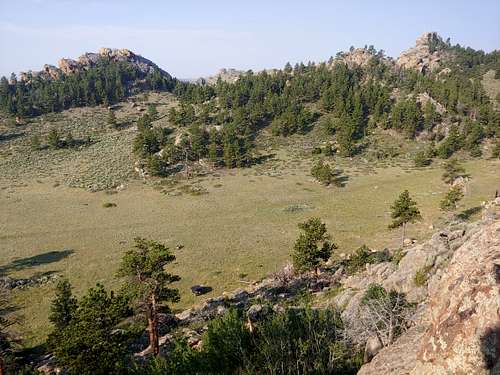
Here's the trick: You can't see Zephyr Wall from the roads in. Once you reach Meadow Mound, keep driving past a sign about fire and sheep and look for a faint track heading left and uphill. It will go up and then left into a meadow below Zephyr Wall.

|

|

|
Back down below, if you reach a low-angle slabby outcrop, you've gone just a little too far.
Routes
There are 7 routes on Zephyr Wall. Currently, the MP Page lists just 4 of them. Although I've climbed all 7, I'm bolding only those that are on MP because the grades on the others are just my best guess.
- 5.8 or 5.9
- 5.8 or 5.9
- Stellar Ascension-- 5.6
- Matt's Crack-- 5.9
- Hollywood Propaganda-- 5.7+
- 5.8 or 5.9
- Red Zephyr-- 5.5, 2 pitches, walkoff option

|

|

|

|

|

|

|

|
Red Tape
Avoid private property.
The area is closed to human usage from February 1 through April 30.
When to Climb
Late spring through early winter
Camping
Dispersed