
-
 9677 Hits
-
 76.66% Score
-
 7 Votes
|
|
Area/Range |
|---|---|
|
|
30.24416°N / 97.79695°W |
|
|
Hiking, Trad Climbing, Sport Climbing, Toprope, Bouldering, Scrambling |
|
|
Spring, Summer, Fall, Winter |
|
|
Overview
Austin, probably the best place in the state of Texas to spot one of its most critically endangered species-- a Texas Democrat-- is now the 11th-largest city in the country and the 4th-largest in Texas. Considering that, one probably would not think of Austin, a city far from any real mountains, as a place with climbing, whitewater kayaking, and mountain biking, yet it has those and more. Welcome to the Barton Creek Greenbelt, a semi-wilderness mostly within the Austin city limits. Since this ostensibly is a climbing site, this page will focus mostly on the climbing.
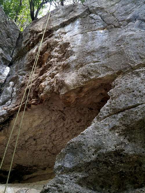
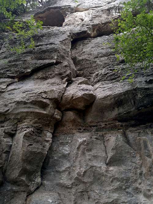
Limestone is the rock here. A lot of it is highly polished by generations of climbers, but there are spots that still tear your hands up. Note that because of the polish and because many of the routes here were put up before grade inflation became so rampant, many climbs will feel tough for the grade, maybe even a full grade harder.
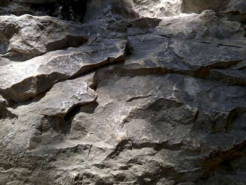
Polished Limestone at Seismic Wall
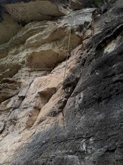
Almost all the routes are bolted, and most of those have sport anchors. There are some toprope routes, some of which can be done off sport anchors and some of which have to be set up from above, and there even is a handful of trad routes. Bouldering exists as well. Sport routes go from 5.6 to 5.13. Trad routes start at 5.4 and go at least to 5.10a.
Look for fossils, too. Sometimes they're right on the routes!
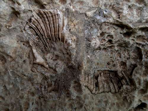
Fossils
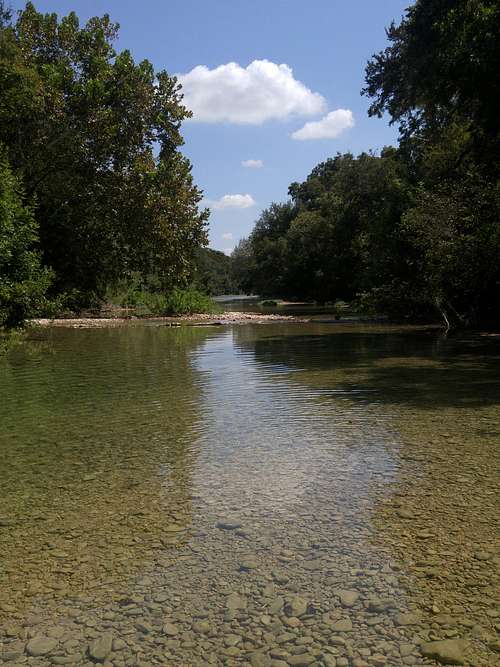
Many of the crags are located adjacent to or near swimming holes. During the warm months, which is like March through October, though winter days in the 80s are not uncommon, it's great to jump in and cool off after climbing (if there's water).
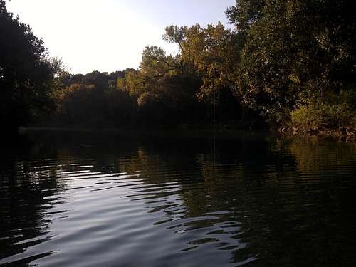
Swimming Hole at Gus Fruh
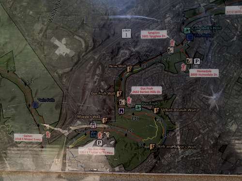
There are several climbing crags here. From north to south as you follow Barton Creek, they are as follows:
- Geritol Wall
- Random Walls
- Great Wall
- The Terrace
- New Wall
- Gus Fruh-- there all five walls here: Gus Fruh proper, Kingdom of Ging, Myth Wall (routes put up in 2014), Rubber Wall (routes put up in 2014), and Guide's Wall.
- Urban Assault Wall
- Kirk and Alvin's Wall
- 5.8 Sanctuary
- Seismic Wall
- Beehive Wall
Bird Dog and Over Easy, 5.8 and 5.9-- Seismic Wall |
Face Off, 5.9+; and Swordfish, 5.8+-- 5.8 Sanctuary |
Worm, 5.9+; Touch of Class, 5.7; Steep Bulge, 5.10a-- Guide's Wall |
Austin Climbing: Sport Routes & Deep Water Solos by John Hogge is the best beta source for the area. The second edition became available in late November 2016, and a revision will be out in late 2018 or early 2019.
There are a few options for guided climbing, but the best in my opinion is Rock-About.
Barton Creek at Seismic Wall
Getting There
There are several access points for the Greenbelt; this site covers most of them. Another site covering the same locations and more, with links to maps as well, can be found here.
The most popular climbing areas are the New Wall area, Gus Fruh, and Seismic Wall.
To reach the New Wall area, exit Mopac at Barton Skyway and go southeast until the intersection with Spyglass Drive.
For Gus Fruh, take Barton Skyway from Lamar Boulevard and turn onto Barton Hills. Drive to the the well-marked trailhead.
Note: the two Barton Skyways do not directly connect, as the Greenbelt splits them. Do not, for example, get off Mopac at Barton Skyway and expect it to take you to Gus Fruh as described above.
If you want to go to Seismic Wall, turn off 360 into the business park just south of the bridge over Barton Creek. Turn left and drive to a marked parking area.
Barton Creek Greenbelt
Red Tape
Read signs with posted regulations. No fees.External Links
Barton Creek on Mountain Project
Barton Creek on rockclimbing.com
crl826 - May 4, 2020 12:51 pm - Hasn't voted
Access points link wrong.Hey, I'm from Austin and have spent a lot of time on the Greenbelt. You have a link to a site that says it lists all the access points, but it is missing one. And it has the addresses to them, but those are a bit misleading since they aren't "official" addresses. I've used this one in the past. https://everythingaustinapartments.com/the-most-complete-guide-to-austins-greenbelt-access-points/ It has all 8 access points and links to maps that can be used to drive or walk. Water levels too since that can close off some entry points. Hope that helps.
Bob Sihler - May 6, 2020 5:07 pm - Hasn't voted
Re: Access points link wrong.Hi, I appreciate the wish to help. First, I have to ask if you are the writer of that page. If "CRL' are your initials, they match the first and last initials of the author. If you're looking to promote your own material and help at the same time, I'd rather you were up front about it. I don't know if the addresses on that other page are correct or official, but the directions are pretty good and I like the order she presents the locations. There are a number of errors on the page you refer to, and many of them are from a climber's perspective. They appear in several sections. Loop 360: I don't know anyone who refers to that spot alternatively as Lost Creek. What climbers and paddlers refer to as Lost Creek is the one your source talks about last. "If you head right on the trail you’ll get to the Seismic Wall and Maggy’s Wall, the prime locations for rock climbing." Seismic and Maggy's are the same location. "If you head right, you’ll head towards the swimming including the Lost Creek." Taking a left goes in the direction of Lost Creek, but it's several miles away. Twin Falls and Sculpture Falls are much closer, and most people access them from the Mopac entrance. Spyglass: "If you turn right (south), you’ll hit the first climbing wall, Enclave. Keep heading south and you’ll end up at Seismic Wall." Enclave is no longer open, or it is a disused name. Generally, climbers refer to the entire area as New Wall, though the first wall reached is actually Random Wall. No one uses this access to get to Seismic Wall, as it is around 4 miles from there. The next area one reaches is Guide's Wall and the other spots at Gus Fruh. They are about a 30-minute hike from Spyglass. Gus Fruh: "If you head south you can hit the Urban Assault or Guide Wall climbing walls." Guide's Wall is one of the cliff bands in the Gus Area, but one does not really head south to get there. Instead, one takes the switchbacks down to the beach or crosses from a different spur when the creek is dry. The former leaves the Gus walls just seconds away to the right, and the latter takes one directly to the walls. Heading south from the beach does indeed lead to Urban Assault. Because of these inaccuracies, I cannot put a link to this source in the main page. Climbers using my page could literally get lost or spend way more time than necessary getting to their destinations.
crl826 - May 18, 2020 4:55 am - Hasn't voted
Re: Access points link wrong.First off, apologies for delay in responding. I never received any notification that you had replied. Second, thanks for taking a look. I’ve helped moderate forums before and know what a thankless task it can be. Honestly, I didn’t expect a response at all. And definitely didn’t expect this very helpful feedback. I am the author and I do wish to help and make this the best source for Greenbelt access info. Hundreds of people have used it, perhaps hikers or swimmers instead of climbers, and that is why I haven’t gotten any corrections in the past year and a half. Either way, I’m going to review all of this and make all necessary updates. I don’t want to be responsible for putting bad information out. Thank you again for your time and effort.
crl826 - May 26, 2020 5:08 am - Hasn't voted
Made all your corrections and several other updates as wellAs I mentioned before, I really appreciate the time you took to point out where I needed to improve my post (https://everythingaustinapartments.com/the-most-complete-guide-to-austins-greenbelt-access-points/). Corrected everything you mentioned (and credited you for your help in the post), triple checked everything else, and added a number of other improvements that I had been thinking about already. 1. Updated directions to New Wall 2. Removed references to Enclave 3. Clarified Seismic Wall and Maggie’s Wall are the same thing 4. Updated the best access point to get to Seismic. 5. Updated Lost Creek to note that they are now charging for access (I could not find any other list of access points that mentioned this) 6. Made sure to include all the different names of all the different access points. 7. Made maps to the access points, climbing walls, and swimming holes I really do want this to be the best list of access points on the internet. I’ve looked at a lot of other lists and can’t find one that is close. Of course, I’d love it if you would update the link you currently have. Your feedback made the list better and I thank you for it either way.
Bob Sihler - Jun 4, 2020 8:40 pm - Hasn't voted
Re: Made all your corrections and several other updates as wellHey, I'm not ignoring you; I just haven't had a chance to sit down with this yet. I promise I will!
crl826 - Jun 21, 2020 1:52 pm - Hasn't voted
Re: Made all your corrections and several other updates as wellOf course. I had no doubt. Thanks for your time.
Bob Sihler - Aug 6, 2020 6:45 pm - Hasn't voted
Re: Made all your corrections and several other updates as wellI've been away a lot, but I finally added a link to your site on the main page. Thanks!