A Hike To Black Mountain in the San Jacinto Mountains
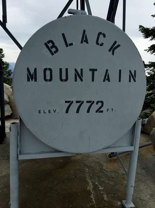
On June 27, 2015 I hiked to the top of Black Mountain in the San Jacinto Mountains, at 7,772 feet one of the lower summits in the range. The hike is about 3.5-4 miles long, and gains about 2,700 feet in elevation. There is a road that leads close to the summit, but what is the fun in that?
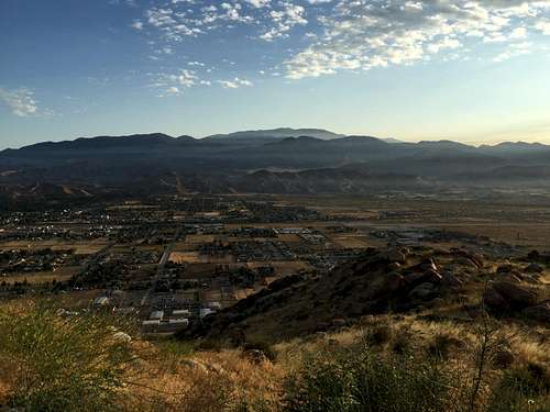
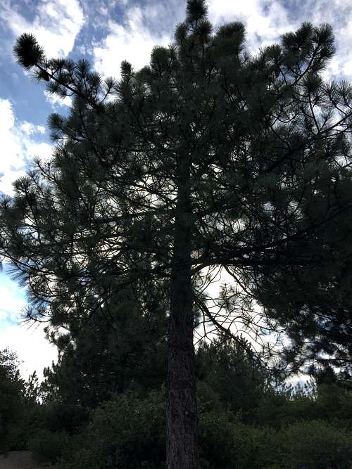
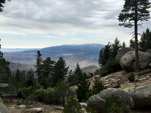
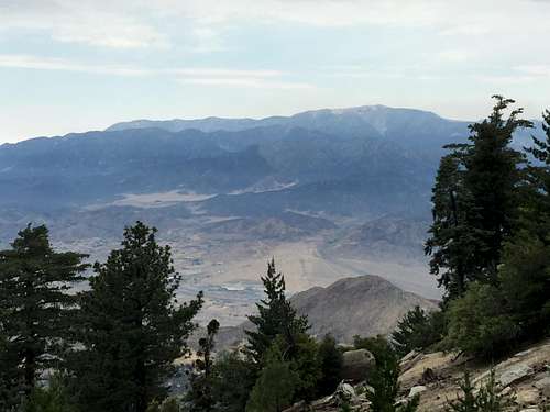
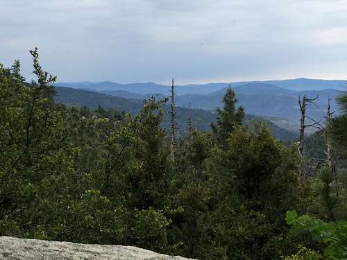
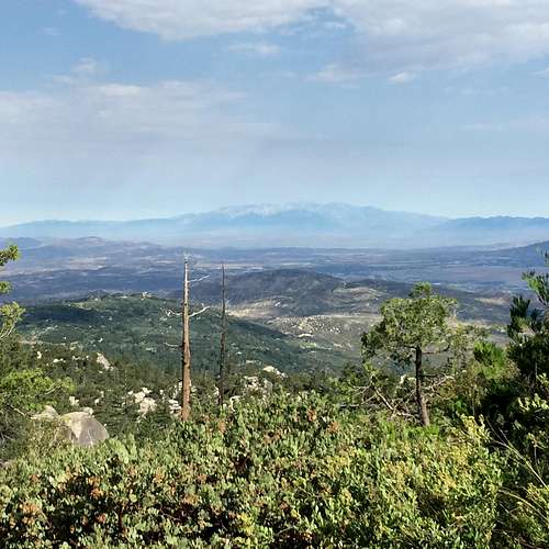
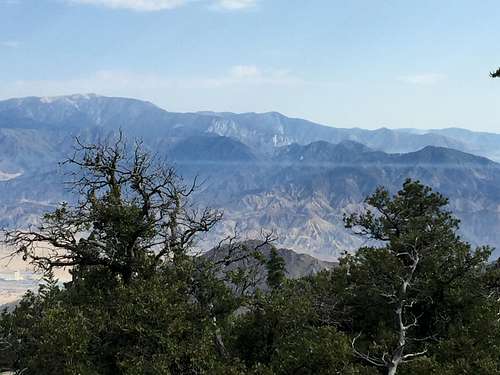
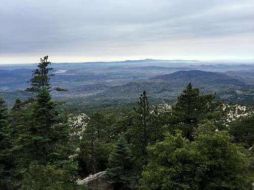
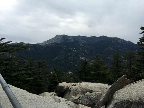
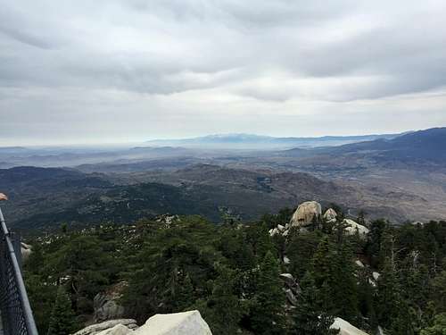
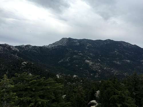
The hike was quite steep almost throughout, with just occasional level stretches to catch one's breath. Plus, the first mile to a mile-and-a-half or so was not that exciting, with vistas obstructed by chinquapin, small oak trees, and short Jeffrey Pines. While the hike does not sport views of Black Mountain itself, about halfway in views began to open up to the east, to the Santa Ana Mountains, and north to the San Bernardino Mountains. By the time I reached the fire lookout on the top of the summit, the views were truly outstanding, with fantastic vistas of San Jacinto itself and Fuller Ridge, the San Bernardino Mountains, San Gabriel Mountains, Santa Ana Mountains, areas of the San Jacinto Mountains south of the trail, and even the Palomar Mountains and Santa Rosa Mountains. The payoff made the somewhat tedious slog up the trail worth it.
By good luck, I picked a nice, mostly cloudy day to to the hike. It looked like it might rain several times, but never did. After I got back to my car at the end, there were a few patters on my windshield, but not anything very strong, and the "storm" lasted no more than 2 minutes. I suspect the hike would be quite hot on a more normal California summer day, and is probably better done in cooler seasons. I was never uncomfortable , though, due to the nice cool weather.
There were only two other cars parked when I left. I saw just 3 people heading up, and 3 other people at the lookout. Going down I saw maybe ten people (not including the camping area where the trail meets the road). Thus, the trail boats good solitude for being so close to Los Angeles and in such a popular mountain range.
It took me about 2:45 minutes to hike to the top, and another 1:30 to come down, for a total time hiking time of about 4:15. I spent about 4:50 on the mountain.
Prologue: Why Black Mountain?
I had originally planned on hiking to the top of Tahquitz Peak using the Devil's Slide trail near Idyllwild. I knew that I would need a wilderness permit, but it was unclear to me how the permitting process would work. I knew that there were self-issue permits available outside the Idyllwild ranger station, but I was concerned that self-issue permits might not work for the Devil's Slide trail, which is subject to quotas from Memorial Day to Labor Day. Therefore, I looked for backup plans in advance, and settled on Black Mountain as being the most likely one (as it was most suited to my time-frame and abilities) with Apache Peak another possibility.
Part of the difficulty is that it is hard for me to find summit hikes within my fitness levels and time windows. For example, on this trip I hoped to be back to South Pasadena by 3 pm at the latest, and it takes close to two hours to drive from South Pasadena to Idyllwild. Most hikes in the area seem to be either too short and too easy -- and in areas too hot to hike the Southern California summer heat -- or are way too long and strenuous. I hope to do harder peaks soon, but Mt. Baldy via the Ski Hut trail stretched my abilities to the limit, and San Jacinto (unless done from the tram -- which I do not want to do) and San Gorgonio look much longer and harder. And the Sierra Nevada are too far away. Further complicating matters, much of the area around San Gorgonio was closed due to the "Lake Fire," and I suspected any hikes close those to that area, even if open, would be unpleasant and full of smoke. So after much wailing and gnashing of teeth (I kid of course -- looking for hikes is almost half the fun!) I settled on Tahquitz Peak, with Black Mountain the backup plan.
I planned to get up around 6 so that my drive from South Pasadena would put me at the Idyllwild ranger station around the time it opens at 8 am. But I woke up at 5 am, and did not see any point in trying to go back to sleep. I left and got to Idyllwild just before 7 am.
![San Bernardino Mountains from Highway 243]() San Bernardino Mountains from Highway 243
San Bernardino Mountains from Highway 243I quickly spotted the permit station and filled out a wilderness permit for the Devil's Slide trail. But I then noticed that all Devil's Slide Permits had to be stamped to be effective, and, of course, there was no one there to stamp them. So, I would either have to wait around for an hour for the station to open so that I cold get the permit stamped, or go somewhere else. Waiting an hour did not appeal to me, and I decided to look for another destination.
Excited by the scenery and cool weather, I initially filled out a permit for Fuller Ridge, knowing that I would not be able to summit in time, but thinking I could hike just partway up. I promised my wife I would be home around 3 pm, and did not think I had the time -- or, perhaps more importantly (sorry Imelda) -- was in good enough shape to summit. As I headed back to my car and started driving back to the Black Mountain road toward the Fuller Ridge trailhead, I realized my plan was a loony one, as I might not even have the discipline to turn back before the summit. The full hike would take me at least 7-8 hours, I suspected. Even if I was able to summit, I would not get back to South Pasadena until early evening, breaking my promise to my wife. So, no Fuller Ridge: Black Mountain it would be!
The Trail to the Junction with Black Mountain Road
Black Mountain has a road that goes almost the way up to the top. Coincidentally, this road is the same one leading to the Fuller Ridge trailhead. Even 2 years ago I would have been happy to settle for the road followed by the short walk to the summit. No longer. To count, a mountain must be hiked to the top from the nearest reasonable trailhead.
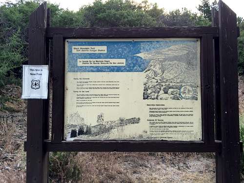
The Black Mountain trailhead is just a few hundreds' yards drive off of Highway 243, just 14-15 miles off the exit from I-10, quite a bit before Idyllwild. The trip does not require a permit, and I could have saved lots of time skipping the trip to the Ranger Station. Oh well -- live and learn. I doubled back from Idyllwild and reached the trailhead about 7:30, parked my car, and was off! Note that, according to this sign, an Adventure Pass is not required to park at this trailhead. (I have a yearly pass, so I put it on display in my car anyway.)
![Black Mountain trailhead sign]() Black Mountain trailhead sign
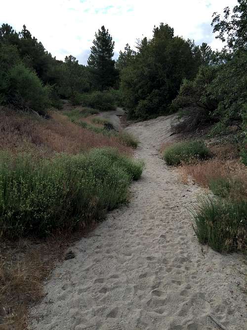
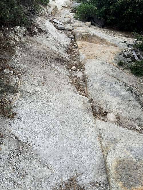
Black Mountain trailhead signThe first part of the trail is broad and either sandy or full of dirt. There were a couple sections that were a bit rocky, but nothing that would trouble even the most novice hiker. The trail was quite steep, though. It is about 3.5 miles to the road from the trailhead. The trailhead is at about 5100 feet, and the road is close to 7600 feet. That's 2500 feet in 3.5 miles, or an average of 714 feet per mile. By way of comparison, the Mt. Whitney trail averages about 642 feet per mile from the trailhead at the Whitney Portal to Trail Crest. Of course, the Mt. Whitney trail is (I suspect, never having done it) much much harder due to the longer distance and very high altitude, but the comparison should give some idea of the steepness of this trail.
![Beginning of Black Mountain Trail]() Beginning of Black Mountain Trail
Beginning of Black Mountain Trail![Rocky Section of Black Mountain trail]() Rocky Section of Black Mountain trail
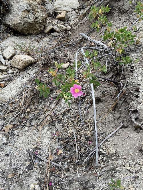
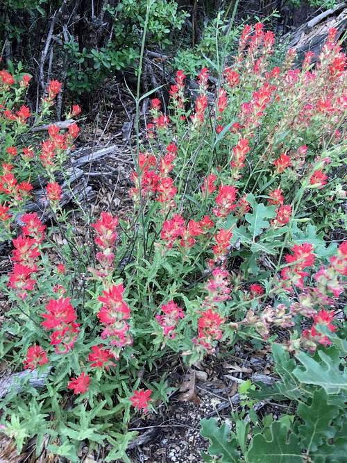
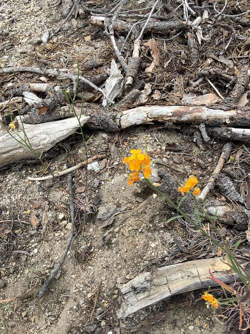
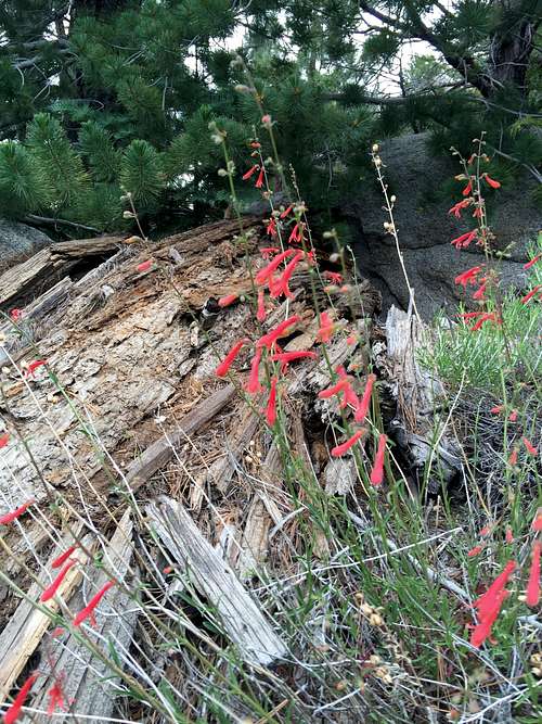
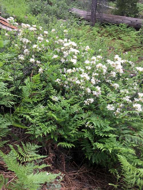
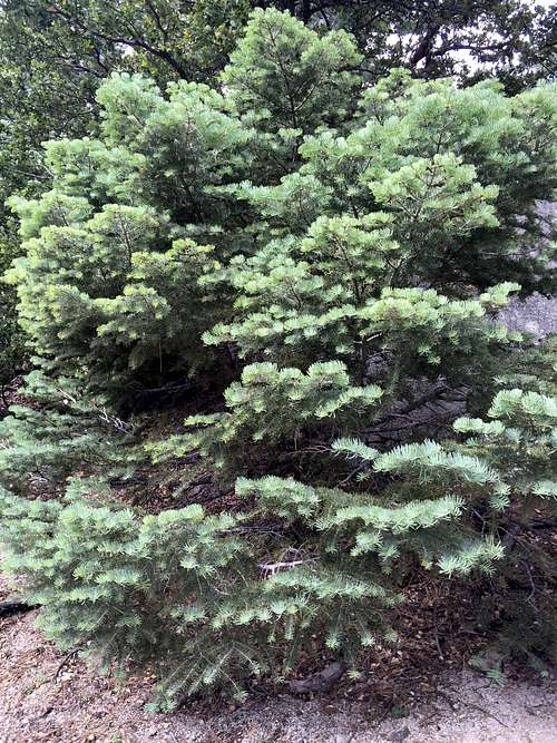
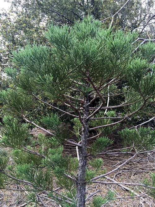
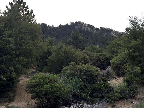
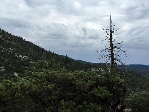
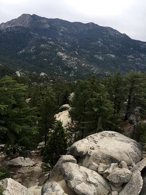
Rocky Section of Black Mountain trailAlthough the first portions of the hike were not especially interesting, there were a large number of beautiful wildflowers. This area apparently suffered from a bad fire in the 1990s, but I saw little sign of that fire when I hiked it. There were a few blackened trees, but the area was mostly a short forest of Jeffrey Pine and oak. The trail started just above the lower timber line in the mountains, and I would not have expected to see lush forests at this low altitude. The entire hike area was greener and more lush than I had expected.
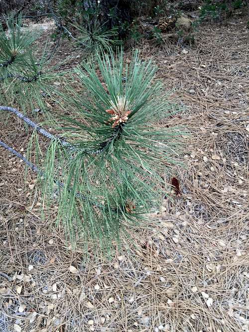
![Jeffrey Pine on Black Mountain trail]() Jeffrey Pine on Black Mountain trail
Jeffrey Pine on Black Mountain trail![Young Jeffrey Pine]() Young Jeffrey Pine
Young Jeffrey Pine![Lupines (?) on Black Mountain]() Lupines (?) on Black Mountain
Lupines (?) on Black Mountain![Creek Monkeyflower (?) on Black Mountain trail]() Creek Monkeyflower (?) on Black Mountain trail
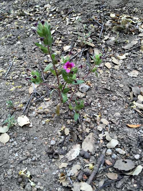
Creek Monkeyflower (?) on Black Mountain trail![Palmers Monkeyflower(?) on Black Mountain Trail]() Palmers Monkeyflower(?) on Black Mountain Trail
Palmers Monkeyflower(?) on Black Mountain Trail![Primrose (?) on Black Mountain]() Primrose (?) on Black Mountain
Primrose (?) on Black Mountain![Indian Paintbrush on Black Mountain Trail]() Indian Paintbrush on Black Mountain Trail
Indian Paintbrush on Black Mountain Trail![Davidson's Lotus (?) on Black Mountain Trail]() Davidson's Lotus (?) on Black Mountain Trail
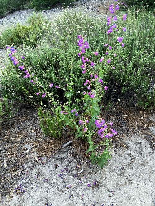
Davidson's Lotus (?) on Black Mountain Trail![Penstemmons on Black Mountain Trail]() Penstemmons on Black Mountain Trail
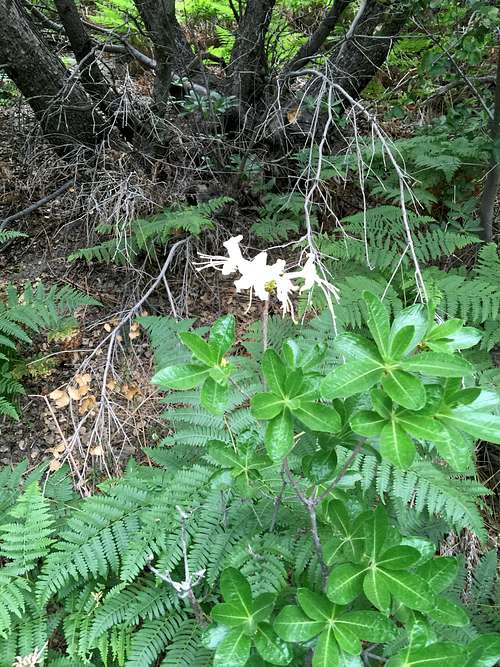
Penstemmons on Black Mountain Trail![Azalea (?) on Black Mountain trail]() Azalea (?) on Black Mountain trail
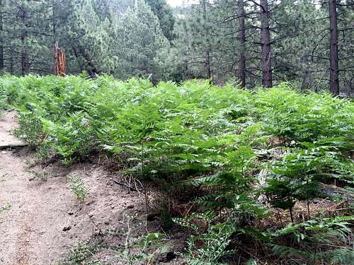
Azalea (?) on Black Mountain trail![Ferns on Black Mountain Trail]() Ferns on Black Mountain Trail
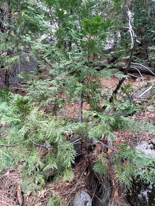
Ferns on Black Mountain Trail![Cedar tree on Black Mountain]() Cedar tree on Black Mountain
Cedar tree on Black Mountain![Ferns and Azaleas (?)]() Ferns and Azaleas (?)
Ferns and Azaleas (?)![Young fir tree on Black Mountain]() Young fir tree on Black Mountain
Young fir tree on Black Mountain![Young Juniper Tree on Black Mountain]() Young Juniper Tree on Black Mountain
Young Juniper Tree on Black Mountain
I am even more a novice in identifying wildflowers than I am in mountaineering. I've done my best in labeling these based on information I obtained googling, such as from this great site, but please let me know if I got any of these wrong so that I can fix them!
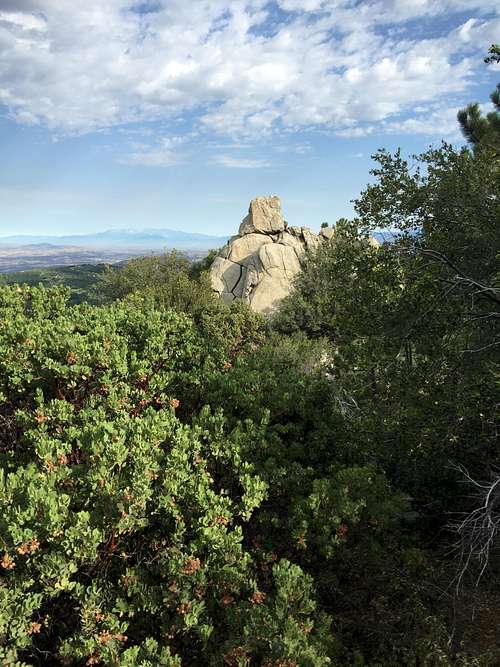
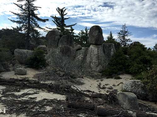
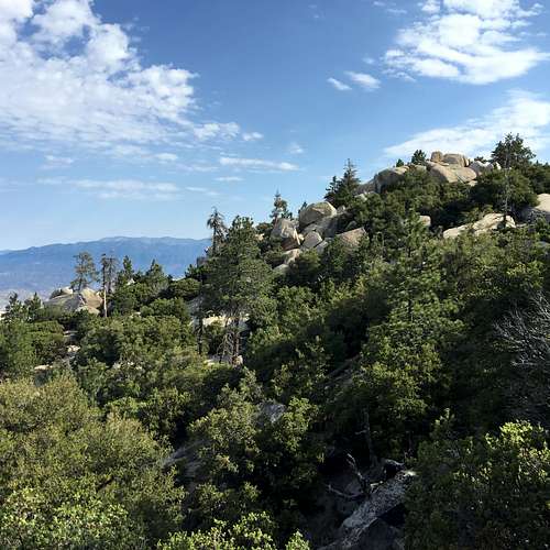
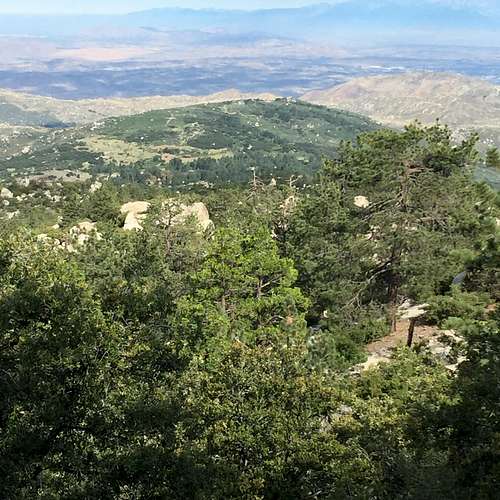
Fairly early on, I began to see lots of interesting looking boulders scattered all over the mountains. It looked like an angry god or child had smashed a giant boulder all over the mountainside. The area reminded me of our living room after our kids get done with it each day -- only much wilder and with much bigger "toys." Not being a boulder-hopper or rock climber, I do not know if these rocks would be of any interest to climbers, but I suspect that least some of them might be.
![Boulders on Black Mountain Trail]() Boulders on Black Mountain Trail
Boulders on Black Mountain Trail![Boulders on Black Mountain Trail]() Boulders on Black Mountain Trail
Boulders on Black Mountain Trail
![Boulders on Black Mountain Trail]() Boulders on Black Mountain Trail
Boulders on Black Mountain Trail![Boulders on Black Mountain Trail]() Boulders on Black Mountain Trail
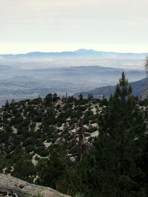
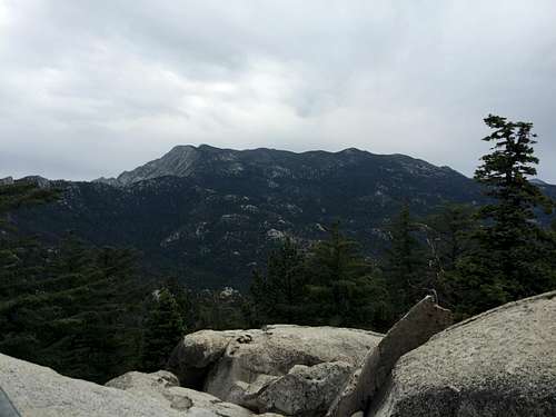
Boulders on Black Mountain TrailEventually, views to the east and north began to open up. The Santa Anas and Santiago Peak were clear and easy to see -- better than in the photos I took of the area. The same goes with the San Bernardino Mountains to the north, and the other mountains I saw.
![San Bernardino Mountains from Black Mountain]() San Bernardino Mountains from Black Mountain
San Bernardino Mountains from Black Mountain![San Bernardino Mountains from Black Mountain]() San Bernardino Mountains from Black Mountain
San Bernardino Mountains from Black Mountain![Santiago Peak from Black Mountain]() Santiago Peak from Black Mountain
Santiago Peak from Black Mountain![Santiago Peak]() Santiago Peak
Santiago Peak![Palomar (?) and Santa Rosa Mountains]() Palomar (?) and Santa Rosa Mountains
Palomar (?) and Santa Rosa Mountains![Ranger Peak (?)]() Ranger Peak (?)
Ranger Peak (?)![San Gabriel Mountains]() San Gabriel Mountains
San Gabriel Mountains
The San Gorgonio wilderness is still closed due to the "lake fire." But I did not see much smoke hiking up the Black Mountain trail. The day had better visibility than I had expected, particularly given the cloud cover. Undoubtedly the clouds and possibly even rain was helping put down the fire. In fact, weather conditions were perfect: Clouds were holding down the temperature, but no rain was falling, and the clouds did not obstruct any views of any mountains.
Most of the Lake Fire is on the northern side of San Gorgonio, and was not visible from the trail. I did see one small, smoldering area in front of San Gorgonio to the right (east). I did my best to snap a photo of it, but the zoom function on my iPhone isn't that great.
![San Bernardino Mountains and Lake Fire From Black Mountain Trail]() San Bernardino Mountains and Lake Fire From Black Mountain Trail
San Bernardino Mountains and Lake Fire From Black Mountain Trail![Lake Fire from Black Mountain Trail]() Lake Fire from Black Mountain Trail
Lake Fire from Black Mountain Trail![Lake Fire from Black Mountain Trail]() Lake Fire from Black Mountain Trail
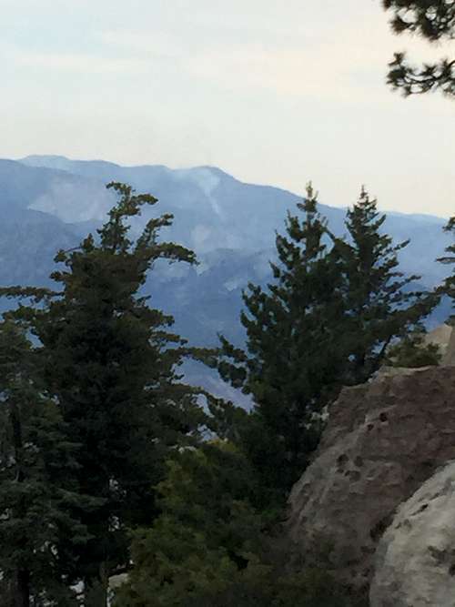
Lake Fire from Black Mountain Trail![Clouds over the San Jacintos to the South of Black Mountain Trail]() Clouds over the San Jacintos to the South of Black Mountain Trail
Clouds over the San Jacintos to the South of Black Mountain Trail
Eventually the trail reached the south side of some unnamed "bumps" and switch-backed steeply up the ride to the junction with the road.
Junction with the Road to the Summit
When I reached the top of the trail, there was a wide path (but still not a road) heading in one direction, and a small, but distinct and well-worn trail heading another. I was not sure which to take. The trail looked more inviting, and I decided to go that way, thinking that it would probably still likely meet up with the road. It didn't, but did lead to the top of a cliff looking down to the west. I selected a nice round boulder, sat down, and had a nice break and snack. Then I snapped a photo of Santiago and Modjeska Peaks to the east.
![Santiago Peak from Rock Outcropping on Black Mountain]() Santiago Peak from Rock Outcropping on Black Mountain
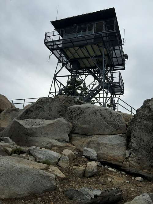
Santiago Peak from Rock Outcropping on Black MountainAfter my break, I had to decide which way to go. I could have backtracked to the junction with the road, but that way was not appealing. I decided I could probably manage scrambling up the ridge to the road if necessary. I decided to do that. It turned out a faint use trail led precisely in that direction. The use trail is probably bad for the forest's ecosystem -- everyone should always stay on trails if possible -- but it was there and I did not feel that guilty using it. Soon it met up with the road, with the towering Black Mountain lookout directly above.
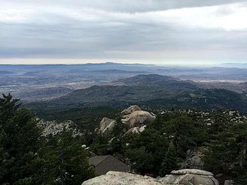
The Summit of Black Mountain
Views from the Black Mountain summit were simply heavenly, far better than what I can describe in words, and better than the photos show. Still, I will let my photos do the talking for me.
![Lookout Tower on Black Mountain]() Lookout Tower on Black Mountain
Lookout Tower on Black Mountain![Black Mountain Lookout Sign]() Black Mountain Lookout Sign
Black Mountain Lookout Sign![San Jacinto Massif from below Black Mountain Lookout]() San Jacinto Massif from below Black Mountain Lookout
San Jacinto Massif from below Black Mountain Lookout
![San Jacinto Peak from Black Mountain Lookout]() San Jacinto Peak from Black Mountain Lookout
San Jacinto Peak from Black Mountain Lookout
![San Gabriel Mountains from Black Mountain]() San Gabriel Mountains from Black Mountain
San Gabriel Mountains from Black Mountain![San Bernardino Mountains from Black Mountain]() San Bernardino Mountains from Black Mountain
San Bernardino Mountains from Black Mountain
![San Jacinto from Black Mountain Lookout]() San Jacinto from Black Mountain Lookout
San Jacinto from Black Mountain Lookout![San Jacinto from Black Mountain]() San Jacinto from Black Mountain
San Jacinto from Black MountainWhile at the top, I chatted with the volunteers for a little while. While no official announcement has been made, current suspicions are that the "Lake Fire" was started intentionally. Unbelievable! I can understand accidents. I can even try to understood why murderers and other unsavory characters do the things they do -- while their actions cannot be justified, and I agree with punishing them, usually it is possible to at least get a sense for why they talked themselves into doing the things they did. But I doubt I will ever be able to understand how someone could intentionally burn down a forest. Natural fires are good and healthy for the forest in the long run. Arson is not. If someone did intentionally start the Lake Fire," he/she should punished as severely as the law allows!
The lookout itself is an impressive structure, and even has a nice looking bed in it -- although the volunteers rarely stay for the night. It would have been fun to stay up for a while longer, chatting, reading the materials and looking at the maps inside the shelter on top, and enjoying the views. But I needed to get back to my family, so after spending about 20 minutes on top, I headed down. The hike down was steep and not that enjoyable -- though, because I was facing west, the views were better than one the way up. I made it back to my car at about 12:20 pm.


Comments
Post a Comment