
-
 342 Hits
-
 80.49% Score
-
 12 Votes
|
|
Mountain/Rock |
|---|---|
|
|
46.75627°N / 11.80721°E |
|
|
Bolzano Alto Adige |
|
|
Hiking, Skiing |
|
|
Spring, Summer, Fall, Winter |
|
|
7185 ft / 2190 m |
|
|
Overview
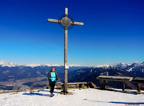
Cima Campill / Monte Campiglio 2190 m
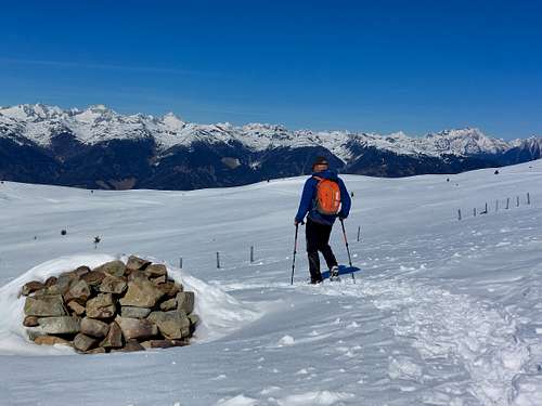
Cima Campill 2190 m is a popular summit located in the Lusneralm - Alpe di Luson, a grassy wavy plateau between the Badia, Pusteria and Isarco valleys. The mountain is located on the edge of the Odle/Geisler dolomitic group, in the area nearby the Val Pusteria/Pustertal and bordering the Putia/Plose group. As all the mountains in the area of Alpe Luson, Cima Campill is an essentially grassy peak that can be traveled on in all seasons, becoming much more interesting during the winter months, when it offers an excellent opportunity to be summited on skis or snowshoes, or with crampons, depending on the snow conditions.
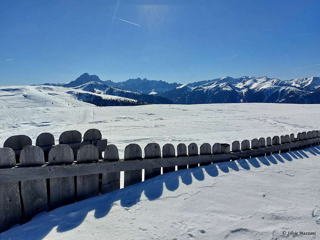
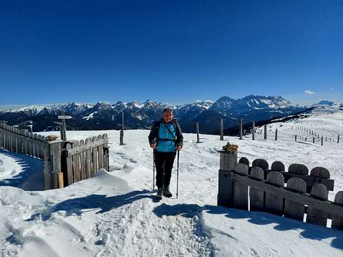
Very famous and popular in reason of its beautiful environment and broad panorama, it can be climbed from the side of Alpe Luson, an open and panoramic plateau very well known by the cross-country skiers. Along the route to the summit, you go through the large pastoral environment of the Alpe Luson with the presence, moreover, of various huts and mountain alms along the way
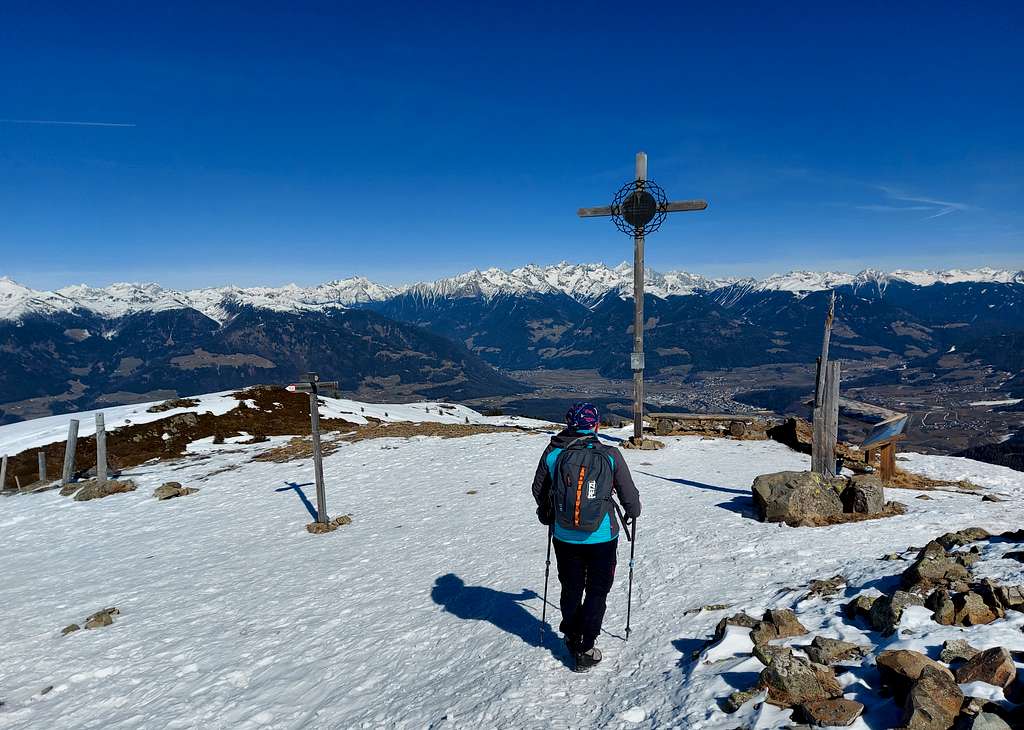
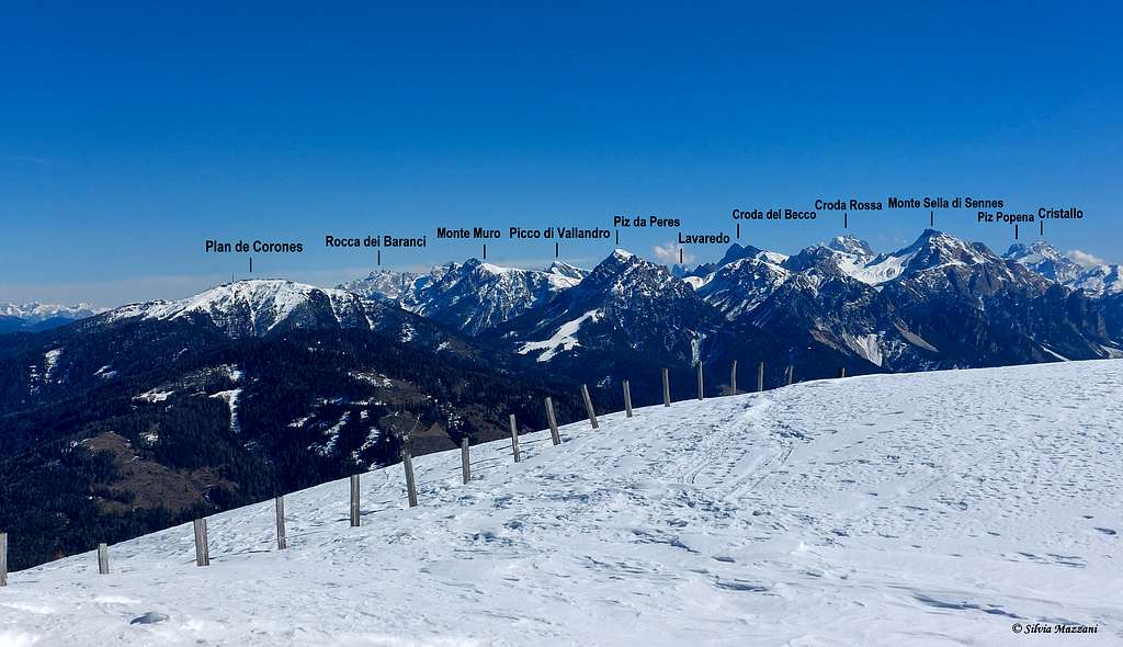
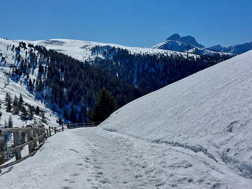
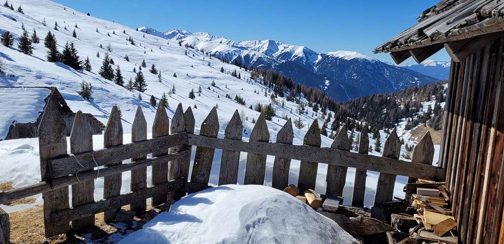
>Some orientation tables have been positioned on the summit, very interesting to recognize the peaks belonging to the extraordinarily numerous mountain groups visible from the top. In fact, the summit offers a very wide and impressive panoramic view of the Dolomites, the Sarntal Alps, the Aurine Alps, the Vedrette di Ries and the Hohe Tauern.
Getting There
From A22 Autobrennero exit Bressanone, drive in the South direction to reach the town and here take the road SP30 to Luson. Once past the village, turn left following the signposts Valletta/Flitt and drive up to the hamlet of Flitt 1337 m. We can leave the car in one of the car parks that we find in succession after passing the hamlet, depending on the snow on the road. The third and final car park is the Schweiger Böden 1730 m.
Route
Cima Campill from Alpe Luson (from South-East)
Summit quote: 2190 m
Difficulty: E, EI in winter
Difference in level: 460 m from the Schweiger Böden parking lot
Exposition: S
Starting point: Schweiger Böden parking lot 1730 m
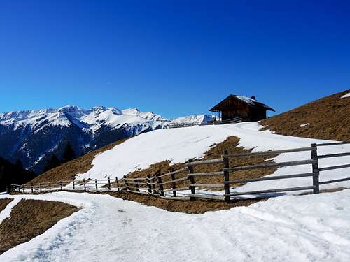
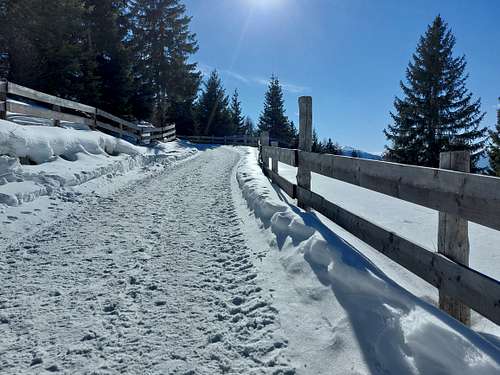
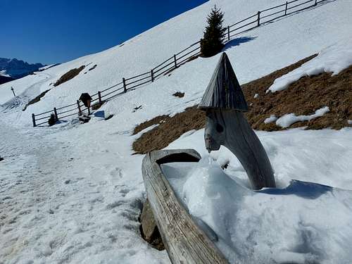
From the parking lot take the mule track n. 2, with a starting initial short stretch in the woods. In a few minutes you exit the woods onto the forest road which you take to the right walking alongside some small huts and then along a wooden fence with beautiful views of the Sass de Putia. You pass near the Malga Genaideralm 1940 m. The forest road now continues towards the North-East and shortly after the alm you will reach a small wooden house with a wooden fountain at 2010 m of altitude.
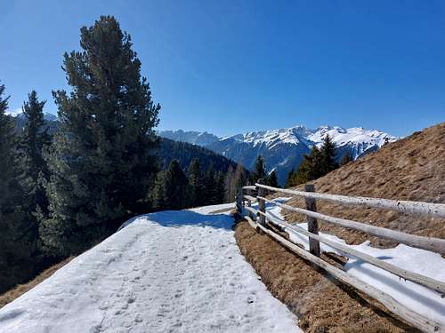
Just here leave the road and take the path that continues at altitude on the right in the direction of the church of S. Giacomo. Pass a little wooden gate and continue with a long traverse towards the east, up to the splendid tiny houses of Astalm 2020 m with the namesake alm.
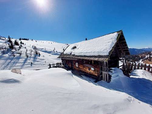
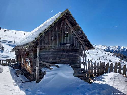
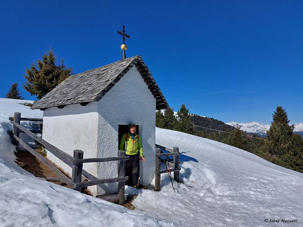
After these nice mountain huts you come across a crucifix and the beautiful tiny church of San Giacomo / Jakobsstöckl 2030 m, patron saint of wayfarers and pilgrims.
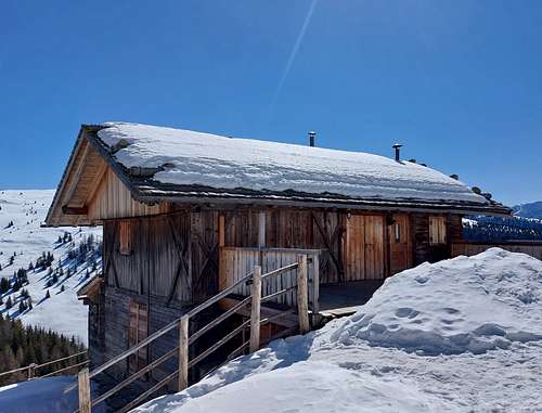
Here you turn sharply left climbing up the wide ridge and following the itinerary n. 2 in a Northerly direction, but leaving it shortly after to follow the signs to the Kreuzwiesen Hütte in a North-West direction. In the upper part you will flank a series of poles and pass through a wooden gate.
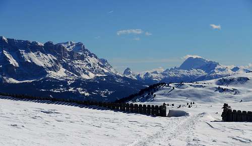
Cima Campill offers an extensive summit panorama towards several groups of the Eastern Dolomites, with Civetta and Sass dla Crusc, Sesto Dolomites, Sass de Putia and the Odle, the Plose, Monti di Fundres and up to the peaks of the border ridge between Italy and Austria with the Aurine and Vedrette di Ries.
The descent is done on the opposite side following the itinerary n. 10A and passing the Kreuzwiesen Alpine Hütte. From here you continue along the path n. 2A in the direction of the Schwaiger Böden parking lot, which can be reached in about 1 hour.
Red Tape
No fees no permits required
When to Climb
All year long. Winter climbs require the use of specific equipment, such as snowshoes, skis or crampons depending on the snow conditions. The stability of the snowpack is subject to sudden and unpredictable changes. Always consult the avalanche and weather bulletins to find out the conditions of the snow cover and the level of safety of the itinerary.
Accomodation
Different possibilities in Alpe Luson.
Meteo
Guidebooks and maps
Kompass 1:25.000 Val Pusteria, sheet 1