
-
 2499 Hits
-
 83.1% Score
-
 16 Votes
|
|
Route |
|---|---|
|
|
46.36013°N / 11.76442°E |
|
|
Hiking, Mountaineering, Skiing |
|
|
Spring, Summer, Fall, Winter |
|
|
Half a day |
|
|
Alpine F in winter, E in summer |
|
|
Overview
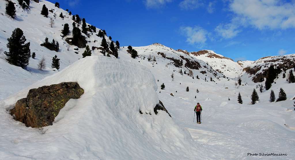
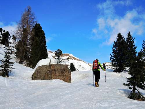
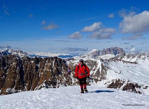
Cima Juribrutto from Malga Vallazza
Cima Juribrutto 2697 m is the second highest mountain in the Cima Bocche Group, a small chain located in the Southern part of the Western Dolomites, while Cima Bocche is the highest one. Cima Juribrutto - also named Iuribrutto - is located in the municipality of Moena on the northern border of the Paneveggio - Pale di San Martino Natural Park and right in front of the majestic Pale di San Martino group.
This mountain can be climbed all year round; in winter the ascent starting from Malga Vallazza is particularly interesting. This classic and frequently attended itinerary takes place on gentle open slopes that lead us to discover unique landscapes and panoramas. The starting point is the Malga Vallazza m 1935, located just before the Passo Valles Pass along the road from Paneveggio. From the shelter the route climbs up in the North-West direction to the Laste di Juribrutto, from here without an obligatory route and through gentle slopes it reaches the summit. The descent takes place along the ascent route.
Cima Bocche group is mainly composed of red porphyry rocks and therefore from a geo-morphological point of view it is much more similar to the nearby Catena di Lagorai to its South than the Dolomites to its North.
Getting There
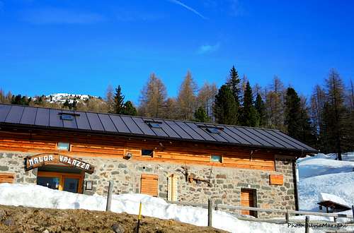
From Trento or Bolzano take the A22 Autobrennero and exit Egna-Ora-Neumarkt. From here we take the state road to Val di Fiemme/Fassa. Through various villages the state road reachs Predazzo, where we take the road SS50 towards Passo Rolle. Before climbing up the hairpin bends to Passo Rolle, about 2,4 km after the Forte Buso-Paneveggio dam the road branches off to the left in the direction of Passo Valles. Before traveling along this state road in winter, make sure you don't come across any sporting event of particular interest and importance, such as the Marcialonga, in order to avoid boring and long queues. After driving about 5 km. you reach a parking lot on the right in front of the building of Malga Vallazza 1935 m, a few hundred meters before Passo Valles.
Route Description
Difficulty: F (mountaineering) - MS (ski-mountaineering) - E (summer hike)
Vertical gain: 750 m
Exposition: South
Starting point: Malga Vallazza 1935 m
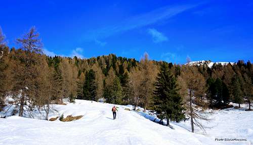
We skirt the Malga Vallazza 1935 m on the left in the West direction and take the path 631 which almost immediately enters the wood. The itinerary quickly climbs the slope through the trees with a short but rather steep section. After the woods, the path becomes less tortuous and steep and cross a plain.
At the end of the plain, the route bends sharply to the left in correspondence with some reddish rocky outcrops to go up a steep slope to be crossed to the left. At the end of the ascent of the slope you reach a signpost where the itinerary joins the one coming from Malga Juribrutto. The route starts to climb a new steep slope (Laste di Juribrutto) after leaving a bump on the right. The itinerary leads to the top of the ridge that separates the Vallazza on the right from the valley where it flows the Rio Juribrutto, a valley located between Cima Bocche and Cima Juribrutto.
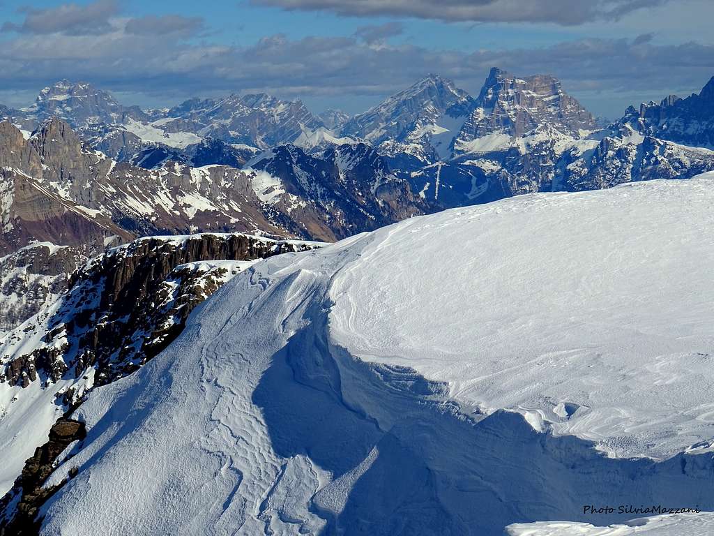
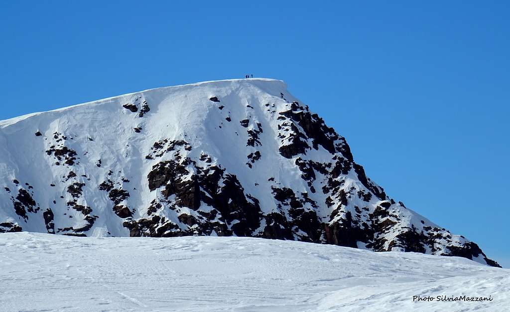
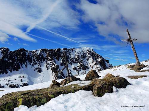
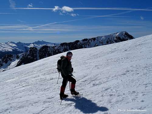
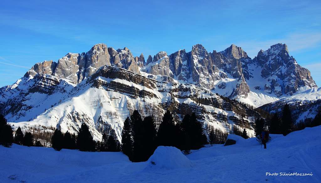
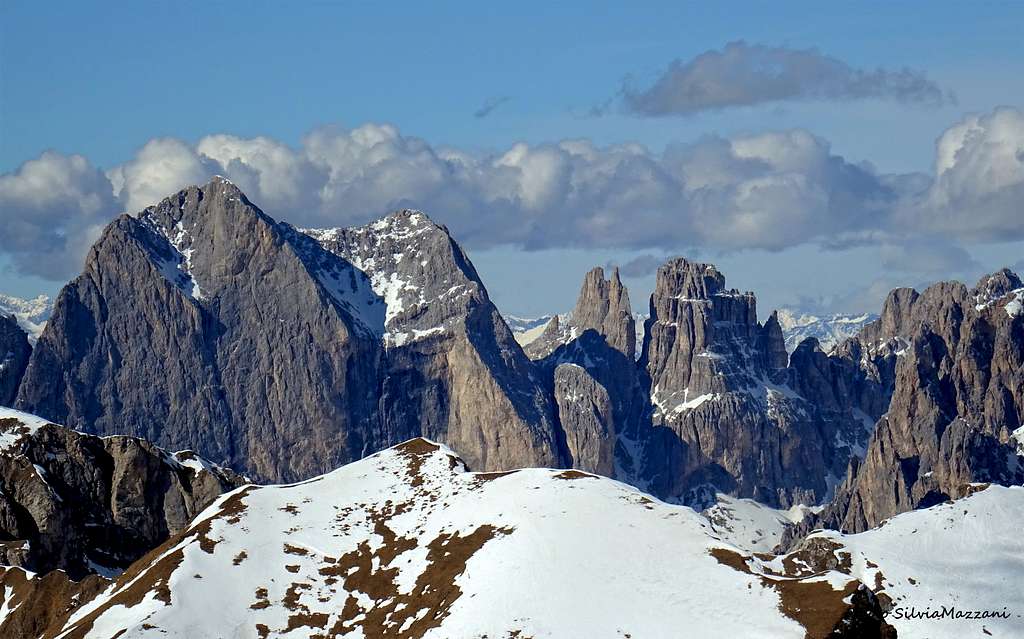
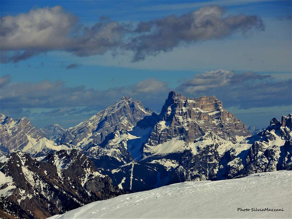
You reach a rocky hump with some small wooden crosses in view of the stretched beautiful ridge of Cima Bocche. The view behind us is already superb with the majestic Pale di San Martino group with the Vezzana and Cimon della Pala right in front, while Pale di San Lucano, Civetta and Pelmo rise to the left. At this point, head to the right and climb for a rather long time on slightly steep slopes until you reach the flat top of Cima Juribrutto from where an absolutely spectacular panorama opens up on the Western Dolomites with Catinaccio and Sassolungo, on Marmolada and on the various groups of the Eastern Dolomites.
Descent: the descent takes place along the ascent route.
Essential gear
Winter ascents require snowshoes or ski. Crampons and ice-axe may be useful in case of shortage of snow and presence of ice.
Red tape
Cima Iuribrutto is located within the park boundaries of the Parco Naturale Paneveggio - Pale di San Martino. The Natural Park consists of the area of the Pale di San Martino Group as well as the forest of Paneveggio and the porphyritic chain of Lagorai. It contains an area of 125 sqare km which in 1987 has been divided in three different levels of protection: 33% of the area have been declared complete protected areas, 60% are restriced areas while 7% are controlled area. For more information you can look at the Park's official website. There are no fees and no permits required.
Before traveling along the state road to Passo Valles in wintertime make sure you don't come across any sporting event of particular interest and importance, such as the Marcialonga.
Accomodation
Various possibility of acomodation in Val di Fiemme and Passo Valles.
Where to climb
This itinerary can be frequented all year long. The winter and early spring ascents requires snowshoes or ski, crampons and ice-axe with shortage of snow and ice. The best time in summer is June through October.
Meteo
Guidebooks and maps
Tabacco sheet 022