
-
 2830 Hits
-
 84.82% Score
-
 19 Votes
|
|
Route |
|---|---|
|
|
68.19414°N / 14.27039°E |
|
|
Summer |
|
|
Most of a day |
|
|
5, Norwegian (UIAA V+) |
|
|
8 |
|
|
Overview
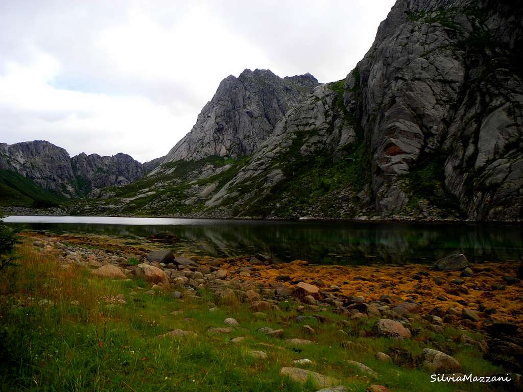
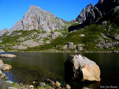
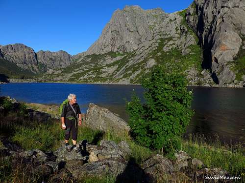
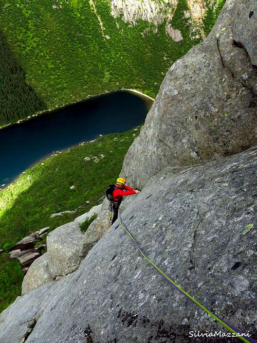
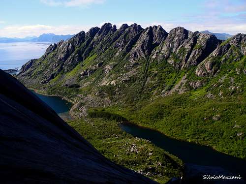
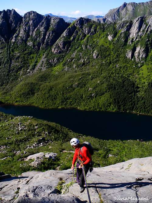
The mighty Pillaren is located on the island of Austvågøy, Lofoten archipelago. It's a great and impressive buttress of high quality granite rising above the hidden lake named Djupfjordvatnet, which is the continuation of the Djupfjord, crossed on a causeway by the Road 816 in the direction of Henningsvær. The cliff, facing North-West and getting the sun late in the afternoon, constitutes the Vågakallen North West buttress, ending in the Point 713.
The lower sector consistes of some beautiful granite slabs, named Bare Blåbær slabs, up the freshwater mirror of the lake, one of most popular climbing destinations of Lofoten. These slabs have several routes, being Bare Blåbær the classic one and best known giving the name to the sector. The name is Norwegian for a task of no great difficulty. In this page it will be instead described a magnificent combination that allows you to climb a 8 pitches route with difficulties slightly above Bare Blåbær.
Getting There
Getting to the Lofoten islands
There are various possibilities:
- By car from Evenes Airport to Svolvær - By ferry boat from Skutvik to Svolvær or Skrova (North of Lofoten) - By ferry boat from Bodø to Moskenes, Værøy or Røst (South of Lofoten) - By plane from Bodø
Road Approach
It's possible to approach the cliff directly from Svolvær, Lofoten major center, following the road E10 for about 20 km and also from Kabelvag, in about 15 km. along the same road, turning to left to Henningsvær (Road 816) at E10 and Road 816 forking. Otherwise the shortest way to approach the cliff is from Henningsvær (less then 5 km.), or from Lyngvæar (less then 5 km), a place along E10, about 20 km. West to Svolvær. The coast road to Henningsvær crosses Djupfjord narrow isthmus in the beginning (parking before the causeway).
Walking Approach
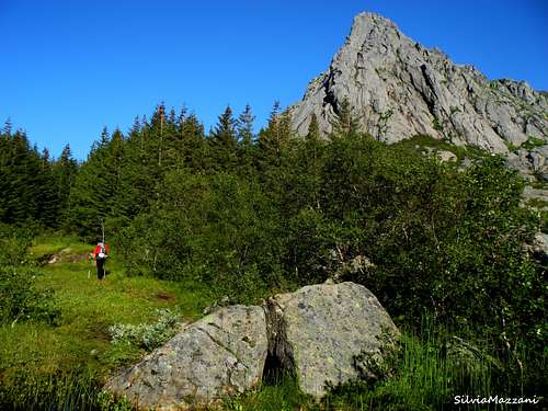
Park the car near the causeway across the Djupfjorden. The Bare Blåbær slabs are approached following a good path, starting from the road 816 close to the isthmus and running along the Djupfjord North-Western shore (on your left-hand side when you’re looking inside at the fjord). The trail gains the terminal moraine, which divides the fjord from the hidden inner lake. When you’re getting to the path’s first junction close to the moraine, don’t follow some cairns heading to the right – this is the path heading to Vagakallen-Kvandalstinden Col and Pillaren longest routes area - but follow the trail on your left-hand side. Continue on rough terrain and after a pine wood and a bit after reaching the lake, the correct trail forks from the main path and rises towards right along steep vegetated slopes inside a wide gully between two outcrops. At the end of the gully head to left in the direction of a small easy-angled slab leading to the base of the slabs sector (1 hour from the coast road). Some enourmous cairns mark the climbing area.
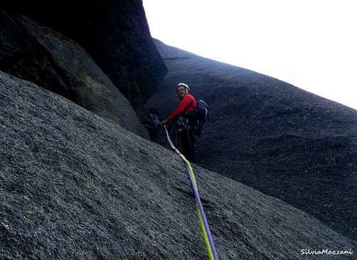
Route Description
Coley Smoke - Very Expensive Ticket combination report - Norwegian scale
Difficulty: 5 Norwegian, (V+ UIAA)
Climbing length: 30 m
Equipment: not equipped
Exposure: West
First ascent of Coley Smoke: Nick Ashton, Glenn Henry, Dave Musgrove 11.8.1998
First ascent of Very Expensive Ticket: Pawel Grenda, Bartek Malinowski, Marcin Szymelfenig (Poland) 16.6.2005
Starting point: causeway on Djupfjord, road 816 to Henningsvær
A wonderful combination that allows an interesting climb of 8 pitches on excellent rock with difficulty not exceeding the Norwegian 5 degree (V + UIAA). The lower part of the itinerary is made up of the four pitches of "Cooley Smoke", route ending at its fourth stance. A connection pitch allows you to join the upper parte of "Very Expensive Ticket".
The start of the route Cooley Smoke is located on the left of the start of the route Bare Blåbær (which is about in the middle of the slabs), in correspondence with a 100 meters high beautiful triangular pillar in the shape of a pyramid, made up of slabs interspersed with small roofs. On this pyramid we find four routes, Cooley Smoke is the one located further to the left and follows a line running along dihedral and beautiful cracks in the middle of the pyramid. It gains a ledge located at about 2/3 of the pyramid where it ends. Here you connect with the final part of Very Expensive Ticket for four more pitches.
L1 - Easy rocks lead to the base of a small chimney. Up the chimney and exit obliquely to the left on a slab to a stance at the base of a slanting right dihedral, 4, 30 m
L2 - Climb up the magnificent dihedral-crack, then obliquely to the left for a cracked slab under a roof. Stop at the base of a cliff carved by a fissure, 5, 30 m
L3 - Climb up the chimney crack above the stance, continue through a system of cracks, then traverse to the right under a roof, stopping at the base of a narrow chimney 5-, 30
L4 - This is the last pitch of Cooley Smoke. Climb up the chimney and pass a stuck boulder, then continue along the dihedral up to about half way, to go to the left side of the dihedral itself and take a magnificent finger-crack to be climbed to the belay on a ledge with block and tree, 5- 30 m.
L5 - A short and easy pitch on small walls and slabs, which at this point allows to join the upper part of "Very Expensive Ticket", which is a hard climb in its lower part (up to 7 Norwegian), while in the upper part allows a climb on difficulties similar to the first four lengths of Cooley Smoke. Belay on some blocks below an overhanging band of rocks, 3, 28 m
L6 - A long fine pitch! Take a narrow crack, overhanging at the start, on the right side of the stance. Continue through the beautiful finger-crack cutting the slab up to a small ledge. Oblique left, go beyond an edge and climb in the bottom of a narrow gully to the stance on a ledge with blocks, 5, 50 m
L7 - Slanting left, climb a small dihedral and then oblique to the right to reach the top the central gully which bords the pyramid on the right, 3, 20 m
L8 - Climb the fine open dihedral, then vertically to take a system of slabs that must be climbed to the right to reach the final stance of Bare Blåbær 4+, 50 m
Descent: from the final stance it's possible to abseil down following a new set of descent anchors installed to the right of the route Bare Blåbær to avoid pulling ropes over a nasty crack and rappelling down on top of ascent parties.
Essential Gear
2 x 60m ropes, full set of stoppers, few medium to small hexes. Several cams in the finger to hand range, no larger than a #3 Camalot. Slings.
Red Tape
No particular restriction in climbing and hiking.
Where to stay
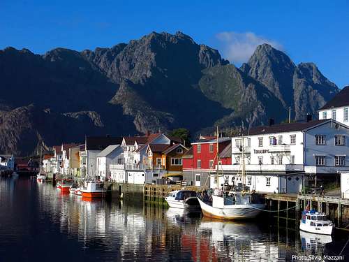
Camping - In Norway camping is allowed in every place, if not expressly forbidden. Best free campsites in this area are located in Festvåg, in front of the Gandalf cliff, and Paradiset, just close to Henningsvær. The nearest equipped campsite is the “Lyngvaer Bobilcamping” (campers, tents and cabins), situated 20 km. West to Svolvaer and a few kilometers from the Djupfjorden climbing area. Accomodation can be found also in the picturesque village of Henningsvær, quite close to the Djupfjorden climbing area, a bit of a focus for climbers. There is also a climbing school, besides several possibilities of accomodation.
Climate
On Lofoten the weather can change suddenly from clear and blu sky with sunshine or the Northern Lights (Aurora Borealis) to violent storms with rain or snow. Maximum temperatures go from +30°C in June and July to -15°C in January and February; the average temperatures for these months are from +12°C to -3°C. The period with the minimum rainfall goes from April to June, while we may expect the maximum rainfall or snowfall between October and December.
Midnight sun: from 27 May to 17 July
Polar night: from 6 December to 6 January
The Northern Lights can be seen over Lofoten from September to April.
When to climb
Best months for climbing are late May, June, July and August.
Meteo

Guidebooks and maps

Lofoten Rock" by Chris Craggs and Thorbjorn Enevoid
External Links
Climbing info: Rockfax Lofoten Guidebook
Tourist info: Lofoten Islands Lofoten