-
 9311 Hits
-
 87.31% Score
-
 24 Votes
|
|
Mountain/Rock |
|---|---|
|
|
68.19235°N / 14.27073°E |
|
|
Nordland |
|
|
Trad Climbing |
|
|
Summer |
|
|
2339 ft / 713 m |
|
|
Overview
Pillaren 713 m
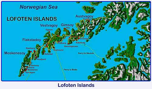
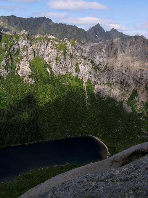
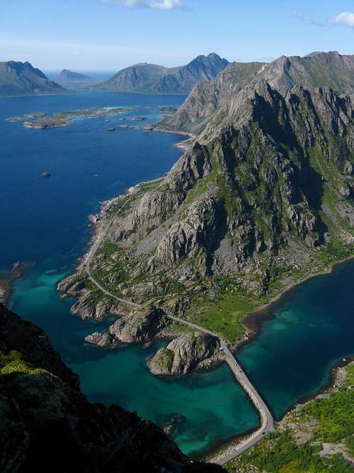
The Lofoten archipelago, including five big and five smaller islands, lies off Norway's Northern coast, West to Narvik and about 200 km North to the Polar Arctic Circle. These breathtaking islands offer a wide choice of granite rock-climbing as well as both winter mountaineering and summer scrambling. On the island of Austvågøy, when driving along the road 816 in the direction of Henningsvær and crossing the narrow neck of Djupfjord on a causeway, it appears on the left a great spur of high quality granite close to Budalstinden and rising above the Eastern shore of the freshwater lake named Djupfjordvatnet: it's the Pillaren (The Pillar). This water mirror, which is the continuation of the saltwater fjord, from which it is separated by a small moraine, is not visible from the road.
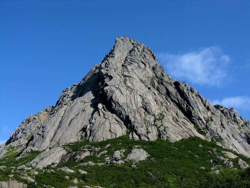
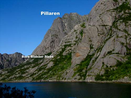
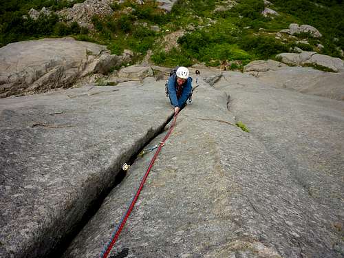
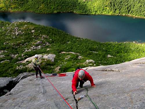
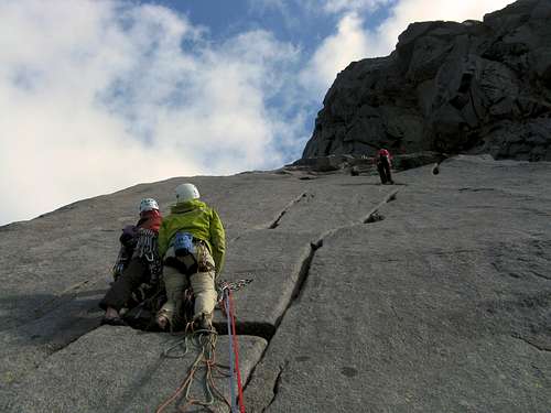
The high cliff, facing North-West and getting the sun late in the afternoon, constitutes the Vågakallen North West buttress, ending in the Point 713, but it's known to the climbers with the simple name of Pillaren. This impressive high spur is home of a handful of long and challenging routes, little frequented. On the contrary, the same cannot be said about the sector of the beautiful and less demanding granite slabs of Bare Blåbær, nicely overlooking the lake, with several routes. The classic one and most frequently climbed is Bare Blåbær, from which it takes the name the entire sector, one of the most known climbing destinations of Lofoten.
Getting There
Getting to the Lofoten islands
There are various possibilities:
- By car from Evenes Airport to Svolvær
- By ferry boat from Skutvik to Svolvær or Skrova (North of Lofoten)
- By ferry boat from Bodø to Moskenes, Værøy or Røst (South of Lofoten)
- By plane from Bodø
Road Approach
It's possible to approach the cliff directly from Svolvær, Lofoten major center, following the road E10 for about 20 km and also from Kabelvag, in about 15 km. along the same road, turning to left to Henningsvær (Road 816) at E10 and Road 816 junction. Otherwise, the shortest way to approach the cliff is from Henningsvær (less then 5 km.), or from Lyngvær (less then 5 km), a place along E10, about 20 km. West to Svolvær. The coast road to Henningsvær crosses Djupfjord narrow isthmus in the beginning (parking before the causeway).
Walking Approach
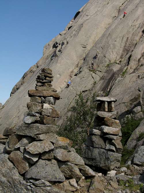
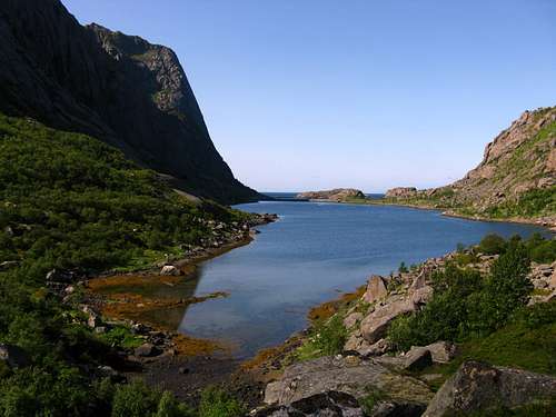
All the routes on Pillaren are approached following a good path, starting from the road 816 close to the isthmus and running along Djupfjord North-Western shore (on your left-hand side when you’re looking inside at the fjord). The trail gains the terminal moraine, which divides the fjord from the hidden inner lake. When you’re getting to the path’s first junction close to the moraine, don’t follow some cairns heading to right – this is the path heading to Vagakallen-Kvandalstinden Col and Pillaren longest routes area - but follow the trail on your left-hand side. After a pine wood and a bit before reaching the lake, the obvious slabs are approached following a good trail forking from the main path and rising towards right along steep vegetated and rocky slopes (1 hour from the coast road). Some enourmous cairns mark the climbing area.
Pillaren routes overview
Pillaren Routes (Norwegian Scale)
***Bare Blåbær Slabs Area:
- Coley Smoke 5, 120 m
- Coley Smoke + Very Expensive Ticket Combination 5, 250 m
- Child’s Play 5+, 125 m
- Very Expensive Ticket 7, 220 m
- Whale Meet Again 7-, 40 m
- Bare Blåbær (Just Bluberries) 5-, 240 m
- Thiras Mirith 6, 240 m
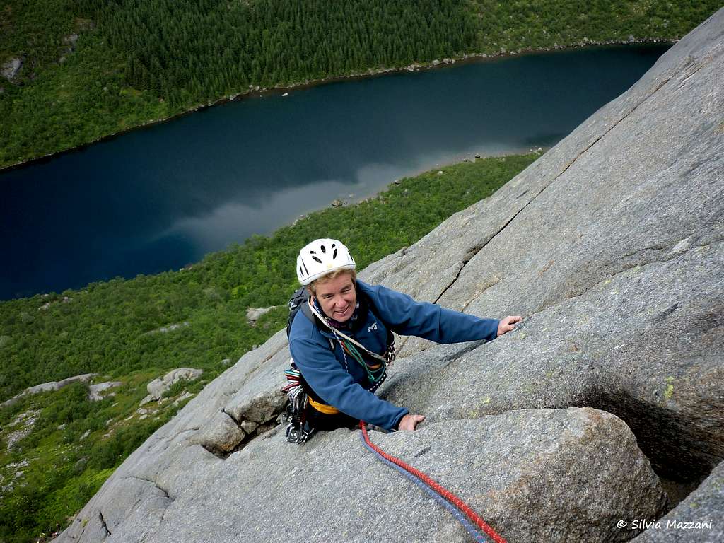
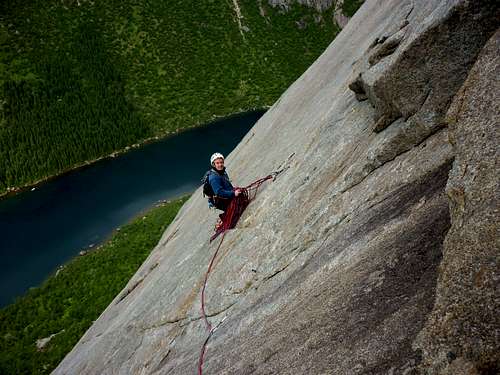
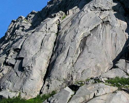
With its magnificent granite mirror, the great classic of Bare Blåbær is maybe the most popular climbing route of this grade on Lofoten, notwithstanding the cliff is not just close to the road. The route is facing NW: at the height of summer the route gets the sun in the middle of the afternoon until late in the evening and after rainy days it dries very quickly. Bare Blåbær – literally “Only Bilberries” – is a Norwegian expression to mean an easy play.
***Pillaren Point 713 long routes:
- Celebrian 6- 400 m.
- Hostgull 7- 400 m.
- Elgfesten 6 400 m.
Where to stay
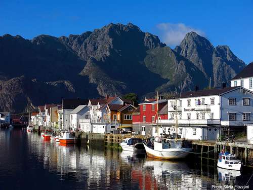
Camping - In Norway camping is allowed in every place, if not expressly forbidden. Best free campsites in this area are located in Festvåg, in front of the Gandalf cliff, and Paradiset, just close to Henningsvær. The nearest equipped campsite is the “Lyngvaer Bobilcamping” (campers, tents and cabins), 20 km. West to Svolvaer and a few kilometers from Djupfjorden climbing area. The picturesque village of Henningsvær is quite close to Djupfjorden climbing area and it's a bit of a focus for climbers. There is also a climbing school, besides several possibilities of accomodation.
When to climb
Best months for climbing are late May, June, July and August.
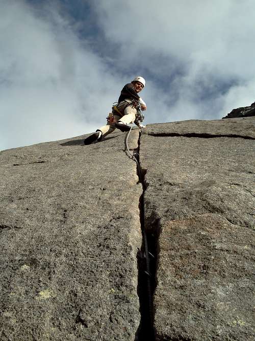
Second pitch on Bare Blåbær - Ph. Sonnik |
Red Tape
No particular restriction in climbing and hiking.
Climate
Useful info about climate: Meteorologisk Institutt
| Month | Avg Low | Avg High | Precipitation (mm) | Wet Days | Daylight (Hours) |
| January | -2°C | 1°C | 65 | 18 | 5 |
| February | -2°C | 1°C | 60 | 17 | 10 |
| March | 0°C | 3°C | 65 | 18 | 14 |
| April | 1°C | 5°C | 55 | 17 | 20 |
| May | 5°C | 9°C | 55 | 18 | 24 |
| June | 7°C | 12°C | 70 | 18 | 24 |
| July | 9°C | 15°C | 65 | 18 | 24 |
| August | 8°C | 15°C | 90 | 20 | 22 |
| September | 7°C | 13°C | 100 | 22 | 15 |
| October | 5°C | 8°C | 110 | 23 | 10 |
| November | 3°C | 6°C | 85 | 19 | 6 |
| December | -1°C | 3°C | 75 | 19 | 2 |
Guidebooks and maps
"Lofoten Rock" by Chris Craggs and Thorbjorn Enevoid
External Links
Climbing info: Rockfax Lofoten Guidebook
Tourist info: Lofoten Islands - Lofoten - Visit Lofoten
Meteo
