
-
 3040 Hits
-
 74.92% Score
-
 5 Votes
|
|
Route |
|---|---|
|
|
34.26890°N / 118.238°W |
|
|
Download GPX » View Route on Map |
|
|
Scrambling |
|
|
Most of a day |
|
|
Overview
Beginning from a far West ridge accessible from the circuitous Sunset Trail (a fire road that encircles the peak's southwestern flanks), Contemplation Trail climbs steeply out of a gully, quickly gaining an interesting ridge which will take you scenically up and down along its spine all the way to where it joins the top 1/4 mile of the Stone Canyon Trail, leading you to the summit of Mt Lukens.After the initial climb onto the ridge, this route should be considered cross country, albeit with very easy navigation and being no more steep than Class 2, up until it joins the Stone Canyon Trail. Although the beginning of the route is on trail, it is severely neglected, and is, in places, quite brushy.
At around 12-14 miles, depending on how you return, and around 4000' of overall elevation gain, this route makes for an enjoyable day.
Getting There
The simplest approach is to park at the end of Alpine Way in Sunland, via Big Tujunga Canyon Road. Exit 210 on Sunland Blvd, then head East. After about 1 mile, take a left onto Big Tujunga Canyon (there is a 711 on the NE side of this intersection, and a sign pointing North for Angeles National Forest). Follow it for about another mile, and turn right onto Mt. Gleason, then immediately left onto Alpine Way. Follow it until its end, and park there.Route Description
From the end of Alpine Way, walk up onto the Sunset trail and head West. It will wind around a few times, and eventually settle down into a valley and continue North. If you look carefully, you can see a sign, and a faint trail heading East into the scrubby chaparral.Follow this poor trail eastward as it gently climbs, eventually depositing you in a washed out creek bed. It is possible to get disoriented here; follow the creek bed for 20 to 30 feet, and the trail will reappear, climbing suddenly out of the rocky bed.
Continue up as the trail gently switches back up the steep slope, until you gain the ridge.
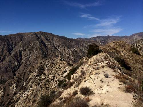
Along the ridge, Contemplation Trail
From the ridge, marked by a downed wooden sign, continue SE, either sticking to the top of the ridge or trying your luck on one of several game/ use trails that contours its northeastern slopes.
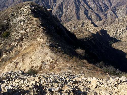
Looking back the way we came.
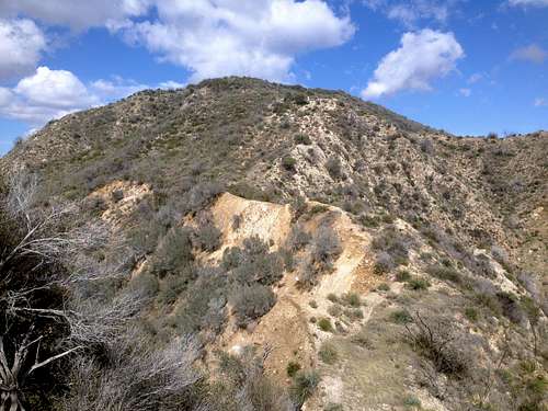
Either way, your next objective is eventually a rocky high point along the top of the ridge, adorned by a flag (or at least a pole). As visible below, it's a bit crumbly much of the way. Although the rocks to the left of the ridge appear larger, they are neither well enough connected nor solid enough to give any advantage over the ridge top itself.
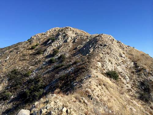
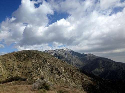
Follow this ridge up towards Mt. Lukens
This is a great place to have a snack and enjoy the views...
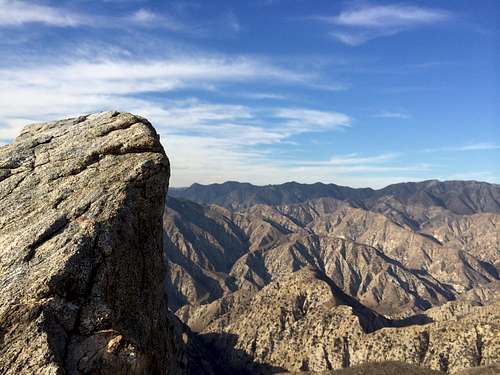
Taken from the flagpole
After this, continue ENE along the ridge. Mt. Lukens should be clearly visible to the East, and the remainder of the route is largely in sight. Continue as the ridge rises and falls, at times dramatically.
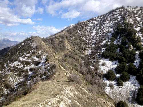
Mt. Lukens, still a ways up/down the ridge..
More of the ridge route
After a few more ups and downs, you should see the western slope of Mt. Lukens in front of you. The key here is to climb the slope, looking for a light trail going around to the North side. This will lead you to the Stone Canyon Trail, at which point simply continue up to the summit.
A view of the final pull up to the Stone Canyon Trail
As a round trip, it may be desirable to hop onto the Haines Canyon trail for the descent, for a more relaxing latter half of the hike, making a roughly 14 mile round trip. Before getting to the reservoir at the base of Haines Canyon, turn right onto the Sunset Trail, which will return you to the parking area at the end of Alpine Way.
Essential Gear
Standard day hiking gear; it can be very hot and sunny on the ridge top, or very chilly if there is wind during the cooler months. Although there is sometimes a couple inches of snow on the ridge, it would rarely be solid or substantial enough to warrant snow gear.External Links
Some information about this route, including a crude map and data on other popular routes can be found below: