
-
 6731 Hits
-
 76.66% Score
-
 7 Votes
|
|
Mountain/Rock |
|---|---|
|
|
36.08365°N / 115.47793°W |
|
|
Scrambling |
|
|
Spring, Fall, Winter |
|
|
5600 ft / 1707 m |
|
|
Overview
Dead Horse Point is a minor subpeak, really just an outcrop or a feature, located near the southern end of Mt. Wilson. From many perspectives, it hardly stands out at all. However, it is among the most enjoyable minor peaks of Red Rock Canyon National Conservation Area for a number of reasons:1. At only about 2 miles from the car to the summit, the route can be a pretty quick one, making it among the few in Red Rock much suitable for summer forays.
2. The route is a fun one, with several spots of Class 3-5 scrambling, and it is not overly brushy (that does not mean it is not brushy at all).
3. White Rock Pinnacle, another outstanding minor peak in RRCNCA, is very close by and easy to pair with this peak.
4. It is possible to continue on and climb Wilson, the highest sandstone peak in RRCNCA.
Go prepared-- the single hardest move on the standard route is described as 5.4. There traditionally has been a fixed line here that lowers the spot to Class 4, but as the peak lies within a federally designated wilderness area, fixed lines are illegal, and you can't be positive that rangers won't have removed the line. Do not attempt this route unless you can "scramble" up a 25' 5.4 pitch or unless there is someone in your party who can can offer a belay to others or set a handline. Likewise, if you can't downclimb something like this or don't feel comfortable doing so, bring a rope (60' to be safe) and other gear for rappelling.
Go prepared-- the single hardest move on the standard route is described as 5.4. There traditionally has been a fixed line here that lowers the spot to Class 4, but as the peak lies within a federally designated wilderness area, fixed lines are illegal, and you can't be positive that rangers won't have removed the line. Do not attempt this route unless you can "scramble" up a 25' 5.4 pitch or unless there is someone in your party who can can offer a belay to others or set a handline. Likewise, if you can't downclimb something like this or don't feel comfortable doing so, bring a rope (60' to be safe) and other gear for rappelling.
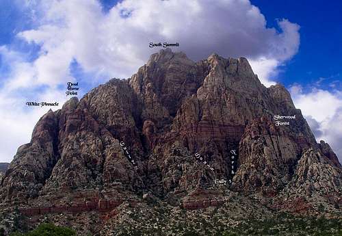
Mt. Wilson and subpeaks
Not far from White Rock Pinnacle's summit is the unofficially titled Dead Horse Point (see picture above). To reach it, work west from the canyon exit (the canyon ascended via the principal route for the peak) on Class 3 terrain and then soon work slightly north and then back east to reach the summit block of this other subpeak. Climbing it looks harder than it actually is; it is Class 3 though exposed in places.
On Peakery, DHP has an elevation of 5600'. Please note that the coordinates given on this page are approximate.
Originally, I did not intend to create a separate page for this peak and had included it with the WRP page instead, but after a recent PM conversation with another SP member and considering that each peak has its own register and local name, I decided a separate page wouldn't hurt.
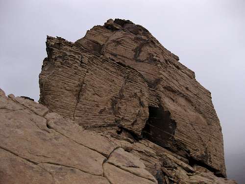 Dead Horse Point | 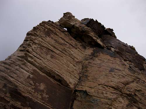 Dead Horse Point | 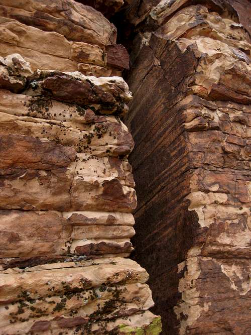 Dead Horse Point-- Crux Pitch |
Getting There
Take Charleston Boulevard (SR 159) west through Summerlin. After the development abruptly ends and the desert begins, drive a few miles and pass the well-marked entrance to the Scenic Drive.The exit from the Scenic Drive is about three miles farther along 159, and not far after that is a roadside trailhead for Oak Creek Canyon. Continue on just about a mile along 159 and find the roadside trailhead for First Creek Canyon.
Routes Overview
It seems that most people climb these peaks first by ascending White Rock Gully (Class 4-5.4; see attached route page entitled "Standard Route" but refer to the modified directions in the overview). Climbing both WRP and DHP and using this gully for both the ascent and descent is 4-5 miles RT tops and something like 1500-2000' of elevation gain in all.There are, however, a couple of other options:
- A longer but technically easier approach via First Creek Canyon. One way to do this is via the Hidden Bowl route.
- Climbing Dead Horse Gully, which is the first gully to the right of White Rock Gully. From what I gather, this is a challenging Class 4 route. My only experience with it so far was when I headed into it mistakenly thinking it was White Rock Gully. At the time, I had a heavy backpack with rope and rappelling gear since I was alone and wanted to be prepared, and I eventually turned back due to getting onto Class 5 terrain that was too risky for me to negotiate with such a large, heavy pack on. Something of note is that Dead Horse Gully is quite a bit brushier than White Rock Gully is.
Climbers going up one of the gullies can traverse west from the summits and pick up the Hidden Bowl route to the summit of South Wilson and Mount Wilson.
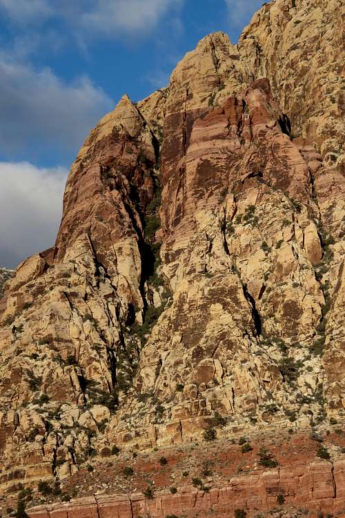
White Rock Pinnacle and Dead Horse Point with White Rock Gully on left and Dead Horse Gully on right