
-
 16012 Hits
-
 85.28% Score
-
 20 Votes
|
|
Canyon |
|---|---|
|
|
38.66389°N / 109.58444°W |
|
|
Hiking, Scrambling |
|
|
Spring, Summer, Fall, Winter |
|
|
Overview
Dragonfly canyon
Dragonfly Canyon
Rating: 3 B
Length: 3-5 hrs
Gear: Standard Technical Gear (there are anchors).
Rappels: 2 (1st 20 meters =66 feet; 2nd 40 meters = 130 feet)
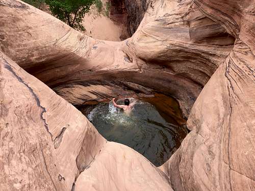
Water: Generally a couple of pools to swim, we encountered only one in late April. The swim is short, but very cold.
Flashflood: minimal, unless heavy rains right over the canyon.
Season: the best in the spring, summer, or fall. Winter can be cold.
Personal note: not a tight slot as one may explore in San Rafael or North Wash areas, but still a pretty exciting adventure. What a green and lush spot in a desert! Definitively worth checking it out.
Getting There
From the Arches Visitor Center head into the park 4.3 miles, where you will cross a bridge over Courthouse Wash. If you have 2 cars, leave one there. Either way, proceed another 1.3 miles (5.6 miles from visitor center) to a large dirt pull out. This is a quarter of a mile before the well signed Petrified Dunes Pullout. This is the trailhead.
Route
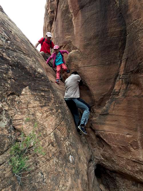
Easy down climb
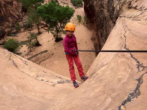
1st rappel
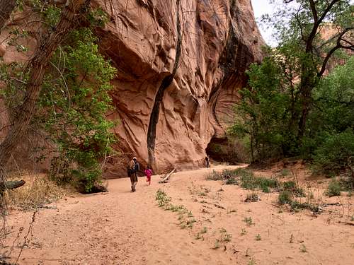
Dragonfly Canyon
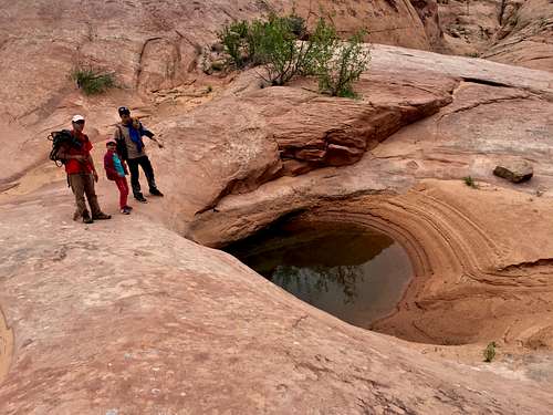
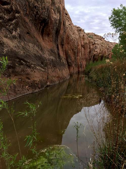
Once you reach the head of the Dragonfly Canyon you will be in a wash the remainder of the downstream route. Walk down to a narrow crack to a short down climb that deposits you in the wide canyon bottom. I found this down climb really easy with good handholds. Continue down the canyon to a pothole section. The first few potholes are easily walked around, then down climb a short slabby section. When Road Trip Ryan did the canyon he found all potholes full, and had three short swims. In lower water conditions, once or two of the potholes may be difficult to exit. When in doubt, leave a member of your party above the pothole section until someone has reached the anchor. The next 2 potholes may be linked into one large pool when full, are followed by a short sandy section, and then a down climb into a 3rd pool. Right after this 3rd pothole is a 20 m (66 foot) rappel with 2 bolts on the right to use as an anchor. We could easily walk around these potholes and avoid getting wet until the last one - April 2017. After exiting the pothole almost immediately you will encounter a deep water filled pothole guarding the edge of a 65 foot rappel. The rappel is anchored from 2 bolts on the west (right) canyon wall. The rappel deposits you on the edge of a pool. From the base of the first rappel continue down canyon. Shortly the canyon will narrow up and the bottom will fall out. This is the second and final rappel. The anchors for this 130 foot rappel are 2 bolts on the east (left) canyon wall. The rappel deposits you at the edge of a pool. * if used long sling, one 60 meter rope will be sufficient. I have not tested the one 60 meter rope, we had two ropes with us. The pretty bushes to the side with three leaves are poison ivy. It is easy to avoid if you are aware of its existence. The base of the 2nd rappel is a beautiful grotto and is a nice place to enjoy a snack before the refreshing hike out begins. During the hike out you might encounter short sections of quick sand and areas of poison ivy. Both are easy to avoid. Coil your ropes, take off your harnesses, and enjoy the stroll down canyon. This section of the canyon can contain sections of shallow wading and even a spot or two of quicksand. It is a a beautiful riparian section. Follow the canyon down until you reach the junction with Courthouse Wash.
From the grotto continue hiking downstream approximately 3/4 miles to the junction with Courthouse Wash. At the junction turn west (right) and follow Courthouse wash upstream approximately 1/4 mile to where a small side drainage enters from the north (right) side. This is really the first place that a reasonable escape from Courthouse Wash is possible so it is not extremely difficult to locate. Follow the emerging hiker trail up the small north side drainage to the Slickrock above Courthouse Wash. Hike north, staying on slick rock and following a shallow wash, for approximately 1 mile to the Dragonfly TH.
Once at the junction head up Courthouse Wash to the bridge and road. This section is very nice and contains a well used social trail in spots. From the bridge, you can try walk the road or try a hitch a ride the 1.5 miles back to your car at Petrified Dunes.
Red Tape
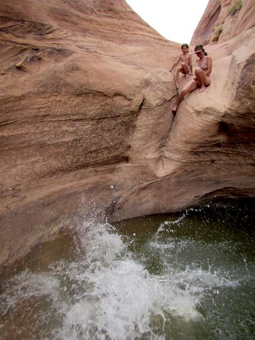
Getting ready for a jump
Dragonfly Canyon
Fragile desert soil
All canyoneering adventures in Arches National Park require a free permit along with some group size limitations. It is easy to obtain at the entry into the park, there is a place just outside the visitor center.
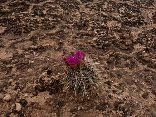
Two of the largest concerns the park has is the development of new social trails and multiple rappel stations for a single drop which results in unnecessary webbing, anchors and rope grooving. Please remain in washes and on slickrock whenever possible to help avoid damaging the fragile soil. Avoid stepping on cryptobiotic soil.
Camping
There is one campground inside Arches National Park - Devils Garden Campground - for information see this link.Moab is a major tourist destination and there is a multitude of campgrounds along the Colorado River. The campsites can get crowded during touristy season. Here is a link for more information.
External Links
- Dragonfly Canyon on Road Trip Ryan: great description for tons of adventures
- Dragonfly Canyon on climb-utah
- Canyoneering in Arches National Park: great resource
- Arches National Park