
-
 20688 Hits
-
 87.63% Score
-
 25 Votes
|
|
Canyon |
|---|---|
|
|
38.78800°N / 109.4905°W |
|
|
Hiking, Canyoneering |
|
|
Spring, Summer, Fall, Winter |
|
|
Overview
Lost and Found Canyon
It is a technical canyon rated as 3A II, and requires 3 rappels, one 130 feet long (you need two sixty meter ropes!).
Some argue Lost and Found Canyon is the finest slot canyon in Moab area. Outstanding narrows (really tight even for a small person), long rappels, and mind blowing scenery. You can combine it with a nearby canyon MMI. A good source of information is "Moab Canyoneering" Exploring Technical Canyons Around Moab by Derek Wolfe.
The canyon is dry - no wading, swimming and therefore no wetsuits needed.
The flood danger still exists, but lower than with other canyons.
![La Sal Mountains]()
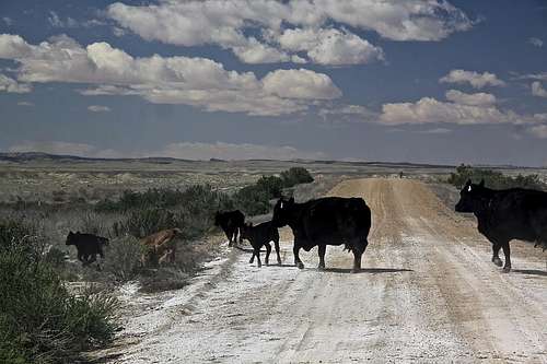
La Sal Mountains![Traffic on the way in]()
Traffic on the way inAlthough most of the canyon is located within north eastern borders of Arches National Park, the access is from I-70. Expect at least 80 min drive from Moab, and cows on the road.
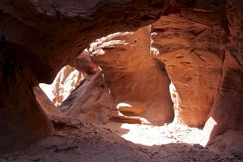
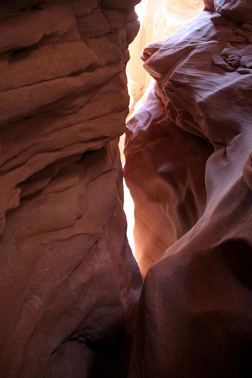
![Lost and Found Canyon]()
Lost and Found Canyon![Tight squeezes]()
Tight squeezesFrom the trailhead, follow the fence northwest on en established trail. After 10 min you will pass the first wash, continue on a path along the fence. Enter into the 2nd wash and walk down this wash. It is very open and shallow for the first 15 min, which keeps you wondering whether you are heading the right way. The canyon is wider here, not a slot, but still enjoyable, passing some slick rock section and some sandy sections.
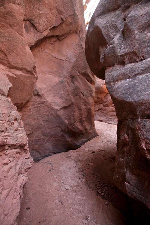
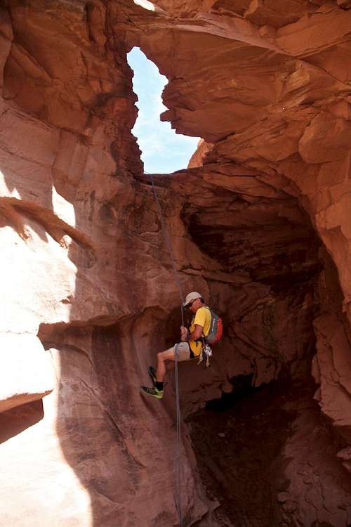
![1st rappel through the arch]()
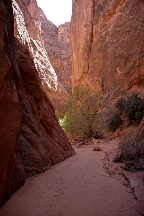
1st rappel through the arch![Canyon exit]()
Canyon exitRoute Out
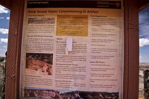
![Park regulations]()
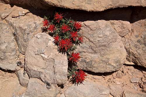
Park regulations![Indian Paintbrush]()
Indian Paintbrush
You should have a permit since the canyon is located within Arches National Park. The permit is free, you can get it on-line and limits group size to 6. Information on canyoneering in Arches.
Getting There
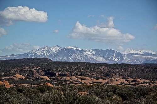
La Sal Mountains
Traffic on the way in
Take Exit 204 for Cisco from I-70. Head south on Utah 128 and take a right turn onto the frontage road heading west, located 0.1 mile sough of the interstate exit.
Follow the frontage road for 1.9 miles and make an angling left turn at pipeline gauge.
Follow the frontage road for 1.9 miles and make an angling left turn at pipeline gauge.
Drive another 6.9 miles from the pipeline gauge and turn left.
Travel 2.6 miles and make a right turn where there is a sign for an arch.
Follow this road for 1.1 miles until it dead ends at a junction. Turn left.
Follow this road for 1.1 miles until it dead ends at a junction. Turn left.
After 1.2 miles from the junction, turn right onto a less traveled road and drive 2.9 miles to a fence with a gate.
Park on the east side of the fence. This is the trailhead. There is a kiosk with an information regarding canyoneering.
We took a wrong turn on the way back and ended up on Yellow Cat road, which brought us to I-70, exit 193. I think taking Yellow Cat road is just a little bit longer.
The road was described as 4WD, but it was dry, little sandy, not really a high clearance, and I would imagine easily passable by 2WD vehicles in dry conditions.
Route
Lost and Found Canyon
Tight squeezes
Soon you will come to the first rappel, 12 meters (little over 40 feet) though a natural bridge. It is spectacular. The anchor for this drop is a single bolt high up on the right side of the canyon before the bridge. It can be tricky to spot per descriptions, but we had no problems finding it since someone has place a long blue webbing making this very obvious. The webbing was in excellent condition (April 2016). Pay attention not to hit your head when passing through the arch.
From the first rappel, a 5 minute walk finds you in a cave like room above the 2nd rappel. This one is about 23 meters, 76 feet. You land in a tight slot with a log, dry to make it on rappel on the way to the log. First members of the party can continue from the above anchor and rappel 12 more feet onto a better floor. The last person should either a down climb, or pull the rope down from the high anchor and sling it over a smooth log and rappel down. If you would go all the way down, there is a high chance of getting your rope stuck (you are at the point of no return, up climb is extremely hard and the next rappel is 130 feet!).
The canyon opens a bit in this section, before narrowing quickly again. These are the final tight narrows before the last rappel. It is very tight here and a bit awkward, first I tried to climb over, but you have to go down. This section may be really hard for large people. Very narrow chimney dropping you to the platform where the last long rappel is. There is a great view from the platform. The actors are solid here and very obvious. Rappel is 42 meters, 135 feet. The last section of the rappel is little overhanging.
Walk down from the last rappel, enjoying the last sections of the canyon. It is wider here, but still very scenic. After a few minutes you get to the confluence with MMI canyon. Turn left - up and into the MMI canyon. The route out is from MMI canyon.
1st rappel through the arch
Canyon exit
We did the more technical route out. I read there is an easier, but longer route out in the lower part of MMI, I have not done it.
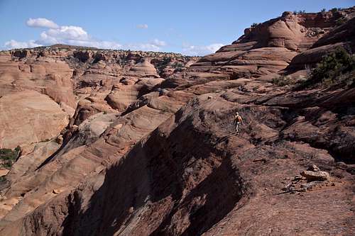
Advance route out - go up MMI canyon for about 0.2 miles. The going is easy here, the canyon is wide and the floor is sandy. There is a lot of vegetation on canyon floor. Soon you will find a sign for exit - it is marked by National Park Service. Climb on a slick rock bench, several cairn marked the route. You will encounter a few interesting moves here and there. You will be traversing on slick rock, some sections are very exposed and a fall here would lead to a serious injury/death. Information at the trailhead says that rating is 5.7 rock climb - it is NOT, but you will encounter a few low 5th class slab moves, and slab here is dirty with sand. Pay attention on your way out. The most of the slick rock is class 3, and some class 4. Look for cairns.
Once at the top of the canyon, head for La Sal Mountains. We found an established path, which took us to a dirt road and eventually back to the trailhead. The route finding was easy.
One website describes exit : the exit for this slot is a Bitch!!! I agree, it must be hard for non rock climber, but anyone used to a little exposure should have no problems. It was very windy when we did the canyon and the slab was covered with sand and the wind was so strong that occasionally I was just laying low waiting for the gust of wind to pass and not to throw me off balance.
 Lost and Found Canyon | 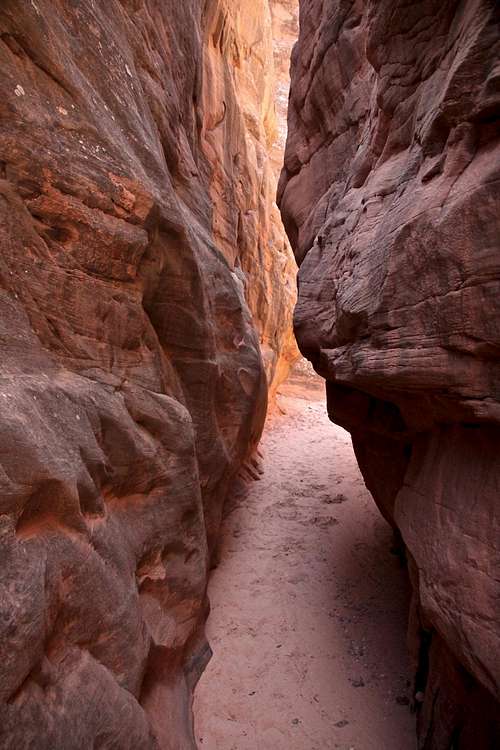 Lost and Found Canyon | 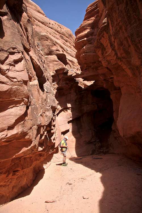 Below the first rappel |  2nd rappel |
Gear
- Harness
- Helmet is a good idea
- Two sixty meter ropes
- Rappel device
- Extra slings, webbings, rappel gloves possibly, prusik
- Comfortable shoes, consider approach shoes since you will be required to climb slab on your return with a few low 5th class moves
- Dry canyon - meaning no wetsuit needed
- Plenty of water
- Camera
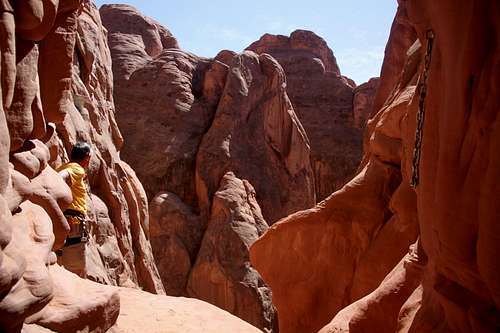
![3rd rappel]()
3rd rappel
Red Tape
Park regulations
Indian Paintbrush
The park is also asking to stay on trails as much as possible and follow the marked exit route. Walk in washes and on slick rock whenever possible to help avoid damaging the fragile soil.
All canyons in Arches National Park require a 10$ park entrance fee.
Parking is free. Camping is outside national park boundary, it is free as well.
Camping
You can camp at the trailhead, but it did not look so great - open unprotected space, could be unpleasant when windy. There was an excellent campsite on slick rock with amazing views of La Sals and Arches about half a mile from the trailhead (you will pass it on your way in).Bring plenty of water since the area is dry.
External Links
- Canyoneering Lost and Found Canyon - Arches National Park | Road Trip Ryan - great resource, create a free login
- Undercover Canyon - Moab - Canyoneering - nice images and some information
- Undercover Canyon AKA: Lost And Found - Technical canyoneering trip | EveryTrail
- 14ers.com • Trip Report - The Slot Canyons of Arches - trip report of MMI and Lost and Found Canyon
- Trip Report TR- Undercover (aka Lost and Found) and Winter Camp Wash
- Lost & Found Canyon Technical Canyoneering (hiker, mtn biker options too) - Backpackers Anonymous - Salt Lake City, Utah (Salt Lake City, UT) - Meetup
- Canyoneering - Arches National Park (U.S. National Park Service)