
|
|
Route |
|---|---|
|
|
39.43100°N / 106.1051°W |
|
|
Mountaineering, Skiing |
|
|
Spring, Summer, Fall, Winter |
|
|
Half a day |
|
|
Moderate Snow / Class 2+ |
|
|
III |
|
|
Approach
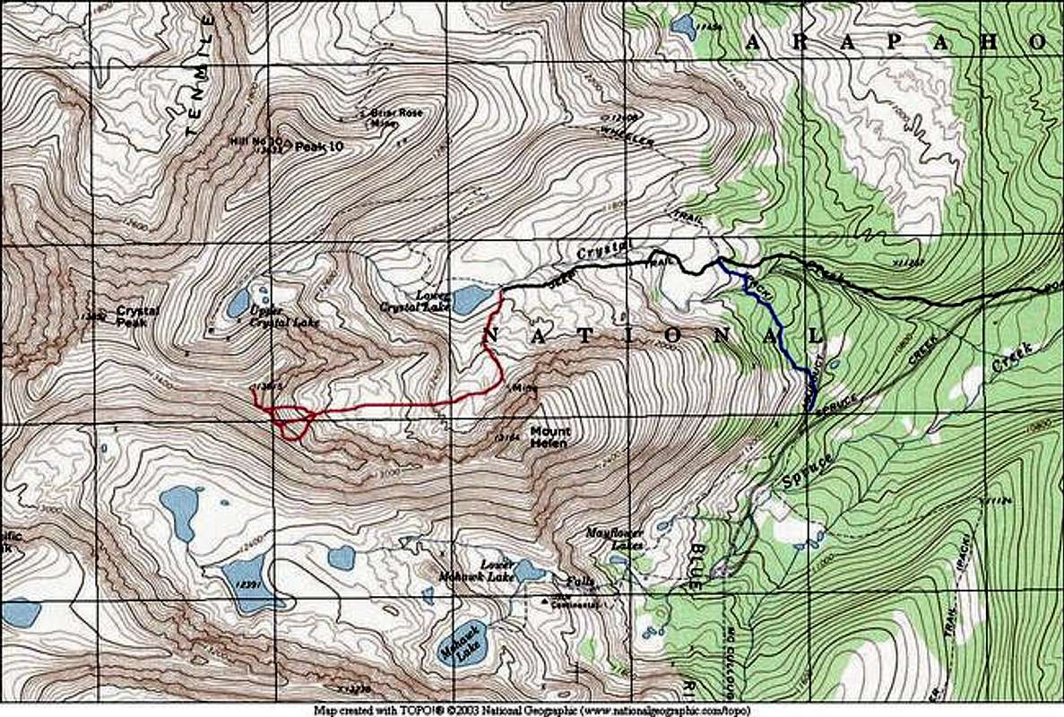
Approach #1Use the Crystal Creek Road TH. See main page for directions. Follow the Crystal Creek road to Lower Crystal Lake by foot or vehicle.
Approach #2
Use the Aqueduct Road Gate TH. See main page for directions. This approach is best for people without sturdy 4x4 vehicles. From parking, follow the road for about 100 yards and then turn left onto the Wheeler Trail (well-marked). Follow the Wheeler Trail below the East Slopes of Mount Helen until it intersects the Crystal Creek Road. Leave the Wheeler Trail and follow the Crystal Creek Road to Lower Crystal Lake.
Route Description
Dyer Straits is a very fun route, and one of the best, in my opinion, in the Tenmile. It offers moderate snow climbing and some fun scrambling to a great summit block.From Lower Crystal Lake, look for an old mining road that goes south to Mount Helen's slopes. Follow this old road briefly until you find yourself in the broad talus fields in this drainage below Father Dyer Peak's East Slopes.
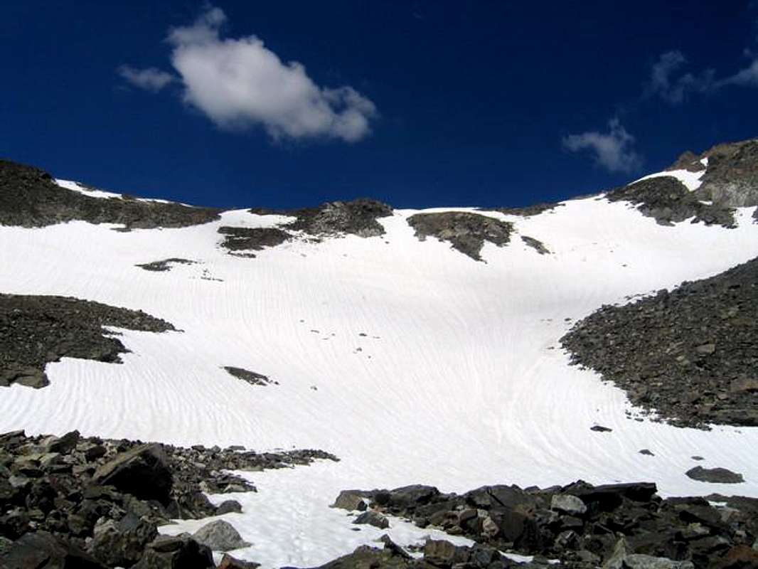
There is no good trail through the talus fields. Travel on solid snow when possible, and take care hopping over the boulders. Depending on the time of year, there may be good snow all the way.
Soon, you will find yourself below the Mount Helen - Father Dyer ridge. Your task now is to climb snow fields to this ridge. There are usually three possibilities. Each is of similar difficulty. The center snow couloir is usually the best bet late in the season. The snow reaches a maximum steepness of about 40 degrees near the top of the ridge, and the lower slopes are much more gentle. An axe and crampons are recommended for these slopes. A fall will drop you into the boulders at the base of the snow fields.
Once you gain the ridge, the summit block is your next challenge. Run the ridge to the base of the steep sections, and take a good look at the terrain ahead. It looks a lot tougher than it really is. The best way to the top will not exceed Class 2+ scrambling. Go to the base of the steep part, and work slightly to the climber's right. The toughest move is a mantling move to the higher area. Take your time here and find the easiest route. Ensure that you take care when climbing near the East Face. A fall here means an 800 foot free fall to the lower area. If you are on the easiest route, you shouldn't be very close to the edge.
Gain the small summit and enjoy your perch!
Skiing
This is a great bet for skiing. Catch this one earlier in the Spring season before it melts out. The slopes below the Father Dyer - Mount Helen ridge are fun.
From Lower Crystal Lake:
RT Mileage: 2.4 miles
Elevation Gain: 1,600 feet
From Aqueduct Gate TH:
RT Mileage: 5.6 miles
Elevation Gain: 2,540 feet
From 2WD Parking at Spruce Creek TH:
RT Mileage: 6.8 miles
Elevation Gain: 3,200 feet
The snow climbing to the Father Dyer-Mount Helen Ridge