


-
 24674 Hits
-
 89.39% Score
-
 29 Votes
|
|
Area/Range |
|---|---|
|
|
49.77772°N / 11.29944°E |
|
|
Sport Climbing, Toprope, Bouldering |
|
|
Spring, Summer, Fall, Winter |
|
|
Overview
The Frankenjura is a low mountain range in southeast Germany that developed approximately 60 million years ago from sediments of the still older Tethys sea. The climbing area consists of lime stone and dolomite. In the lower layers laminated lime structures prevail, while the upper layers consist of a magnesium-enriched derivative of lime stone which is famous as dolomite. The layers rise roughly from east to west, so that in the western part we find in the valleys rock-forming lime stone, while more to the east only dolomite reaches the surface. In most places both sorts of rock are very solid.The northern boundary of Frankenjura is formed by the river Main between Bamberg and Bayreuth, where it borders the much older granite mountains of Fichtelgebirge and a schist plateau with deep valleys called Frankenwald. From there it stretches basically south to river Danube. It is geologically continued over Schwäbischer Jura to Swiss/French Jura, but that's another topic.
Rocks, Routes and some History
With now far more than 7000 routes and countless boulders, distributed over nearly 1000 rocks, Frankenjura is one of the biggest and most historical sport climbing areas in Europe. One finds a large variety of climbs, regarding the rock condition and the route character. Frankenjura is a climbing area with a long tradition going back over 70 years - in fact, the 1st climbing guide "Der Kletterer im Frankenjura" (The Climber in Frankenjura) appeared as early as 1931. Then the "Bühler guide" appeared in 1949 and reappeared from 1964 on in several new editions in quick progression. The following diagram shows how the number of routes grew over 40 years:
 Bühler piton
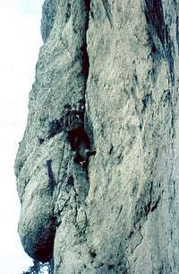 E.g. Buhl memory route
The sixties were also in Frankenjura a time when technical climbs were en vogue, and until that time the rocks were mainly used as a training ground for higher alpine goals. But just in that time a new cemented type of bolt, the famous "Bühlerhaken" made from rustproof steel and invented by the Nuremberg climber Oskar Bühler, was introduced step by step. The now increasingly perfectly secured routes (thousands of such bolts cemented in approx. a decade) paved the way for the free-climbing "red point" movement started in the 70ies by Kurt Albert, which was also the beginning of climbs with difficulties exploding the classical 6-step UIAA scale. This new development was linked to the red point insofar as at first old technical routes were now climbed in free clean style: e.g. the route "Hermann-Buhl-Gedächtnisweg" (Buhl memory route) on Röthelfels was rated V/a2 (technical) or VIII- (clean style) already in the Bühler guide of 1979.
Most of the rocks have a height between 15m and 25m. Some rocks reach up to 50m and often show classical multipitch climbing lines (e.g. Schlesinger Weg on Matterhornwand in Wiesenttal, where one has limestone in the lower and dolomite in the upper part of the wall). In the last 20 years or so many low massifs with 10m or less were opened with new and often very difficult boulders (e.g. Klagemauer in Trubachtal). Usually these routes are also perfectly secured. However, often the difficulty of these routes consists of just one single hard move.
Since 1991 Frankenjura holds one of the most difficult climbs of the world, "Action directe", rated XI- or 5.13, opened by Wolfgang Güllich.
Geographical overview of important climbing regions
The following image gives a (somewhat historical, but essentially still valid) overview of the most relevant climbing regions in Frankenjura, taken from the Bühler guide. Detailed topo outlines are given in the respective section for each region. Climbing region of Frankenjura
Northernmost Region
This region covers the entire range north and south of the highway 70, and the areas along the federal highway B22 until Hollfeld.The region offers the following climbing areas:
|
1) Wattendorf 2) Stübig and Burglesau 3) Würgau 4) Steinfeld 5) Paradiestal (Paradise Valley) 6) Treunitz 7) Oberstes Wiesenttal (Uppermost Wiesent valley) 8) Hollfeld - Krögelstein 9) Südliches Kleinziegenfelder Tal (Southern Kleinziegenfeld Valley) 10) Nördliches Kleinziegenfelder Tal (Northern Kleinziegenfeld Valley) 11) Bärental (Bear Valley) 12) Zillertal (yes, also here!) |
 Würgau section and Kleinziegenfelder Tal Würgau section and Kleinziegenfelder Tal |
 Efeuwand in early spring Efeuwand in early spring |
|
Northwest Region
This region covers the area west of the line Heiligenstadt - Streitberg, limited by the federal highway B470 in the south.The region offers the following climbing areas:
|
1) Burggrub and Oberngrub 2) Frankendorfer Klettergarten 3) Leinleitertal 4) Tiefenellern 5) Pfarrwaldfelsen |
 Frankendorf and Leinleiter sections Frankendorf and Leinleiter sections |
 Frankendorfer Klettergarten Frankendorfer Klettergarten |
Central Region - north
This region covers the area east of the line Heiligenstadt - Streitberg, limited by the federal highway B470 in the south.
 Lower Wiesent valley Lower Wiesent valley |
 Central Wiesent valley and side valleys Central Wiesent valley and side valleys |
The region offers the following climbing areas:
|
Wiesenttal (Wiesent valley): 1) Around Waischenfeld 2) From Waischenfeld to Doos 3) From Doos to Behringersmühle 4) From Behringersmühle to Muggendorf 5) Streitberg Side valleys of Wiesent valley: 6) Aufseßtal 7) Ailsbachtal 8) Unteres Püttlachtal 9) Pottenstein 10) Weihersbachtal |
 Aufseßtal Südwand Aufseßtal Südwand |
Central Region - south
This region covers the area south of the line Ebermannstadt - Pottenstein (Wiesent valley) until Gräfenberg and west of the highway A9.
 Walberla section Walberla section |
 Trubach valley Trubach valley |
 section east of Trubach valley section east of Trubach valley |
The region offers the following climbing areas:
|
1) Gößweinstein 2) Allersdorf and Stadelhofen 3) Graisch, Leienfels, Bärnfels and Soranger 4) Stierberg, Leupoldstein and Betzenstein 5) Spies 6) Naifertal and Umgebung 7) Hiltpoltstein 8) Trubach valley and side valleys 9) Walberla and Ehrenbachtal |
 On top of Zehnerstein On top of Zehnerstein |
 Wolfstein near Bärnfels Wolfstein near Bärnfels |
Southeast Region
This region covers the area east of the highway A9 in the triangle Pegnitz - Velden - Königstein. It mostly covers the valley of river Pegnitz and side valleys and is called "Hersbrucker Schweiz", after one of the main villages in the Pegnitz valley.
 Northern Pegnitz valley Northern Pegnitz valley |
 Southern Pegnitz valley Southern Pegnitz valley |
 Lehenhammertal etc Lehenhammertal etc |
The region offers the following climbing areas:
1) Northern Pegnitz valley with Krottenseer Forst and Königstein section 2) Southern Pegnitz valley with Hirschbach side valley incl. "Schwarzer Brand" 3) Sections around Lehenhammertal, Förrenbachtal and Högenbachtal |  Hirschbachtal Hirschbachtal |
Southernmost Region
This region is about 100km more to the south than the preceding one andoffers in particular the following climbing areas:
 Section Upper Altmühltal Section Upper Altmühltal |
 Sections Lower Altmühl and Danube valley Sections Lower Altmühl and Danube valley |
 Sections Laber and Naab valley Sections Laber and Naab valley |
|
1) Naab valley 2) Laber valley 3) Altmühl valley 4) Danube valley around monastery of Weltenburg (so called "Donaudurchbruch" where the highest walls in Frankenjura with up to 100m are found) |
 Dohlenfels Dohlenfels |
|
Zoning and inhibited rocks
The rocks in the Frankenjura are devided in three zones:Zone 1: Quiescent zone, here one does not climb.
Zone 2: Climb only on the existing routes up to the return hook, no new routes, except possibly after consultation of the appropriate local authorities.
Zone 3: Climb on the existing routes, new routes with return hooks are possible outside of vegetation zones.
It is very important to respect these zones!!! A lot of rocks are situated on private ground, and the landlords are giving way to the public on a voluntary base. But they are not obliged to do so. So when people are offending against these zones the owner of the areas can force the local administration to inhibit climbing.
The same is about the protection of the environment. The legality of the wide-spread climbing in Frankenjura after about 1985 is the result of a very long process, in which ecologists, climbers, ranger, private owners and members of the public adminstration met for more than 15 years and tried to find compromises between their different interests. As one result among others some rocks are inhibited during some parts of the year because of breeding birds. Also in most cases it is forbidden to walk upon the heads of the rocks - if possible one should use the existing return hooks. Please respect these rules as we all participate in and profit from accessible rocks (and of course a sound nature).
Actual information on inhibitions can be found on www.klettern.frankenjura.com/deutsch/index.php3
Camping
There are many camping grounds, vacation homes and pensions, scattered across all of Frankenjura. Wild camping is forbidden according to the law and will also not be accepted by the native inhabitants.It is forbidden in the entire Frankenjura to light a fire in free nature.
In particular during summer time the danger of forest fire must not be underestimated.
Applies also here: Who is gotten, must count on heavy penalty ... and likewise: no plaintiff, no judge - you must behave decently and mustn't do any harm, that's the essence.
External Links
A link to a video of Action Directe www.youtube.comSince almost every week new routes are climbed, printed guides are often already partly outdated when published.
For everything about Frankenjura (weather, Topos, inhibitions, pictures, information on special routes, further information) look here: www.klettern.frankenjura.com
IG-Klettern Frankenjura & Fichtelgebirge e.V. has another good site:
www.ig-klettern.com
jomagam - Jan 29, 2010 12:53 pm - Hasn't voted
Action directeThat route is an 8c+ later upgraded to 9a, which translates to a 5.14c or d on the YDS scale, not a 5.13.