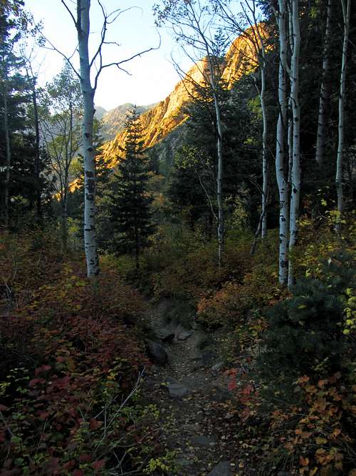
Ever since becoming converted to the idea of doing multi-peak ridge traverses, the Triple Traverse is the one I had been looking forward to the most. You could also say it was the one I was the most nervous about, though. The first time I scrambled up Broads Fork Twin Peaks seven years before, I figured it wouldn’t be too difficult and that we could just continue with the rest of the Triple Traverse afterward, but the mountain had other ideas. Due in large part to the heat and me not bringing enough water, I completely bonked that day, and I was so dehydrated upon returning to the trailhead that I was on the verge of hallucinating. I also recall that at the time I did that hike, the crux on the east ridge of Twin Peaks was a bit above my comfort level, which didn’t make things any easier.
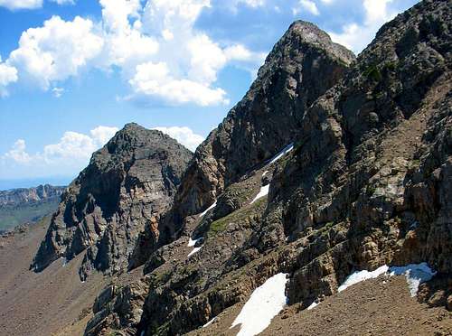
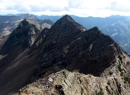
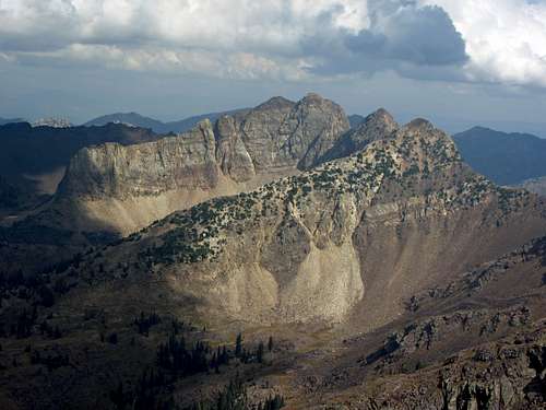
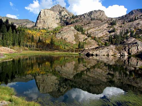
![Dromedary & Sunrise]() The two that got away: Dromedary Peak (left) & Sunrise Peak (right)
The two that got away: Dromedary Peak (left) & Sunrise Peak (right)This time I had a better idea of what to expect, and felt that I was adequately prepared to complete the entire Triple Traverse. First off, we would be doing the hike later in the year, with the weather forecasts predicting temperatures 20 degrees cooler. In conjunction with this, I’d learned from experience that for me personally, when hiking in normal summer/fall conditions, I need to bring on average 1 liter of liquid for every 3 hours of hiking (so with an estimated hike time of 12 hours, I planned on bringing 3 liters of water and 1 liter of Gatorade). Second, we would be taking the Robinson Variation up the north ridge of Twin Peaks, saving us an ascent up the loose scree fields leading from upper Broads Fork to the Cottonwood Ridge. Third, and perhaps most important, I had become more comfortable with exposed scrambling and route-finding over the last few years, so I was confident that we’d be able to handle whatever terrain the route decided to throw at us. To add some extra spice to the day’s adventure, I was hoping to descend down the always scenic Lake Blanche Trail, which would give us the chance to hike a complete loop with different views the entire way but without requiring a car shuttle, since we’d be returning to the same parking lot we left from (Mill B South / Broads Fork trailhead is at the southwest corner of the S-curve parking lot, while the Lake Blanche trailhead is at the east side).
Robinson Variation
The morning of the hike I was woken up at 3am by some pretty intense rain, lightning, and thunder. I knew that the worst weather would pass over before we started our hike, but it was still difficult to fall back asleep. After a few more hours drifting in and out of sleep I finished filling my pack and made the drive to Big Cottonwood Canyon. David met me at the S-curve parking lot at 7 am and after a quick visit to the parking lot restroom (I chugged a small bottle of Gatorade on the way there) we were off.
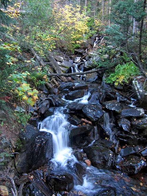
![Broads Fork stream]()
Some nice scenery ...
![Broads Fork orange tree]()
... along the Broads Fork stream
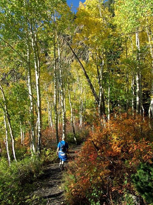
The temperature was perfect, and the previous night’s rain had left everything moist without making the trail too muddy. The bushes off to the side of the trail were still pretty wet though, so after just a mile or so my pants were already soaked from brushing up against them. This was evidenced by the fact that after hiking a short ways I pulled out my map and route description, which had the feel of a wet napkin. After peeling apart the folded paper I held it above the bushes from then on to try and air dry it.
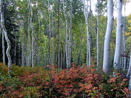
![Broads Fork aspens]()
After walking through some aspen groves ...
![Dromedary revealed]()
... Dromedary Peak made its first appearance
![Arriving at the meadow]() Arriving at the meadow
Arriving at the meadow
![Mount Olympus]() Mount Olympus
Mount Olympus
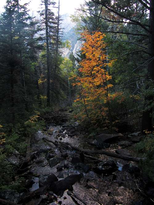
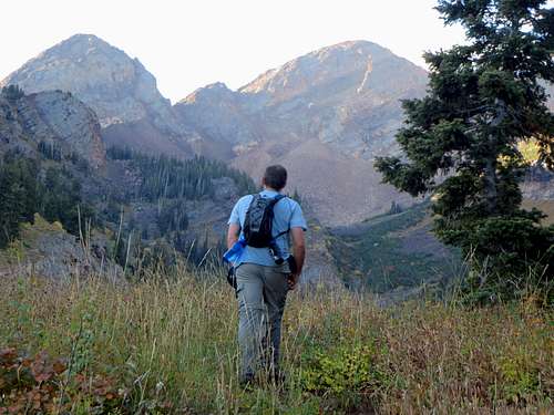
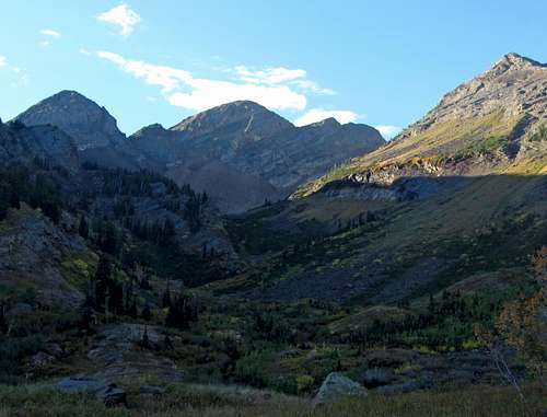
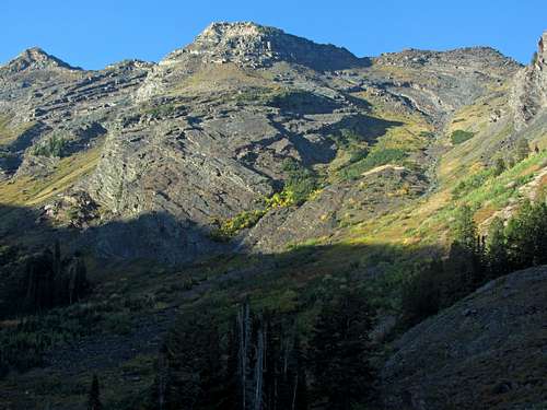
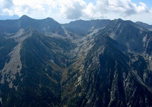
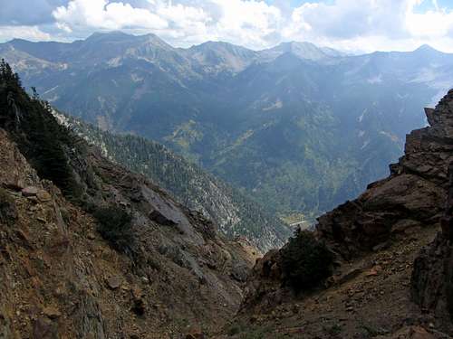
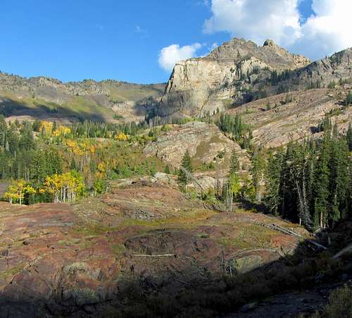
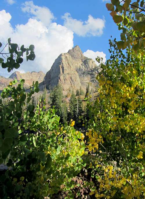
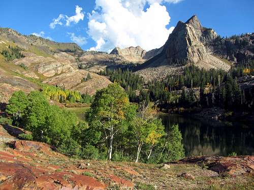
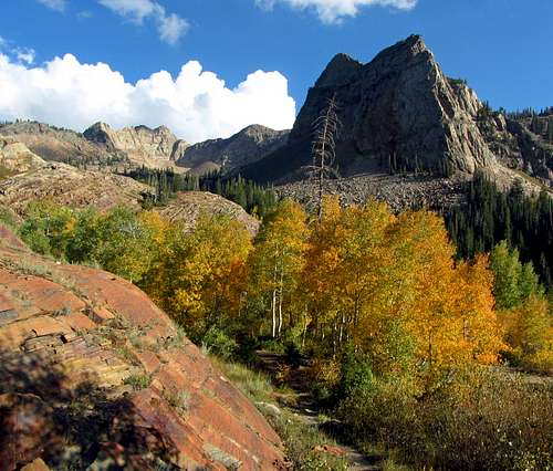
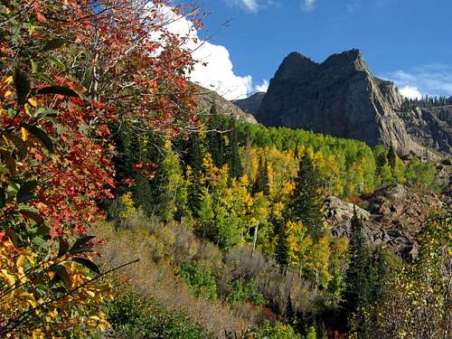
Every now and then we’d spot some fall colors, but for the most part they weren’t that vibrant as we made our way up Broads Fork (I was hoping they’d be better in the Lake Blanche Basin). At one relatively flat section we caught our first glimpse of Dromedary Peak's distinctive camel hump profile in the distance. We continued up another steep section of trail, and an hour and a half after leaving the trailhead we arrived at the lower Broads Fork Meadow, with all three peaks of the Triple Traverse now on display.
![Peaks over Broads Fork]()
Broads Fork meadow views of the Triple Traverse peaks ...
![Robinson Variation]()
... and the Robinson Variation route (north ridge of Twin Peaks)
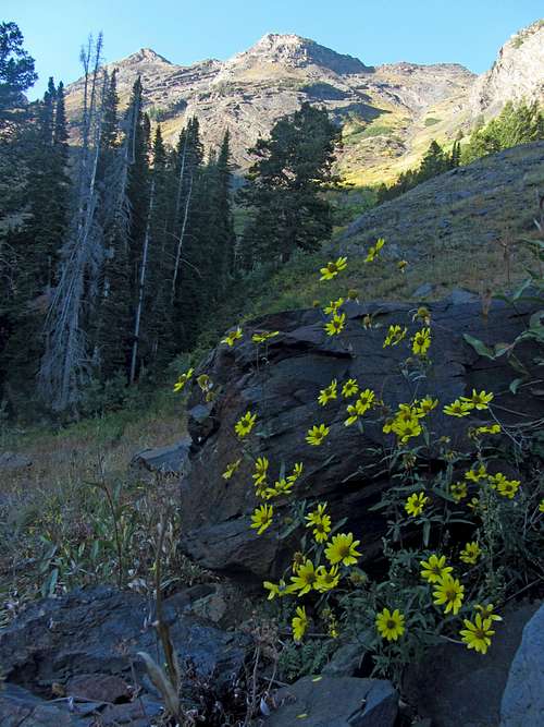
![Broads Fork wildflowers]() Broads Fork wildflowers
Broads Fork wildflowers
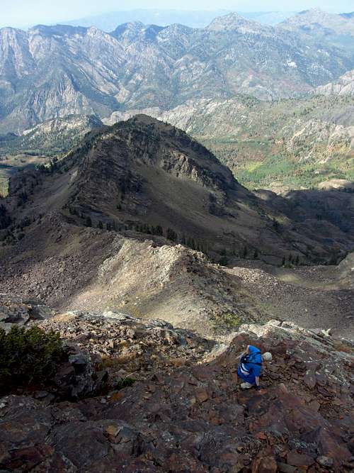
![Cottonwood Ridge peaks]() Cottonwood Ridge peaks
Cottonwood Ridge peaks
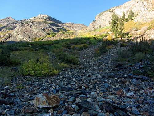
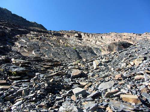
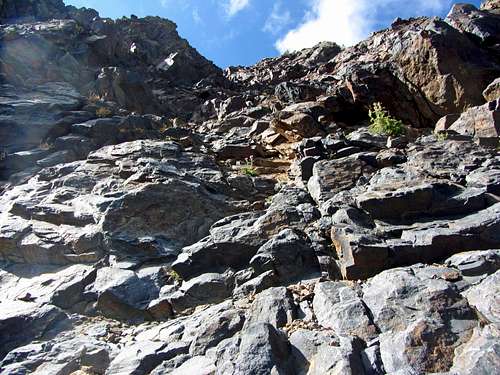
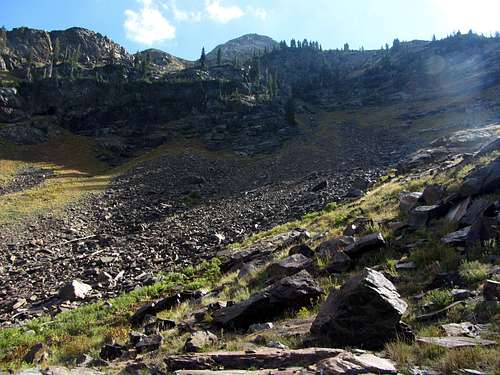
There was a clear split in the trail around the knoll in the meadow after just over 2 miles and around 2,000 feet of elevation gain, so we took the right fork leading up towards the Robinson Couloir. After losing some elevation the trail led us to a small talus field. The route description said to follow the cairns from this point on, but since we couldn’t see any, we started veering off to the right slightly in an effort to stay on the talus and out of the thick nest of bushes and trees to our left. Despite our best efforts, there were still a couple times when we had to bushwhack through a couple walls of vegetation, but soon afterward we would get back onto open patches of talus. As we gained elevation we realized that the rock fall path we were following wasn’t taking us straight towards the Robinson Couloir, so eventually we started traversing across a loose slope towards the larger looking slabs in the couloir.
![Base of Robinson Couloir]() As we went up the Robinson Couloir ...
As we went up the Robinson Couloir ...
![Robinson Couloir talus]() ... we encountered loose scree and talus
... we encountered loose scree and talus
![Robinson Couloir slabs]() Robinson Couloir slabs
Robinson Couloir slabs
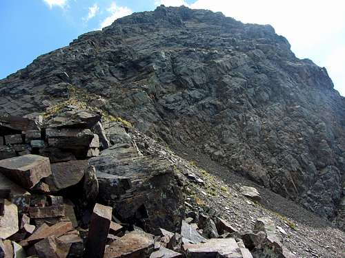
![Solid slabs]() Almost to the ridge crest
Almost to the ridge crest
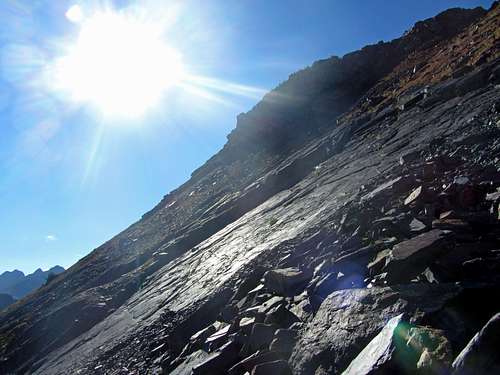
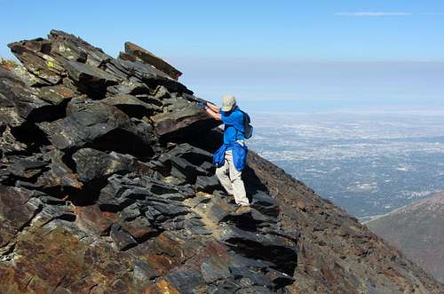
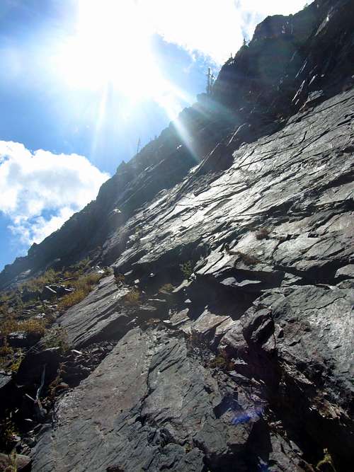
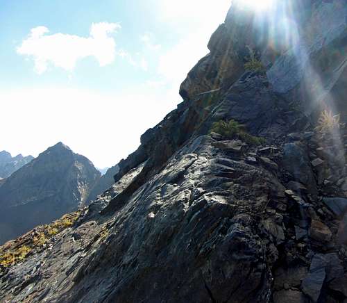
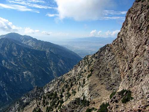
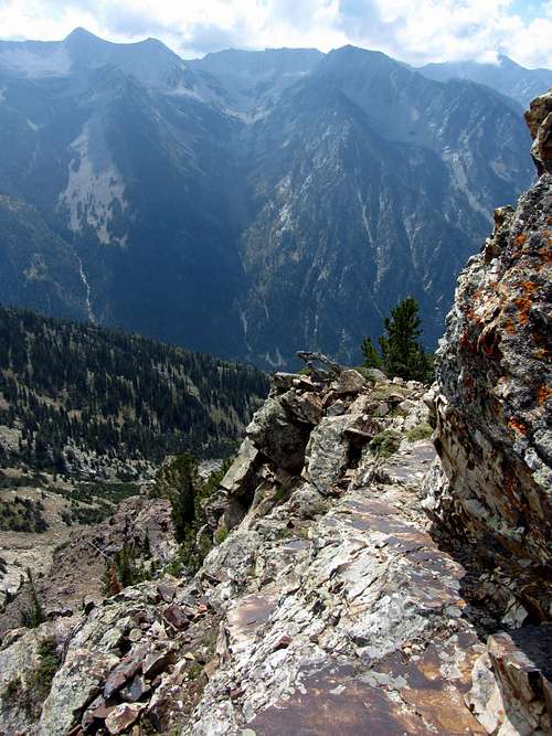
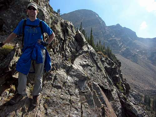
The terrain leading up towards the Robinson Variation and north ridge of Twin Peaks was a little loose, but not as bad as I remember the scree being in upper Broads Fork. In general, we’d opt for the larger looking talus and slabs as we made our way up, except at the point where we ran into the largest (and circular-looking, from lower in Broads Fork) slab formation. At this point we traversed along the right edge of the big slab, since going straight up it would have resulted in us running into some steep vertical walls. This is where the nastiest loose scree and talus was found, so several times I had to catch my breath before bursting upward for a few dozen feet. A couple times my feet sank/slipped in the scree, which killed my upward momentum. We finally got to a point above the scree where we could cut straight back across some of these smooth slabs as we made our way south towards the saddle below the Hounds Tooth. Fortunately the slabs were completely dry and not too steep, otherwise it would have been difficult to get the traction we needed to go straight up them. Two hours after leaving the lower meadow, we were finally looking down into the Salt Lake Valley from Twin Peaks’ north ridge.
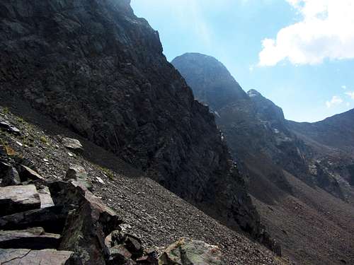
![Top of Robinson Couloir]() At the top of the Robinson Couloir ...
At the top of the Robinson Couloir ...
![Hounds Tooth]() ... we had nice views of Salt Lake Valley and the Hounds Tooth
... we had nice views of Salt Lake Valley and the Hounds Tooth
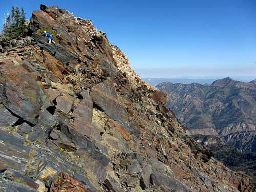
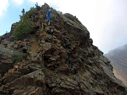
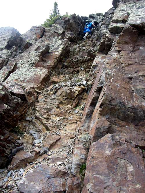
![North ridge tricky spot]() Some fun scrambling ...
Some fun scrambling ...
![North ridge downclimbing]() ... on the north ridge
... on the north ridge
From the weather forecast, I was expecting clouds almost the entire day, but the sun had been shining down on us the entire time, and would continue that way for the majority of the day. This made the hiking and scrambling a bit more difficult for me (was glad I at least brought more water this time), and also meant we’d be facing the sun most of the way across the north ridge (more so than earlier in the summer due to the sun following a lower latitude path). As a result, my pictures didn’t turn out that well, but it still turned out to be a more enjoyable alternative to the standard route.
![Dromedary north ridge]()
Scouting out the north ridge of Dromedary Peak ...
![North Ridge scramble]() ... from the north ridge of Twin Peaks
... from the north ridge of Twin Peaks
![Steep north ridge]() Steep terrain
Steep terrain
![North Ridge pic]() Awesome scenery
Awesome scenery
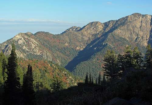
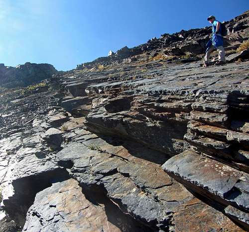
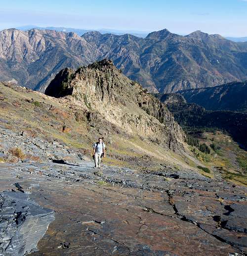
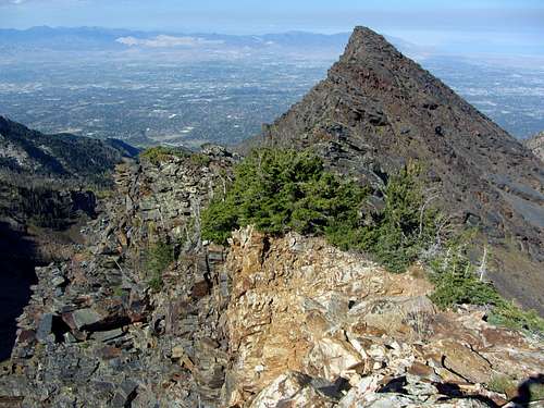
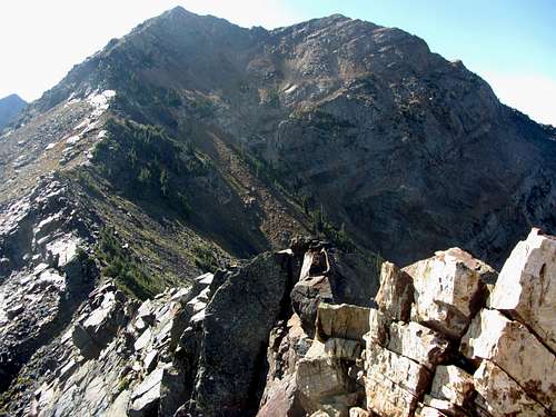
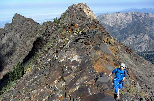
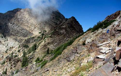
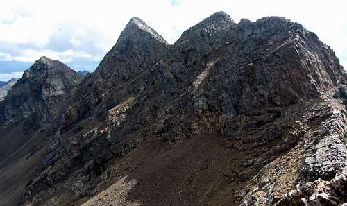
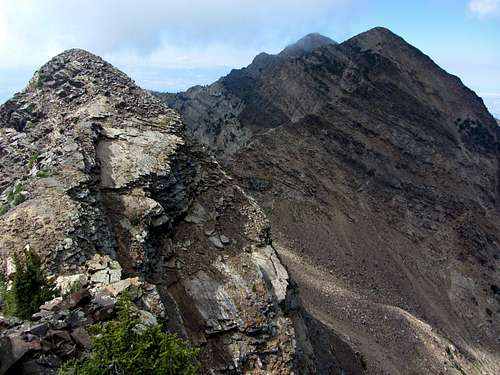
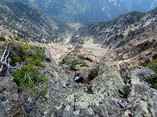
We scrambled across the north ridge, occasionally dropping off to either the left (east) or right (west) side, but for the most part we tried to stay right on top of the ridge itself. There were a few places which required a short class 4 move, but never for a sustained length. There were also a few places with some exposure dropping down to the west, but for the most part the scrambling was easy and enjoyable. Across upper Broads Fork the views of the rest of Cottonwood Ridge to the east became more impressive, stretching from Sunrise Peak to Dromedary Peak all the way back to Monte Cristo in the background.
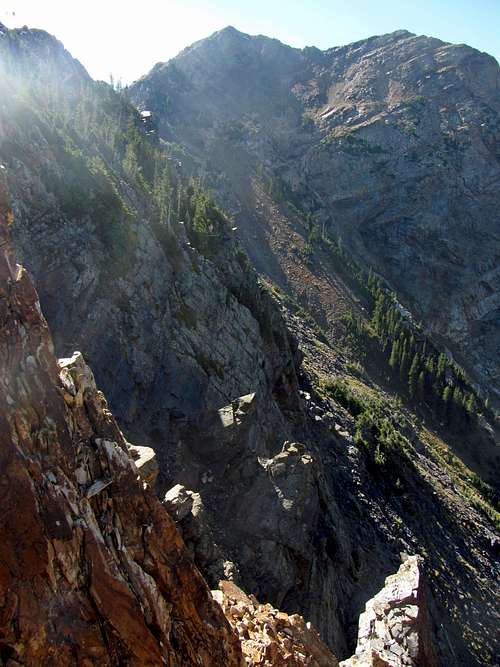
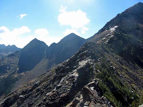
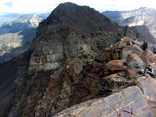
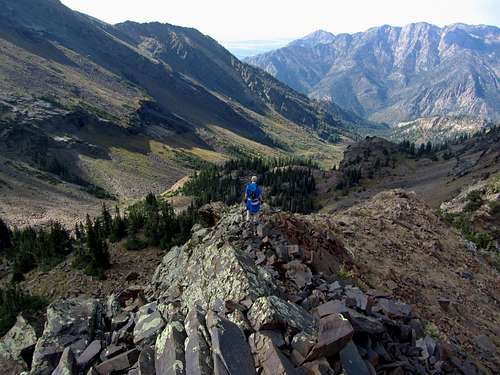
![Rest of the route]() The remainder of our route ...
The remainder of our route ...
![North Ridge route]() ... up Twin Peaks' north ridge
... up Twin Peaks' north ridge
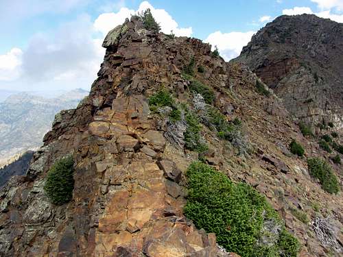
![Fun north ridge]() Easy route-finding ...
Easy route-finding ...
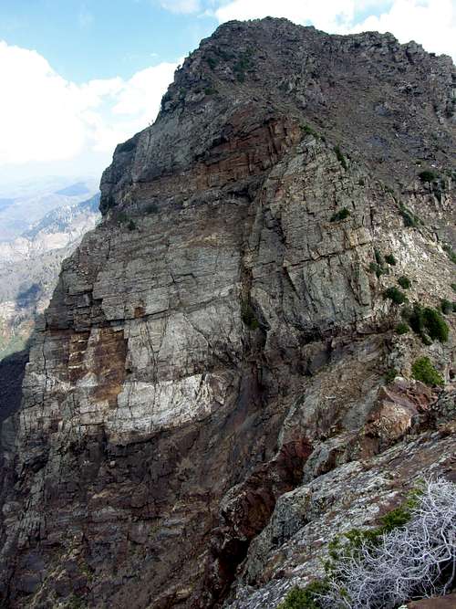
![Too smooth]() ... until some steep, smooth terrain
... until some steep, smooth terrain
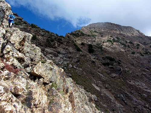
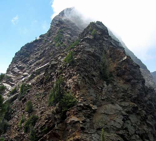
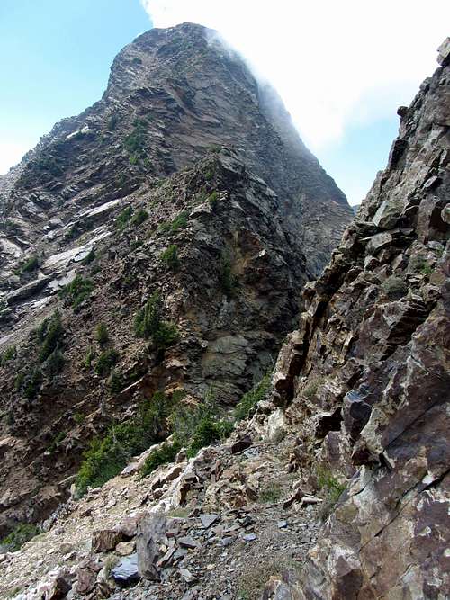
Scrambling south, we were forced to lose a little elevation before coming to some steep smooth slabs just a few hundred feet below the summit. Instead of proceeding straight up, this is where we traversed left (southeast) under the smooth terrain as prompted by the SP route description, until we found a weakness in the slabs that would grant us easier access to the summit.
![Finding the weakness]() Finding a weakness in the walls a few hundred feet below the summit ...
Finding a weakness in the walls a few hundred feet below the summit ...
![North ridge gully]() ... we proceeded up this gully below the northeast side of the summit
... we proceeded up this gully below the northeast side of the summit
At first the terrain was relatively solid, but we soon encountered a lot of loose rock. I did my best to stay near the more solid side walls of the gully we were now ascending, and thought I was being pretty light on my feet in not knocking any rocks down onto David behind me, but as the terrain got more loose I warned him that it might be best for him to stay behind each new outcropping we passed until I was far enough ahead just in case. It was for the best, because eventually I did accidentally knock down some loose rocks. About a hundred feet below the summit the rock became more solid again though, easing the remainder of our path to the summit.
![Loose north gully]()
Steep, loose terrain leading to the highest point on Cottonwood Ridge
![Alpine Ridge]() Alpine Ridge
Alpine Ridge
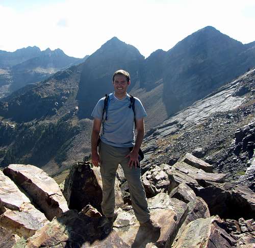
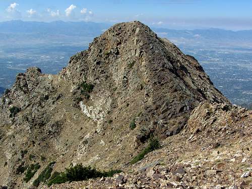
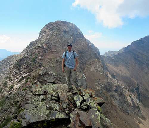
![Twin Peaks west summit]() Twin Peaks west summit
Twin Peaks west summitLast time it took me five and a half hours to make it up, so I was satisfied in shaving off half an hour this time. Soon after starting second breakfast on the main east summit of Twin Peaks, though, I was reminded that there are a lot stronger and faster hikers out there than me. Jogging up the standard route was a guy in trail runners with just a single bottle of water in his hand (if he had a beard and no shirt then I may have mistaken him for Kilian Jornet). After saying hello, he continued on towards the slightly shorter west summit, and returned back to us in only about 10 short minutes before we could even finish our snacks. I asked him if he was doing the whole ridge today since his speed seemed to indicate that he could have done so faster than it would have taken me to just do Twin Peaks, but he said this was it for today. Upon asking him if he’d summited Sunrise and Dromedary before, he responded affirmatively, although he said it had been a while and from what he remembered there was a tricky spot between the two peaks. I couldn’t wait to find out for myself what the scrambling was like and what terrain we’d come across.
Peak Traverse X 3
There were some thunderclouds forming in the distance to the east, but nothing too menacing, so I was excited to do the complete Triple Traverse this time. We made our way down to what I remember being the crux of the standard route, and before even getting there, our trail runner friend disappeared below the saddle down into Broads Fork. He would end up being the only person we’d see that day until well on our way back down by Lake Blanche.
![Route view from Twins]() Route view from Twin Peaks
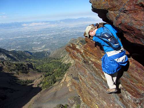
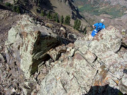
Route view from Twin PeaksLast time up here, everyone I’d seen had gone up and down a narrow crack in the crux wall on Twin Peaks’ east ridge, but I still felt it was easier to go down the rock dihedral instead. Right at the top of the dihedral is a big loose-looking rock, which may deter some folks, but I tested it and once again found it to be completely solid. I went down without any issues, and waited for David to do the same from the ledge that traverses across the long steep wall south of the ridgeline.
![Twin Peaks dihedral crux]() David coming down the Twin Peaks dihedral crux ...
David coming down the Twin Peaks dihedral crux ...![Twin Peaks & ledge]() ... and across a narrow ledge
... and across a narrow ledge
![Twin Peaks ledge]() Twin Peaks ledge
Twin Peaks ledge![Lone Peak from Twin Peaks]() Lone Peak from Twin Peaks
Lone Peak from Twin Peaks
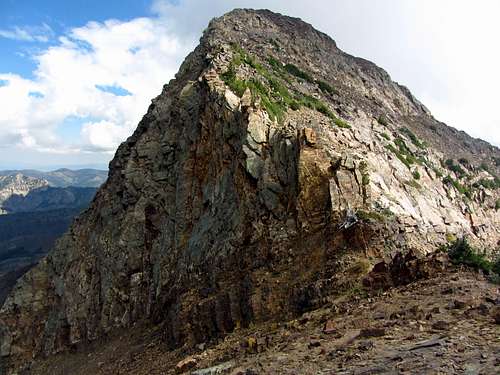
The rest of the way down to the saddle between Twin Peaks and Sunrise Peak the scrambling was easy, although the continually slanted rocks make you work the muscles on one side more than the other. David started to slow a little here (or maybe I started to speed up due to Sunrise summit fever), and I was hopeful that he still had enough energy for the traverse (I had heard him coughing a little bit behind me, so him having a lingering cold is probably the only reason he wasn’t way ahead of me). We slowly got closer to the abrupt cliff walls below Jepsen’s Folly (false summit below Sunrise Peak), trying to scout out the best possible route from here.
![Twin Peaks from below Jepsen's Folly]() Making our way from Twin Peaks ...
Making our way from Twin Peaks ...![Sunrise Peak crux ledge]() ... past some tricky terrain up to Sunrise Peak
... past some tricky terrain up to Sunrise Peak
![View from saddle]() View from Twins/Sunrise saddle
View from Twins/Sunrise saddle![Sunrise Peak ledge]() Sunrise Peak ledge
Sunrise Peak ledge
Every report I’d read seemed to indicate that it was easier to drop down a bit on the Little Cottonwood Canyon (south) side of the ridge from here and then skirt around the steepest sections of the ridge before finding an easier way back up to the ridge between Jepsen’s Folly and the true summit of Sunrise Peak, so that’s what we decided to do. We worked our way around some trees/shrubs until rounding a corner along the steep south facing walls of Jepsen’s Folly.
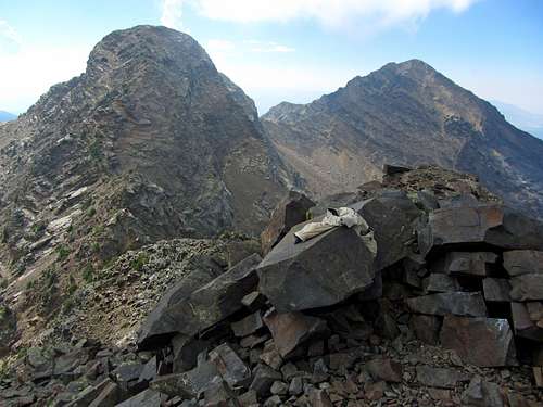
![Jepsen's Folly & Twins]() Back on the ridge, with Jepsen's Folly (left) & Twin Peaks (right) behind us ...
Back on the ridge, with Jepsen's Folly (left) & Twin Peaks (right) behind us ...![Sunrise Peak]() ... and Sunrise Peak to the east
... and Sunrise Peak to the east
![Steep north face of Sunrise]() Sunrise north face
Sunrise north face
From here it looked like there might be a decent way back up to the ridge, but all of the ramps above us looked quite smooth and steep from down below, so we kept tracing our way along the bottom of the steep walls. We went around another corner, expecting the route to become easier and more apparent, but nothing seemed to jump out at me. We could now see what must have been the true summit of Sunrise Peak about 500 feet above us to the northeast, but the way up looked quite steep. After some deliberation we decided that this is where we’d need to start going up, so up we went.
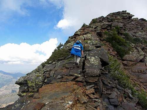
![Staying on the ridge]() As long as we stayed directly on the east ridge of Sunrise Peak ...
As long as we stayed directly on the east ridge of Sunrise Peak ...![Dromedary from Sunrise]() ... the exposed traverse down to Dromedary Peak was surprisingly easy
... the exposed traverse down to Dromedary Peak was surprisingly easy
![Sunrise false summit]() Sunrise false summit
Sunrise false summit![Steep west face]() Dromedary west face
Dromedary west faceDavid went straight up a smooth slab, while I continued wrapping around the steep rocks to the east. I soon came to a big drop off, though, where I was forced to climb around and over one of those trees growing straight out of the rock. This would end up being the sketchiest move of the day for me (had to wrap my body around the tree with a drop of over a hundred feet below/behind me), but I made it across without incident. Well, not unless you count the fact that I felt a slight muscle spasm in the side of my back a couple times as I was bending myself from one handhold to the next on my way up (not sure if it was cramping from lack of food intake, but eating more snacks on top of Sunrise would take care of that). Upon making it above the tree, I spotted David above me, who had discovered a nice little ledge system that would lead us straight back to the ridge between Jepsen’s Folly and Sunrise Peak.
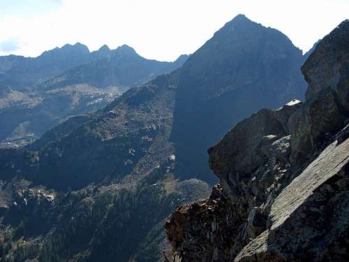
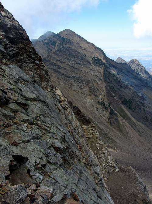
![Alpine Ridge from top of Tanners Gulch]() Alpine Ridge on the other side of Little Cottonwood Canyon ...
Alpine Ridge on the other side of Little Cottonwood Canyon ...![Tanners Gulch]() ... with Tanners Gulch down below
... with Tanners Gulch down below
![Sunrise in cloud]() Cloud over Sunrise Peak
Cloud over Sunrise Peak
The view of both Sunrise Peak and its false summit behind us to the west were impressive from this spot on the ridge. We continued east, winding below and to the right (south) of another steep section of ridge before getting back onto the ridge once again for the remaining easy scramble the last couple hundred vertical feet to the summit. Sunrise Peak has an interesting summit, in that it’s narrow and pointy-looking when viewed from the west or east, but rises up slowly and gradually as you climb along that line. Just as we made it to the top, clouds started forming around us.
![Sunrise east ridge]() Looking back at impressive Sunrise Peak ...
Looking back at impressive Sunrise Peak ...![Dromedary southwest ridge mini-gully]() ... before climbing up a mini-gully on Dromedary Peak
... before climbing up a mini-gully on Dromedary Peak
With two summits down and only one to go, we decided to cut our summit stay short (didn’t bother to open up the summit register mailbox) to beat the weather if necessary. The views over to Dromedary Peak were impressive, and the scrambling from the top of Sunrise down and back up to Dromedary would end up being my favorite part of the day. The light clouds passing overhead must have dropped the temperature slightly, because we could now see our breath (I was probably more preferential towards this kind of weather than David, but then again, I do have an extra layer of insulation around my midsection to keep me warm). Per advice from others, we tried our best to stay directly on the ridge, and I can’t emphasize enough just how sound this advice is. There are places looking down towards Dromedary Peak where you’ll think that you can’t possibly go straight down the ridge, but as you do so, the route reveals itself. There were a couple times when I was tempted to veer off to the right (southeast) side of the ridge, but soon discovered that the loose terrain there was worse than the relatively solid rock found right on top of the ridge.
![Back on Dromedary west ridge]() Once back on the west ridge of Dromedary Peak ...
Once back on the west ridge of Dromedary Peak ...![Final Dromedary scramble]() ... it was an easy scramble to the top
... it was an easy scramble to the top
After some fun down-climbing we reached the saddle separating us from our final peak of the day, with some nice views down Tanner’s Gulch to the southeast towards Little Cottonwood Canyon Road 4,000 feet below. With a steep sheer wall separating us from a climbable route up Dromedary Peak, we dropped about a hundred feet back down to the northwest (upper Broads Fork side of the ridge) until we found a weakness in the steep southwest face of Dromedary Peak that would allow us to climb back up to Dromedary’s southwest ridge, depositing us directly above that un-climbable wall. Looking back from there, Sunrise Peak appeared quite impressive, with clouds obscuring the summit. The ridge itself was still quite steep here, so we proceeded around the right (southeast side of the ridge) until we found a rubble-filled series of ledges that would lead us to a more gentle part of the ridge. From this point we just stayed on the top of the ridge for about a couple hundred more feet of easy scrambling.
![Summit pants]() From the summit we had nice views of Sunrise Peak and Twin Peaks to the west ...
From the summit we had nice views of Sunrise Peak and Twin Peaks to the west ...![Monte Cristo]() ... and Monte Cristo to the east
... and Monte Cristo to the east
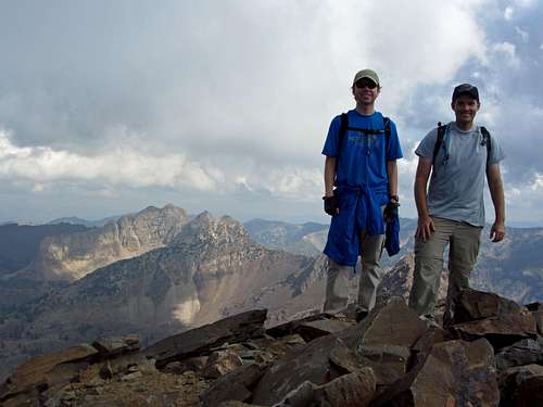
With some route-finding difficulty it had taken us an hour and a half to get from the summit of Twin Peaks to the summit of Sunrise Peak, but it only took us an hour to get from there to the summit of Dromedary Peak. The summit views from Dromedary were probably my favorite, with the Twins and Sunrise rising up nearby to the west, the intimidating un-named peaks near Monte Cristo off in the distance to the east, Pfeifferhorn and friends along the Alpine Ridge to the south, and both the Broads Fork and Lake Blanche basins stretching out below us to the north. We took a nice long break on the summit, where I tore through most of the rest of the food I had brought on the hike. I didn’t notice any summit register, but we did see some “summit pants” resting on one of the big summit rocks (not sure who left them behind or why). It felt good to finally summit Sunrise and Dromedary, the two peaks that had eluded me the first time around, and this time I still had a decent amount of energy for the descent.
![Dromedary summit shot]() David & Brandon on summit of Dromedary Peak (last peak of Triple Traverse)
David & Brandon on summit of Dromedary Peak (last peak of Triple Traverse)
Scenic Lake X 3
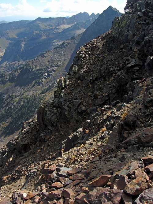
While there seemed to be a general consensus as to the best way of starting out the Triple Traverse (going up the Robinson Variation was the best option for adding more scrambling and not having to backtrack down the standard route), it seemed everyone had a different opinion as to the best way to descend from Dromedary Peak. The last place I checked was MrWasatch’s website, where he said that the person who led them up and down preferred the north ridge over the southeast ridge, so we decided to give it a try. There is a gradual path leading directly northeast from the north end of the summit, so this is the way we started down.
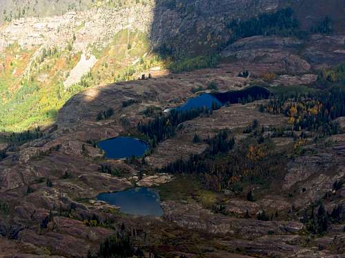
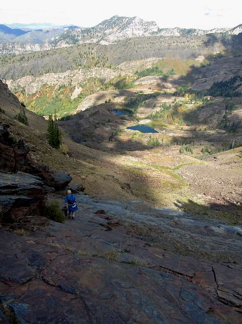
![Triple Lakes]() Lakes Blanche, Florence, & Lillian below
Lakes Blanche, Florence, & Lillian below
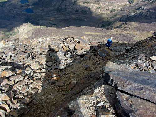
Upon spotting some steep terrain below us and not wanting to get cliffed out, after the initial path leading down to the northeast we cut back 90 degrees in a northwest direction. This appeared to be the best way to descend directly down to the main spine of the north ridge visible below us. David did a good job of finding the easiest path down a steep gully that was somewhat loose in places, and the scrambling ended up being much easier than I initially thought it would be when looking down from above. We dropped straight down onto the north ridge of Dromedary Peak, and looking back I could see how it would appear daunting looking up at the north face for the first time if you didn’t know the right way to go up.
![Dromedary summit descent]() After heading northeast down a path directly below the summit of Dromedary ...
After heading northeast down a path directly below the summit of Dromedary ...![Down to north ridge]() ... we cut back to the northwest to get down the north ridge
... we cut back to the northwest to get down the north ridge
![Dromedary scree field]() Scree field below Dromedary
Scree field below DromedaryFrom the north ridge it was fun glancing back at Dromedary, Sunrise, and the Twins, and the U/Horseshoe-shaped route we had taken around upper Broads Fork. It definitely felt rewarding looking back at the long route we had taken, and while the hardest scrambling was behind us, we still had work to do. Heading down the north ridge we kept looking down towards Lake Lillian, Lake Florence, and Lake Blanche, looking for the easiest spot from which to break off of the ridge and begin our descent into that other basin. We decided that since the rock was solid that we would just keep going all the way until the saddle between Dromedary and the un-named point to the north. I tried climbing down some smooth slabs a little before the saddle, but when I saw how steep they became I decided to join back up with David and continue until the true low point of the saddle before descending down some less steep terrain.
![Dromedary north face]() We descended down the easier-than-it-looks north face of Dromedary Peak ...
We descended down the easier-than-it-looks north face of Dromedary Peak ...![North ridge views]() ... and continued scrambling down the north ridge
... and continued scrambling down the north ridge
![North ridge tricky spot]() North ridge tricky spot
North ridge tricky spot![David on north ridge]() David on north ridge
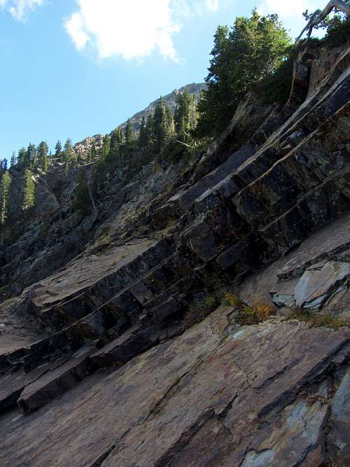
David on north ridgeThe northeastward descent down the slabs below Dromedary’s north ridge was similar to the terrain in the Robinson Couloir in that it wasn’t too steep (mostly around a 30 degree slope), but isn’t somewhere you’d want to be in a rainstorm as it would become slick very quickly. After the slabs we started encountering a combination of loose scree and dirt mixed in with more vegetation. The overgrown parts of the slope were actually the trickiest since it was hard to tell exactly what we were walking through and if there was solid ground or not beneath the grass and weeds we were walking through.
![Steep slabs]() After reaching the low point of the saddle between Dromedary and the lower unnamed peak to the north, we started going east down these steep slabs
After reaching the low point of the saddle between Dromedary and the lower unnamed peak to the north, we started going east down these steep slabs![Slab descent]() Slab descent
Slab descent![Dromedary descent]() Dromedary descent
Dromedary descent
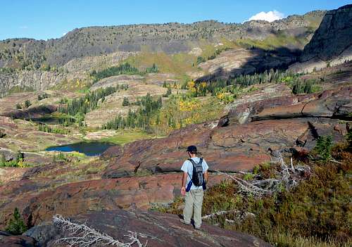
Closer to the lakes we started encountering some bright reddish colored rock. We’d often need to go up and over each gradually sloped red rock hill, requiring a bit more elevation gain and loss than we anticipated, but the terrain was easygoing for the most part. One rock hill just before Lake Lillian abruptly ended in a small cliff though, so we had to cut to the left (north) and backtrack a bit to get down to a spot where we could cross the stream just before the lake. It took about two hours for us to get from the summit of Dromedary Peak down to the lakes.
![Red rock hills]() As we got closer to the lakes we encountered some nice smooth, red rock ...
As we got closer to the lakes we encountered some nice smooth, red rock ...![Sundial Peak west aspect]() ... with interesting views of Sundial Peak's west side
... with interesting views of Sundial Peak's west side
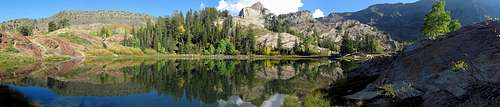
Lake Lillian and Lake Florence were both quite scenic, and it made me wonder why I hadn’t continued on the trail from Lake Blanche over here before (the other two times, my goal was to climb Sundial Peak). Whereas in Broads Fork it seemed that most of the colors were on the downswing, here around the lakes it appeared that the aspens had just barely started turning yellow. Other Wasatch lakes I’d been to this late in the season often seemed to have visibly lower water levels due to run-off, but all of these ones seemed to be near their normal water level, perhaps due to all of the late summer rain we’d been receiving recently.
![Lake run-off]() Lake Lillian run-off
Lake Lillian run-off
Happy to be back on an actual trail for the first time in a while, we leisurely walked through our incredible surroundings. The water, fall colors, and peaks above us on the Cottonwood Ridge were gorgeous, and I was glad that we had figured out how to come this way on our descent. We saw a few people at the lakes, but they were too enthralled by the awesome scenery to notice us.
![Lake Lillian]() Scenic Lake Lillian ...
Scenic Lake Lillian ...![Mount Dromedary over Lake Lillian]() ... below Cottonwood Ridge
... below Cottonwood Ridge
![Lake Lillian wildflowers]() Lake Lillian wildflowers
Lake Lillian wildflowersJust when we were about to switch the legs to autopilot for an easy trail descent, we came to the section of trail that crosses a boulder field run-out. We went straight across the boulders, expecting the trail to re-appear on the other side, but didn’t see any semblance of the rest of the trail. I scouted higher while David scouted lower down on the north side of the sloped boulder field, but neither of us could see the trail. It had been three years since we’d been up here to climb Sundial Peak, so I’m guessing a landslide in the boulders must have prompted trail maintainers to re-route the trail, since we distinctly remembered the trail completely crossing the boulders before. After sitting there for a few minutes we heard some voices approaching, so decided to stay put and see where the people came from and ended up going. They came out onto the south end of the boulder field just a little below where we had come out, walked a couple dozen feet higher up the boulder slope, and then cut back onto the same trail we had just left. Relieved to have someone there to show us the way (ironically, this part stumped us longer than anything up on the Triple Traverse, including the section below Jepsen’s Folly), we hopped back across the boulders and dropped down to get onto the lower section of trail. I guess that’s one of the tricky things about these loop hikes when you’re descending a trail that you haven’t been on in a while.
![Lake Florence]() Looking over Lake Florence ...
Looking over Lake Florence ...![Dromedary over Lake Florence]() ... with Dromedary Peak back to the southwest
... with Dromedary Peak back to the southwest
![Lake Florence pano]() Lake Florence pano (click pic to expand)
Lake Florence pano (click pic to expand)![Sundial through trees]() Sundial through trees
Sundial through trees
The rest of the way down, we ran into several people asking how much further the lakes were. When posed with the question, I was tempted to either downplay or exaggerate the distance, just to see their reaction, but we were as truthful as possible (although at this point I was in zombie hiking mode and really wasn’t paying much attention to how far we’d gone from the lakes). When one person asked if we’d made it to the top, we responded that yes, we’d hit three of the highest peaks above 11,000 feet on Cottonwood Ridge, but they clarified by saying they only meant the top of Lake Blanche. David and I drank the last 20 ounce bottle of Gatorade I had saved until this point, and exactly twelve hours after leaving our cars (and two hours after leaving Lake Blanche) we were back on the paved part of the Lake Blanche trail leading us back to the parking lot. While my legs weren’t quite as sore as earlier in the summer when we’d descended Bells Canyon during the Beatout Hike, the hard pavement served as a painful reminder for my feet of how far we’d hiked that day.
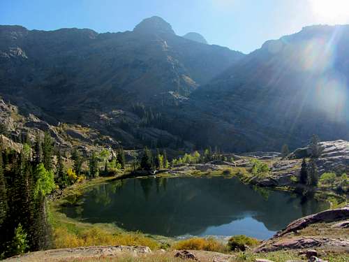
![Lake Blanche]() At always scenic Lake Blanche ...
At always scenic Lake Blanche ...![Fall colors below Sundial]() ... the colors were just starting to change
... the colors were just starting to change
![Lake Blanche trail]() Lake Blanche trail
Lake Blanche trail![Scenic Sundial]() Scenic Sundial
Scenic Sundial
The Triple Traverse ranks right up there with the Beatout as one of my favorite Wasatch ridge traverses (Bullion Divide would come in a close third). Overall, I found the scenery a little better on the Beatout (though a lot of that had to do with the nice misty/cloudy weather), but the scrambling felt more difficult and rewarding on this hike. While it was mostly class 3, there were several little class 4 moves required throughout the traverse (one or more going up and down each of the three peaks). There aren’t many places I know of nearby (in Utah, at least), where you can find three peaks as impressive as these ones in such close proximity to one other, making this one of the climbs I’m most proud to have completed. Seven years ago after my epic bonk on Twin Peaks I thought there was no way I’d ever be able to knock off these three bad boys in a single day, but now I figure I should never say never (who knows, but maybe in seven more years from now I’ll be able to do the entire Cottonwood Ridge in one go).
![Big Cottonwood sunset]() Heading back down the Lake Blanche basin towards Big Cottonwood Canyon ...
Heading back down the Lake Blanche basin towards Big Cottonwood Canyon ...![Sunset on Lake Blanche Trail]() ... with some more fall colors along the trail
... with some more fall colors along the trail
More than anything, I think it’s cool that David and I have been able to do the scrambles we have without anyone to guide us. I’ve never hiked up a mountain with someone who’s already previously been up it, so as a result, we've had to do all of our route-finding on the fly, which has definitely added more excitement and adventure (a big part of our success can be attributed to resources like Summitpost, though). One thing to note for anyone considering this route is that there are practically no cairns to speak of. Even the large distinctive cairn I’d seen in pictures of the Sunrise Peak summit was missing this day, so my guess is that a mountain purist may have recently gone through and knocked them all down. If you’re confident enough in your scrambling and route-finding though, the Triple Traverse offers one of the best adventures around.
Triple Traverse Loop Stats
DISTANCE:
12 miles one way
BROADS FORK TRAILHEAD:
6,200 feet
BROADS FORK TWIN PEAKS ELEVATION:
11,330 feet
SUNRISE PEAK ELEVATION:
11,275 feet
DROMEDARY PEAK ELEVATION:
11,107 feet
LAKE BLANCHE TRAILHEAD:
6,200 feet
ELEVATION GAIN / LOSS:
6,300 feet / 6,300 feet
DIFFICULTY:
Class 3+
TIME:
12 hours![Triple Traverse Route]() Our route across Twin Peaks, Sunrise Peak, & Dromedary Peak ...
Our route across Twin Peaks, Sunrise Peak, & Dromedary Peak ...![Triple Traverse Peaks from Mt. Olympus]() ... for the Triple Traverse
... for the Triple Traverse


Comments
Post a Comment