Overview
![Graslitzen from the west]() On the western slopes
On the western slopesGeneral Information
Difficulty: It's a medium hard hiking tour. There's no climbing, only a few details of scrambling and some steep slopes to cross. There some additional care is required. On the Swiss Hiking Scale its difficulty is graded T3.
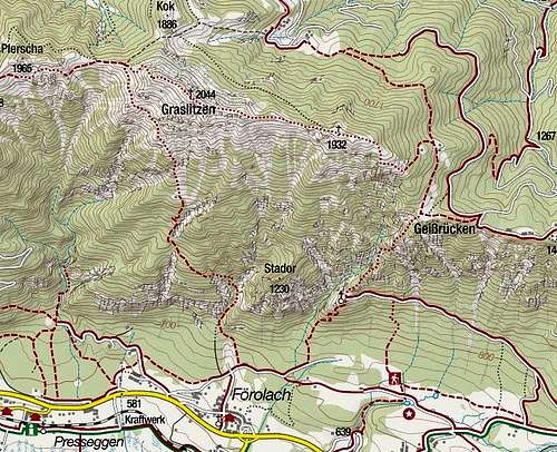
Orientation: It's quite easy. Most of the route is well marked, but above the hunters hut, we must carefully follow the decayed red spots on the ground. Map to be recommended: Kompass, Gailtaler Alpen, Karnische Alpen, 1:50000.
See also the GPX track in the header!
Slopes Orientation: South oriented below in the woods, then more west oriented to the main ridge, the summit ridge is north-west oriented.
Exposition: There is no big immediate exposition on the path, only some short sections are a bit exposed.
Objective dangers: Realistically none. In spring you may meet the challenge of crossing some west oriented snow ravines.
Best season: Late spring, summer and autumn till the first snow.
Gear: Good shoes and poles are sufficient in summer conditions.
Tour start: The end of the road above Förolach, 619 m. See the parent page how to drive till there!
Highest point: 2044 m.
Altitude to overcome: cca 1450 m.
Time for ascent: 4 h.
Route Description
![Mountain hut below Graslitzen]() Above the hunters hut
Above the hunters hutFrom the
parking place we cross the meadow towards the north. The cart-road soon narrows into a nice path, which leads us through pine woods. Later it crosses into the
Alm-Graben. It is full of fallen trees, but the path through that mess is well cut. In the upper part of the ravine there is a crossroads, where we keep left (there is no mark, but we find red spots immediately after that place, in the woods). The path goes in steep switchbacks up the forrested slope, generally keeping towards the left. An enduring ascent finishes for some time when we reach a nice, almost horizontal
terrace, overgrown by nice tree species. We follow the terrace far towards the left. In the middle of it, a god sign greets us from a strong tree. So, till the next turn we don't gain much of altitude, but there the path turns right, and again continues up the slope. We gain altitude again in comfortable turns, then on a clearing where trees are cut down, we spot the grassy summit slopes. There the path turns left, crosses a amall forrest and soon reaches a nice meadow with a
hunters hut. They call it also "Gemauerte". From there on the path will be much more panoramic, but in also more hot.
![Vellacher Egel from the east]() Vellacher Egel
Vellacher Egel![Foerolacher Sattel]() Förolacher Sattel
Förolacher Sattel![Graslitzen NW summit ridge]() The summit ridge
The summit ridgeFrom the hut we continue up across the meadow. On the upper part of it we don't go by the path right (to the water source), but just up into the woods and in several turns up towards the summit. In the beginning big marks on trees are leading us, later they disappear and we only hardly follow some decayed red spots on the ground. A
forrested ridge leads us always up, on the right we see a distinct, broad ravine. When we reach the timber line, the path starts keeping left There it is most steep, and the terrain gets rocky. It brings us on a wonderful
edge, from which a nice view on Presseger See and on Vellacher Egel opens. From there we continue abit more up by a grassy ridge, but soon we must be attentive to the path, which starts crossing the
western slopes of the mountain. We still all the time steadilly gain some altitude, there are only a few descents from grassy side ridges. We cross afew ravines mostly they are grassy one is filled with rubble, the othe one requires some scrambling over lose rocks. From the last rib we enjoy a nice view, but from there no path goes up towards the summit. We must cross the slopes to the main ridge - we reach it on
Förolacher Sattel. There inscription plates turn us sharp right. First a bit below the ridge, then by it, and finally by an almost flat NW
summit ridge we gain the
summit in 30 min from the saddle.

 1276 Hits
 76.66% Score
 7 Votes