
Comments
No comments posted yet.
|
|
Trip Report |
|---|---|
|
|
43.28580°N / 116.5414°W |
|
|
Download GPX » View Route on Map |
|
|
Apr 27, 2021 |
|
|
Hiking |
Guffey Butte Elevation: 3130 ft
Snake River Elevation at the base of Guffey Butte: 2260 ft
Prominence: 480 ft
Rank: Guffey Butte is Idaho’s 5769th highest ranked peak
Guffey Butte
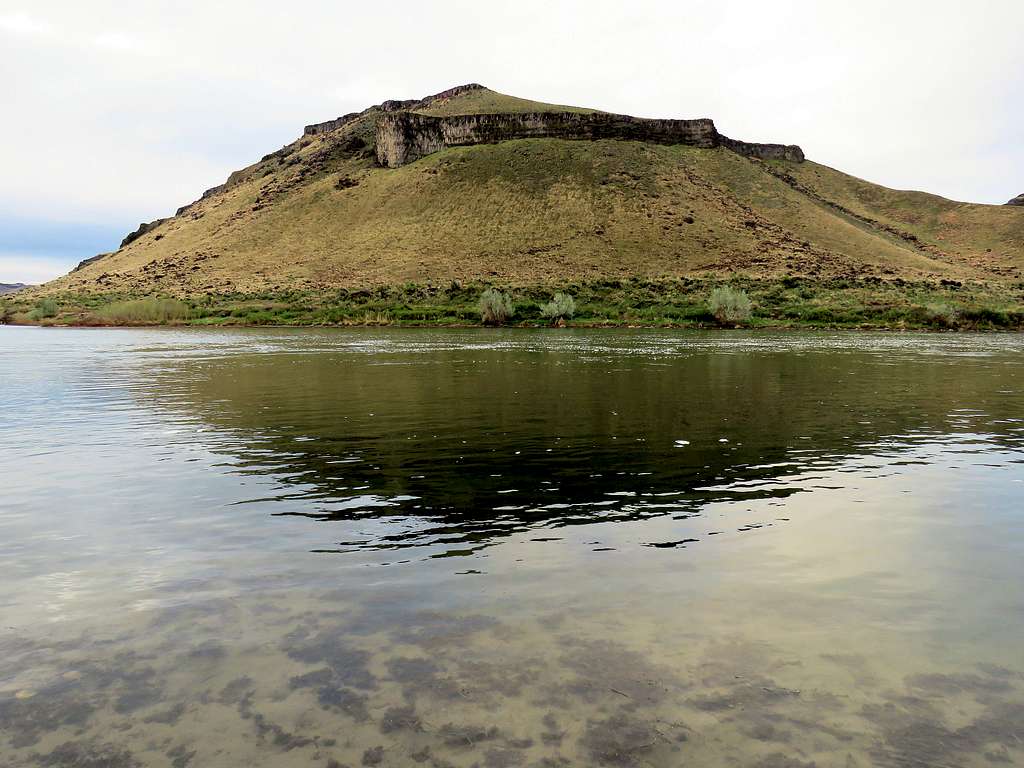
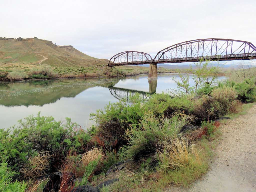
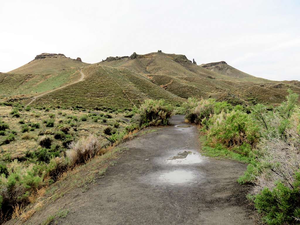
Guffey Butte rises on the southern banks of Snake River 21 miles south of Boise, Idaho. Its summit is 870 ft higher than the level of the river. A 2.2 miles long trail starts in Celebration Park on the northern banks of the river, crosses the river over an abandoned railroad bridge and goes to the summit of Guffey Butte. On its way, the trail takes you by a number of hoodoos. From the summit of Guffey Butte, you will get limited views of the river but the surrounding farmlands, desert plains and the distant Owyhee Mountains will be in good view.
Plateau to the east
To the east of Guffey Butte, you will find a large flat-top plateau at an elevation of 2920 ft. The northern and northeastern walls of the plateau rise 660 feet directly above the river providing you with great views of the river. No trail goes to the top of the plateau but it is easy to add it to the hike to Guffey Butte.
Hike Length: 8.2 miles
Total Ascent: 1400 ft
Left the vacation rental house to the east of Grand View, Idaho at 6:10 a.m. Had an hour drive to Celebration Park. It had rained over the previous 3 days but was supposed to get sunny. At that hour, it was still cloudy.
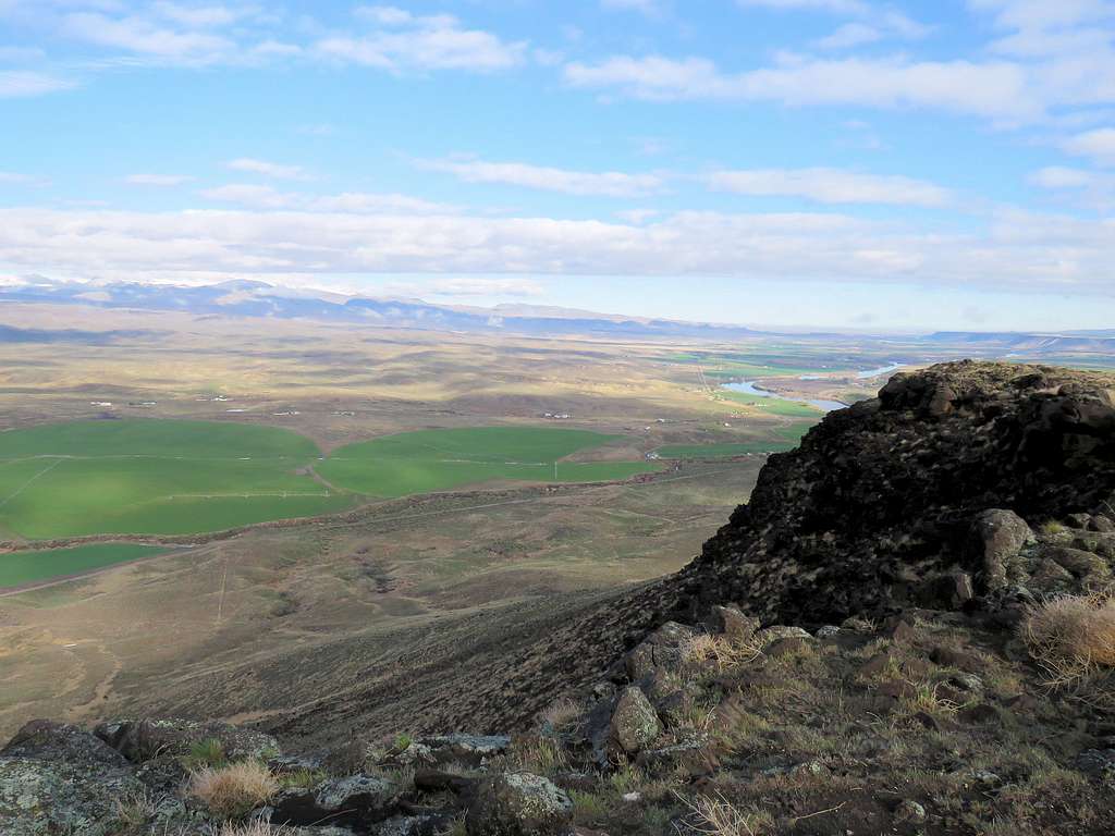
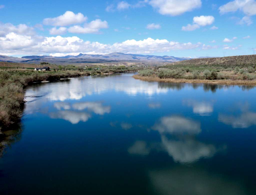
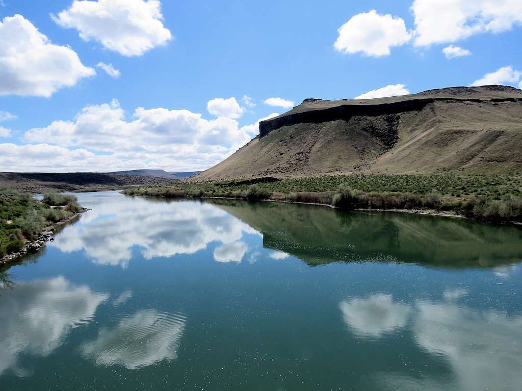
Started my hike at 7:25 a.m. in Celebration Park. It was 43 degrees F and elevation was 2280 ft. Went by the river and took a picture of the plateau on the south side of the river where I planned to go after Guffey Butte.
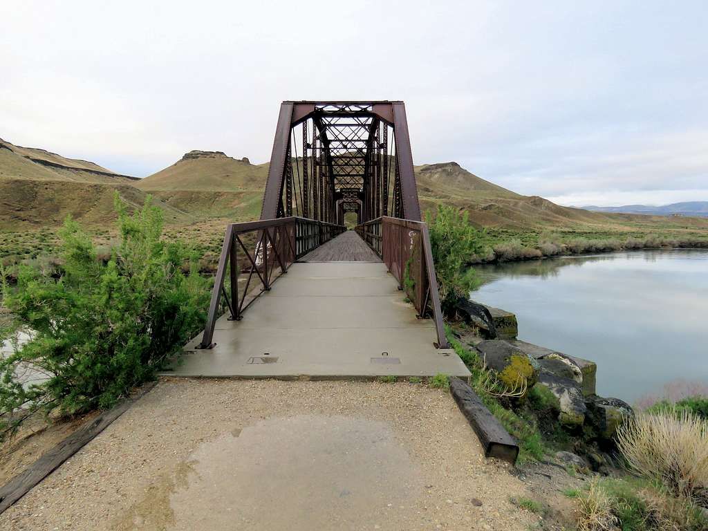
Followed a riverside trail a short distance west to reach the old railroad bridge that had been converted into a hiking path.
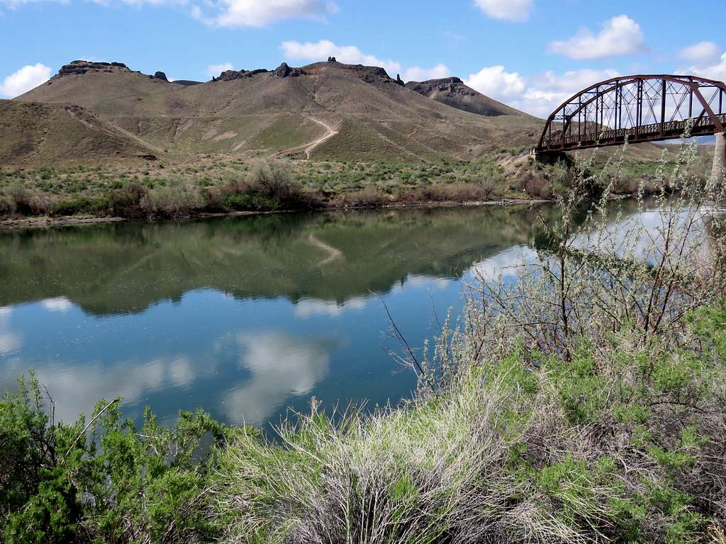
Guffey Butte seen on the right after crossing the bridge.
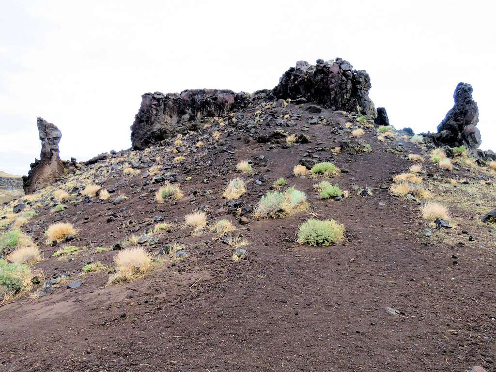
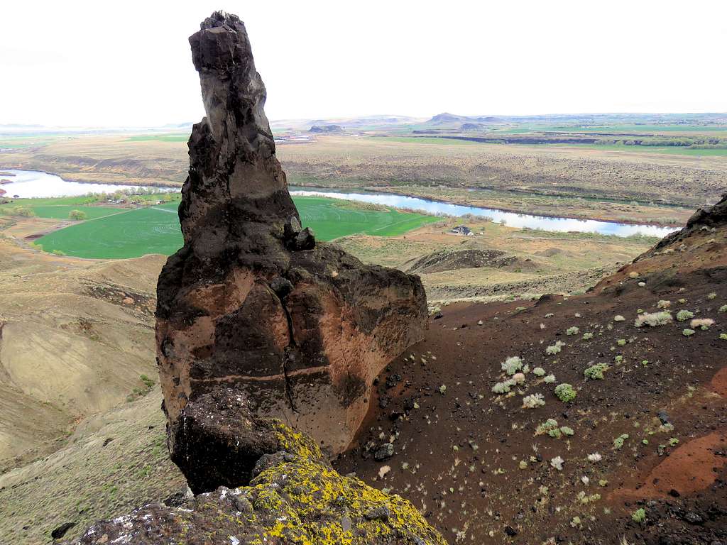
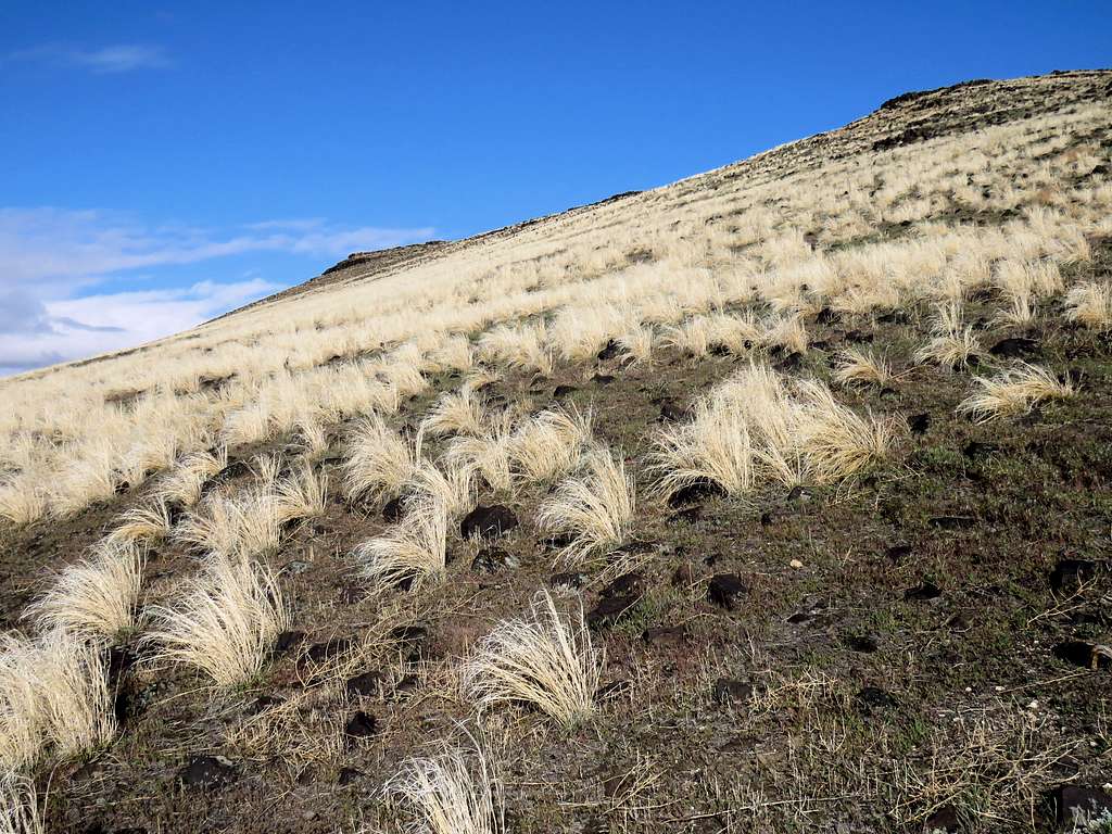
A steep trail went up to a gently sloped area, then the trail turned west (right) and went up another steep area to reach a number of hoodoos. The big pinnacle was not visible from there.
Looking back at the bridge.
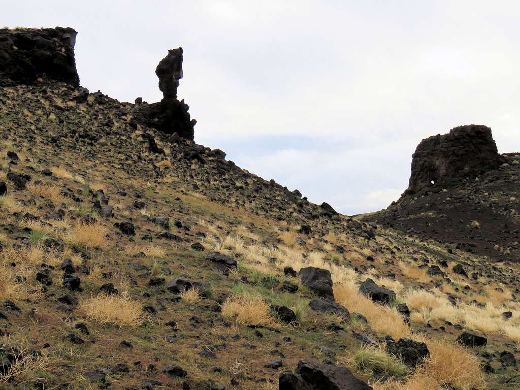
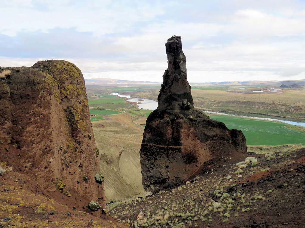
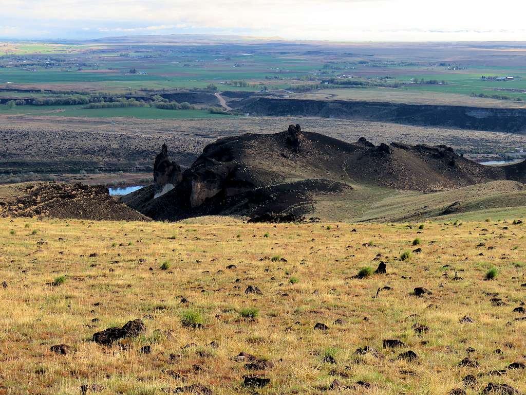
I then went off the main trail and followed a beaten path to reach the big pinnacle.
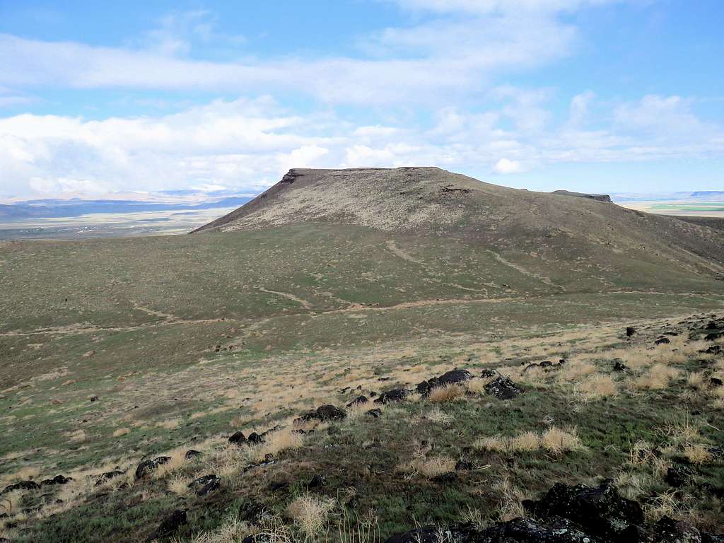
Went back to the main trail and continued up the trail toward the summit. View of the big pinnacle behind.
The top was a large gently sloped mesa. The summit was marked by a big pile of rock, a US flag and even a summit registry. I was there at 8:35 a.m. and 2.26 miles of hiking. It slowly began to get sunny. Owyhee Mountains came to view to the south and west.
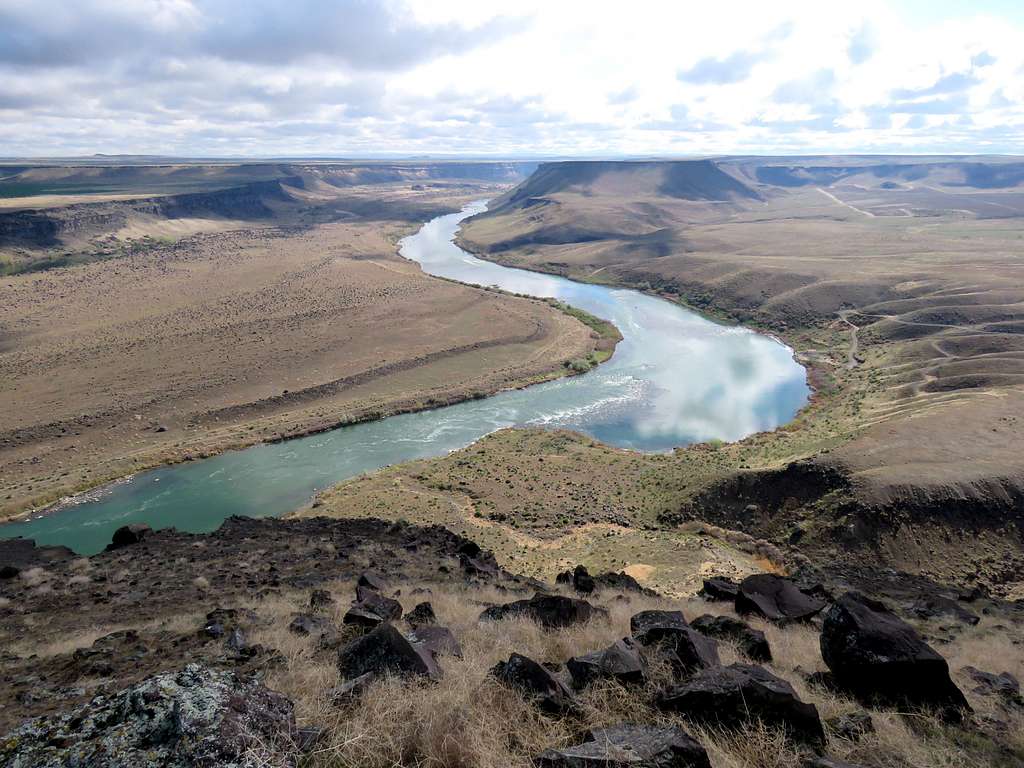
Snake River to the northwest.
View to the plateau southeast where I planned to go next.
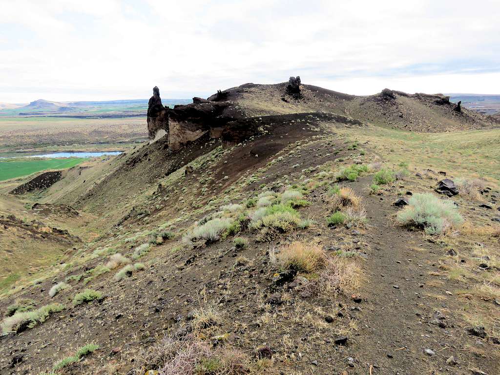
After 10-15 minutes, I left the summit heading east going off trail toward the flat-top plateau. Another view of the big pinnacle and the hoodoos.
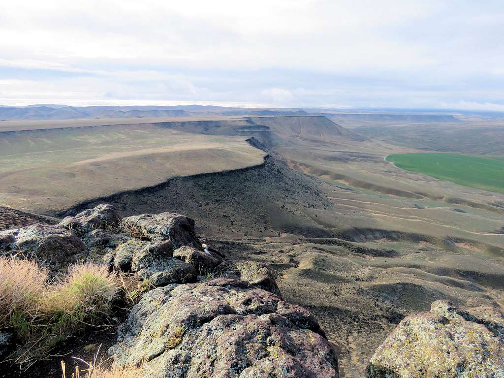
Had to go down to a very broad 2800 foot saddle and then up again to reach the 2920 ft flat-top plateau. A band of cliffs ran under the surface of the plateau but there were many opening where one could hike up. I was going toward an opening I had seen on Google Earth.
Down a pretty slope.
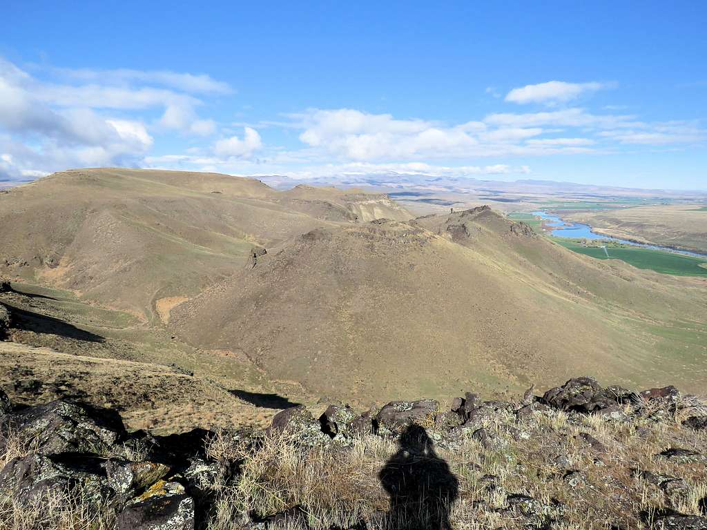
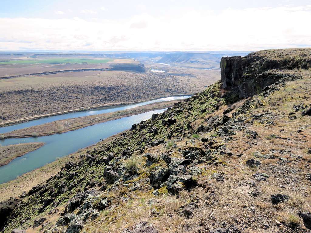
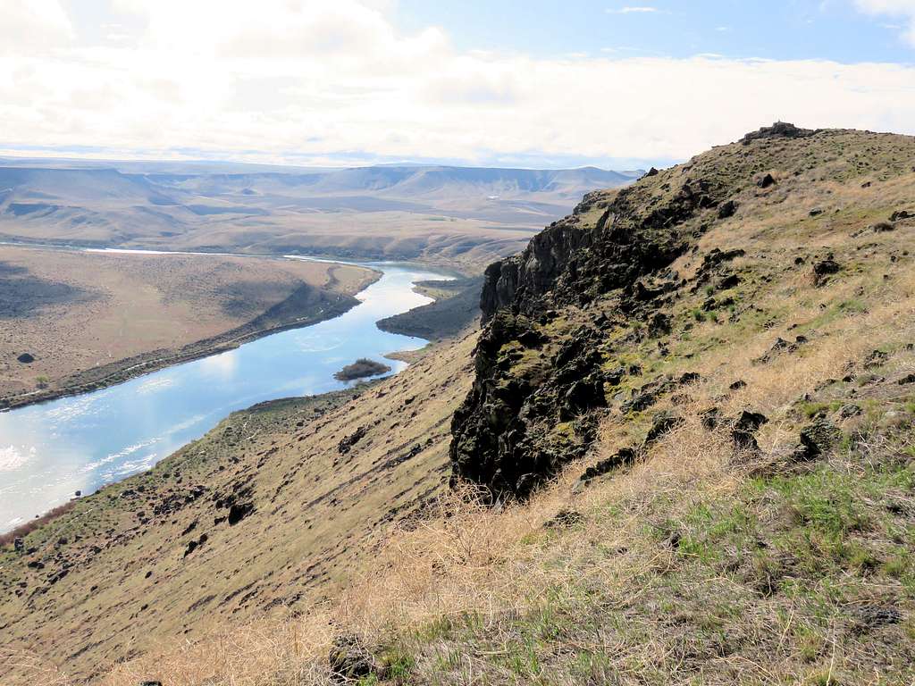
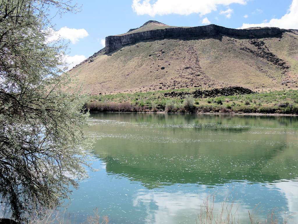
On the other side of the broad saddle, went up a slope to the top of the plateau. Looking west at Guffey Butte.
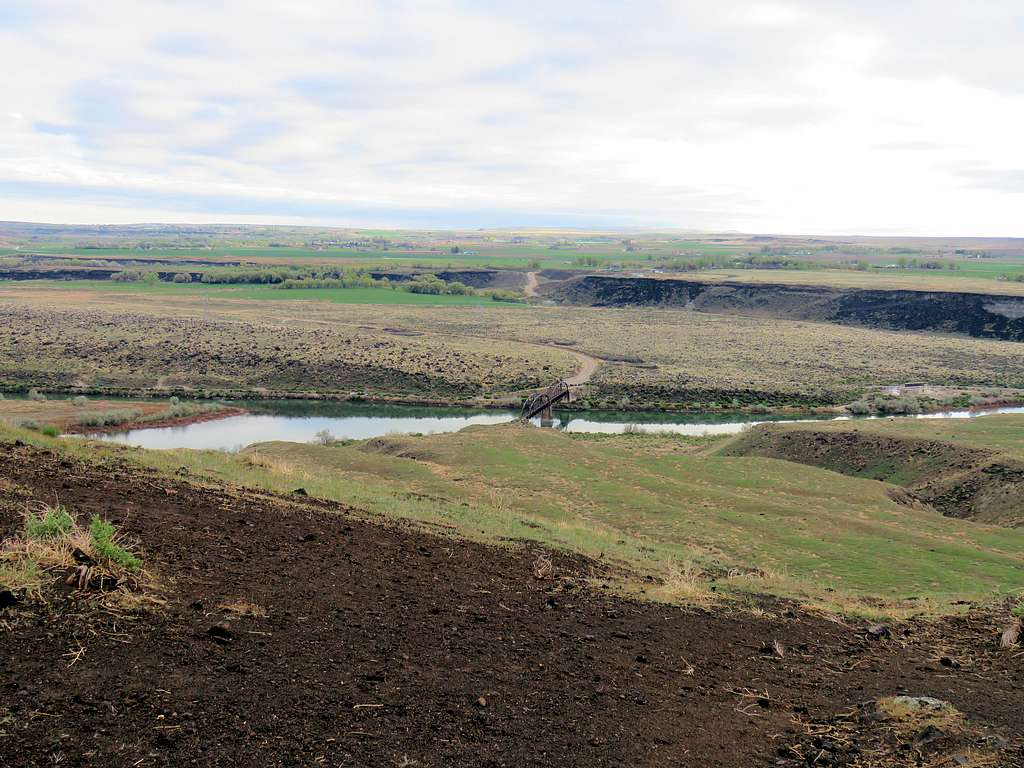
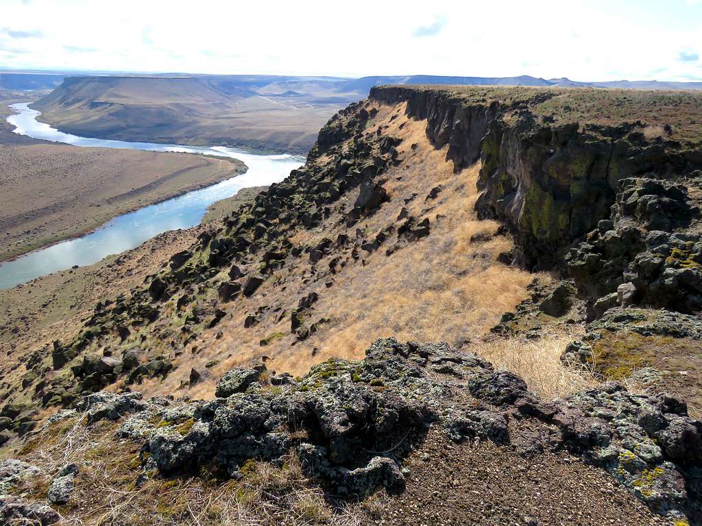
Guffey Butte, Snake River and the hoodoos area.
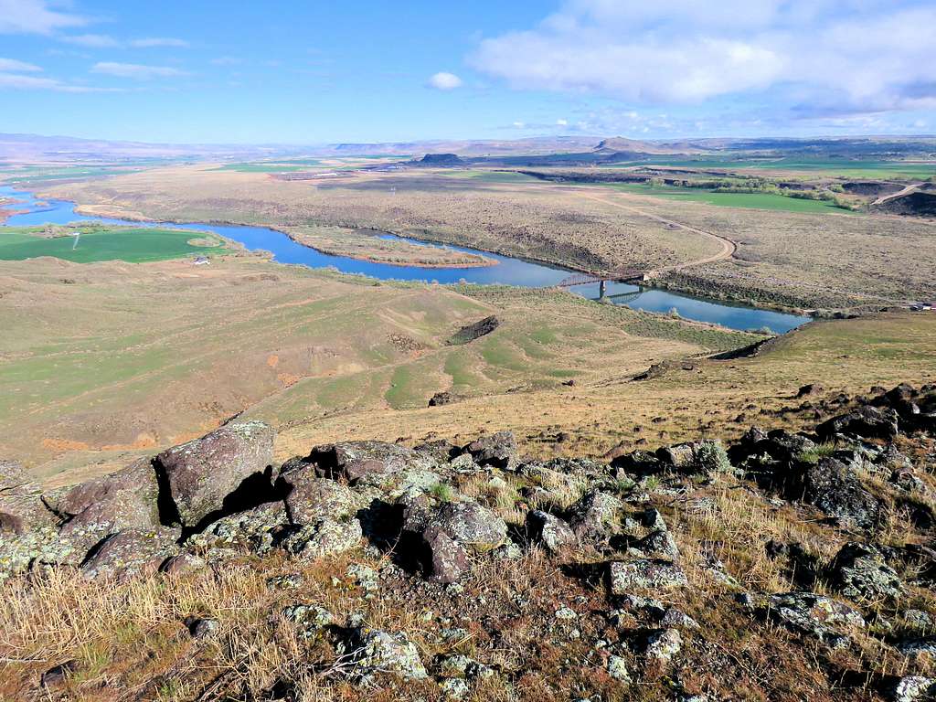
The bridge.
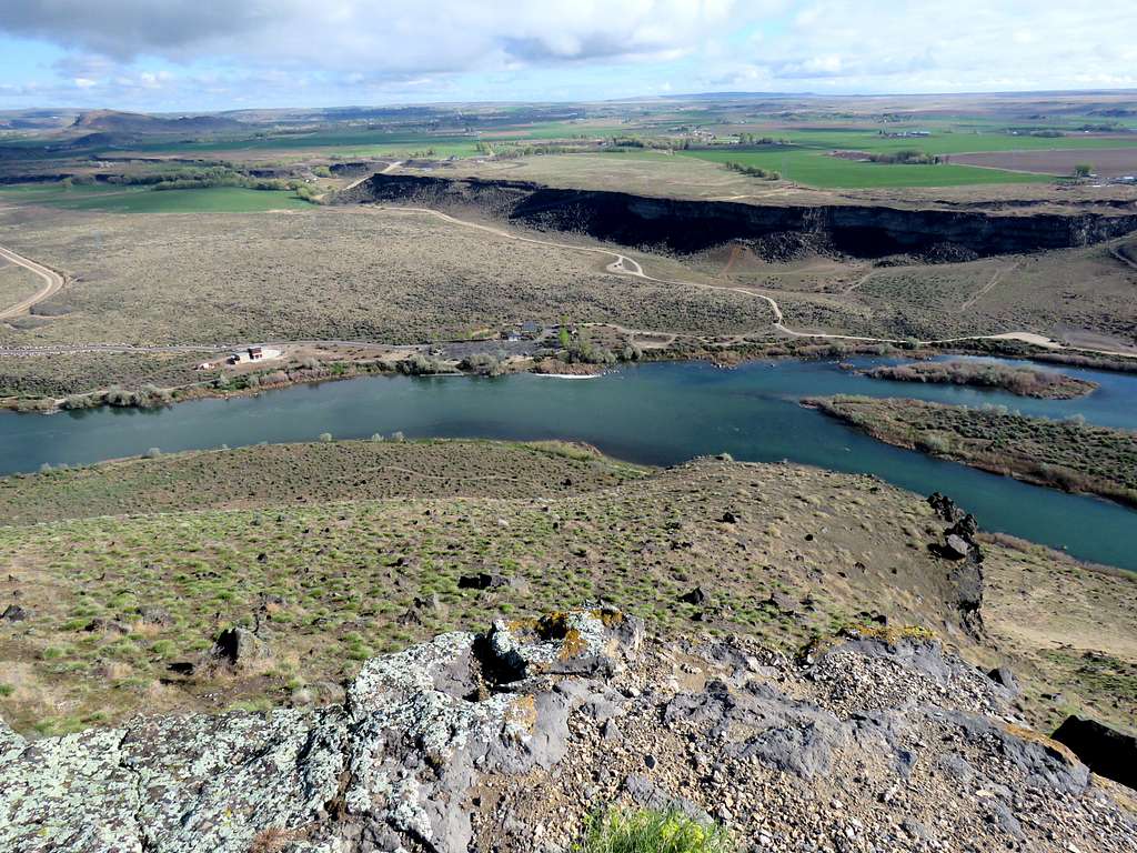
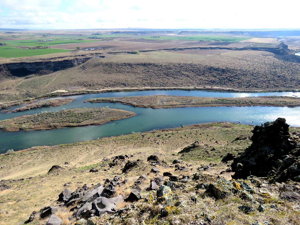
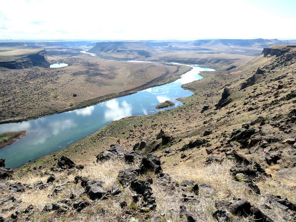
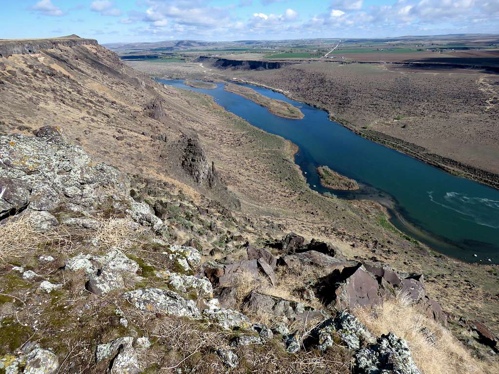
At the north rim of the plateau, I was directly above Celebration Park where I had parked.
More wonderful river views.
I then followed the rim of the plateau southeast toward a relative high point. Unfortunately, construction equipment on the north side of the river made much noise.
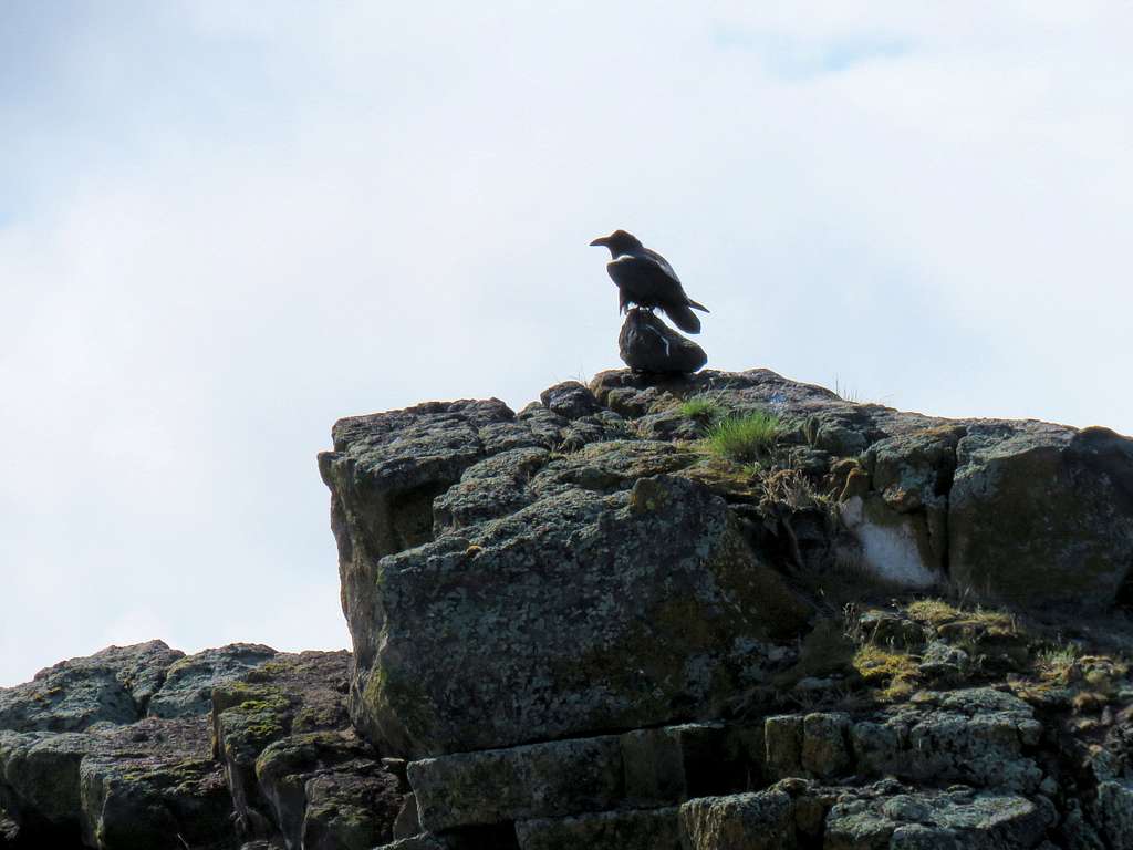
I could see some sort of a pinnacle on top of the high point and thought it was a marker or a statue. I zoomed with my camera to see a big raven sitting on top.
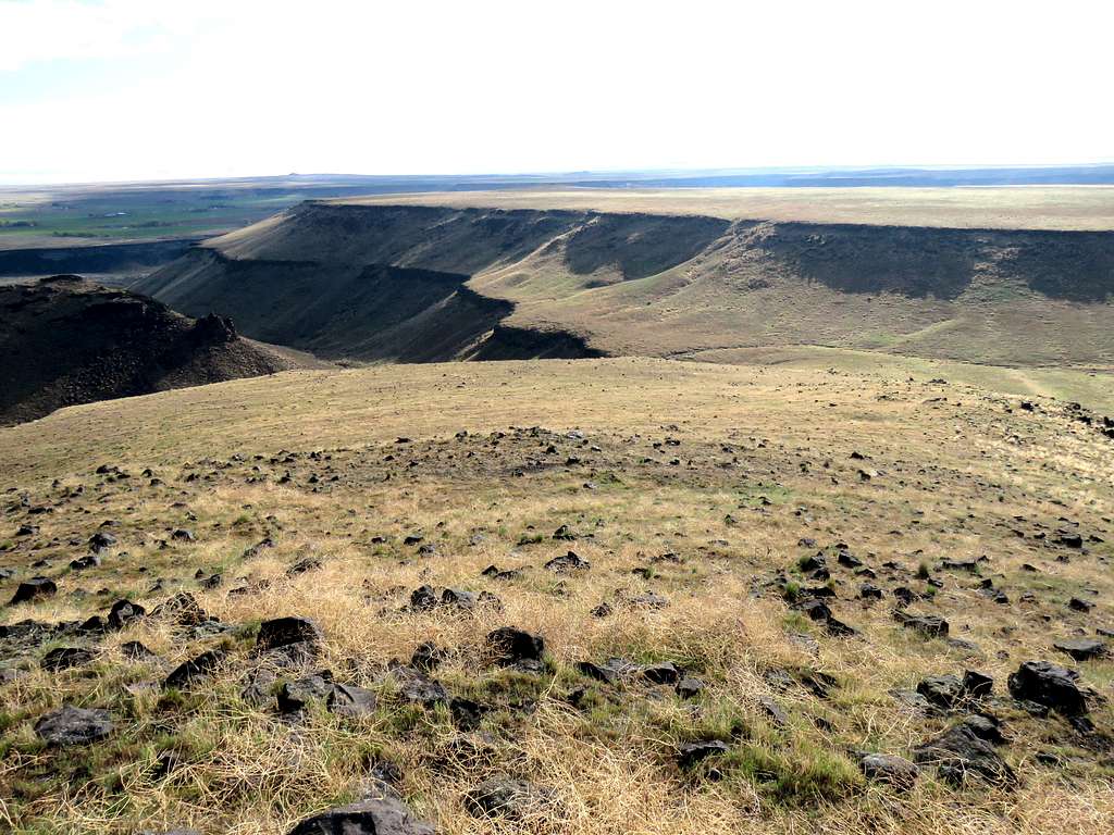
The raven finally left as I reached the high point at 10:00 a.m., 4.4 miles and 2970 ft elevation. Sat there to eat drink and enjoy the views while being bothered by construction noise.
I then continued southeast along the rim.
After 5.38 miles of hiking, I reached where the rim of the plateau turned south while the river turned northeast. Sat there a little again to enjoy. Construction noise was no longer audible.
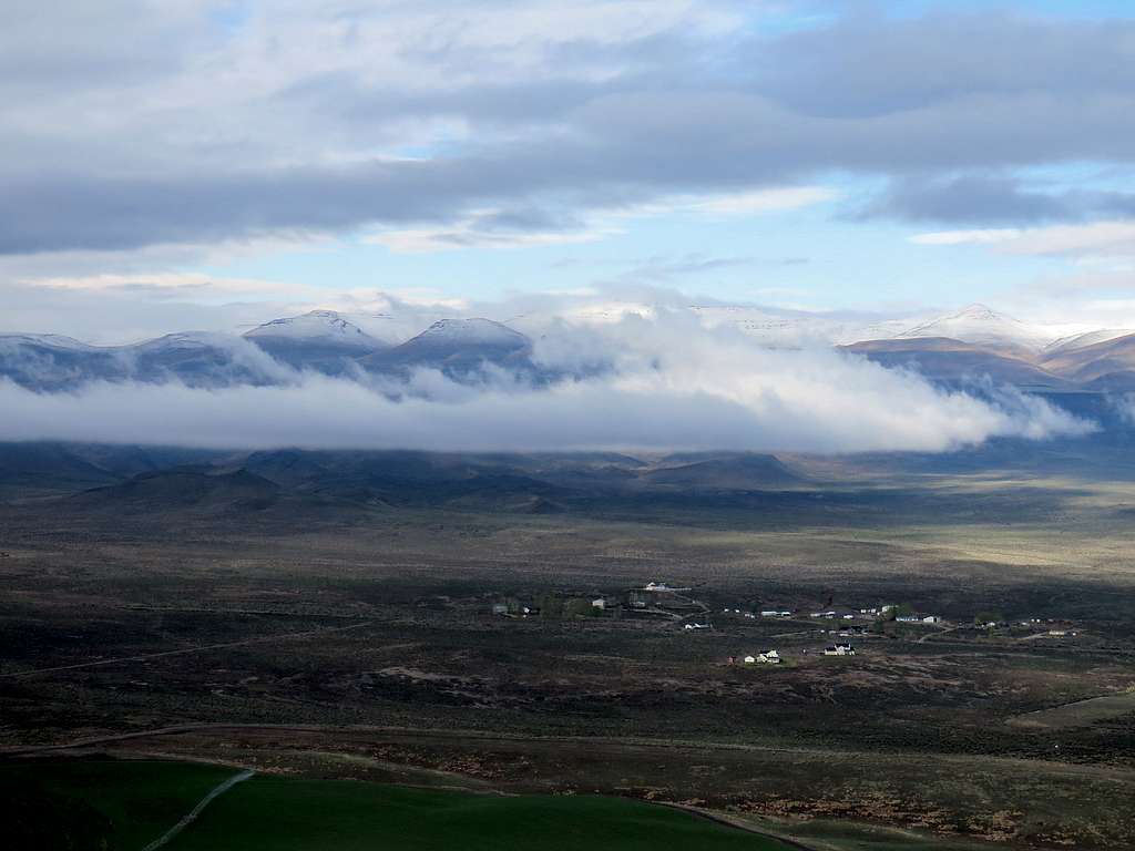
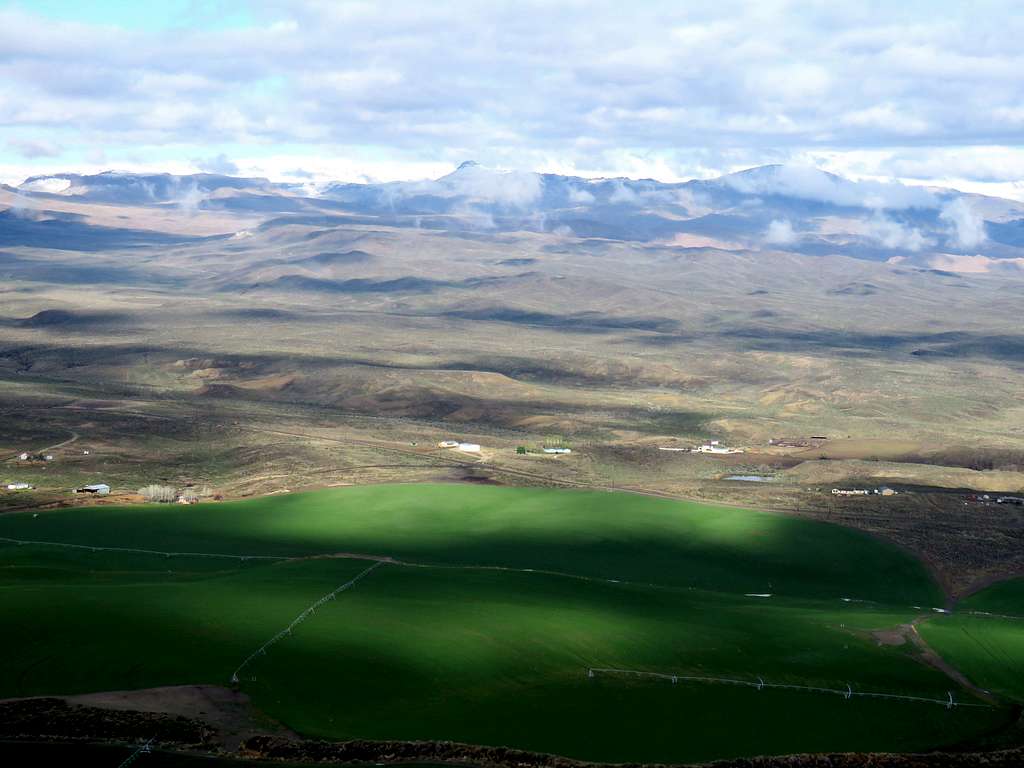
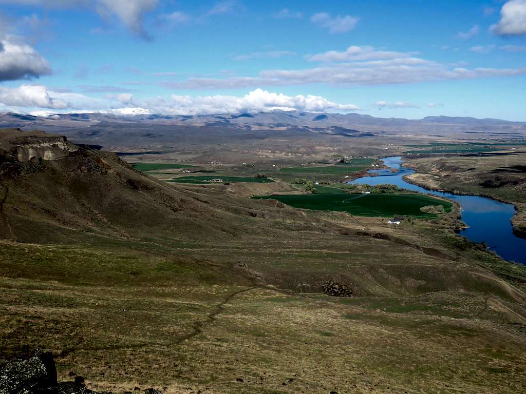
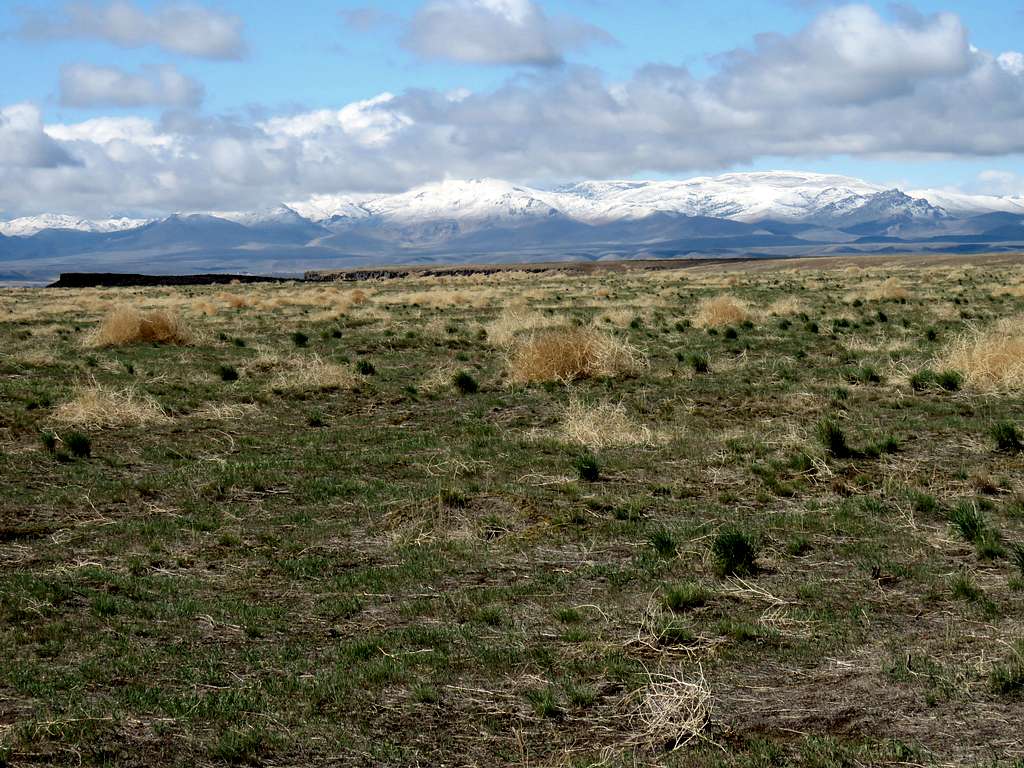
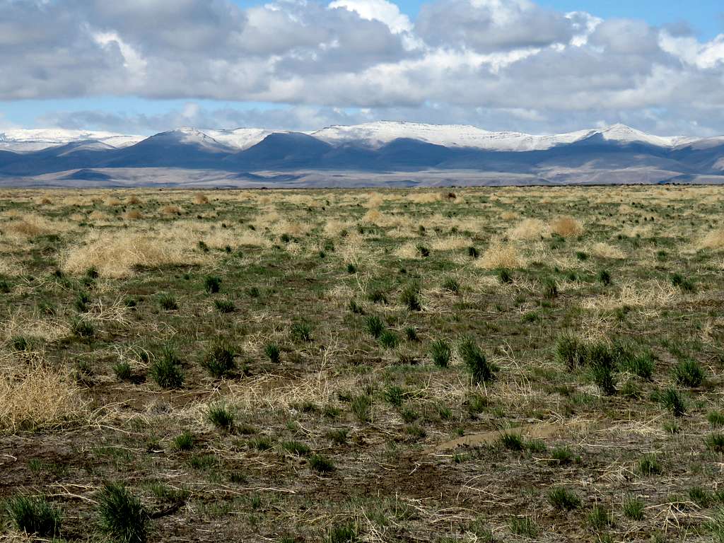
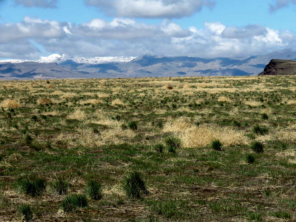
Left the rim at 10:55 a.m. heading west over the grassy flat surface of the plateau toward an opening I had seen and marked in my GPS in the cliffs under the west rim of the plateau. Owyhee Mountains were well visible. They had a fresh coat of snow over them
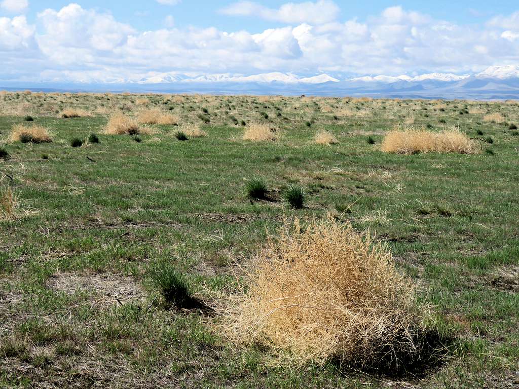
The ever present tumbleweed.
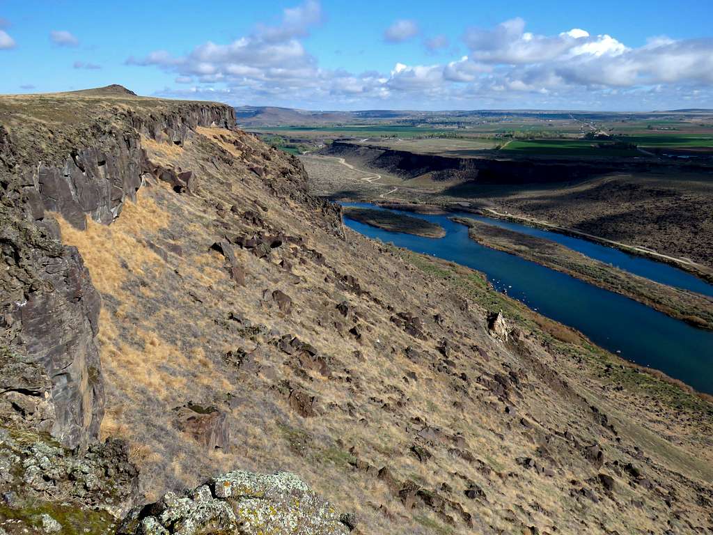
At 11:22 a.m. and 6.55 miles of hiking, I was at the western rim of the plateau. Went down the opening in the cliffs to the bottom of a drainage and then followed it north downhill until I reached the trail. I then followed the trail down to the bridge running into a family with a number of children near the bridge.
View west from the bridge.
East at the plateau where I had been.
Crossed to the north side of the river. View of the bridge plus Guffey Butte and the hoodoos.
From Celebration Park where I reached my Jeep at 12:05 p.m.
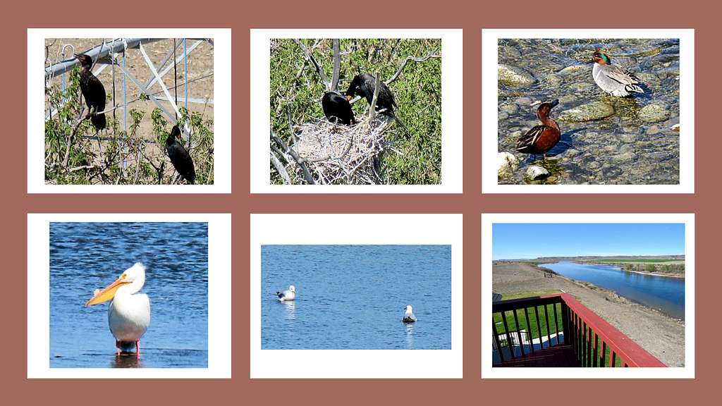
Had a one hour drive back home, took a shower, ate and spent more than an hour doing office work, then sat on the porch enjoying views of Snake River. The island in the river seemed to be a choice habitat for birds. Took many pictures.