
-
 16546 Hits
-
 74.92% Score
-
 5 Votes
|
|
Trailhead |
|---|---|
|
|
Los Angeles |
|
|
Spring, Summer, Fall, Winter |
|
|
2030 ft / 619 m |
Overview: Access to Big Iron and the East Fork Gorge
This trailhead in the Sheep Mountain Wilderness provides access to the most widely used route to Iron Mountain #1 (Big Iron)(8,007’) and to destinations along the East Fork of the San Gabriel River (East Fork) including the popular “Bridge to Nowhere” hike. There is a camping site alongside the river within half a mile of the trailhead.The Heaton Flat Trail is the principal trail from this trailhead. It winds roughly northeast until it reaches Allison Saddle. From there, the south ridge of Iron Mountain can be taken to its summit. The hike to Iron Mountain is one of the toughest hikes in the San Gabriel Mountains. The roundtrip is a little over 14 miles with 7,200 feet of gain.
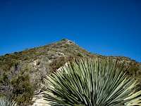 Bump on south ridge route to Big Iron
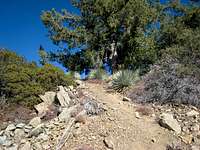 Along the south ridge route to Big Iron
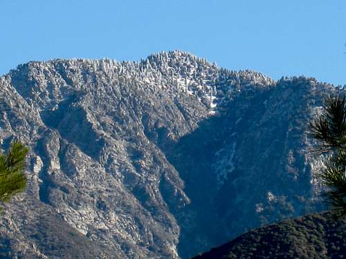 Big Iron seen from the west 2/24/07
Alternatively, from Allison Saddle, one can also take a use trail that starts left from the saddle and traverses to Allison Mine.
 Allison Gold Mine high up in Allison Gulch
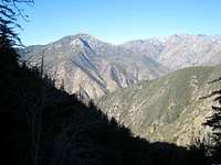 View NW along Allison Mine Use Trail
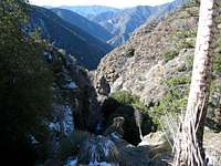
The second major option from the trailhead is to simply hike upstream along the East Fork (from the trailhead the river actually travels north-south). There are use trails as you head north along the river and a number of campsites including The Narrows, Iron Fork, Fish Fork and Mine Gulch. To give some perspective, a trip from the trailhead to Mine Gulch, which trip would traverse the middle and upper sections of the East Fork, would be about 11 miles of up-canyon travel.
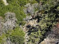
 Looking down Allison Gulch as it winds into the East Fork of the San Gabriel River
Getting There
From either Interstate 210 or Interstate 10, take the Azusa Avenue (SR 39) exit and go north winding up San Gabriel Canyon about 12 miles to where the East Fork Bridge intersects SR 39. Turn right and go across the bridge. In about 6 miles, you will come to a point where the road starts to curve very sharply right and uphill. Right at this curve, you will see a road straight ahead of you. Take a left onto the right hand lane of the road you’ve just seen and in less than a mile you will come to a large paved parking lot at the end of the road overlooking the East Fork of the San Gabriel River. Park here. Sign as you enter trailhead parking area
To get to the Heaton Flat Trail, from the trailhead parking area, go past the large gate and hike north and east on the road that follows above the river bank for about ½ mile. There, by a smelly outhouse, the Heaton Flat Trail (designated 8W16) begins on your right. To hike to destinations along the East Fork river itself, simply continue hiking along the road and you will drop into the canyon floor and then be following the river.
Red Tape
You will need an Adventure Pass or Golden Eagle Pass to park your vehicle at this trailhead. Although they are sold at some visitor centers and ranger stations within the Angeles National Forest, and, infrequently, at some trailheads, it might be safest to purchase one beforehand ($5 per day or $30 for a yearly pass) at a sporting goods store.A permit is required to hike the Heaton Flat Trail. Permits are available at the San Gabriel River Ranger District, 110 N. Wabash, Glendora, telephone 626.335-1251, or from the United States Forest Service Entrance Station on SR 39.