
Looking down on Mont de l'Etoile (3370m) from the slopes of Pointe de Vouasson (3490m)
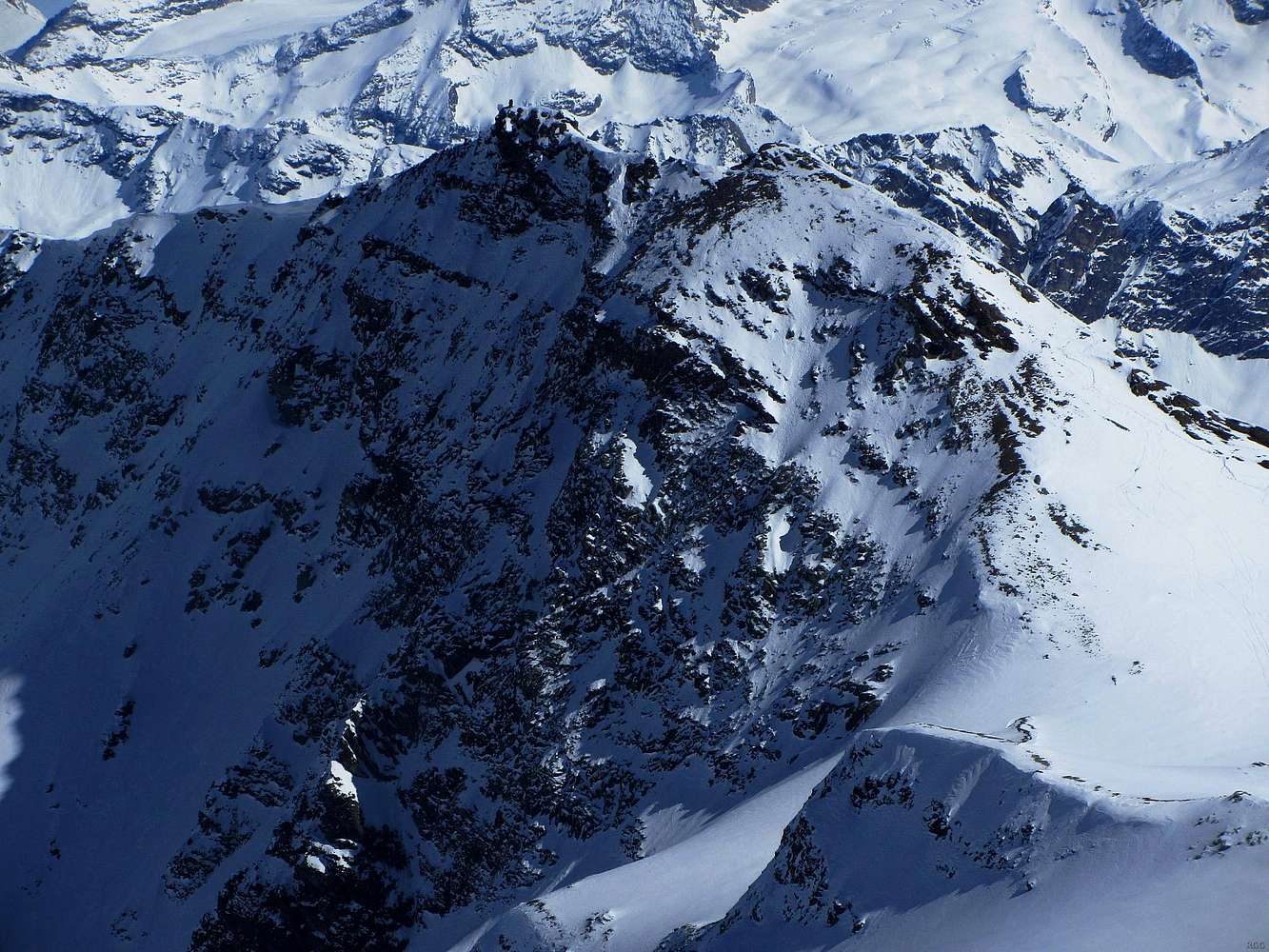
This is a zoomed in version. If you look closely, you can recognize two summits: the SW one on the right and the NE one on the left. The more distant slopes further back make the connecting ridge a bit hard to see, but even so, it's clear that there are cornices on this side of the ridge near the NE summit.
Today I'm taking it easy, starting and ending at Cabana des Aiguilles Rouges and only going to Pointe de Vouasson. Tommorrow I want to traverse Mont de l'Etoile and descend all the way down to the trailhead at La Gouille. From the map I figured that the route up to Mont de l'Etoile shouldn't be too difficult, but when I specifically asked about it, I was told that bringing crampons would be a good precaution. I have no idea yet whether only the normal route will be easy or if I can do a traverse. In fact, I don't even know which of the summits is the highest, nor where the normal route comes from.
My winter map of the area shows a route traversing the mountain. The route traversing Mont de l'Etoile is intended for ski mountaineers. Higher up it's a dotted line, meaning that it's not easy - for skiers, that is. Looking at it from Pointe de Vouasson, it's clear that the NE summit is a little higher than the SW summit. I can see that it will be no problem to get up to the SW summit from the right (along the wide SW ridge). However, the summit ridge is a question mark, and I can't even see where the route continues past the NW summit. By the looks of it, I think I can get to the NW summit by going over the SW summit. Should I then find out that I can't continue and complete the traverse, I can always retrace my steps.
Later, back at Cabane des Aiguilles Rouges, I ask the hut warden about the normal route up the mountain. He appears to be genuinely surprised that I believe that there are actually two possibilities and answers that the normal way up is from the NE, via the ridge. Though I'm not planning to do that, I'm happy to learn about this because it implies that when I make it to the NE summit from the SW, I'll have the normal route for my descent.
10 March 2014.


