
-
 6263 Hits
-
 91.14% Score
-
 34 Votes
|
|
Mountain/Rock |
|---|---|
|
|
36.60551°N / 118.12745°W |
|
|
Inyo |
|
|
Sport Climbing |
|
|
Spring, Summer, Fall, Winter |
|
|
4667 ft / 1423 m |
|
|
Overview
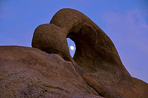


Lost Eye To The Moon is a rock formation in the The Alabama Hills on the outskirts of Mount Whitney in the Sierra Nevada Range., California.
This formation is located just to the north of The Corridors, East End and across the wash from Cattle Pocket area. Lost Eye to the Moon could have easily been named Lost In the Shuffle since it was not explored for its climbing potential until the late 2000s, decades after The Corridors were climbed. The similarity between this formation and The Corridors, East End is uncanny, in shape and in character. The only difference seems to be that it is much lower angle than its close cousin. The slabby nature of this formation coupled with the grainy surface could have been the reason for this lack of attention.


How to Get to Lost Eye to the Moon:
From the town of Lone Pine, California, on Highway 395 take Whitney Portal Road at the only traffic light in town. Drive 2.7 miles west on this road to intersect Movie Road. Turn right onto the Movie Road. This road is paved for a short distance then it turns into a dirt road. The first dirt road to intersect the Movie Road heads for Shark's Fin. Miss this one and drive about half a mile to the next dirt road from the left. Turn into this one and pass by Paul's Paradise. Shortly further up the road you will see the Blackhawk Pinnacle and the beginning of Cattle Pocket. Before reaching the Blackhawk Pinnacle look for a dirt road to your right. Take this road that should head north for a short distance then west, left again. Note; taking this side road avoids having to cross the wash that is deeper a bit further. Stay on this road all the way to the East End of The Corridors. Lost Eye to the Moon is just to the north of the The Corridors, East End.
Select Routes
 |
|
Camping
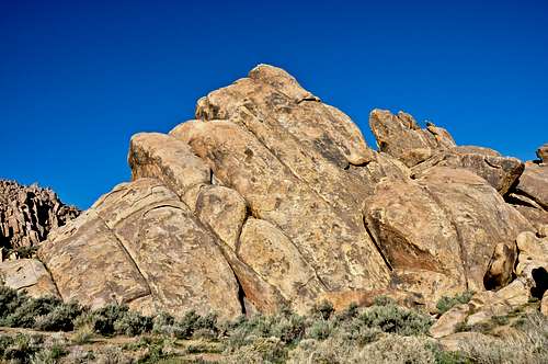
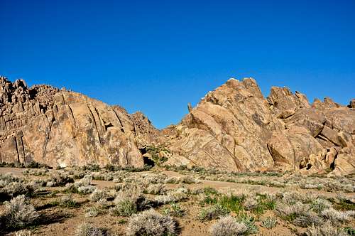 Corridors, East End on the left and Lost Eye to the Moon on the right
If you don't mind driving another fifty miles, there are many campgrounds along Bishop Creek just to the west of Bishop. There are also many places in The Buttermilks area that are close to a creek that are suitable for camping. Please do not camp in The Buttermilks bouldering area. That area is very crowded and is suffering from the impact unregulated camping has caused.
The following links should help finding a good campsite
Horton Creek Campground
Rock Creek Canyon
Inyo National Forest
Bishop Creek and vicinity camping