
-
 6773 Hits
-
 78.27% Score
-
 9 Votes
|
|
Route |
|---|---|
|
|
45.90470°N / 7.36539°E |
|
|
Mountaineering |
|
|
Spring, Summer |
|
|
One to two days |
|
|
F |
|
|
Overview
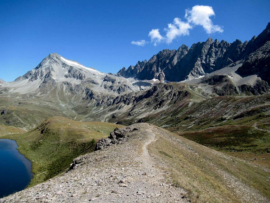
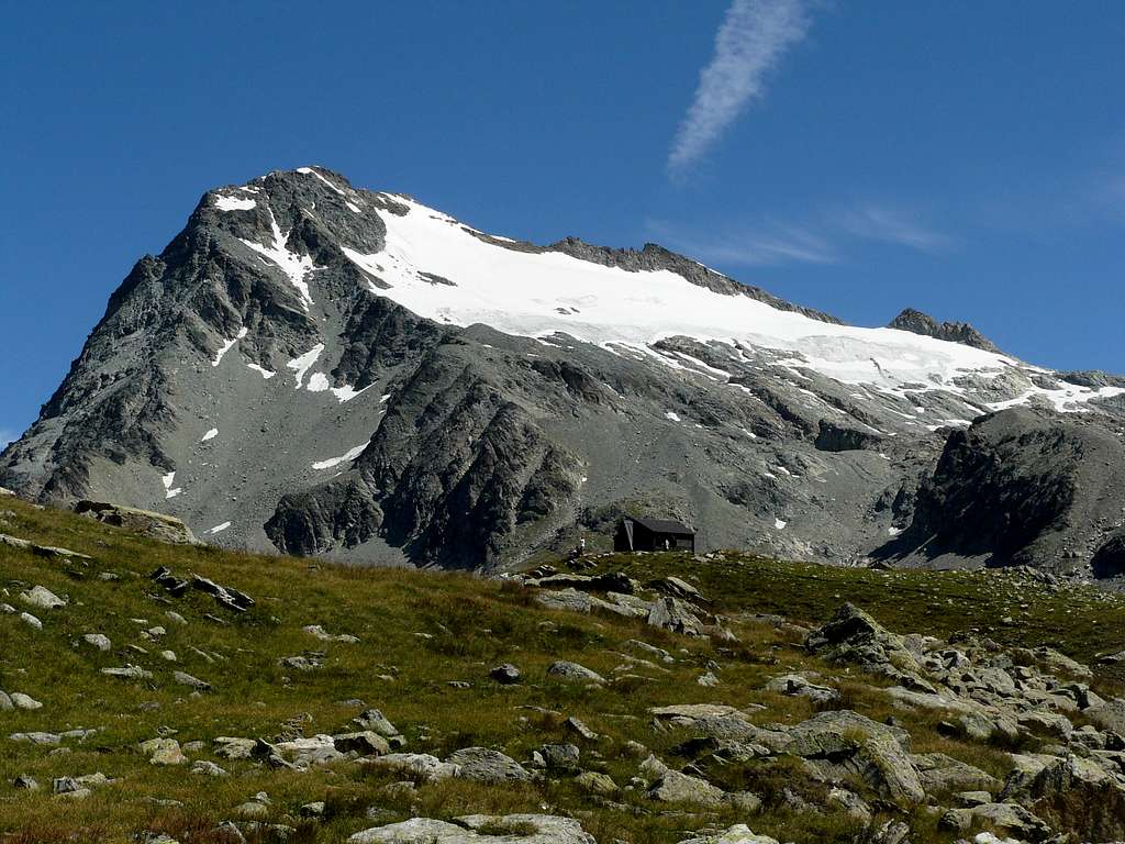
Mont Gelé 3519 m belongs to the Pennine Alps and lies on the main boundary between Italy (Valpelline, Aosta Valley) and Switzerland (Wallis). Precisely Mont Gelè is situated between the Col Fênetre to the North-West and the Col of Crête Sèche to the South-East. On the italian side it separates the Conca di By area from a sub-valley of the Valpelline called Comba di Crete Sèche. As its name suggests - Gelé means "frozen" - Mont Gelè is surrounded by glaciers, except on its Western side. We see to the North-West the Glacier de Fenêtre, to the North-East and to the East the Glacier de Crête Sèche, now greatly reduced, and to the South-East the Glacier di Mont Gelé.
In the upper part this route is in common with the normal route from the Cretes Seches refuge. This itinerary is constantly evolving and it is foreseeable that it will continue to change in the coming years due to the reduction of the glacier due to climate change. Overall, the route is longer and more complex than the route through Crete Seche. If you choose this side, it is advisable to make the climb by the end of June when the residues of winter snow still remain.
Getting there
This itinerary starts from Glacier, the last hamlet of Ollomont. The Ollomont valley is a Valpelline tributary valley
Road access
To climb this route you must take the Valpelline, then the Ollomont Valley .
- From Turin and Milan: follow the A5 Motorway and exit to Aosta Est. Follow the road S27 towards Gran San Bernardo Tunnel, getting after about 10 km. to Variney m. 782; here you must leave the road to Grand San Bernardo and turn to right towards Valpelline m. 960, the valley’s main resort. After passing the village of Valpelline it is necessary to leave the main road and turn left for Ollomont.
- From Switzerland (Grand Saint Bernard Pass or Tunnel). Drive to Aosta direction. 4 km before arriving in Aosta, just before first tunnel, there is Variney village. Turn right for Valpelline and then turn left for Ollomont.
- From France via Mont Blanc tunnel or Petit St. Bernard pass. Follow Aosta direction via SS n.26. or Motorway A5 (exit Aosta Ovest because itdoesn't exist an exit to Aosta Est driving from Aosta to Turin). Once reached Aosta, follow the Grand St. Bernard direction. If you are on the old road for Grand St. Bernard, it joins the new one at Variney. Follow Valpelline, Place Moulin Lake direction. From Variney follow Valpelline, then Ollomont.
Route Description
Route n. 2 - from Bivacco Regondi-Gavazzi (beg. at Glassier village, 1549 m.)
From this route, it takes two day to reach Mont Gelè summit.
Day 1 - In the village of Glassier park the car where the road ends, cross the river and follow the footpath n 6, direction Inclouisa lakes/Bivacco Regondi. The trail is well marked and there are any difficulties to get to Bivacco Regondi 2590 m (3h00min.).
Day 2 - Walk NE direction. Once passed the Benseya lake the trail begins to fade in stony ground and is always closer to the Morion chain. Walk on the right site of first snowfield: Colle del Mont Gelè must be reached (2h30min, 3.160m). Avoid the middle of Mont Gelè glacier! From the Colle del Mont Gelé to the summit the itinerary overlaps the route "Via Crete Seche".
Essential Gear
Crampons, ice axe and light rope essential for day2
Red Tape
No fees no permits required
Huts and bivouacs
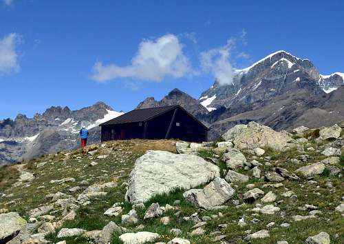
The Bivacco Regondi-Gavazzi is always open and with 16 places, however there are no cylinders, but there is a gas lamp. The water is located at the lake below the refuge (5 minutes) or it is 15 minutes from the spring, going down the access path.
The bivouac was erected for the first time in 1952 in memory of the young mountaineer Nino Regondi. Initially it was a sheet metal construction with 6 beds. It is currently a beautiful and comfortable wooden construction and sheet metal roof inaugurated in 1995. It is now named after Nino Regondi and Pietro Gavazzi. The bivouac is owned by the CAI sections of Desio and Bovisio Masciago.
When to climb
It is advisable to make the climb by the end of June, when the residues of winter snow still remain.
Meteo
Meteo Regione Valle d'Aosta
Meteo Switzerland
Guidebooks and maps

"Alpi Pennine" by Gino Buscaini - Guide dei Monti d’Italia CAI-TCI
"La Valpelline" Foglio 115 -scale 1:30.000 - IGC (Istituto Geografico Centrale)