
|
|
Mountain/Rock |
|---|---|
|
|
46.33498°N / 10.49687°E |
|
|
Hiking, Mountaineering, Scrambling |
|
|
Summer |
|
|
9925 ft / 3025 m |
|
|
Overview
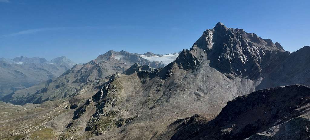
Monte Gaviola 3025 m
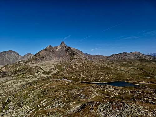
Monte Gaviola 3025 m is a secondary peak representing the extreme South-Western end of the Ortles-Cevedale group, Cevedale-San Matteo subgroup, It's a small pyramid dominat the Passo Gavia from the SE and facing the highest and most majestic Picco dei Tre Signori. Passo Gavia is a marked saddle which divides the high Ortles-Cevedale range from the sub-group of Monte Sobretta, connecting Valfurva with upper Val Camonica. It opens between Monte Gaviola and the highest Monte Gavia. The Southern slope of the pass is rather steep, while the Northern slope opens towards the Valfurva with a large, not very steep valley. Immediately North of the pass is the suggestive Lago Bianco.
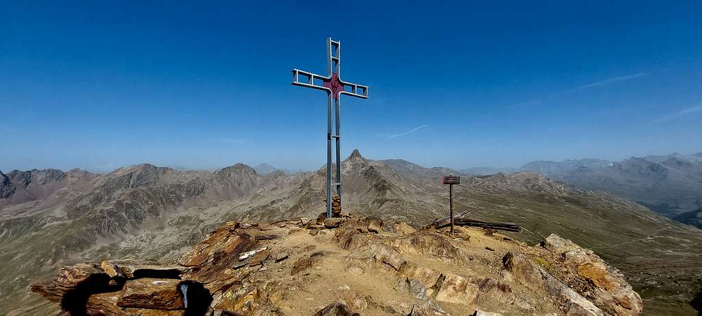
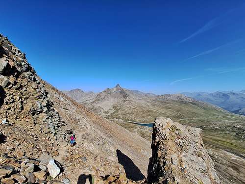
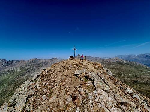
The mountain offers an extensive panorama of the peaks surrounding the Passo Gavia and further away in the North drection towards the Ortles and Gran Zebrù, while towards the South the view opens onto the peaks of the Adamello group.
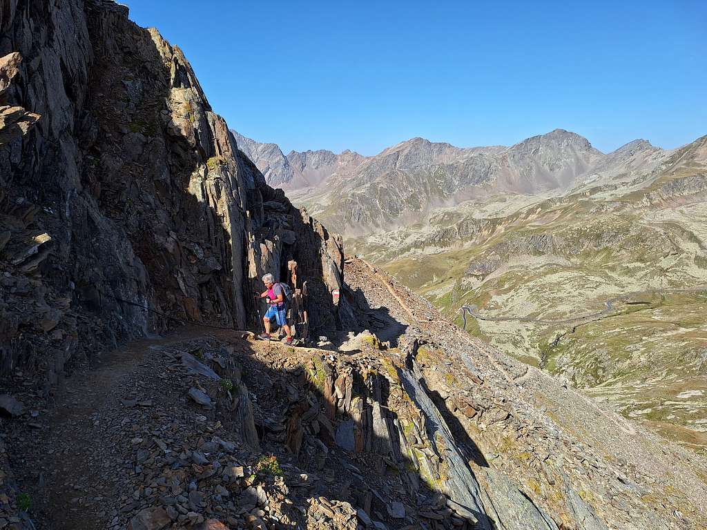
The normal route to Monte Gaviola follows the traces of a military walkway, which rises with numerous hairpin bends on the North-West side of the mountain. In the upper part, the miltary walkway becomes a trace requiring a minimum of experience and attention.
Getting There
The starting point to climb the mountain is Passo Gavia, 2618 m
Road access to Passo Gavia
- Coming from Brescia, you go to Lake Iseo, then go up the Val Camonica up to Ponte di Legno. Shortly after, take the branch on the left that goes up to Passo di Gavia (2618 m).
- Coming from Trento drive up the road across the Val di Non and then the Val di Sole, reaching Passo del Tonale. From here drive down the road until the btanch on the right that goes up to Passo di Gavia (2618 m).
Route
Monte Gaviola Normal route report
Summit altitude: 3025 m
Difficulty: hiking and scrambling
Vertical gain: 450 m from the parking lot in front of Rifugio Bonetta, Passo Gavia
Starting point: Passo Gavia 2618 m
The route is a marked path, excluding the last stretch to climb the summit pyramid which is an easy scramble marked with cairns
From the car park on the Passo Gavia 2618 m follow the mule track to the Corno dei Tre Signori which crosses the pastures to the left, leaving it before a small bridge at a crossroads at an altitude of approximately 2630 m, to follow the wide ex-military dirt road which branches off to the right (signposts to Belvedere and Monte Gaviola). Proceeding in this way, you go under the north-west side of the mountain, which you climb up in hairpin bends between debris and outcropping rocks.
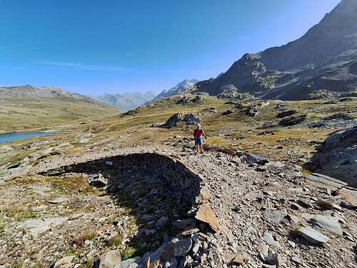
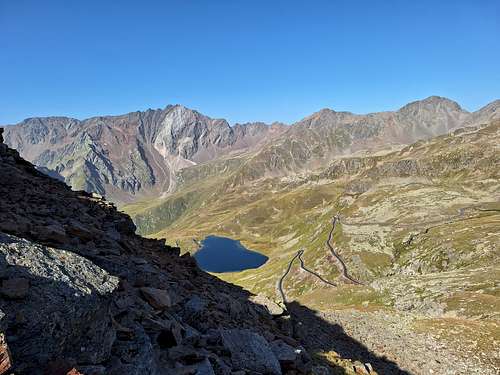
At about 2850 m, turn left, passing some large boulders and a short traverse dug into the rock (cable as a handrail). You pass the last bends of the old mule track, which then disappears and continues on a small path, which crosses the steep detrital slope with slightly exposed passages.
When you reach a saddle upstream of a rocky blade, turn right, climbing along the maximum slope. After a few easy steps, turn left again and, having rounded a ridge, descend briefly into a basin cluttered with boulders; from here the summit cross of Monte Gaviola finally appears.
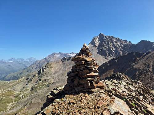
Resuming the ascent, you soon reach a small saddle at 2974m on the north-east buttress of Monte Gaviola, upstream of a hillock surmounted by large cairns.
The path turns right and climbing the large buttress quickly leads to the top.
Descent: following the same itinerary
Red Tape
No permits or fees for climbing are required. The mountain lies in the area of Stelvio Park (National Park Stilfser Joch).
When to Climb
From June to October
Accomodation
Meteo
The weather conditions could be proofed here:
Guidebooks and maps
"Ortles-Cevedale" by Gino Buscaini - Collana Guide dei Monti d'Italia TCI-CAI
TABACCO N. 08 - Ortles-Cevedale 1:25.000
KOMPASS N. 072 - Parco Nazionale dello Stevio 1:50.000