
-
 1059 Hits
-
 81.18% Score
-
 13 Votes
|
|
Mountain/Rock |
|---|---|
|
|
46.44145°N / 10.66997°E |
|
|
Hiking, Trad Climbing, Sport Climbing, Scrambling |
|
|
Summer, Fall |
|
|
9964 ft / 3037 m |
|
|
Overview
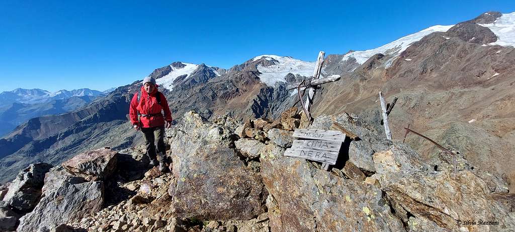
Cima Nera 3037 m
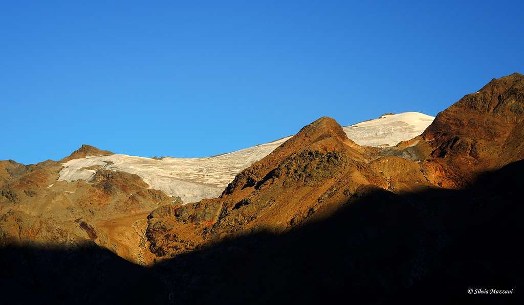
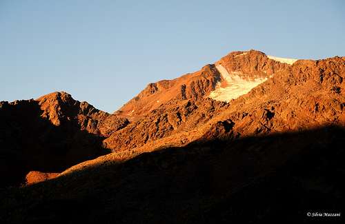
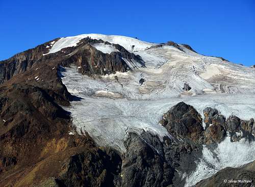
Cima Nera 3037 m is a secondary peak located in the Ortles-Cevedale group, Venezia sub-group, which occupies an absolutely privileged position and enjoys a spectacular panorama of the great glaciers around Vioz, Palon de La Mare and Cevedale mountains. To the North, the Gran Zebrù is also visible, albeit further away. Towards the South West it has a steep wall of compact rock, while on the other sides it is mainly detrital. The mountain is located on the crest that branches off towards the South between the Forcola and the Passo Vedretta Alta. The Venezia subgroup is a dividing ridge between Val Martello, Val di Rabbi and Val di Peio on which don't emerge very significant mountains, but enjoying magnificent views.
The ascent to the summit is quite easy, despite taking place in a magnificent high mountain environment. The ascent route is mainly oriented towards the South and for this reason it tends to clear the snow fairly quickly. It is possible to stay overnight in the Rifugio Larcher, but the ascent can also be done starting directly from the valley floor with an overall height difference of about 1300 metres.
Getting There
From the Autobrennero exit S.Michele Adige and continue towards Cles driving up the Val di Non on the state road n. 43. Continue along the main road ignoring various crossroads and finally go up the Val di Sole. Having reached Dimaro, here we ignore the detour to the left to Madonna di Campiglio and continue along the state road. After Pelizzano we leave the state road that goes up to Passo del Tonale and take the right road to Peio. We briefly go up the Val di Peio up to Cogolo, where we turn right following the signpost to "Malga Mare" and driving up the Valle de la Mare on a narrow and winding road, currently closed near Malga Prabon 1730 m and no longer open to the dam with the small artificial lake near Malga Mare 1972 m.
Normal Route
Cima Nera Normal route report
Summit altitude: 3037 m
Difficulty: hiking and scrambling
Vertical gain: 1300 m from the parking lot near Malga Prabon, 400 meters from the hut.
Starting point: Malga Prabon 1750 m
The route is a marked path, excluding the last stretch to climb the summit pyramid which is an easy scramble marked with cairns
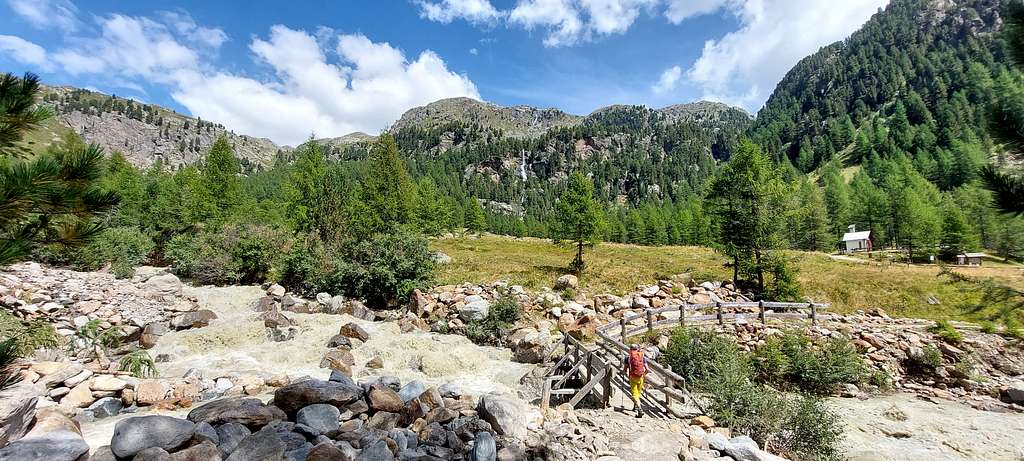
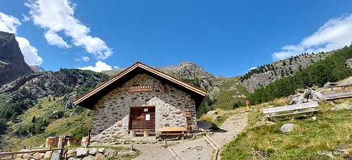
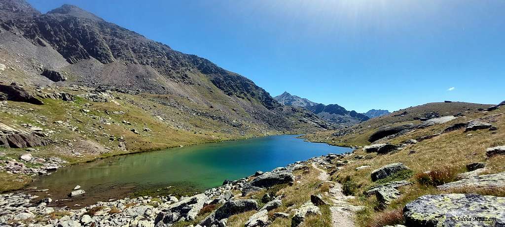
From the car park near Malga Prabon take a mule track that crosses the stream on a wood bridge and goes up the left bank of the stream as far as the dam car park. From here in 10 minutes to Malga Mare 2031 m. Continue along the path n. 102 in a NW direction reaching a signposted crossroads where you keep left and then Pian Venezia, a large flat valley created by the movement of glaciers (observatory hut). The path continues along the right side (left orographic) of the valley. The Rifugio Larcher is already visible and can be reached in about 1.15 hours.
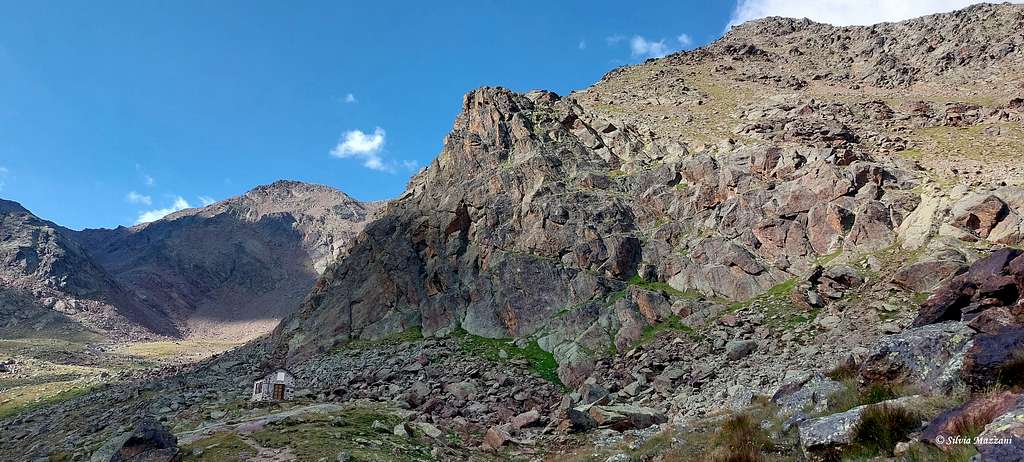
A few tens of meters before arriving at the Refuge Larcher 2608 m, the path n. 104 branches off to the right and takes us towards Lago delle Marmotte 2704 m. Climb up to a long saddle and then descend briefly on the opposite side heading left to skirt Lago delle Marmotte from above without descending.
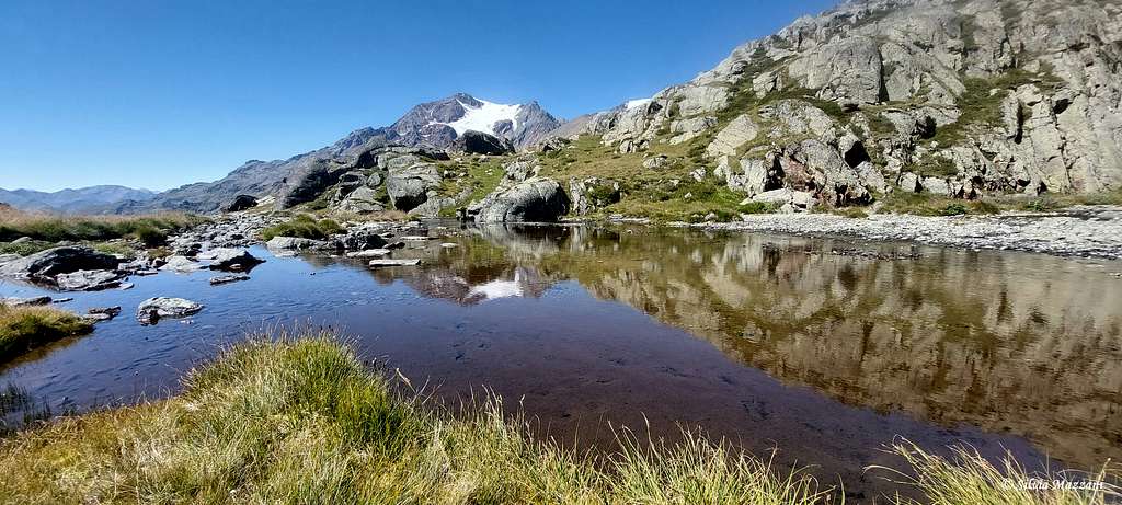
Continue on a military path with some cairns. The ground becomes rocky. Just below the top there is the remains of a trench from the WWI. From the top where it's situated a small wooden cross there is a magnificent panorama towards the West with Vioz 3644m, Palon de La Mare 3703m, Monte Rosole 3536m, Cevedale 3769m and Gran Zebrù 3851m, Cima delle Marmotte and Cima Venezia, the Lago Marmotte and the Lago Lungo.
Descent: you can reverse the same itinerary, but the best advise is to follow the Sentiero dei Laghi, skirting the Lago Lungo and joining the ascent route near Pian Venezia.
Red Tape
No permits or fees for climbing are required. The mountain lies in the area of Stelvio Park (National Park Stilfser Joch).
No particular restrictions in hiking and climbing inside this area. Respect the general rules regarding the National parks. The whole fauna and flora is protected. Don’t disturb fauna and other mountaineers and hikers’ peacefulness with every kind of noise.

Official site of the Stelvio National Park
When to Climb
From June to October
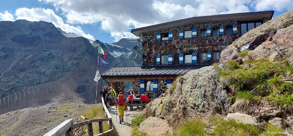
Hut
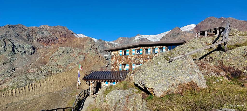
Rifugio Larcher al Cevedale S.A.T. 2607 m
Situation: high Val Venezia
Open: from June 13th to September 20th
Guardian: Fam. Casanova
Refuge's phone: +390463751770 - Mob. +393286529615
The Refuge Larcher al Cevedale is located in Val Venezia, in front of the Vedretta de la Mare, the Cevedale, Zufall Spitze, Palon de la Mare and Viòz. The refuge, built for the first time in 1882, bears the name of the famous senator Guido Larcher. The landscape background is that of the Stelvio National Park with its characteristic flora and fauna typical of an uncontaminated high mountain environment. Over the years the Refuge has been modernized several times. It is also open from March to April for the ski mountaineering season.
Meteo
The weather conditions could be proofed here:
Guidebooks and maps

"Ortles-Cevedale" by Gino Buscaini - Collana Guide dei Monti d'Italia TCI-CAI
Kompass: Nr 72, Ortler/Ortles-Cevedale, 1:50.000
Kompass: Nr 636, Ortler/Ortles-Stilfser Joch/Passo dello Stelvio, 1:25.000
Tabacco: Nr 08, Gruppo Ortles - Cevedale/Ortlergruppe, 1:25.000