We Have Some History
My nephew has joked for some time that Mount Alice is my Eleanor.
We do have a bit of a history, and since I’ve written all of it before in other Trip Reports, I’ll keep this rehash of it brief! 2006 stumbled onto the slopes of Alice on my first ever off trail hike. Wasn’t even considering summiting, and the weather ensured we wouldn’t. 2007 wussed out at the base of Hourglass Ridge. 2014 turned around just before reaching the Alice/Chiefs Head saddle due to my nephew’s altitude sickness. Maybe I’m just not supposed to summit Alice!
I had no plans for trying for Alice again in 2015 but when my son’s travel plans were taking him to Denver the last weekend in August he suggested RMNP for our annual hiking trip, and since I was coming back I figured I’d give Alice another whack.
My Wild and Empty Basin
I love Wild Basin! For a number of reasons, I love Wild Basin. I suppose some of it is sentimental. Ever since I started making my annual trips out west, I’ve had some of my most memorable adventures in Wild Basin. In 2005 my first big hike in the park was to Bluebird Lake. In 2006 it was that fateful first off trail hike to Boulder-Grand Pass. In 2007 there was the summit of Isolation Peak – and the subsequent getting lost in the woods below Box Lake on our descent, and then the failed attempt on Alice later that week.
Of course I love the scenery of Wild Basin. Between all the lakes and all the peaks, the scenery is some of my favorite in all of Colorado.
And I love Wild Basin because it is empty. At least by National Park standards, Wild Basin just doesn’t see a lot of traffic. Maybe it’s the long approaches? Maybe it’s all that walking in the woods? Whatever the reason, getting a few miles past the trailhead on a weekday ensures some solitude. I’ve gone an entire day in Wild Basin without seeing another person. I would be well down the mountain on this day before I saw another person. Yes, I love my wild and empty basin!
Lions or Thunder
There was never any doubt in my mind that I would be making a loop on this summit day. Up until a few weeks before the trip I just assumed I would head up Alice via Hourglass Ridge. I suppose some of this was ego! After wussing out at the base of the ridge in 2007 I felt I had something to prove to myself.
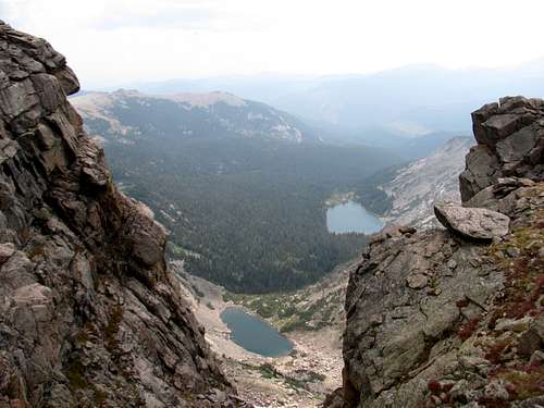
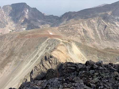
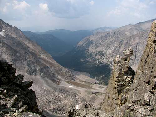
![North Face of Mount Alice]() I got this view of Alice's Hourglass Ridge Route on Monday from the summit of Longs
I got this view of Alice's Hourglass Ridge Route on Monday from the summit of Longs
Fortunately some sensibility came over me a few weeks prior and I started considering going up via Boulder-Grand Pass and then descend the Hourglass. From a scenery standpoint this just made more sense. I had only been out to Thunder Lake one time, back in 2006, and on that day the clouds were thick and low so I missed what is rumored to be some stellar scenery. Besides, I had made the approach via the Lion Lakes twice now. It was time for a change in scenery. I wouldn’t be disappointed in this decision!
I left Alice for the end of the week, giving myself a two day window of Thursday or Friday. Thursday ended up not even remotely being a realistic option. By Thursday my legs were tired, and my ankles were really swollen from the adventures on the previous four days on the trail, which were all good days and included hitting Ida, Longs, Otis, and then Sky Pond on Wednesday. I had to have a recovery day on Thursday and used it to drive my son and his friend to Longmont where they were meeting up with some friends to get their DMB concert weekend party started. I had a couple of beers with them at Oskar Blues and then headed back to Estes Park solo to get ready for Alice on Friday.
I originally planned to hit the trailhead at 4 AM. At 17 to 18 miles, and 4800 feet of elevation gain, Alice guarantees a long day, so the early start is a necessity. I ultimately decided on a 5 AM start. Since I would be hiking alone I decided I didn’t want to hike solo via headlamp for too long of a time. Hey, I can lose a trail in broad daylight, let alone in the dark, so I went for the 5 AM start.
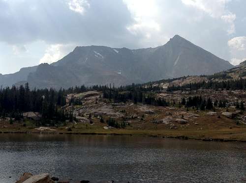
![Copeland Mountain]() Copeland Mountain
Copeland Mountain
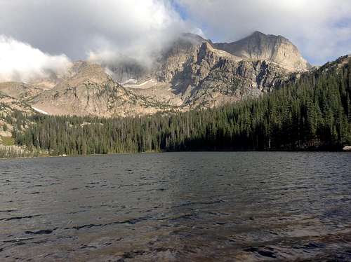
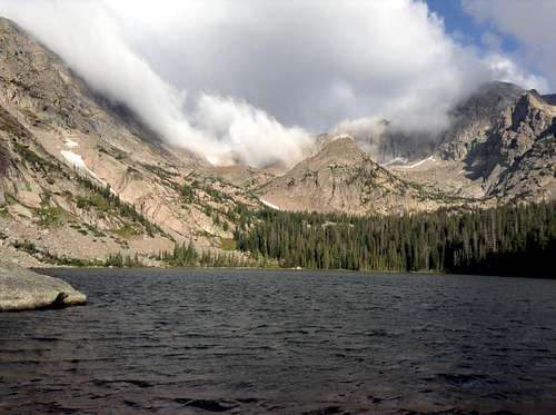
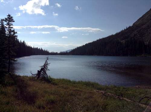
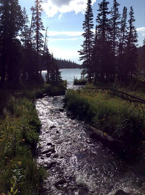
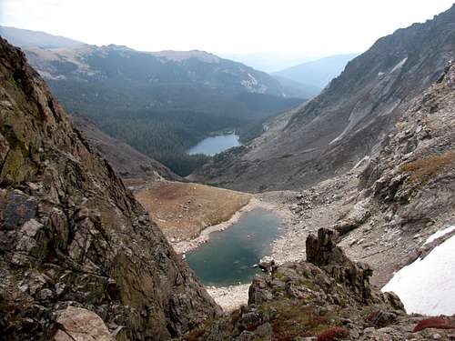
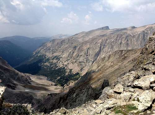
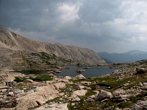
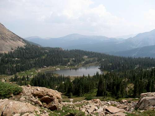
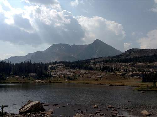
The six plus mile hike in the woods to Thunder Lake was uneventful. The weather appeared to be cooperating as well. Although when I reached the lake I wasn’t so sure about that. There were blue skies behind me, but there were plenty of clouds over Tanima Peak, Boulder-Grand Pass and Alice as well.
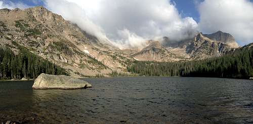
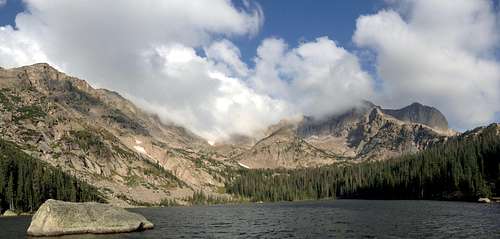
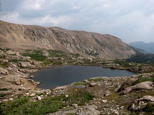
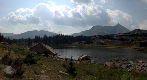
![Thunder Lake]() Thunder Lake Panorama
Thunder Lake Panorama
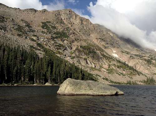
I stopped at Thunder Lake for quite a while, mostly just to soak in the scenery. The rumors were definitely true. Thunder Lake is a gem! While I would have preferred blue skies, the clouds did add a certain ambience to the scene.
![Thunder Lake]() Mount Alice
Mount Alice ![Thunder Lake]() Boulder-Grand Pass
Boulder-Grand Pass ![Tanima Peak]() Tanima Peak
Tanima Peak
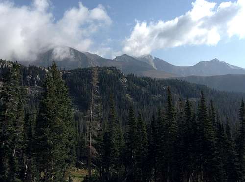
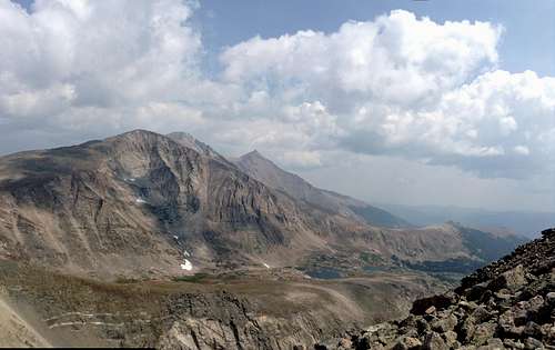
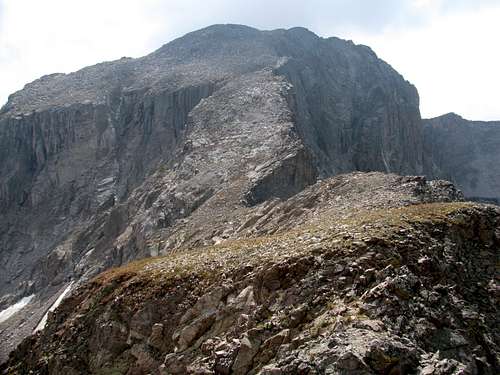
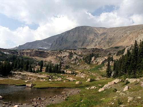
I made my way around the lake to the unmaintained trail that leads to Boulder-Grand Pass. I was loving the scenery on the hike to the pass! In 2006 this was completely clouded over, but today I was graced with the amazing view towards Chiefs Head, Longs and Meeker. It was a view I would take in for a good portion of the day. I was very glad I made the decision to ascend via Thunder Lake!
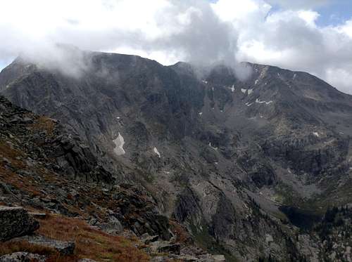
![Views on the hike to Boulder-Grand Pass]() Chiefs Head, Pagoda, Longs and Meeker
Chiefs Head, Pagoda, Longs and Meeker
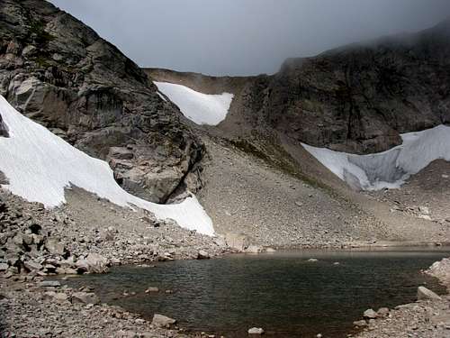
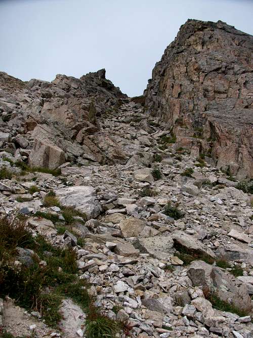
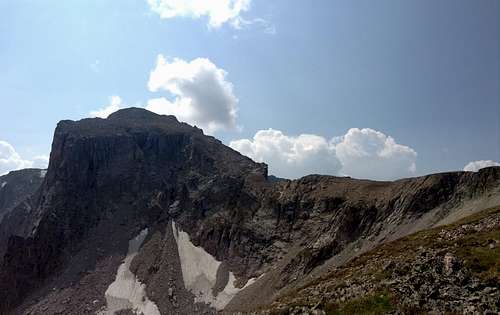
When I got to Lake of Many Winds I got my first good look at the ascent gully that takes you to Boulder-Grand Pass. It seemed steeper than it did back in 2006! And as for the ascent, this is a scree infested pain in the ass! As much as I could I stayed close to the wall on the right. There were plenty of good holds to use that kept me off the scree for quite a bit of the ascent.
![Lake of Many Winds]() Lake of Many Winds
Lake of Many Winds ![Boulder-Grand Pass]() Lake of Many Winds and Thunder Lake
Lake of Many Winds and Thunder Lake Boulder-Grand Pass: Eleanor Rears Her Ugly Head
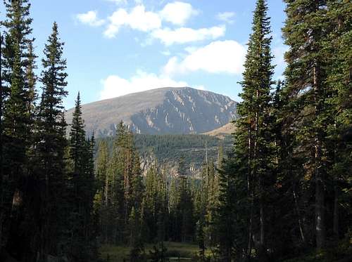
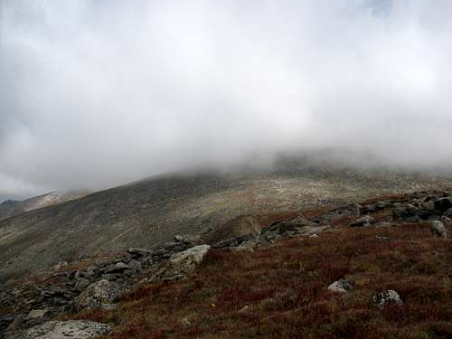
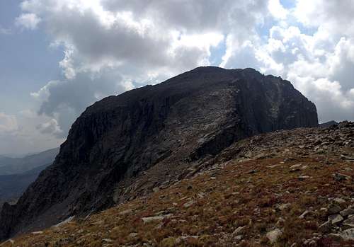
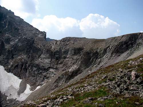
![A Lovely Day on Alice]() Mount Alice is up there somewhere!
Mount Alice is up there somewhere!
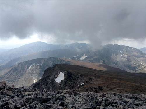
When I reached the pass I was not encouraged by the weather. The clouds were thicker and lower and they looked ugly. I couldn’t even see up the slopes of Alice! I was pretty sure Eleanor was going to win the day again. I was in no hurry to turn around though. After coming this far I was going to at least cross the pass and take in the views of the East Inlet Lakes. Fortunately, it’s a pretty fair walk across the pass to get a good viewing spot, so I had plenty of time to consider whether or not I was going to try and summit. Before I even reached the other side I decided I would turn back and leave Alice for another day. I was amazed at how willingly I came to this decision. I think I even chuckled a bit. With all the luck I had on Alice in years past maybe it was almost expected. I shook my head and laughed it off and took in the wonderful view of the lakes, the East Inlet and of Isolation Peak.
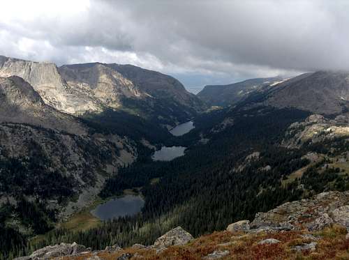
![East Inlet Lakes]() East Inlet Lakes
East Inlet Lakes ![Isolation Peak]() Isolation Peak
Isolation Peak
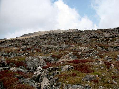
I also did some reevaluation on the weather at this time. Yeah, the weather didn’t look great, but it reminded me of some weather I had been in on previous trips to Colorado. There was no electricity in the air, and the clouds weren’t building. And things still looked clear on the east side of the pass. Based on my observations I made the decision to go for the summit. Regardless of whether or not my analysis on the weather was technically accurate, or complete non-sense, in the end it would end up being a non-issue. The clouds actually lifted as I hiked up, and the skies cleared up a bit.
A Beautiful Walk in the Park
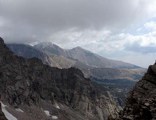
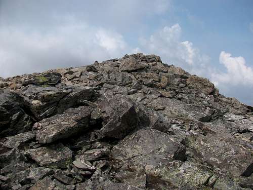
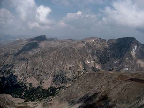
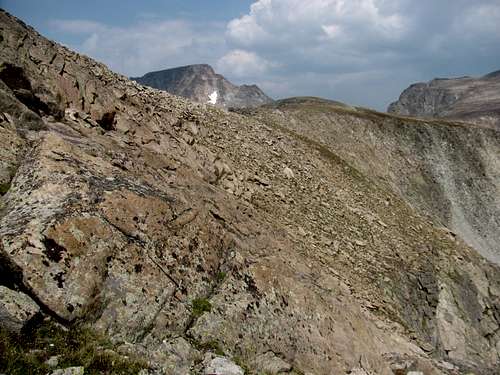
I stayed close to the cliffs on the ascent. There were plenty of great views to be had, down towards Falcon and Thunder Lakes, as well as towards Chiefs Head and Longs. After a few false summits, the summit proper finally came into view, with the summit cairn in obvious view, and I tagged the summit at 12:30 PM.
![Longs and Meeker]() Longs and Meeker
Longs and Meeker ![Falcon and Thunder Lakes]() Falcon Lake and Thunder Lake
Falcon Lake and Thunder Lake![Tanima Peak]() Tanima Peak and Boulder-Grand Pass
Tanima Peak and Boulder-Grand Pass![The Slopes of Mount Alice]() One of a few false summits
One of a few false summits ![Chiefs Head, Longs and Meeker]() Chiefs Head, Longs and Meeker
Chiefs Head, Longs and Meeker
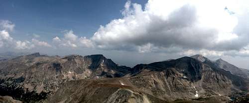
I stayed on the summit for close to a half hour soaking in the scenery and getting plenty of pictures and video. The views in all directions were amazing!
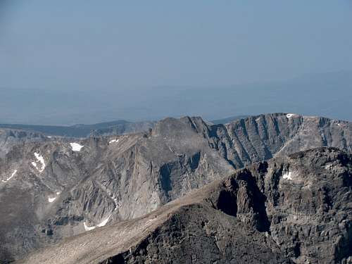
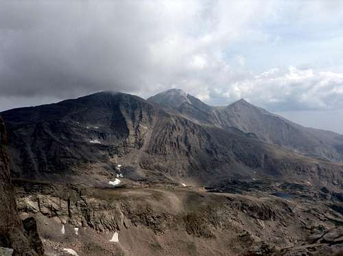
![Mount Alice Summit View]() Summit Panorama
Summit Panorama ![Continental Divide]() Continental Divide with Taylor to the left and McHenrys to the right
Continental Divide with Taylor to the left and McHenrys to the right ![Hourglass Ridge]() Hourglass Ridge
Hourglass Ridge![Boulder-Grand Pass]() Boulder-Grand Pass
Boulder-Grand Pass ![The South Ridge of Chiefs Head]() Chiefs Head, Longs and Meeker
Chiefs Head, Longs and Meeker
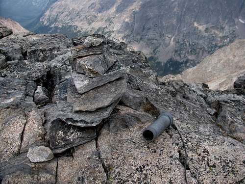
There was a canister for a summit register, and a broken pen, but no register or paper. Normally I don’t sign registers, but in this case I wanted to and write “with Rob Wood and David Didier in spirit”. Rob had been with me on all of my previous attempts on Alice and Dave was there last year. I thought of both of them quite a bit this day.
I did break one of my rules and powered up my phone and texted my wife. She doesn’t love when I go hiking solo so I promised her I’d send a text when I summited. She also wanted to have some clue as to when I was going to be down, so I wrote in the text that I expected it to take me six hours to get down. My ankle was pretty tender at this point so I knew that I would be descending at a pretty leisurely pace.
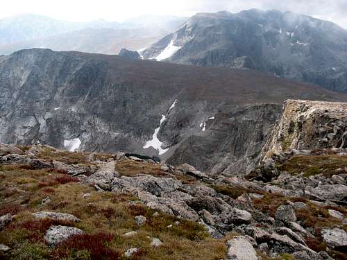
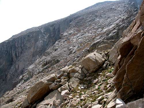
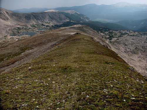
The descent down the ridge to the base of the Hourglass seemed to take forever. I guess it was actually a lot farther than I expected. From the pictures it looks like the descent could be exposed as there are shear drop offs up high. I never felt the exposure! Maybe it was the solid talus? I just never felt like I was close to a cliff.
![Slopes of Hourglass Ridge]() North Face of Alice
North Face of Alice ![Slopes of Hourglass Ridge]() North Face of Alice and Hourglass Ridge
North Face of Alice and Hourglass Ridge ![Hourglass Ridge]() Hourglass Ridge
Hourglass Ridge![Continental Divide]() Continental Divide
Continental Divide
As for crossing the Hourglass, I don’t know if it makes more sense to stay up on top of the ridge the entire time or not. I went a little low and this did put me closer to some of the drop-offs than if I would have just stayed up high.
Once to the Alice/Chiefs Head saddle I stopped again to get plenty of pictures and then started the descent towards Snowbank Lake and the Lion Lakes.
![Hourglass Ridge]() Hourglass Ridge and the North Face of Mount Alice
Hourglass Ridge and the North Face of Mount Alice![Hourglass Ridge]() Hourglass Ridge
Hourglass Ridge ![Descent Ridge]() Descending Ridge
Descending Ridge ![Snowbank Lake]() Snowbank Lake
Snowbank Lake![Snowbank Lake]() Snowbank Lake
Snowbank Lake ![Snowbank Lake]() Snowbank Lake
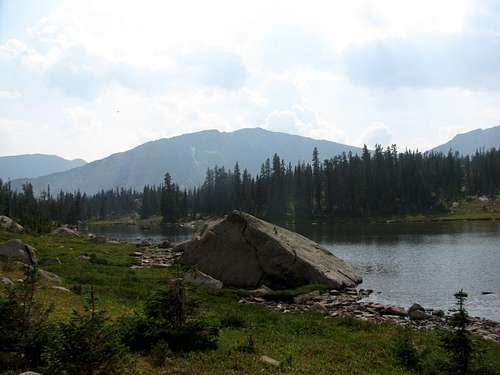
Snowbank Lake ![Lion Lake no. 2]() Lion Lake No. 2
Lion Lake No. 2![Lion Lake no. 1]() Lion Lake No. 1
Lion Lake No. 1
When I reached Lion Lake No. 1 I finally saw a couple of backpackers, the first people I had seen all day, nearly 12 hours into the day. They were resting on some big rocks by the lake, and looked like they were enjoying their solitude, so I stayed up on the trail to snap my pictures. I don’t think they saw me going by!
![Chiefs Head]() Chiefs Head from Lion Lake No. 1
Chiefs Head from Lion Lake No. 1![Tanima Peak]() Tanima Peak from Lion Lake No. 1
Tanima Peak from Lion Lake No. 1 ![Tanima Peak and Mount Alice]() Tanima and Alice Panorama
Tanima and Alice Panorama
I would see one other couple on the Lion Lakes Trail. Once I reached the junction with the Thunder Lake Trail I did start to see a few groups of backpackers heading out to Thunder Lake for the weekend. Honestly, if it wasn’t a Friday afternoon, I think the odds would have been pretty good that I wouldn’t have seen anyone all day.
Once back to the trailhead I pointed the car towards the Olive Ridge campground.
Bill Reed and his wife Linda were camping there and Bill and I had made arrangements to meet there after I finished on Alice. It was great to finally meet Bill. We had talked and texted a number of times over the past couple of years and it finally worked out to meet. We shared a few beers and a few stories before I headed back to Estes Park. I would have like to have stayed around longer but I was unfortunately in a bit of a hurry to get back to some cell coverage. It was already after the time that I promised my wife I would call, and after my late evening shenanigans coming down Otis Peak on Tuesday, I knew I owed her a call sooner than later. I stopped in Estes Park for a beer and some BBQ before heading back to camp at Glacier Basin.
Bagging Alice was the perfect ending for what had been another wonderful week in RMNP. I'm glad it worked out finally, because now I can start focusing on some other Wild Basin peaks that I have put on the backburner.


Comments
Post a Comment