|
|
Mountain/Rock |
|---|---|
|
|
38.41940°N / 112.4119°W |
|
|
12137 ft / 3699 m |
|
|
Overview
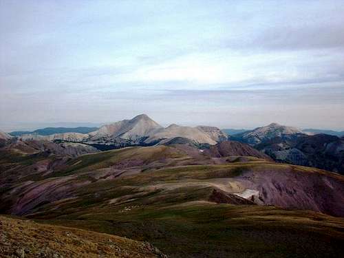
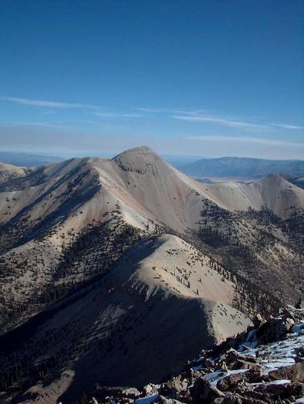
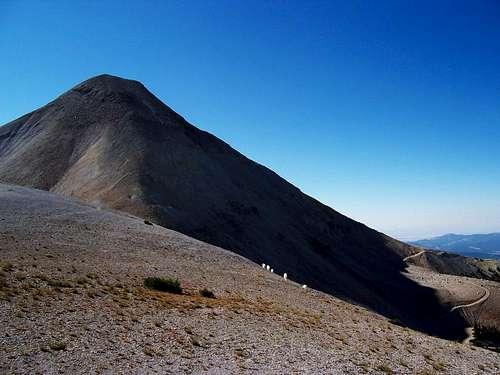
Belknap is within the Tushar mountains and located east of Beaver, Utah and West of Marysvale, Utah and about 190 miles south of Salt Lake City. This entire mountain range is composed of volcanic rock dating back some 23 million years. Mining has also played a large part in the ability to access the peak easily. Though Delano (highest peak in the Tushar’s) is about 10 meters higher, Belknap is much more challenging, and probably the most impressive peak in the Tushars.Belknap was also used as a Heliograph Station and ruins of the surveyors huts are still very present just west of the summit.
Utah's 12,000+ Foot Peaks With 200+ Feet Prominence
Utah's 12,000+ Foot Peaks With 300+ Feet Prominence
Getting There
BeaverFrom I-15 take Exit 112 and head east and south into the town of Beaver 1.5 miles to state route 153 (Elk Meadows signage). Take left and follow for 16 miles, turn left onto dirt road (Big John Flats). Follow dirt road for 9.9 miles and a sharp switchback to the right. Plenty of parking for about four cars. A bit of trivia: #1) At just over 11,500 feet, this is the highest road in Utah. #2) Butch Cassidy, famous outlaw was born in Beaver.
Marysvale
From the intersection on Route 89 and bullion Ave head east .60 miles to Beaver Creek road. Turn right onto Beaver Creek road and follow for about 14.5 miles to a sharp switchback to the left. Plenty of parking for about four cars.
I-70
From I-70 take exit 17, get on the north side of I-70 and follow dirt road (Kimberly Road) southwest while paralleling I-70 and than crossing under it while now driving in a southerly direction for about 13.5 miles to an intersection with Beaver Creek road. Turn right onto Beaver Creek Road and follow for about 5.25 miles to a sharp switchback to the left. Plenty of parking for about four cars.
Routes Overview
By far the most popular route is via the Southeast Ridge. This is also the shortest route and takes only a few hours. A variation of this route is from the pass at elevation 10,973.There is another route in from Blue Lake. This route is longer and much less used, but makes a nice loop with Baldy Peak. I will be adding it when time is available.
Red Tape
No red tape, there are a few gates in using the Beaver (Big John Flats) approach that could be closed during winter months.When To Climb
Summer and Fall are the easiest times since Beaver Creek Road is open. In winter, the road may be plowed to the old Elk Meadows Ski Resort, and no farther. In winter, climbing Mount Belknap is a 3-4 day affair.Camping
CamgroundsMohagany Flat Campground is at Puffer Lake and is the closest campground to the trailhead.
Primitive Camping
There are plenty of camping areas throughout the Big John Flats area.
Mountain Conditions
TUSHAR MOUNTAINS WEATHER FORECASTBelow is the climate summary for nearby Elk Meadows at 10,450 feet elevation, and near the trailheads. These are all averages, so expect more variation, but this will give you a good idea about the climate at higher elevations in the area. *National Weather Service Data.
| MONTH | HIGH | LOW | PRECIP (in) | SNOWFALL (in) |
| JAN | 26 | 1 | 5.51 | 69.9 |
| FEB | 29 | 4 | 4.31 | 61.5 |
| MAR | 34 | 7 | 4.55 | 64.9 |
| APR | 43 | 14 | 3.88 | 45.7 |
| MAY | 52 | 21 | 3.65 | 23.6 |
| JUN | 63 | 30 | 1.19 | 3.0 |
| JUL | 69 | 38 | 2.38 | 0 |
| AUG | 67 | 36 | 2.92 | 0 |
| SEP | 61 | 28 | 2.11 | 4.8 |
| OCT | 50 | 19 | 1.73 | 17.6 |
| NOV | 36 | 9 | 2.57 | 35.2 |
| DEC | 27 | 3 | 3.66 | 48.8 |


