
-
 20366 Hits
-
 84.9% Score
-
 20 Votes
|
|
Mountain/Rock |
|---|---|
|
|
35.69000°N / 117.987°W |
|
|
Kern |
|
|
Hiking |
|
|
Spring, Summer, Fall, Winter |
|
|
7215 ft / 2199 m |
|
|
Overview
 A sunrise view of Morris Peak from Indian Wells Canyon. A cross country route leads up to the prominent saddle, then follows a use trail to the top. The south ridge of Mount Jenkins leads up the right skyline.
Morris Peak is the first named peak that you encounter on the Sierra Crest north of historic Walker Pass. It is an easy half-day walk from Highway 178. The trail passes through low grassland and scrub into lovely Pinon Pine forest. Scenic Views of the Indian Wells Valley and the Lake Isabella watershed are to be had the entire way. There is a decent amount of shade in the middle part of the trail, making this an acceptable route on warm days. Morris Peak offers much the same view as its higher neighbors Mount Jenkins and Owens Peak, but is accessed by a much better trail.
The origin of the peak's name is unknown. The Sierra Club has done considerable reasearch, but no definitive answer is available. It seems likely that the peak was named for an early miner, rancher or surveyor, but no records of a Morris have been found. The name first turned up in surveyors field notes in 1926, and on maps in 1940.
An ascent of Morris Peak is often combined with one or more neighboring peaks. Adding Mount Jenkins to the outing will involve a couple more hours of walking and scrambling. A tour of Morris, Jenkins, and Owens from Walker Pass will be a full day's walk of at least 17 miles. Bob Burd's trip report contains some good info for anyone wishing to climb Morris or the others via the PCT.
Getting There
If you are coming from Southern California, make your way to Highway 14. Travel north on Hwy 14 until reaching Highway 178, shortly before the turn-off for the town of Ridgecrest. Turn left (west) on 178 and go about 10 miles until reaching Walker Pass. From points north (but still on the eastern side of the Sierra) find your way to Highway 395 and head south until the 395/14 split. Take the 14 a few miles south to Hwy 178 and head west.From the Central Valley take Hwy 178 out of Bakersfield and drive east, passing Lake Isabella, until you get to Walker Pass (or Hwy 14, if you are heading for the Indian Wells Canyon TH). If you are coming down the 99 Fwy you can cut over on Hwy 155 in Delano. This will take you to Lake Isabella. From Lake Isabella, take 178 as described above.
For the Indian Wells Canyon TH, head north on Hwy 14 from the 14/178 intersection a few more miles until reaching a dirt road just past the Indian Wells Brewery. The driving gets involved from here. See the route section for more information.
Routes
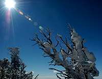
 A little fresh snow along the PCT on the way to Morris Peak. Mount Jenkins in the background at left.
The most straightforward access is via the PCT from Walker Pass. The trailhead is not well-marked. Look for a dirt road paralleling the highway for about 100 yards on the north side of the pass, opposite the monument marking the pass. There is a BLM sign up on the hill at the start of the trail. The sign does not identify the trail as the PCT, though trail markers along the way do. There aren't any other trails in the vicinity, so if you find a good trail leading north and east from the pass, you've found it.
Follow the PCT approximately 4 miles to a saddle just west of the summit. Follow a use trail that climbs steeply up the south slope directly to the summit area. There are two rocky points on top, the true summit is the eastern one. The summit register is there.
9 miles R/T, 2,000' gain.
There is another reasonable route starting from Indian Wells Canyon. This route follows abandoned roads, then trail to the saddle north of the peak. See the Sierra Club's route description for detailed driving and hiking directions. This route is much shorter (4 miles R/T), but gains more elevation (2,400') and involves mostly cross-country travel. If you wear your running shoes you can probably do the Walker Pass route in less time.
Red Tape
Motorized and mechanized vehicles are prohibited within the wilderness area. Bummer, no mountain bikes. The wilderness area boundaries are complex, but you can assume a setback of 30' from the centerline of dirt roads, and 300' from paved highways. Please be kind to the desert (and avoid getting a ticket!) by keeping your vehicle within these limits, and use only existing roads and car-camp sites.
For more information you can contact:
|
Bureau of Land Management Bakersfield Field Office 3801 Pegasus Drive Bakersfield, CA 93308 (661) 391-6000 |
Bureau of Land Management Ridgecrest Field Office 300 S. Richmond Road Ridgecrest, CA 93555 (760) 384-5400 |
Camping
Camping is available at the Walker Pass Campground operated by the BLM. It is a small CG, but it has water. No fees or reservations. Camping is allowed pretty much anywhere on BLM land. There are several good places in Indian Wells Canyon, but bring your own water.Mountain Conditions
Morris Peak is high enough to get occasional snow in the winter, but low enough for it to melt away fairly quickly. It will be quite hot in the summer time, and there is no water. I found 2 liters sufficient for a hike up the PCT route in March. Add or subtract from this according to your own patterns and time of year.For weather info use your favorite on-line forecast service. Conditions for Lake Isabella should be a good indicator for this peak. Just subtract a few degrees for elevation, and assume that it will be windier. The BLM rangers are spread thin in this area. Don't count on them knowing what conditions are like. You probably won't see one anyway.