11.23.11 - An Offer on Stansbury Island
Upon moving to Utah I interviewed thrice for an analyst position at a small logistics company, and as Thanksgiving Weekend approached I was on the verge of getting the offer. I had hoped to have everything wrapped up so I could maybe take one final little road trip somewhere before returning to the world of gainful employment, but as it turned out, it was the Wednesday before the Holiday and I was still waiting to hear back.
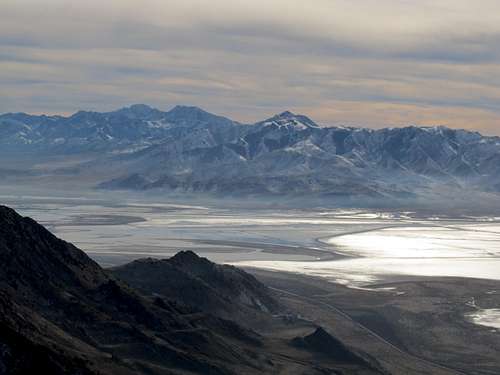
So big plans devolved into smaller ones, and my agenda was to set forth into the West Desert of Utah and climb Graham Peak above the Bonneville Salt Flats. That morning, however, I got a call from my recruiter telling me to hang tight; the offer letter was on the way, and if I could sign it and get it back over before the Holiday, well, that’d be just great.
The next alternative then was the Stansbury Island Highpoint. I figured i
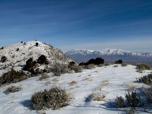
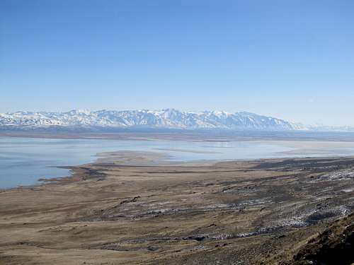
t would make for an easy jaunt, just miles outside of the city, and I’d be back by the early afternoon to take care of any business. I drove out along I-80, found the parking spot without a hitch, and based on the info here on SP and Eric Willhite’s webpage started up a steep slope walking besides the fence that marked private property.
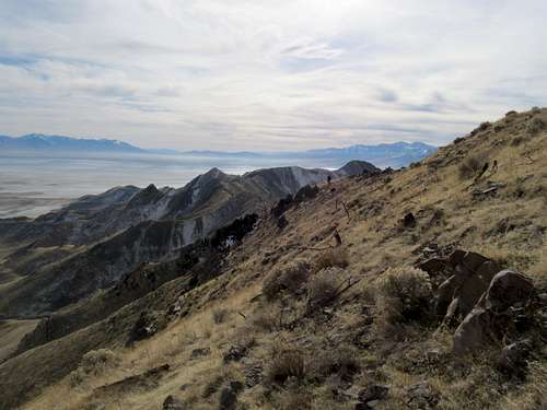
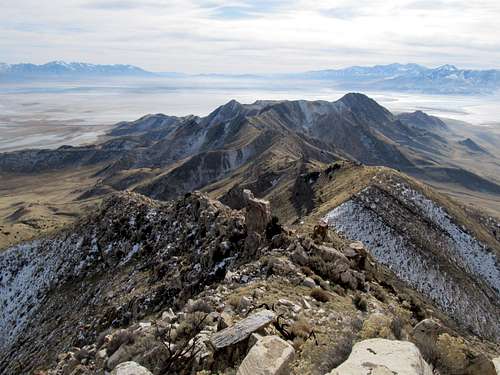
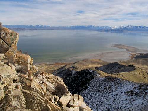
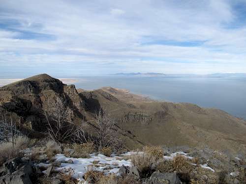
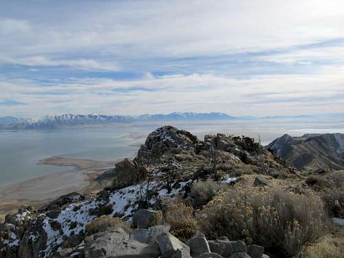
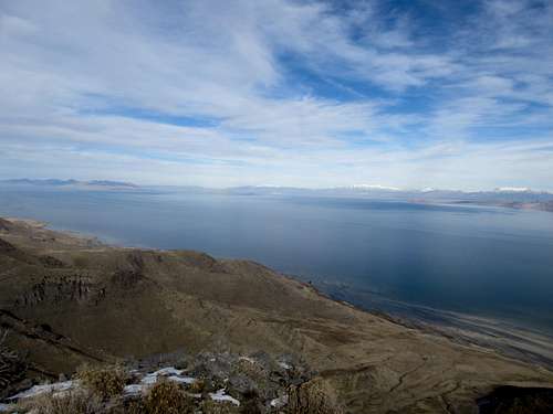
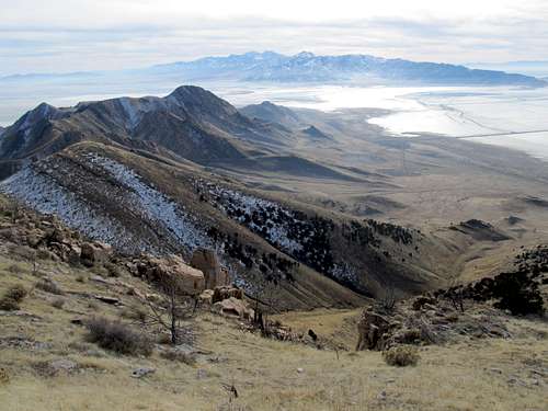
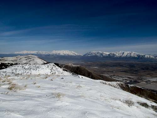
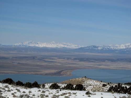
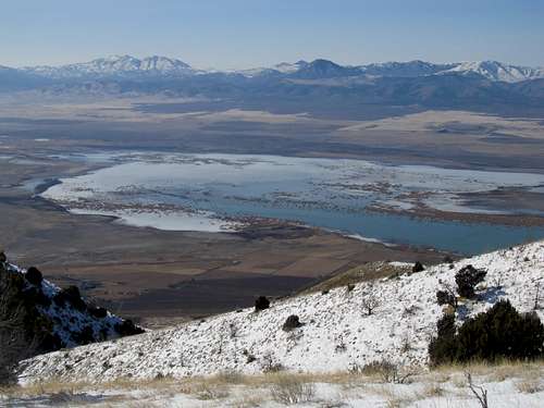
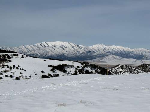
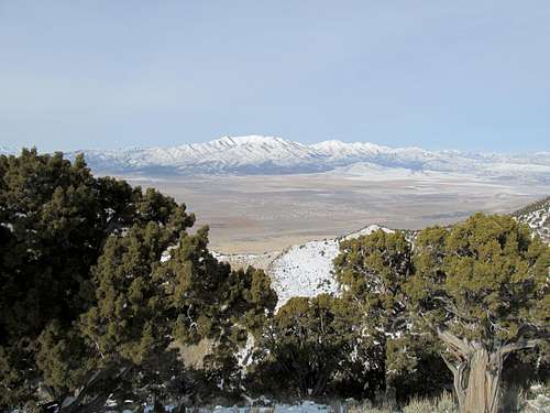
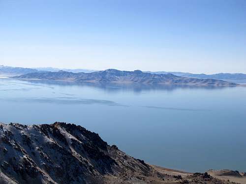
Upon reaching the Bonneville shoreline I decided that I was past the property boundary, and started heading north. It was a pleasant stroll for a bit as the shoreline winded back and forth along the west side of the range. But as the shoreline starting dithering in and out of ravines, curving up and down and back up, I began to get impatient. I started up the slope immediate south of the main notch before Castle Rock, and huffed and puffed my way up the ridge, gaining it slightly before the main saddle. The Wasatch and Oquirrhs appeared before me and blew me away with their views.
I had gotten a call from my recruiter as I was driving down I-80. Now, as I worked my way up the rocky saddle, I got another call. The offer letter had just been emailed; could I sign it? I explained I was outside the city, but once down the mountain I would try to get it back as soon as possible.
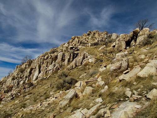
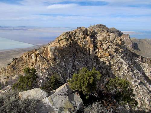
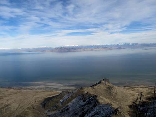
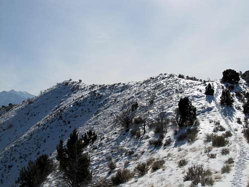
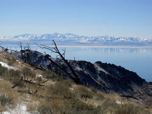
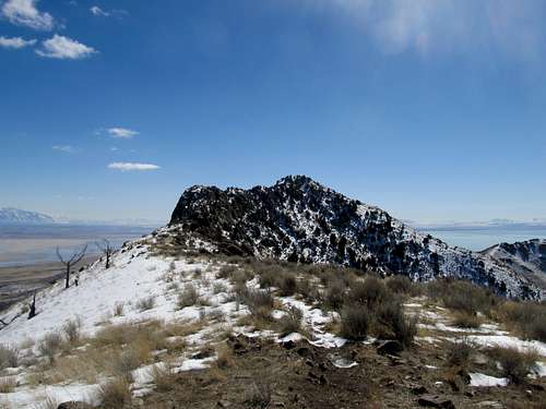
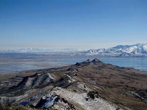
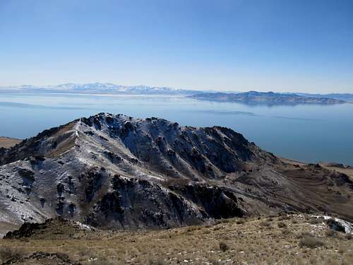
Now I was in a rush, but the sense of urgency seemed to couple itself immediately with a lack of progress on the mountain. The ridge was slower going than I had hoped, with rocky steps, and I found myself wasting time picking back and forth to find the easiest terrain on either side of the ridge. Slope after slope I worked my way up, chiding myself for getting my ass handed to me by such a minor summit. The final stretch before Castle Rock was a relief; some light scrambling, and I was on top, with the main highpoint seemingly only a hundred yards away.
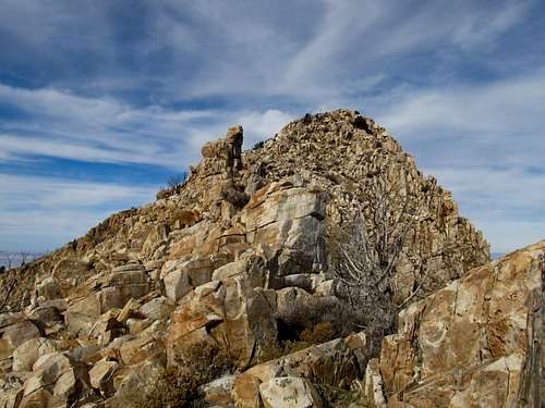
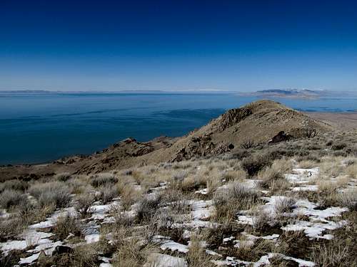
Of course, between us lay several large gendarmes and rock faces. The advised route was to descend about 200 feet, then ascend easier terrain to the true highpoint. Of course, being the lazy bum that I am, along with the added job offer urgency, I had only descended around twenty to thirty feet when I looked at the rocks and said, hey, this doesn’t look too bad. I kept thinking there was an easy way around, but as I scampered up and down chimneys, retreated after false starts and cliff-outs, I was realizing that had I made the full descent I’d be been up and then back down, jaunting towards employment.
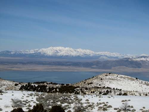
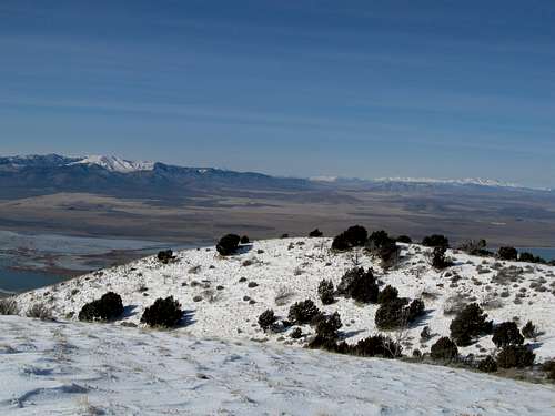
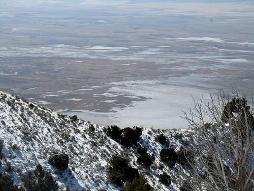
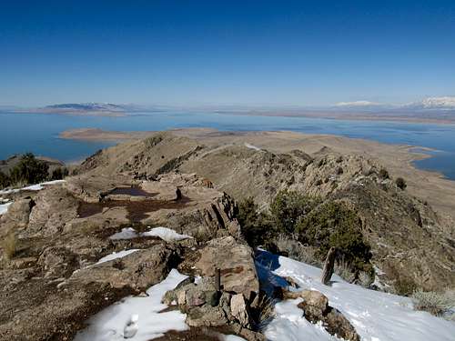
It had been sunny all day, but I found the only cold spot in sight as I rounded a rock traverse, struggling mightily to find a good handhold as the only support my feet could find was some sketchy brush hanging off the cliff face. It was scary, but I made it across, and found myself in this hidden, shaded, and brushy cove on the east side of the range, surrounded on all sides by rocks and boulders. I encountered the first snow of the day: deep, slushy, and untouched. It made the last part of the ascent a pain, but soon I stood atop Stansbury Island.
I took pictures, grabbed a snack, and checked my gmail; sure enough there was the letter. Having dallied around enough, I raced back down the mountain to find a FedEx Kinko’s before they closed for the Holiday.
01.28.12 - Out to West Mountain
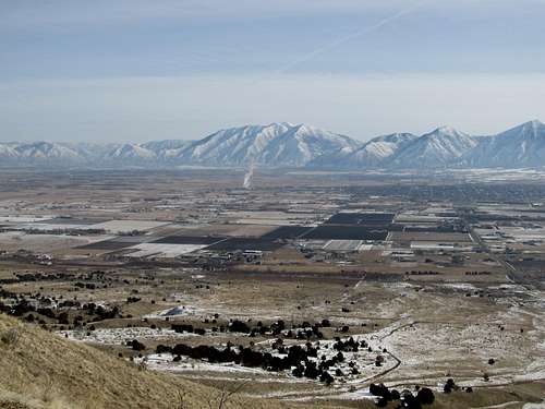
The last weekend of January featured good weather and a lack of NFL Playoff games on TV. This is always a good combination for me to get outdoors, and I set my sights on a few prominence peaks near Provo. First up on Saturday was West Peak, outside the town of Payson sitting on the Southeastern corner of Utah Lake. I drove past the town dump and arrived at the trailhead maybe an hour before noon, and started up the steep ATV slope. Even up close the mountain did not look too imposing, but the slope was steep and the road was slick with the slippery Utah mud that gave you little traction except when it cakes onto your boots.
Behind and below me the gun enthusiasts were out in full force, shooting at targets and such. I heard a few shots whizz close by towards my direction and hoped that me, and my bright yellow backpack, wasn’t too enticing of a target.
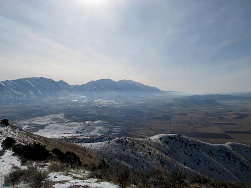
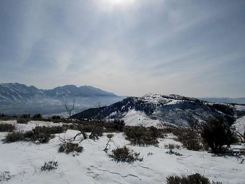
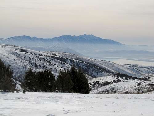
The mud ended and the snow began as I crested a small false summit. Here, the ridge traverse to the top of West Mountain appeared before me. I walked along the narrow ridge in perfect, delightful snow, while taking pictures of Nebo and Timp.
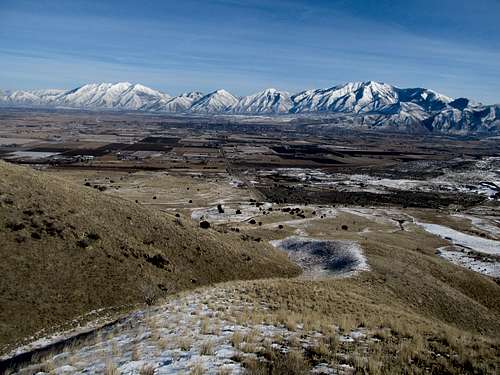
The last steep stretch went quicker than I thought, and I found myself atop another false summit. Right up ahead was the true highpoint, marked by a small triangulation station. I traversed over quickly and enjoyed the relatively mild January weather. The views of the Southern Wasatch were great, and I wondered about Lake Mountain, on the other side of Utah Lake.
I continued north along the ridge unsure of my destination. The towers and facilities on the north summit seemed like an enticing target, but I wasn’t sure if I felt like making it that far. I wandered down the summit slope, into a wooded area, and down a steep snowy slope. Rediscovering the snow covered jeep road, I continued up gentle terrain to another hill.
As I crested I noted that I was midway between the north and south summits. I decided to call it a day, and sauntered back over the main peak. Upon reaching the first bump above my car my mountain ADD kicked in and I missed the turn for the final descent down the ATV track.
It was probably for the better, and I just made my way down the next ridge to reach the Camry. I drove into Payson and to my delight found a wonderful little Cajun’ restaurant called Boudreaux Bistro, a nice little Mom ‘n Pop that I’d take any day over the chain restaurants of Salt Lake City.
01.29.12 - Lake Mountain Peak
The next day I was up at dawn to drive down I-15 again. I returned to Utah Lake, this time to tackle Lake Mountain. I drove a bit past the new housing developments until the dirt road started to turn icy, then proceeded to walk barebooted up towards Israel Canyon.
The hike up was easy but long, and the road certainly took its time as it curled around the northeast flank of Lake before turning south into the canyon. Slowly and surely it gained elevation, only steepening in the last few switchbacks as the summit facilities came into view.
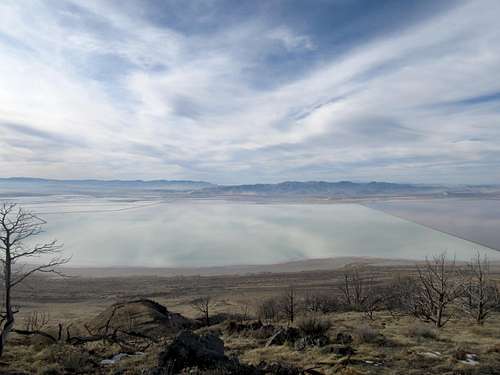
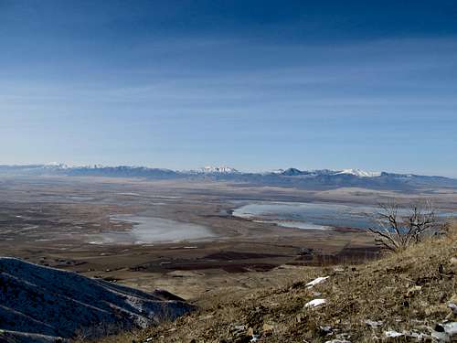
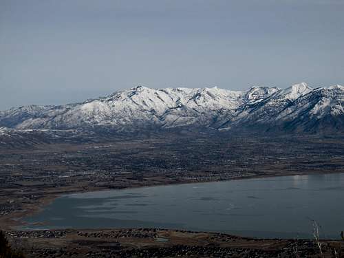
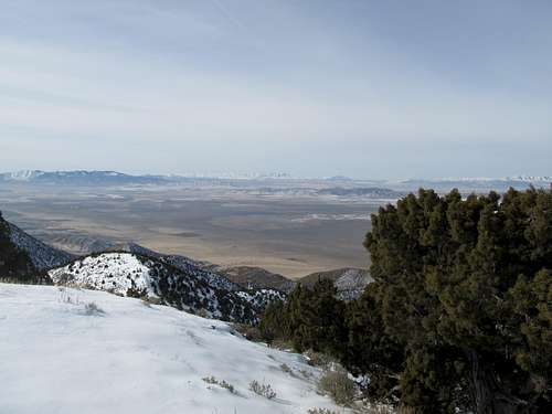
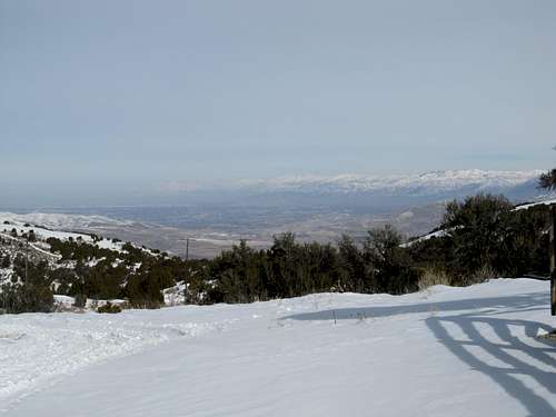
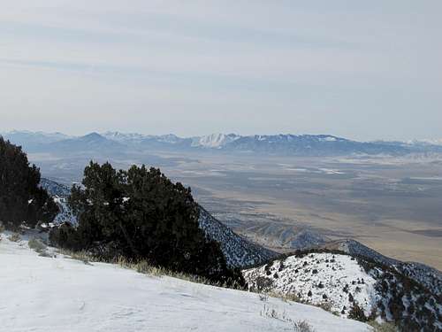
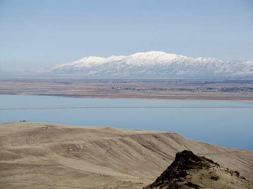
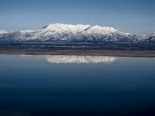
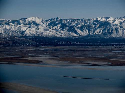
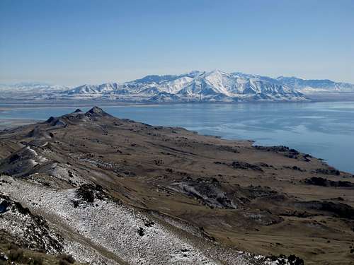
Upon making the main summit ridge I realized that there were a host of different facilities spread across the entire mountain. My first question was, which was the real summit. I first took a left and ambled through deep snow to the summit on the northeastern corner of the mountain. The views of Timp and the Wasatch were spectacular, stretching from the Wellsvilles to Nebo. It was a perfect seat to view the entire range, but as I stared at the triangulation station across from me and the bumps further south I began to doubt that I was at the highest point. I checked the SP page and following its directions, continued down the road as it wound to the FAA facilities at the true summit.
I decided not to trespass onto the shaved highpoint, but made my way, as per the page, to a nice little viewpoint southwest of it. I was treated to amazing views of the southeastern face of Flat Top and the Stansbury’s peeking beyond.
Lake might not have been much of a climb, and may not be much of a peak with its easy access and all the summit facilities, but it really is perched perfectly for the ideal 360 views for all the mountains of the Wasatch Front.
03.04.12 - Fraught with Frary
I was laid low in February from a bad flu caught after a trip to visit friends in Syracuse NY took up the first weekend after the Superbowl (which we shall not speak of), and after a climb of Vickory Peak in the Stansbury’s to start the month, didn’t really get out until the first weekend of March. I was PMS’ing though, from the lack of outdoor time, and Frary Peak, despite its small stature and proximity to the city, was the perfect dose to get me back into things.
I had gone up with Matt (mtybumpo on SP) to Antelope Island once, but the day was a washout, and we decided not to pursue the summit in the pouring January rain. My return to the island was on a sunny and warm March day, but the peak was still melting out from a snowstorm earlier in the week, so much of the trail after the first mile or so was wet and boggy.
But at least I didn’t have to deal with the heat, the bugs, and the smell from a typical summer day in the island. I made pretty good progress up the slopes as the mud turned into a light shallow coating of snow, and before I knew it, crested the summit ridge.
Here’s where things got tricky. Between me and Frary stood a steep and rocky ridge that I didn’t not expect at all. Not knowing the actual trail led down several hundred feet before reascending, I sauntered along the ridge as the false trail disappeared. It reappeared a few times here and there along the rocky ridge.
I descended a steep rock face, then, not seeing any other options, scooted up a steep chimney after several false starts in the cliffy terrain. A few more moves up and over rock, and finally the trail, snow covered, reappeared, leading up to the summit.
Like Stansbury Island, the last few hundred yards had taken much more time and effort than I had anticipated, and I learned, too late perhaps, not to underestimate the mountains of the Salt Lake Islands.
From the top I saw the true trail leading down from the false summit, but it seemed to disappear into the slopes below, and for the life of me I couldn’t find it coming up as I descended the summit ridge. The rest of the descent was a breeze as I skipped and ran past groups of hikers out for a stroll. My cabin fever was cured for the time being, and once again I felt the pangs of summit fever approaching.


Comments
Post a Comment