
|
|
Mountain/Rock |
|---|---|
|
|
47.64752°N / 18.97463°E |
|
|
Pest |
|
|
Hiking, Trad Climbing, Scrambling |
|
|
Spring, Summer, Fall, Winter |
|
|
1076 ft / 328 m |
|
|
Overview
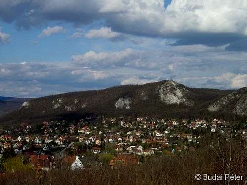 Oszoly from the distance Oszoly from the distance |

Oszoly hill is not at all high, even from the Hungarian perspective, yet it offers activities to both climbers and hikers. From its top a nice panorama opens on the surrounding hills of Pilis and Visegrád Mountains. The name of the hill is said to come from the Serbo-Croatian "Osolje" meaning "sunny /in other context: shady/ hillside".
The naturally outcropping bare walls in the western side of Oszoly are well visible from Csobánka, the village at the feet of the hill. These limestone crags provide a good school for beginners in rock climbing. The place has been a frequented climbing venue for over a century now, as this vintage climbing guide proves (see page 50).
Getting There
Oszoly can be approached the shortest from Csobánka village at its feet, which is most comfortably accessible by car. Leave Budapest northwards on road number 11 towards Szentendre. When you reach the edge of this town, take a left turn for Pomáz and follow the road signs towards Dobogókő. Having left Pomáz, you will shortly arrive to the junction where you should turn left for Csobánka (road sign). There's also a bus stop here (for buses between Pomáz and Dobogókő). The center of Csobánka is only 2 km from here. From the main square (shop, bus stop, buffet, street tap) continue easr on Kossuth Lajos street, which will lead you to the feet of Oszoly (car parking). Final step: find your way up on one of the signed (yellow cross > yellow stripe > yellow triangle) or unsigned trails (used for descend by climbers)
Another, recommended option is, if you have the time, to walk here directly from NW Budapest, following the ridge of Pilis Mountains. From the city center (Batthyányi square) take the Szentendrei HÉV (suburban railway) and get off at Csillaghegy stop. From here, follow the red tourist marks to get out of the town. You have an approximately 10 km hike ahead of you. The first third is not so much interesting, but after crossing an asphalt road, you will begin to have more fun. First comes the forest-covered Ezüst-hegy (Silver Mountain, 415 m), which features a few old quarries close to the hiking path. Next you will ascend Nagy-Kevély (Big Lordly, 534 m), from whose bald top you can enjoy a nice panoramic view. After descending to Kevély-nyereg (Lordly-saddle), you have two options: follow the red stripe marks directly to Oszoly, or make a small detour to check out the Teddy bear cave following the yellow stripe sign.
 Looking south from Nagy-Kevély towards Buda hills
From the other nearby settlement, Pomáz (which is also served by HÉV suburban railway) you can approach Oszoly by following the yellow stripe sign. This is a 5-6 km walk from the railway station, 2/3 of which is within the village.
Climbing
 Climbing on Excelsior wall
There are a handful of distinct climbing spots on Oszoly (Excelsior wall, Veszprém wall, Delago wall, Sundial wall, etc.), each coming with a number of distinct routes, which vary from easy to demanding. Oszoly is a legendary spot for Hungarian climbers, many of whom have masterted the tricks of the trade here. The place has been a long-time favorite for excercising, and continues to be quite popular in our days. Consequently, it is often crowded (it is common to see several groups of beginner climbers receiving lectures). In turn, the walls of Oszoly are stable, but greasy.
For detailed site and route information get hold of the Climbing Guide of Hungary (Hungarian-English biligual), which is available in most climbing stores. You can have a peek at two sample pages here. A few topos can be found online here (click on the route name /út neve/ to get the topo).
 |
 |
 |
 |
Red Tape
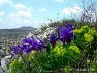
Oszoly is part of the Duna-Ipoly National Park. Visiting is free, but the usual rules apply: be respectful to nature. Several rare plants live here, especially in the rocky areas, therefore it is essential to take care and avoid disturbing their habitat.
 |
 |
 |
Maps
Paper maps
See the Parent page.
Online maps
A powerful free online map is being developed by the Open Maps Project for the area of Central Europe. If you are not familiar with the area or want to skip the zooming job, you can get a quick close-up view of Pilis's area, follow this permalink.
Weather
As the walls are on the western side of the hill, prepare for a great deal of afternoon sunshine in clear weather. Below you can find a weather forecast for Csobánka village by viewweather.com: