

-
 24896 Hits
-
 93.1% Score
-
 41 Votes
|
|
Area/Range |
|---|---|
|
|
40.62400°N / 111.5676°W |
|
|
Hiking, Mountaineering |
|
|
Spring, Summer, Fall, Winter |
|
|
10116 ft / 3083 m |
|
|
Overview
Park City Ridge forms a headwall of Millcreek and, partly, Big Cottonwood Canyon in the Wasatch Tri-Canyon Area. The ridge is rounded, in the general mold of the more Northern parts of the Wasatch range, and only a few high points on the ridge exceed 10,000 ft. None-the-less, Park City Ridge is a formidable mountain range, spanning a dozen miles between Parely's Summit and Guardsman Pass, and containing 3 of Salt Lake County's 32 highest (10,000+) summits.Also, three resorts lay on this Ridge; Deer Valley Resort, Park City Mountain Resort, and The Canyons .
In the summer, this area serves as a playground for mountainbikers, trailrunners and hikers. However, in the winter, snowboarders and skiers flock from all around to sample some of the best snow on know to man.
At northern end of the ridge, NE of Murdock Peak, lies the the Utah Olympic Park. During the 2002 Winter Olympics it served as the venue for Nordic Jumping events and sliding events including Bobsled, Skeleton, and Luge. It still serves an active training center year round for Olympic and development level athletes. Other facilities in addition to the Nordic Jumps and Bobsled Track located on site include a 2002 Winter Olympics Museum, Ski Museum, summer aerial training splash pool, ziplines, and mountain coaster. Click HERE for more information about the Olympic Park
The prominent high points of the ridge, North to South, are Murdock Peak Ninety-Nine Ninety, home to the Canyons' ski lift of the same name, Silver Hill, Scott Hill (the highpoint of the ridge), and, further South across the deep chasm of Scott Pass, Tri-County Peak (Jupiter Peak), Jupiter Hill and Park Mountain.
Iron Mountain, Flagstaff Mtn, Park Mtn Bald Mtn dominate the spur ridges descending towards Park City.
 Some beautiful fall colors in Willow Fork. This picture was taken from the Great Western Trail on the Park City Ridge
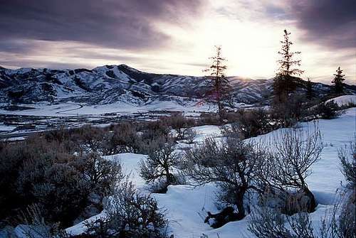 Glenwild Sunset. Photo Credit 46and2
Mountains
The peaks along this ridge, unlike many other Wasatch peaks, are not very rugged. Also, the majority of the peaks along this ridge have lifts either going directly to the top, or pretty close the top. Also, ski resort roads cut through the ridge making access easy in the summer and fall months.Peak List
Scott Hill- 10,116ft
Tri-County Peak (Jupiter Peak)- 10,027ft
"Monitor Peak"- 10,009ft
Silver Peak- 10,006ft
Jupiter Hill- 9,998ft
Desolation Peak (also called Ninety-Nine 90 or Peak 9,990 - 9,990ft
"Square Top"- 9,770ft
Murdock Peak -9,602ft
Park Mountain- 9,363ft
Bald Mountain- 9,346ft
Flagstaff Mountain- 9,213ft
Iron Mountain- 9,018ft
This table provides information on the peaks currently having Summitpost pages.
| Image | Peak Name | Altitude |
|---|---|---|
 |
Scott Hill. | 10,116 |
 |
Tri-County Peak. | 10,027 |
 |
Silver Peak. | 10,006 |  | Jupiter Hill. | 9,998 | 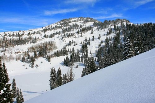 | 9,998 |  |
Park Mountain. | 9,363 | 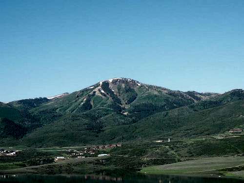 |
Bald Mountain. | 9,346 |  |
Flagstaff Mountain. | 9,213 |
Access
 Guardsmen Pass Road (Closed)
Hiking in the summer at these resorts is free. This makes it easy to access the ridge line by using the maintained resort trails . However, see details about this at their websites.
Red Tape
 PCMR Warning Signs
Lambs and BCC are watershed areas, no non-resident dogs allowed.
Upper Millcreek is off-limits to mountain bikers on odd days. Dogs are allowed every day in Millcreek Canyon, and on odd days dogs may be off leash. Fee is required for Millcreek Road access ($2.25 dayly or an annual pass).
Toll Canyon is a private conservation area.
Also, in the winter Guardsman Pass will not be plowed along with other roads used to access Park City Ridge.
During the winter months, the resorts along the ridge will be open so access for hiking is extemely limited. A lift pass is neccesary to hike the resort areas in the winter. At Park City Mountain Resort it is illegal to enter their property through gaurdsmans pass. It is condidered theft of services, trespassing and reckless endagerment. However, if you go when the resorts winter season is closed; access is unlimited. Typically they close around the end of April.
Camping
The Spruces and Jordan Pines CGs are next to one another in BCC. Otherwise camping is allowed on public land at a set distance off roads and streams. In winter, FS Yurt operates at Big Water TH in Millcreek.Getting There
Nothern fringes of Murdock Peak can be accessed from Lambs and Toll Canyons. Both trails converge at the Northern end of the meadows of the avalanche cuts of Murdock peak, from where the trail continues through the conifers to the NE shoulder of the peak. Millcreek Milepost 3
South of Murdock Peak, the West slopes of the ridge are accessible from Upper Millcreek (the creek trail and GWT join at the lower end of Upper Millcreek meadows, from where GWT takes the North Fork, Nordic Park Trail heads up the Middle Fork, and a fainter trail turns sharply right into the South Fork, towards Little Water bowl. The best access on the East side could be by MMT off Bear Hollow Dr in Sun Peak ( N 40° 41.96 W 111° 33.99)
 White Pine Lake
SW side of 9,990, Silver Hill, and Scott Hill is served by Mill D (Desolation Lake branch), Beartrap, and Willows trailheads in BCC. You can get to the NE side through The Colony perhaps, but the legal way to get there is through the White Pine Lake area, just off the junction of MMT and Iron Mountain trail (off Iron Mountain Court, N 40° 40.157 W 111° 31.740). From White Pine Lake, an old mining roads ascends Pinecone Ridge overlooking Thaynes Cyn).
Scott Pass road (which is also the route of GWT) starts at a locked gate off Guardsman Pass road, but the area is also accessible through Mill F summer houses (either Iowa Tunnel road or Hanscom Cutoff TH), and off MMT in Thaynes Canyon.
Backcountry Skiing
The Park City Ridge is one of the best backcountry locations in the Wasatch Range. With steep bowls, narrow chutes, wide open trees and gentle bunny hills, this ridge has a little bit of everything a backcountry skier could want. Avalanches and cornices are more frequent on the Park City side of the ridge so use caution while touring in this area. The Big Cottonwood Canyon side of the ridge (Mill F Fork, Willow Fork, Beartrap Fork, and Mill D North) is usually the safer side of the ridge. This is because of the mostly gentle nature and southerly exposure of this side. This section will describe some of the more common ski descents that the Park City Ridge has to offer. Troy skiing Will's Hill (Big Cottonwood Canyon side)
 Troy skiing South Monitor (Park City side)
THE BIG COTTONWOOD CANYON SIDE
Mill F Fork- Home of Scott Hill and the famous USA Bowl, Mill F is the smallest and tallest of all the Big Cottonwood Canyon Forks that span across the Park City Ridge. To access this fork, park your car at the upper Solitude lot. From here cross the highway and head strait up till you reach the ridge. There are some homes at the bottom so please respect their land by giving them enough space.
 Ron splitboarding USA Bowl at the end of the day
Willow Fork- One of the best and most popular forks is Willow Fork. Home of Will's Hill and Willow Hights this area is frequented by skiers and snowshoers. There are 2 ways to access this fork. One is to park just above Silver Fork Lodge and the other is from the upper Solitude lot. If starting from Solitude, cross the highway and follow the summer road till a sharp bend. From here head across (down canyon) and slightly up hill. At one point you will have the option to head up a ridge or across the woods. Either one will get you to the top. Carefull, areas along the ridge route are known to slide time to time so use caution. For a more detailed description of Willow Fork check out this link Willow Fork
 Troy skiing Wills Hill
 A human triggered avalanche on the ridge route
 Me skiing North Willow
 A large avalanche on North Willow
Mill D North- This is one of the bigger Forks on the Park City Ridge. Desolation lake, Little Water Peak and Reynolds Peak are the bigger names in Mill D North. Due to the vast amounts of terrain this drainage is quite popular with skiers, snowboarders (from The Canyons) as well as snowshoers.
 An avalanche on Short Swing in Mill D North
 An avalanche on "The Desolation Fin" aka Razorback Ridge in Mill D North
 Troy skiing the safer section of Short Swing
 Troy skinning up Mill D North
Beartrap Fork- This fork used to be the home of bears way back when. Now days it is the home of backcountry skiers in the winter months. With large open slopes and beautiful tree skiing oppertunities Beartrap is one of the better forks for skiing during periods of high avalanche danger.
 Troy skiing Beartrap Fork
 Troy skiing Beartrap Fork
 Troy skiing upper Beartrap Fork Feburary 2012
 Troy skiing Beartrap Fork
THE PARK CITY SIDE
South Monitor- Just behind the top of Willow Fork and Mill F Fork is South Monitor. This steep north facing slope has several different release zones and avalanches out big every year. Once you have skied it, there are several ways to gain the Park City Ridge again. The most common is the slope on the observers right. Be sure that conditions are absolutly stable when attempting this route. This avalanche path is known for tree destroying avalanches that run to the ground.
Troy skiing South Monitor Ron getting ready for another lap on South Monitor
West Monitor- Just down ridge of South Monitor is West Monitor. This east facing slope is a known climax avalancher on the Park City Ridge. Every year several large avalanches destroy trees and tear up the ground to the dirt. Every now and then the avalanches on this path leave debrie piles in excess of 30 feet deep! This run is also known for huge cornices so give the ridge some extra room.
 Troy skiing West Monitor in BLOWER conditions
 West Monitor with just our tracks on it
 Troy skiing the lower slopes of West Monitor in BLOWER conditions
 Troy skiing West Monitor
White Pine Canyon- Home of No Name Bowl, Radar Love Bowl and Limelight, this canyon is considered private property at the bottom. You are allowed to ski the upper sections, but the home owners at the bottom do call the sherrifs office when they catch people trespassing. The only peak Scott Hill which is at the top of the canyon. Several large destructive avalanches occur here every year (especailly in Radar Love Bowl) so use caution while touring in White Pine Canyon.
 Ron splitboarding No Name Bowl
 Tracks on No Name Bowl
Dutch Draw- This large and steep open face is a known killer on the Park City Ridge. Due to its close proximity to The Canyons Ski area, it is very popular with "slackcountry skiers". Several close calls with avalanches occur here every year and several skiers have lost their lives to monster avalanches in the past. Please use caution when charging this very dangerous slope. Here is a link from the Utah Avalanche Center on the accident that occured on Dutch Draw in 2005. DUTCH DRAW ACCIDENT
Murdock Peak- Most of this peak is now a part of The Canyons Ski Area. Access to this peak is usually from Mill D North and it makes for one long day. Most people who tour in this area are "slackcountry skiers" who duck The Canyons boundry rope illegally.
 The most common route to the top of Murdock Peak
 The gentle side of Murdock Peak. Photo Credit MOCKBA
Square Top- Not a part of The Canyons Ski area (yet) but very close to Peak 9,990 is Square Top. This run was featured in a Warren Miller film a few years back and is a very popular with "slackcountry skiers". There have been avalanche fatalities here in the past so be sure that conditions are absolutly stable.
Mountain Lakes
Shadow Lake- At the base of Jupiter Peak is a small lake known as Shadow Lake. Access to this area is easiest from Gaurdsmans Pass. Although it is located in an alpine setting the fact that Park City Mountain Resort's Jupiter Chairlift runs right next to it kinda detracts from the alpine scenery. Dogs are allowed here, even from Gaurdsmans Pass. Just make sure your dog does not get out of the car in Big Cottonwood Canyon...you could recieve a hefty ticket. Shadow Lake
Willow Lake- Popular with summer as well as winter hikers this is an excellent short hike to lake. Only .75 of a mile from the Big Cottonwood Highway the trailhead for this lake can be found just before Solitude. When bad weather or non-hikers get in your plans this can make a bad day....a good day. This lake is also very popular with the moose of the Wasatch Range. Come fall the willow fork drainage is full of aspen trees...which in turn makes some beautiful fall colors.
Willow Lake from the Park City Ridge Some fall colors from the trail that leads to Willow Lake
Desolation Lake- Just behind Peak 9990 there is a well known lake named Desolation Lake. This lake serves as the major land mark for the only trail that leads back into Big Cottonwood Canyon. This makes this area VERY popular with summer and winter travelers, even at night. The most scenic time of year at this lake is fall. The Aspen trees here are on several different aspects...which means that there are several weeks every year where you can find some beautiful colors.
 A perfect reflection off of Desolation Lake
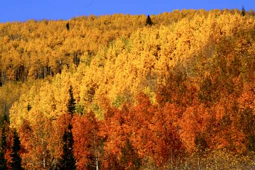 Some fall colors near Desolation Lake
 Desolation Lake reflection
 Desolation Lake from the Park City Ridge
More to come.......
History and FAQ's
 Old Truck
Overview
The area has also been used for grazing, and the meadows of Upper Millcreek (todays Nordic Park) were a site of the Tri-Canyon area's last sheep grazing permit, through 1960s. Today's' dog owners access to Millcreek is largely a legacy of this grazing permit, with the rest of the nearby drainage's all under watershed restrictions.
Watershed and recreation are still the two prime, and often competing, uses of the area. In the recent years, Salt Lake City blocked development of Willow Lake drainage on the Big Cottonwood side of the ridge, turning the area to conservation, while on the Park City side, the Canyons resort extended its lifts and condo developments to within hundreds yards of the ridgeline.
Park City History
In 1868, prospecting Army soldiers discovered rich silver veins in the hills above what would later become Park City. George Snyder, a Mormon polygamist, built a boarding house with his third wife Rhoda to profit from the mining trade. On the Fourth of July, 1872, early miners of Park City raised American flag over the Snyder's log house. "We shall call this place Parley's Park City," George Snyder declared. Very soon the "Parley" (named for early settler Parley Pratt) was dropped and a new mining boom town had its name. In 1898, the "Great Fire destroyed much of the city. Shortly after, the city was rebuilt. One of the reasons it was rebuilt so fast was because this area was booming with silver mines. After this, the town grew rapidly and became an official city, with a bank and many stores that were very profitable. I
It wasn't until the 1920's when people realized that Park City had more to offer then silver. Skiing began around that time and as one can see, it later became better then silver to Park City.
Mining History
After completion of the railroad to Promontory in 1869, large-scale mining became possible. But with this success came and with large-scale mining came the problem of housing the miners. The Snyder (Owned by George Snyder)sawmill, which had supplied much of the lumber to build Salt Lake City, had a bonanza of its own. The lush forests the grew around the area provided very useful in the making of boarding houses for miners. Because of the long and often harsh winters in Park City, the miners and residents had to be cooped up for long periods of time. Because of this, many took up their spare time in writing poems, journals or making poems.
The area has obvivously seen much silver mining activity since 1850s, and served as a gateway to Brighton (across Scott Pass) and Alta mining areas, before the roads through the Cottonwood Canyons were improved. Guardsman Pass road tok place of the older Scott Pass road in the 1960s, it was constructed as a National Guard training project, if you could believe that.
In the mining era, the evegreens were logged and the area was stripped clean of timber, but in 1910s and 1920s, a huge nursery at what is the Spruces CG area today planted millions of seedlings and restored much of the forest in the area.
 The Comstock Mine. Photo Credit Phenom
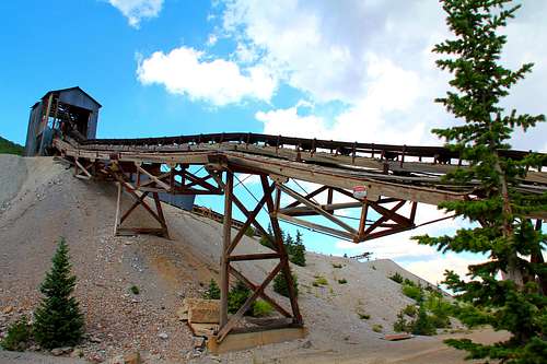 Photo Credit Phenom
Miners Ten Comandments
The Miners Ten Commandments became one of their most popular works.
Thou shalt have no other claim but one.
Thou shalt not take unto thyself any false claims, nor shalt thou jump one.
Thou shalt not go prospecting again before thy claim gives out nor shalt thou take thy hard-earned dust to the gaming tables in vain for the more thou shalt put down, the less thou will take up.
Thou shalt dig or pick only six days for on the seventh thou shalt washeth thy dirty clothes and darneth thy socks and choppeth the whole weeks wood.
Thou shalt not think more of the gold than thy father's blessings or thy mother's love.
Thou shalt not kill thy body by working in the rain nor by getting stewed or three sheets to the wind from drinking down whiskey punches, rum toddies or brandy slings.
Thou shalt not grow discouraged nor go home before thou strikes it rich lest in going home thou will work for fifty cents a day while thou might strike lead and make fifty dollars a day by staying.
Thou shalt not steal a pick or shovel nor take thy neighbor's tools nor borrow those he cannot spare and return them broken nor remove his stakes to enlarge thy own claim.
Thou shalt not tell false tales about thy diggings in the hills nor salt thy claim to deceive thy neighbor.
Thou shalt not covet thy neighbor's wife nor trifle with the affections of his daughter but if thou truly love and covet each other, thou shalt pop the question like a man.
External Links
Utah Avalanche CenterAvalanche Center
Wasatch-Cache National Forest
Deer Valley Resort
Park City Mountain Resort
The Canyons
Misc
If you have any other information/photos about this area please feel free to add them. A panorama shot of the Park City Rigde. Photo Credit 46and2
dillweed - May 10, 2006 1:09 pm - Hasn't voted
thelink for murdock peak is no good. :)
Dmitry Pruss - Oct 27, 2006 3:40 pm - Voted 10/10
Re: Murdock linkfixed it, thanks !