
|
|
Mountain/Rock |
|---|---|
|
|
57.19164°N / 5.09087°W |
|
|
Hiking, Mountaineering |
|
|
Spring, Summer, Fall |
|
|
3287 ft / 1002 m |
|
|
Overview
Pronounced – Sal Hoo-ran
Summit height - 1002 m (3,287 ft)
Meaning – Hill (heel) of the Rowan
Overview
Sail Chaorainn is quite a remote mountain with a rather insignificant summit!
Mostly hidden from view behind Sgurr nan Conbhairean, it is usually climbed after its larger neighbour, often along with Carn Ghluasaid. It can also be approached on its own along a long track from the east or from remote Glen Affric in the north.
Sail Chaorainn’s main claim to fame is that it is a Munro although, it also boasts some good views of remote country north of the A87 and some of the nearby, more impressive Kintail mountains.
Getting There
By Road:
From Fort William, the A82 and A87 roads head northwards towards Kyle of Lochalsh on the northwest coast.
From Inverness, the A82 road heads south along the shores of Loch Ness. Take the A887 westwards towards Kyle of Lochalsh, where it becomes the A87 at Bunloyne junction.
Park on the north side of Loch Cluanie, where the A87 road follows the shoreline. Soon after Loch Cluanie is reached travelling west, there is an “S” bend in the road and the shoreline. This is marked as “Lundie” on the map and is now an area for parking (or camping!). If there is no room when you arrive, there is another large layby about 100m further west down the road.
Travelling from the west, pass through Glen Shiel and up the valley on the A87 road, passing The Cluanie Inn.
Look out for the parking area at Lundie as described above.
From here, you will need to climb Carn Ghluasaid or Sgurr nan Conbhairean (or both) in order to reach Sail Chaorainn from the south.
Alternative ascent route start point.
Alternatively, park alongside the A87 further east, near the Ceannacroc bridge (Map ref: 226106) and head north on foot along the private road to the Ceannacroc lodge.
By Bus
Buses are run from Kyle of Lochalsh to Fort William by City Link services.
The nearest bus stop is at Bunloyne junction where the A87 and A887 meet. This would entail a roadside walk of over 7km (4.5 miles) westwards to reach Lundie along the A87.
For the Ceannacroc bridge route, head east along the A87 road for about 1.5 Km until the bridge is reached.
By Rail:
Kyle of Lochalsh is the nearest railway station. Scotrail’s Highland line which runs between Dingwall (north of Inverness) on the east coast and Kyle of Lochalsh on the west coast is the only railway line.
See the Scotrail website for service information:
https://www.scotrail.co.uk/plan-your-journey/stations-and-facilities/ach
Route
Starting point:
Lundie - There is limited parking in a layby on the A87. Grid reference: 145103
From Lundie, leave the A87 road on the old military road – now a track – which heads west, parallel to the A87. This is the same route used to climb Carn Ghluasaid and Sgurr nan Conbhairean.
Follow one of the descriptions on these mountain pages to reach Sgurr nan Conbhairean.
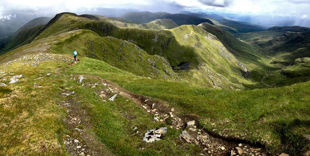
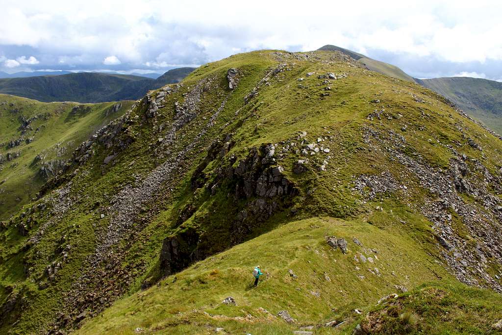
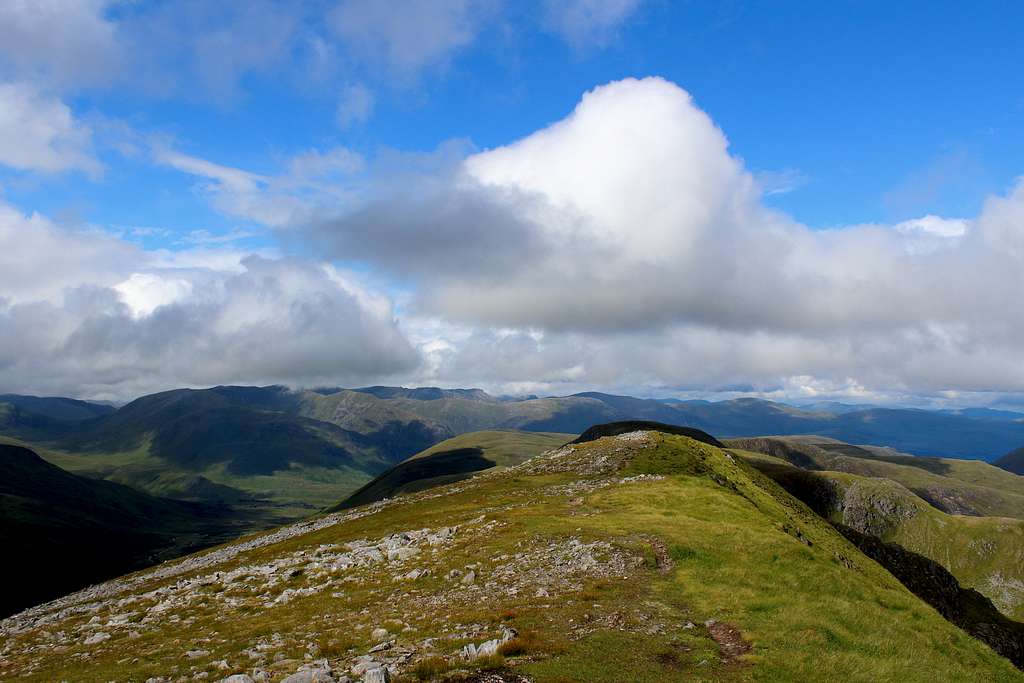
From this summit, descend easily northwards along a path on the grassy ridge. The ridge path descends to a point marked on the map as “914”m. Continue the route by ascending Sail Chaorainn’s south ridge in the same direction.
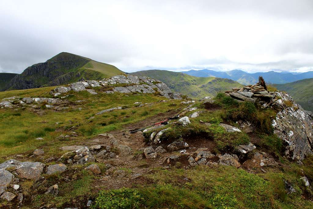
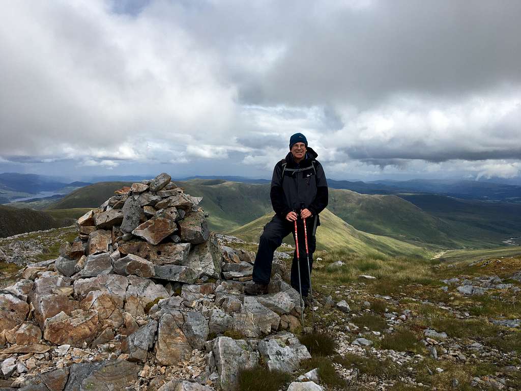
It starts to level out as the ridge from Carn a’ Mhadaidh joins from the east and the summit cairn is seen soon after.
The summit cairn is small and doesn’t really live up to most of the other Munro summit cairns you may encounter!
What makes this more disconcerting is that on a clear day, it’s possible to look north and see the larger cairn on nearby Carn na Coire Mheadhoin – a Munro “top” – and only officially 1m lower! It might be an idea to spend a few minutes following the ridge along and bagging this top too if this concerns you!
Continue along the ridge and on towards the next “top”, Tigh Mor na Seilge if you are aiming to climb Munro “tops” as well. To descend northwards, head down its grassy, northwest slopes towards Glen Affric. (This is only suitable if you have planned a multi-day journey into this wilderness area as it is a long way to get from here to any major road.)
To descend southwards, retrace your steps to Sgurr nan Conbhairean and follow the route description on that mountain page to continue from there.
Alternative ascent
The route from Ceannacroc bridge passes the lodge and continues alongside the River Doe on a track, for around 7km to a bridge and a bothy beyond. Pass the bothy and head up the east ridge of An Reithe, pass over its rocky top and descend to a bealach on the ridge.
From here, climb the broken east ridge of Carn a’ Mhadaidh – ruaidh towards Sail Chaorainn, When the main ridge is reached, its summit is northwards (right) along the grass and rock ridge.
Follow the route description southwards towards Sgurr nan Conbhairean to continue.
In order to return to your start point, descend the east ridge of Carn Ghluasaid – see the “Loch Cluanie – Three Munros traverse” route page for the description.
Red Tape
Scotland has an Outdoor Access code, see link:
https://www.outdooraccess-scotland.scot/practical-guide-all
The area is popular for Deer stalking and Grouse shooting. These activities may impact on any plans for hiking. However, it is still possible to hike during these events with a little extra effort at the planning stage.
This is a useful page on the Outdoor access – Scotland website
https://www.outdooraccess-scotland.scot/practical-guide-all/heading-scottish-hills
When to Climb
Spring, Summer or Autumn (Fall) depending on conditions.
Warning: The above descriptions are for use in reasonable summer conditions. Winter conditions can occur at almost any time of the year. In winter condition, this mountain is a much more serious proposition. Any paths may be covered by snow and ice and gale force winds are common.
Ice axe, Crampons, the knowledge of how to use them allied with excellent map reading and compass skills are essential.
The proximity of the west coast and the sea means that mist often forms and can cover the mountain.
Accomodation
There is limited hotel accommodation at the Cluanie Inn and in the town of Kyle of Lochalsh. There are also campsites around this town and in Glen Shiel.
It is possible to wild camp in Scotland. See the Outdoor access code (above) for more details.
There are many types of self-catering accommodation in these areas but it is best to book these in advance.
External Links
SMC - https://www.smc.org.uk/
The Munros – (SMC Hillwalkers guidebook)
The High Mountains of Britain and Ireland – I. Butterfield
West Highlands – Nick Williams
Ordnance survey map OS 414 Glen Shiel and Kintail Forest. 1: 25 000