|
|
Mountain/Rock |
|---|---|
|
|
57.07826°N / 3.72885°W |
|
|
Hiking, Mountaineering, Trad Climbing |
|
|
Spring, Summer, Fall, Winter |
|
|
4252 ft / 1296 m |
|
|
Overview
Braeriach
Pronounced – bry-ree-ach or bray-ree-ach
Scottish Gaelic: Bràigh Riabhach
Summit height - 1,296 m (4,252 ft)
Meaning – Brindled upland
(Brindled = brownish or tawny with streaks of other colour.)
The Cairngorm National Park was formed in 2003 to protect this unique area. It is the UK's largest national park with a large mountain range at its heart and with many diverse communities around it. The habitat offers a secure haven for many rare species and the forests include remnants of the original, ancient Caledonian pine forest. These contrast with large areas of heather moorland.
There is a well-developed ski and tourist area beneath Cairngorm mountain in the lower reaches of Coire Cas. Here, there are parking, toilet and eating facilities. In winter, it’s possible to get a bus from Aviemore to the ski area to ease the parking congestion.
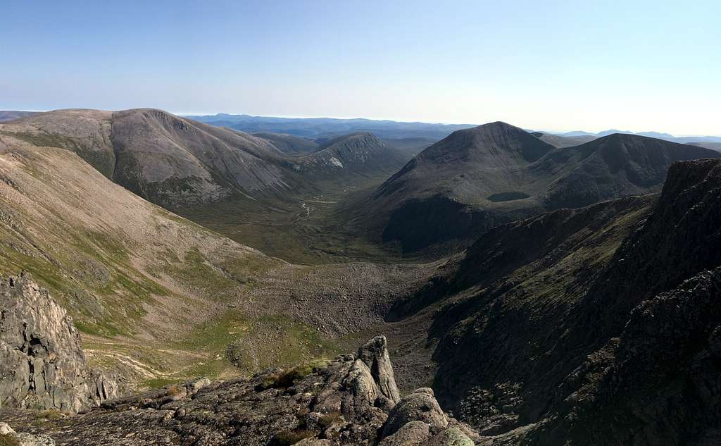
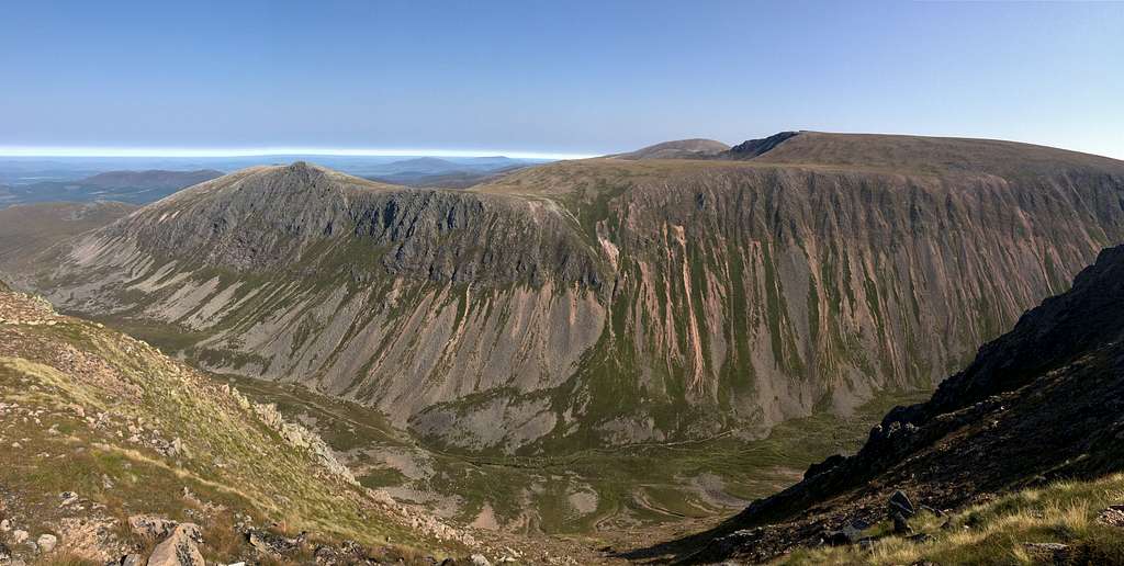
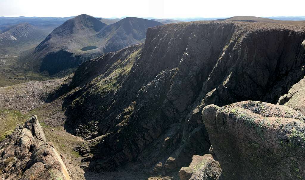
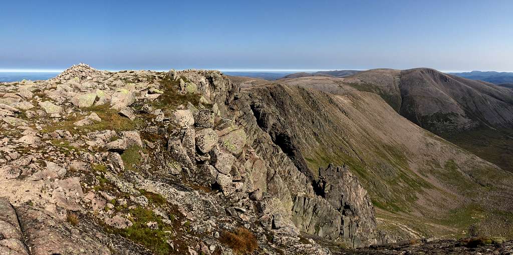
Braeriach is the third-highest mountain in the Uk after Ben Nevis (1344m) and Ben Macdui (1309m). It is a large mountain boasting three northern corries, three south facing corries and an extensive plateau above 1100 metres. It has the highest point in the western section of the Cairngorms and is separated from the central section (containing Ben Macdui and Caringorm) by the deep pass known as the Lairig Ghru. Further to the west is Gleann Eanaich.
Climbing development
The Cairngorms have been a source of enjoyment for walkers and climbers for many years. Back in 1887, the visit of a few enthusiasts to the Shelter stone crag in Glen Avon, caused the creation of the Cairngorms club. Members received a newsletter with descriptions of many routes. The July 1890 edition ran to 28 pages and included an excursion to Braeriach and Cairn Toul.
Some innovators took to climbing the rock and they found some adventurous climbing on good quality granite, particularly in the south facing corries although, these are quite remote.
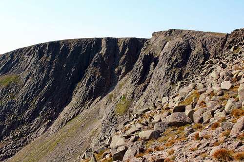
An early edition of the SMC Cairngorms guide in 1928, described fewer than 10 climbing routes in the 2 miles of cliffs in An Garbh Choire. These were mainly buttress and gully climbs and had been pioneered by the likes of Henry Alexander, George Lumsden and the Tewnion brothers amongst others. The “Black Pinnacle” on the Central buttress and the “Central Buttress” route, first climbed by Raeburn and Ling are from this era.
As time passed, equipment and mountaineering standards improved, so did the number of routes.
Many of the winter routes were pioneered during the 1960s and 1970s by local and visiting climbers. (There is a great description of the first winter ascent of “White Nile” (Scottish Grade 4) by Rob Archbold in Ken Wilsons compilation book “Cold Climbs”.)
There are now dozens of routes on many of the buttresses and gullies for both summer and winter ascents. Gully ski descents are also common.
The rise in popularity in recent times of “Munro – bagging” means that Braeriach receives a lot more attention than it otherwise might do although, it would be a fine mountain whatever its height.
Getting There
Aviemore is the main town to use as a base for the northern Cairngorms. It has many hotels and shops and provides a good bus service to the area.
There is a main line train station in the town as well as a good train service to the wider country.
By road, Aviemore is easily accessed from the main A9 road which links Glasgow with Inverness.
From Aviemore a minor road runs to Loch Morlich, and from there onwards to the Cairngorm ski development at Coire Cas.
Route
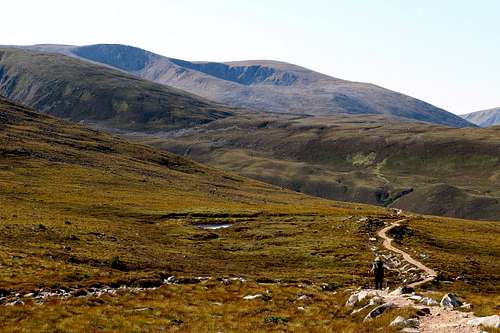
The easiest route up to the summit of Braeriach starts from the Sugar Bowl car park – a pay and display amenity - on the road leading from Aviemore to the Cairn Gorm ski area beneath Coire Cas.
From here, cross the road and descend to a bridge crossing the river. From the opposite side, a path leads over the hillside with views of the Northern corries. After re-crossing the river and continuing upwards again, the path will reach a steep-sided rocky ravine known as the Chalamain Gap. Scramble through this and descend about 100 metres of height on a path to cross the river at the beginning of the Lairig Ghru, an enormous pass cutting through the mountains from north to south.
After crossing this river, the path leads up the north ridge of Sròn na Lairige, a subsidiary top of Braeriach. This is steep at first but on a very good path.
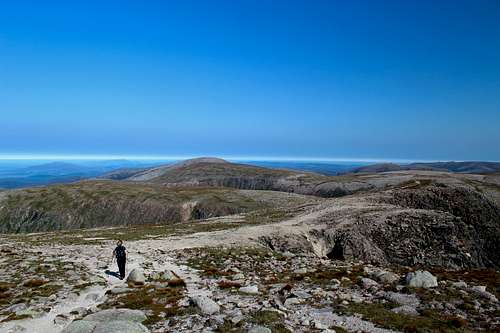
As the angle eases, the path crosses some very rough, rocky ground. The ground later improves and continues south and west around the edge of the steep corries of An Garbh Choire to reach the summit cairn.
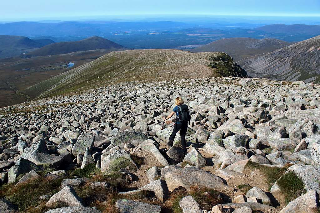
There are fantastic views east and southwards towards Ben Macdui and the remote, high mountains of Carn a’ Mhaim (1037m), Cairn Toul (1291m) and Sgor an Lochain Uaine (The Angel’s peak, 1258m).
Return the same way, round trip is about 13 miles – 20.8 km. Allow 8-10 hours.
There are many other ways to climb and experience this mountain and it’s possible to include it as a traverse with other Cairngorm mountains on extended trips.
Map
Interactive map
OS Explorer Cairn Gorm and Aviemore No. OL57 – 1: 25,000
Red Tape
No red tape.
However, Scotland has an Outdoor Access code, see link:
https://www.outdooraccess-scotland.scot/practical-guide-all
When to Climb
Spring, Summer or Autumn (Fall) depending on conditions.
Warning: The above description is for use in reasonable summer conditions. Winter conditions can occur at almost any time of the year. In winter condition, this mountain is a much more serious proposition. Any paths may be covered by snow and ice and gale force winds are common. Ice axe, Crampons, the knowledge of how to use them allied with excellent map reading and compass skills are essential.
Camping
Many campsites in Aviemore, Coylumbridge and Loch Morlich but probably best to book a place in advance during high season. See the Cairngorms National Park website for details.
It is possible to wild camp in Scotland. See the Outdoor access code for more details.
External Links
Walk highlands - https://www.walkhighlands.co.uk/
SMC - https://www.smc.org.uk/
Cairngorms club - https://www.cairngormclub.org.uk/
Cairngorms National Park - https://cairngorms.co.uk/