
|
|
Route |
|---|---|
|
|
46.47720°N / 11.84176°E |
|
|
Hiking, Scrambling |
|
|
Summer |
|
|
Half a day |
|
|
EE |
|
|
Overview
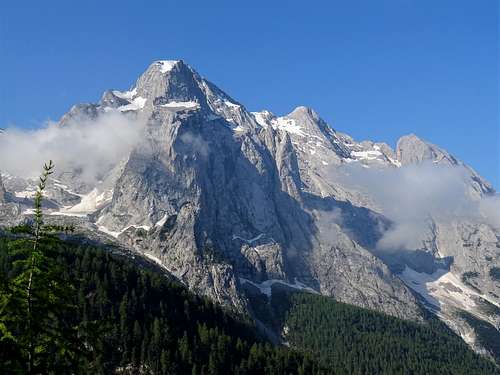
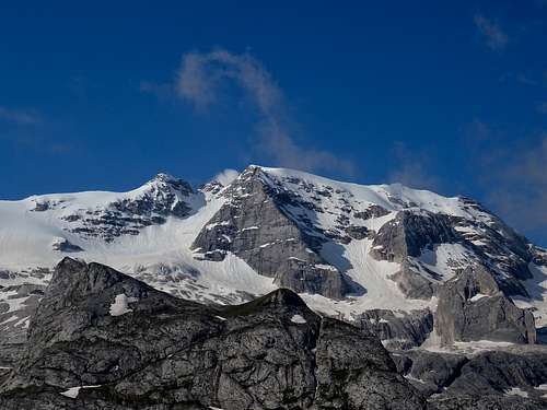
Sass Ciapèl 2577 m. is a rocky buttress located in the vicinity of Passo Pordoi 2239 m. and Passo Fedaia 2057 m, two alpin cols in the Western Dolomites both located on the border between the province of Trento (Trentino region) and the province of Belluno (Veneto region). The mountain belongs to the Catena di Padòn, a mountain range located at the Northern end of the Marmolada group and extending itself amongst the Passo Pordoi, the high Cordevole and Val Pettorina. The Padon Chain is a long ridge which runs in the West-East direction and turns south at Monte Padon.
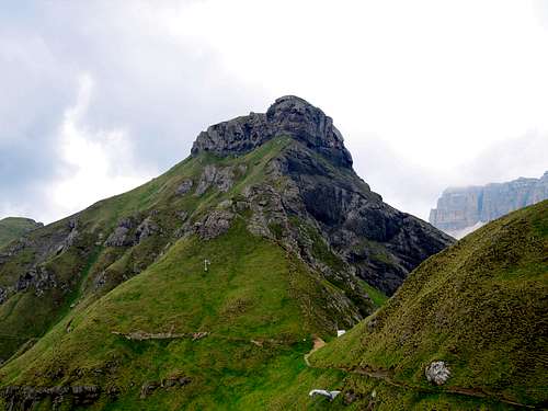
Just a "small" mountain range (at an altitude of 2,400 m) which separates the Sella group from the Marmolada. From a geological point of view the whole Padon chain has nothing to do with the Dolomites that surround it. It consists of black lava rocks and thus offers a stark contrast to the Sella Group to its north and Marmolada to its south. Sass Ciapèl has the same geology.
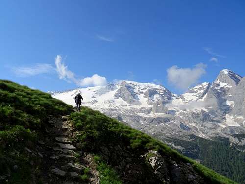
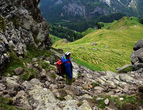
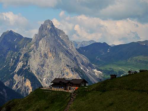
The summit can be reached through various itineraries. Here it will be described the itinerary that starts from Lago Fedaia. It is an easy, very panoramic hike with fantastic views towards the Marmolada glacier and the N face of the Gran Vernel, with a finish involving a very short and easy climb.
Getting There
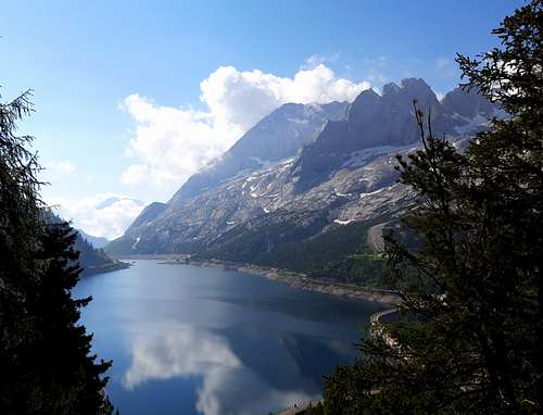
Route access to Lago Fedaia 2057 m
The shortest approach is by A22 "Brennero Motorway"
- From Trento - From A22 Brennero Motorway exit Egna-Ora and take the road SP 232 to Val di Fiemme, then SP 238 to Val di Fassa, getting to Cavalese, Predazzo, Moena, Pera di Fassa and Canazei. In Canazei ignore the road SP 242 to Passo Pordoi and Passo Sella and turn to right in the middle of the village on the SS641 to Alba di Canazei and Fedaia.
- From Bolzano or Brennero - From A22 Brennero Motorway exit Ponte Gardena-Waldbruck and take the road SS242 through Val Gardena, getting to Ortisei, Selva di Val Gardena and Passo Sella. The road descends towards Val di Fassa reaching a crossroads. Turn to right towards Canazei. In Canazei ignore the road SP 242 to Passo Pordoi and Passo Sella and turn to right in the middle of the village on the SS641 to Alba di Canazei and Fedaia.
Route Description
Sass Ciapèl from Lago Fedaia description
Difficulty: EE
Difference in level: 520 m.
Starting point: Lago Fedaia 2054 m
A fun and pleasant hike climb with and incredible panorama
This first part of the itinerary has a fairly steep climb, with several hairpin bends that first climbs to the left then becomes a little less steep and tends to the right, reaching a crossroads from which a branch that also leads to Porta Vescovo.
From here begins the real path called Viel del Pan, so called in memory of the ancient trades, especially of bread and flours, which took place here.
At the crossroads, take the west (left) direction, continuing along a basically flat path with some ups and downs that cut steep the grassy slopes dominated by eruptive rocks along the southern slopes of the long Padon ridge. After having crossed the slopes under the Padon ridge for a long time, you reach a fork under the rocky and blackish mass of Sass Ciapèl with a concrete structure on the right. Here it started the old via ferrata now disused.
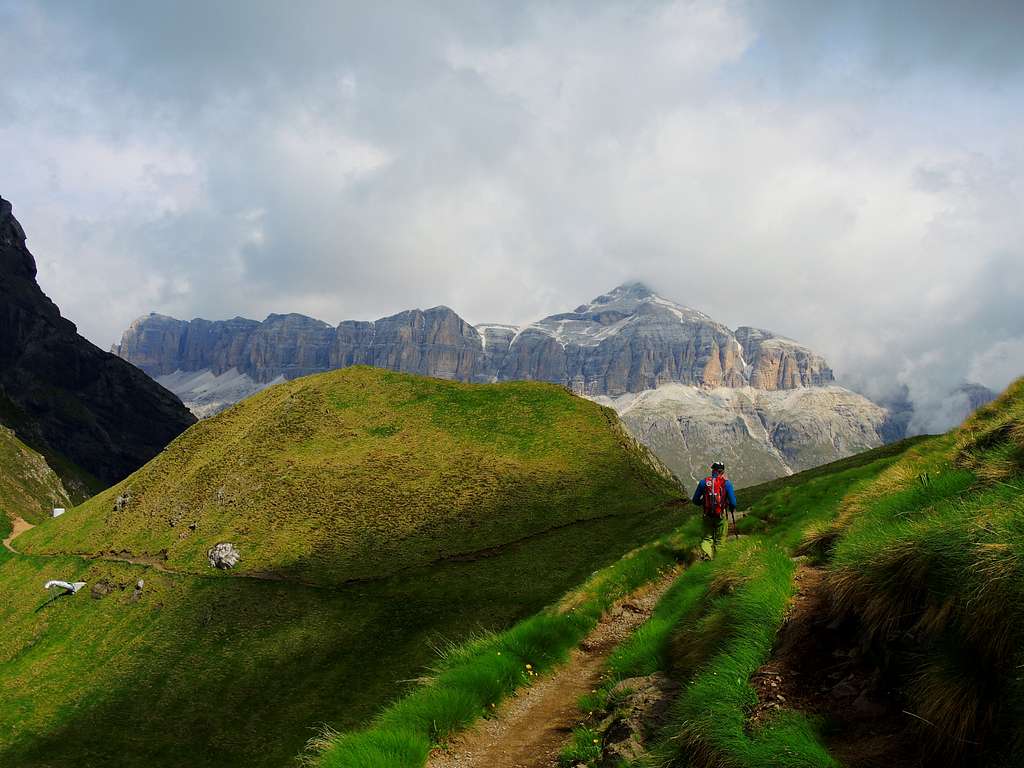
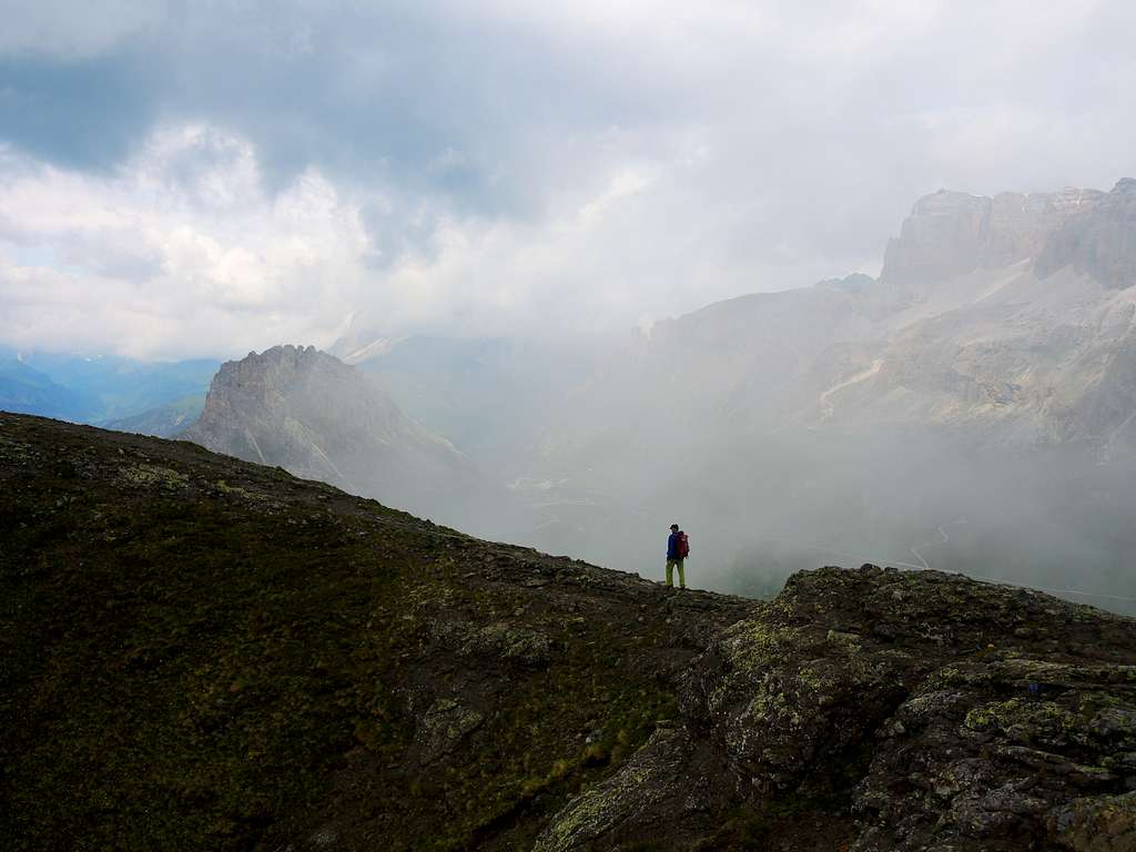
An old track is visible along the ridge. Instead, continue to traverse at the base of the mountain in the direction of the now clearly visible Rifugio Viel del Pan. Arriving about 300 meters before the refuge, leave the main path and climb up along a steep path that climbs at first directly then to the right in the direction of the blackish silhouette of Sass Ciapèl, reaching a ledge traversing to the right under the rocks.
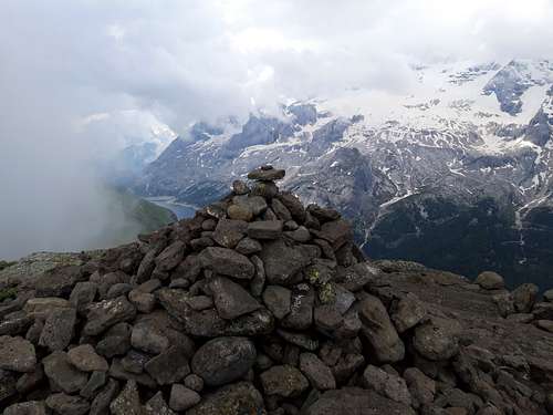
The track continues to the right at altitude and follow the ledge below the summit to find the most weak point to climb near a rocky ramp. Climb it (I grade) reaching a saddle. From here follow the large ridge to the right in the direction of the summit and on a flat arch-shaped ridge to the little cairn of the summit.
Descent: reversing the same itinerary
Essential Gear
Normal hiking gear, high mountain clothes and mountain shoes
Hiking and scrambling scale
T - Turistico (Tourist): Itineraries on wide, clear and well worn paths, sometimes on mule tracks or gravel roads. The routes are never exposed, don't give any orientation problems and don't exceed 2500 meters of altitude. Suitable also for children
E - Escursionisti (Hikers): Itineraries on marked trails, even narrow and with possible steep and impervious sections. They are never exposed and don't give any orientation problems. They can tread different kinds of ground, such as forests, gravel, meadows, pastures, easy rocks, etc.). They form the majority of the trails that wind up in the mountains and require a certain habit to walk; you need equipment suitable for the altitude and resistant footwear with soles suitable for rough terrain
EE - Escursionisti Esperti (Experienced Hikers): Itineraries for hikers with experience and good knowledge of the mountain. Some of these paths may have exposed sections, however brief, which require firm foot and no dizziness. They require the ability to adapt to particular terrain, such as steep grassy slopes or stretches of rocks with difficulties that can reach the 1st degree of the UIAA scale. They can also reach high altitudes (3000 m or more). Sometimes they may include unmarked sections, requiring a good sense of orientation. Snow slopes are possible, however which can be overcome without specific mountaineering gear (rope, harness, crampons, ice-axe)
EEA - Escursionisti Esperti con Attrezzatura (Experienced Hikers with equipment - The same as EE, in addition these routes require the use of via ferrata equipment (lanyards, harness, carabiners, heat sink, helmet). This kind of itineraries range from the trails with short easy and not much exposed sections, previously equipped with fixed ropes and iron pegs, to the true and more difficult Via Ferratas climbing on rocky walls or on aerial ridges and ledges, previously equipped with long stretches of iron ropes, iron steps, ladders without which proceeding would constitute a real climbing. It is necessary to know how to use the technical equipment and have a certain habit of exposure and mountaineering terrains.
Red Tape
No fees no permits required
When to climb
The best period goes from middle June to the end of September.
Accomodation
Several possibilities of accomodation on Alba di Canazei, Canazei and Fassa Valley
Bibliography
“Marmolada” Bepi Pellegrinon
Map: Kompass n.59