
-
 2875 Hits
-
 83.1% Score
-
 16 Votes
|
|
Route |
|---|---|
|
|
45.82530°N / 11.11210°E |
|
|
Hiking, Scrambling, Via Ferrata |
|
|
Spring, Summer, Fall |
|
|
Most of a day |
|
|
EEA - Easy Via Ferrata |
|
|
Overview
Sentiero Attrezzato "Franco Galli"
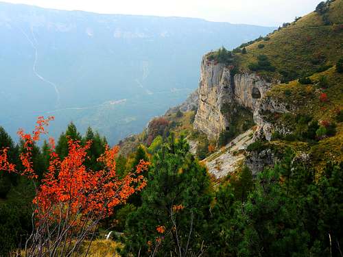
This itinerary leads to the summit of Corno Battisti 1761 m, formerly Corno di Vallarsa, and subsequently, as additional goal, to the summit of Monte Spil 1703 m. Both the summits belong to the Pasubio Group, in the area of the Prealpi Vicentine. Notwithstanding its imposing and impressive rocky feature when viewed from Vallarsa, Corno Battisti hasn't a particular mountaineering importance, however it's historical importance is great. In the described ascent, a loop of about 10 km, the Corno Battisti and the neighboring Monte Spil are climbed following the "Franco Galli" Path, a partially equipped route starting from Tezze, a hamlet of Valmorbia in Vallarsa, a green valley entirely situated in the Trentino territory.

|

|
Getting there
The starting point to the "Corno Battisti-Monte Spil" crossing is the village of Valmorbia in Vallarsa, Trento province.

Road access to Valmorbia
From A22 Autobrennero Motoway exit Rovereto (201 m) and take the SS46 driving along the scenic road of Vallarsa; after San Colombano, where it's situated an ancient hermitage, the road is running across some small hamlets, getting Valmorbia 649 m, a little village celebrated by the famous poet Eugenio Montale, who fought on Corno Battisti. In Valmorbia leave the main road and turn to left, reaching the small hamlet of Tezze. Continue about 500 meters after Tezze and leave your car in a small parking lot just before the access ban.

|

|
Route Description
Sentiero Attrezzato "Franco Galli" from Tezze
Summit quote: 1761 m
Difficulty: EEA
Difference in level: 1000 m
Starting point: Tezze m 723, a hamlet near Valmorbia
An advisable round trip, combining the natural beauties with the strong historical interest for a mountain symbol of the WWI on Pasubio

|

|
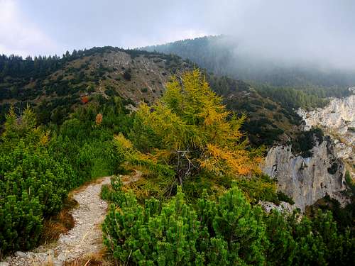
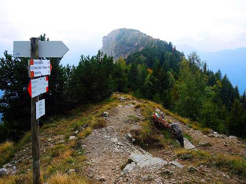
From the parking lot continue along the forest road, reaching at about 780 meters of altitude an obvious junction, where we ignore on the left the path n. 123 to Monte Spil, which we choose to follow during the way back. Thus we continue to the right on the path n. 122, rising steeply and directly into the thick woods of the Val di Grobe, reaching Malga Trappola 1316 m and then the namesake saddle at 1405 m. Here our path joins the path 122b rising from Anghebeni and the thick forest opens, allowing to take a look over the surrounding peaks. From Sella Trappola the path heads to the left and opposes some more demanding stretch, two of which are equipped with a fixed iron rope. Along the path we notice the works done during the Great War (tunnels and trenches) and soon we reach an unpredictable crossroads which on the left indicates the Cappello di Pulcinella (Pulcinella Hat), a panoramic balcony that can be reached with a short digression. Return to the crossroads and take the right path getting the basal wall of Corno Battisti.
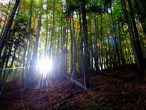
The forest trail |
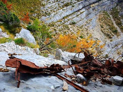
Remains of WWI |
War tunnel |
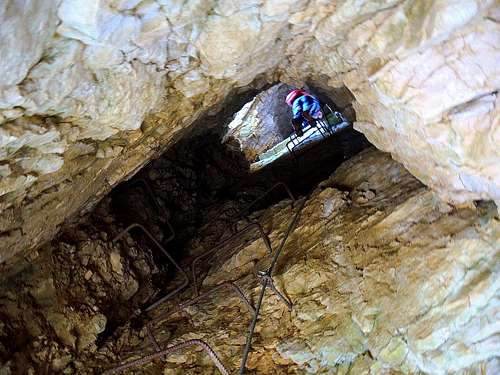
Pozzo della Carrucola |
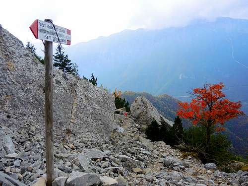
Signpost at the exit of Pozzo della Carrucola |
Exit of Pozzo della Carrucola |
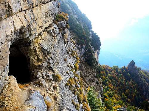
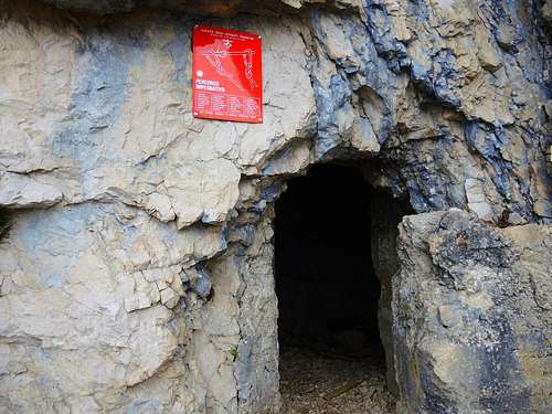
The itinerary follows now a series of stairs with rock steps and tunnels, alternate with stretches on grass and gravel, then it reaches the entrance to the big gallery named "Bocca del Leone", one of the most important fortifications in the area. The tunnel enters the bow of the mountain with a staircase of about 100 steps, illuminated by some small cracks, at the end of which it comes out on a terrace where we can see the great WWI frieze remembering the 33rd and the 160th Miners Companies who performed the work. Now it begins another gallery, similar but shorter than the previous one, leading to a fork, where there are two possibilities: to the right the dark tunnel climbs steeply inside the mountain (necessary a front light), while to the left the path exits outdoors. If we continue straight on, we follow the steep path equipped with a fixed rope inside the tunnel, reaching a next junction with the indication to the equipped staircase of Pozzo della Carrucola. We descend the metal stairs of the famous and a bit awesome Pozzo della Carrucola, well equipped with a fixed rope, and then we leave the system of the galleries, exiting outdoor. A path heading to the right leads to the summit ridge. Once on the summit ridge take to the right the path to the top of Corno Battisti.
Corno Battisti summit crest |
Corno Battisti summit benchmark |
Selletta Battisti |
Selletta Battisti |
WWI memorial on Selletta Battisti |
Monte Spil |
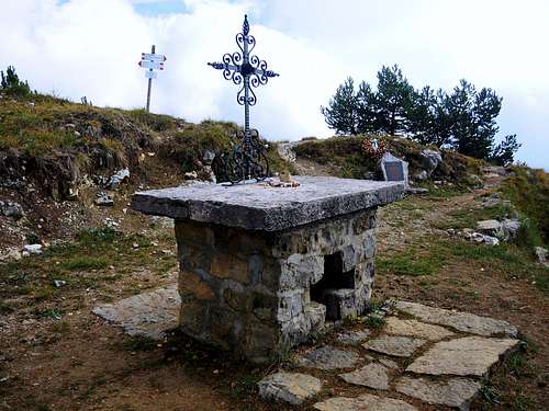
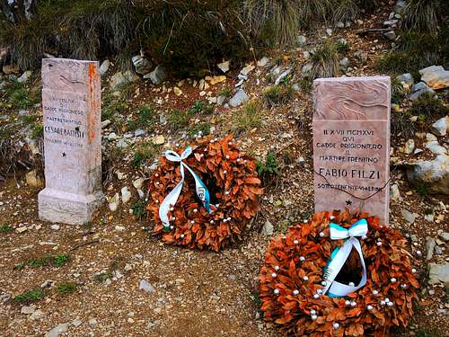
From the summit of Corno Battisti descend back along the crest and continue in the direction of the Selletta Battisti 1740 m, where it's placed a plaque in memory of an Italian officer dead during the battle for the conquest of Monte Corno and two stone logs in memory of the capture of Cesare Battisti and Fabio Filzi, happened on the Corno, later dedicated in memory of the patriot and martyr Cesare Battisti. From the Selletta Battisti continue to follow the crest on the path 119b, almost flat, leading to the Passo Menderle 1679 m, where it starts the trail 123 descending to Tezze and allowing to complete the ring itinerary. Before the descent it's possible to reach with a short deviation even the beautiful summit of Monte Spil. Once returned to the Passo Menderle take the well worn path 123, at first descending steeply on scree terrain beneath the rocky foothills of Mount Spil, then proceeding in the forest and leading to cross the path 122 near the parking lot, which is reached in about 10 minutes.

|

|
Essential Gear
Safety lanyard, harness, some carabiners, helmet, indispensable the front lamp
Red Tape
Pasubio and the whole Prealpi Vicentine are a Natural Reserve, anyhow there is no particular restriction in climbing and hiking.
When to climb

Best season goes from May to October
Where to stay
The close town of Rovereto offers several possibilities of accomodation, alternatively there are some hotels and B&B in Vallarsa.
Meteo
Guidebooks and maps

“Piccole Dolomiti – Pasubio”, Gianni Pieropan - Collana Guide dei Monti d’Italia, CAI TCI
External Links