
-
 14307 Hits
-
 84.27% Score
-
 18 Votes
|
|
Mountain/Rock |
|---|---|
|
|
34.99590°N / 83.5936°W |
|
|
Clay |
|
|
Hiking |
|
|
Spring, Summer, Fall, Winter |
|
|
4340 ft / 1323 m |
|
|
Overview
 AT ascending Sharp Top
From almost any angle, the view of Sharp Top leaves no mystery as to how the peak got its name. A shapely and graceful summit, Sharp Top is the first big climb to greet northbound hikers leaving behind Georgia on the Appalachian Trail. Out of Bly Gap, the trail turns northeast to climb steeply up a mountainside, punishing tired legs and demanding some after-lunch cardio output – this mountain is Sharp Top.
Where the trail reaches its apex along Sharp Top’s summit ridge, most AT hikers, relieved the climb is over, simply traverse and descend without visiting Sharp Top’s summit. Just a few, relatively easy and brush-free feet of additional hiking area require to top out on Sharp Top, and (at least when the trees are not in full leaf), you will be rewarded for your extra steps with a few limited but pleasant views from the summit.
North Carolina Rank: Unranked
Prominence: 160 feet
USGS Quad: Hightower Bald
Planning Map: Appalachian Trail Conservancy Bly Gap to Fontana Dam NORTH CAROLINA
Rank & Prominence Source: Lists of John
Getting There
 AT ascending Sharp Top
Sharp Top can be accessed from the north or the south along the Appalachian Trail.
AT Northbound (from the south)
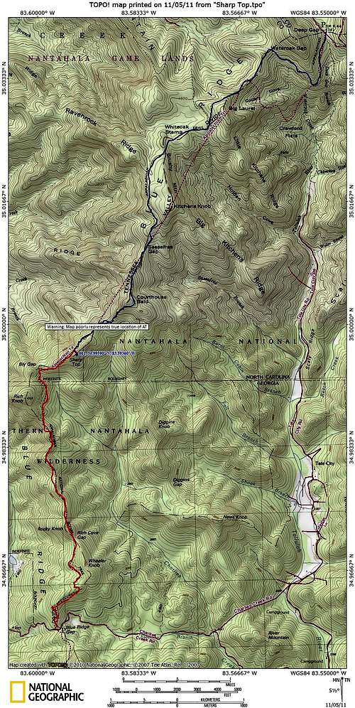
• From Blue Ridge Gap, via the AT, hike 3.1 miles north to Bly Gap, then less than 1/2 mile to highpoint of the AT along Sharp Top’s ridge (total one-way distance to high top is approximately 3.5 miles).
• Blue Ridge Gap is accessed by taking US 76 to Hightower Road. Per my map, Hightower Road is 4x4 the last few miles.
AT Southbound (from the north
• From Deep Gap, via the AT, hike approximately 6.5 miles (one-way) to highpoint of the AT along Sharp Top’s ridge.
• Deep Gap is reached by taking US 64 to Rt 71 (graded gravel).
From the highpoint of the AT along Sharp Top’s ridge, leave the trail and head southeast toward the summit. At a point of sparse brush, there is even a very faint footpath to the top, apparent to the sharp eye in the right season.
 Bly Gap Bly Gap |  Leave the AT here Leave the AT here | 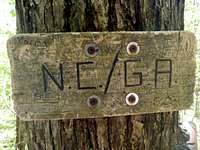 NC - GA border along the AT NC - GA border along the AT |
Red Tape
 Sharp Top Summit
 Famous Oak Tree
There is no fee to visit this part of the Nantahala National Forest and permits are not required for overnight stays in the backcountry. Please be mindful of posted Forest Service user warnings, such as “problem bear” alerts and campfire bans. Note that the Appalachian Trail is open to foot traffic only. Motorized vehicles and pack animals are not permitted. Please practice Leave No Trace principals:
1. Plan Ahead and Prepare
2. Travel and Camp on Durable Surfaces
3. Dispose of Waste Properly
4. Leave What You Find
5. Minimize Campfire Impacts
6. Respect Wildlife
7. Be Considerate of Other Visitors
Camping
 Limited summit views
Bly Gap Campsite: There is rustic tent camping available in the broad, level Bly Gap near the famous Oak Tree. Spring water is available about 100 feet downhill from the trail.
Muskrat Creek Shelter: The nearest AT shelter is the Muskrat Creek Shelter, though I honestly cannot recommend spending the night here. The shelter has, unfortunately, been horribly vandalized. It is surrounded by shallow streams and seasonal standing water, providing prime habitat for mosquitoes and Copper Heads, among other critters. Also, during my visit in 2011, there were no bear cables present. While this may be a minor inconvenience to the prepared backpacker who will utilize other means (traditional rope hang, bear canister) to secure their food, it means the less prepared / less conscientious may not make efforts to secure their food. Upon arriving at this shelter in 2011, I encountered a sack of tortillas casually left on the structure’s railing, half gnawed on by animals.
 Bly Gap views
Weather & Seasons
| Spring and Fall are considered by many the most pleasant time to visit the Southern Appalachians. Spring: In the Spring, daytime temperatures and warm and evenings are cool while the flowering shrubs are in bloom and the waterfalls are running. Water sources such as springs are most reliable this time of year. Fall: In the fall, the broadleaf deciduous trees put on a bright display of autumn color, though waterfalls may not be as impressive and springs and other water sources less reliable. The air is cooler and crisper and visibility should be prime for long-range views. Summer: in this part of the country can be oppressively hot and humid and even the higher elevation and ample tree cover will not keep the hiker from feeling overheated, sticky and dirty. High humidity and haze plus deep leaf cover mean limited long-range vistas, though it is in summer that the term “temperate rainforest” will have the most meaning to and be most appreciated by the visitor. Winter: in the South Appalachians can range from cool and damp to cold and severe with bouts of deep snow following major storms. In other words, while this range may be relatively low in elevation and southern in latitude, mountains are still mountains and can bring unpredictable and potentially dangerous weather. |  Lady Slipper near the NC-GA border Lady Slipper near the NC-GA border |